Will post when I can.
Eeek! Dial-up so slow...can't....load....pictures....
Monday, July 31, 2006
Sunday, July 30, 2006
Appetizer
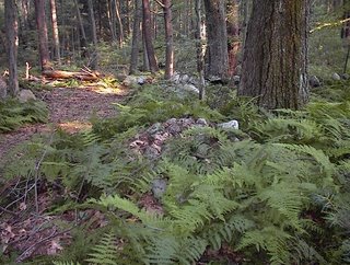
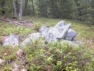
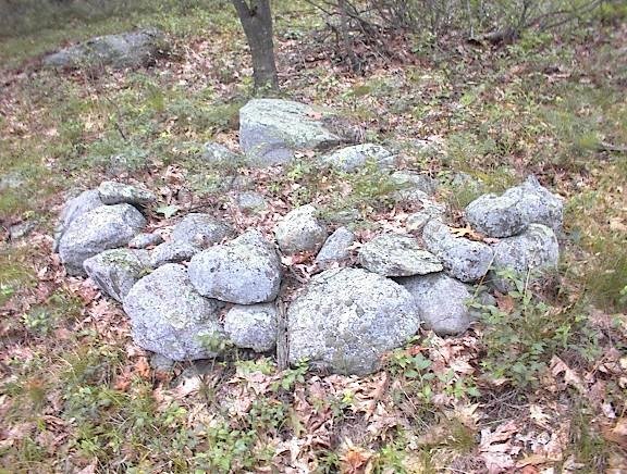
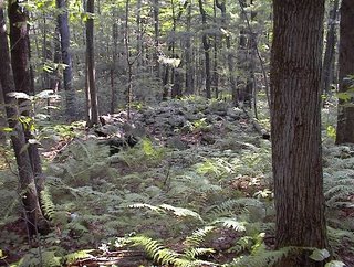
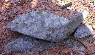
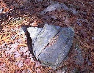
A couple of other sites to report. Here is a preview from one of them: a pile with unusually heavy use of quartz.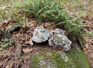 Those little ferns are called "polypody" - a favorite.
 Those little ferns are called "polypody" - a favorite.
Saturday, July 29, 2006
Wachusetts viewing
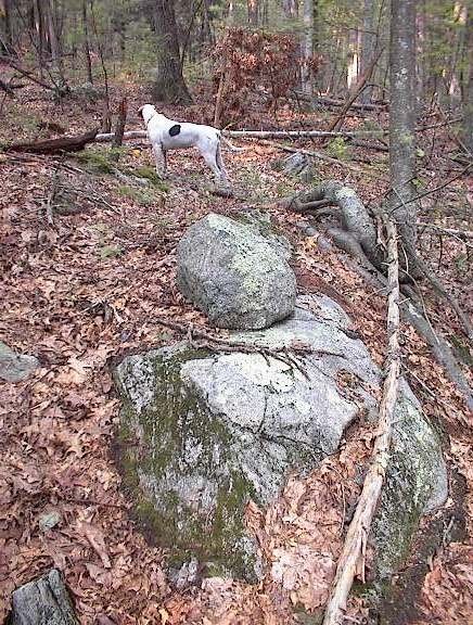
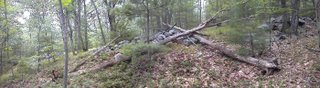
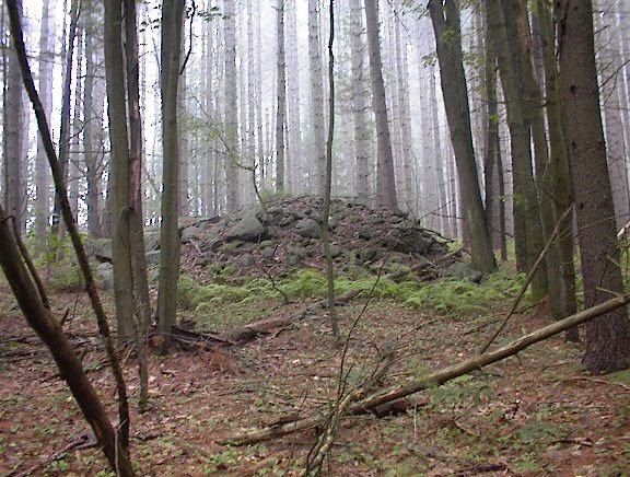
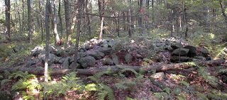
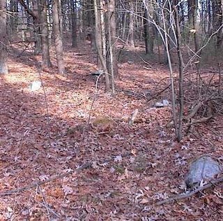
Went back to the site of last week where the slope faces towards Wachusetts. Today was clear and the mountain seemed to fill the sky and loom over us, although the picture may not really convey this. As usual with things seen through a bit of haze, the mountain seemed large.
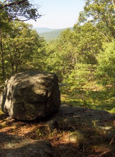 There is no doubt in my mind that this site is a Wachusetts viewing site. The mountain is right there. And I believe this is a marker pile site, so this combination gives a different perspective on what might be these "grid" sites. Well worth studying in more detail.
 The first "field trial" for my new camera. Not perfect but better than the old one.
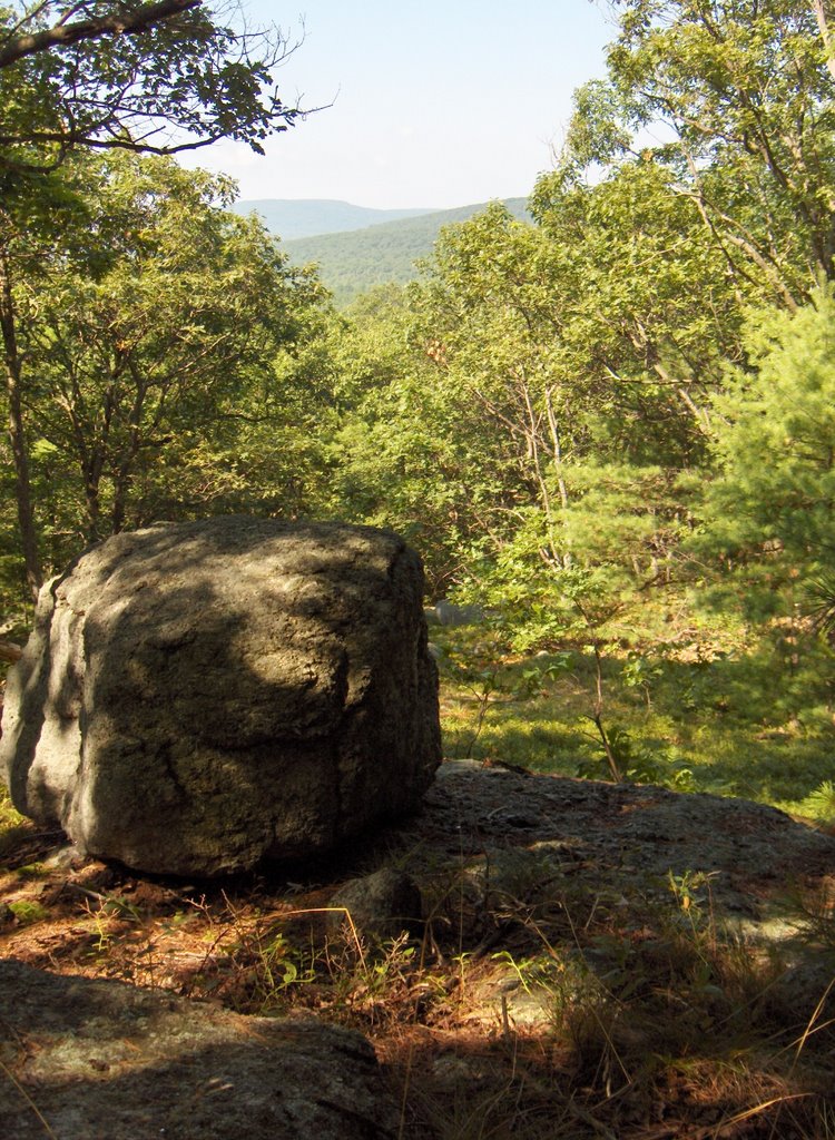 There is no doubt in my mind that this site is a Wachusetts viewing site. The mountain is right there. And I believe this is a marker pile site, so this combination gives a different perspective on what might be these "grid" sites. Well worth studying in more detail.
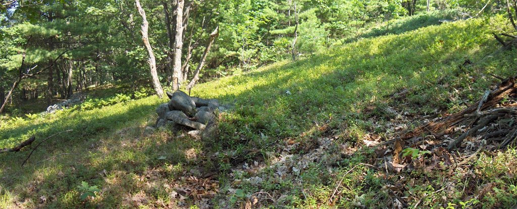 The first "field trial" for my new camera. Not perfect but better than the old one.
Friday, July 28, 2006
An Amiable Amble with FFC
FFC wanted to show me some things in the woods that were hard to photograph. What we saw was a variety of modified rocks, broken, flaked, moved around. We discussed how you learn to recognize these kinds of modifications and how they become especially interesting when you see them near water, or boulders, or where there is a view.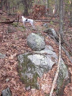
 We came across a split-wedged rock we saw years ago on a walk with our boys. Don't know there that photo went but here is the feature today:
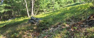
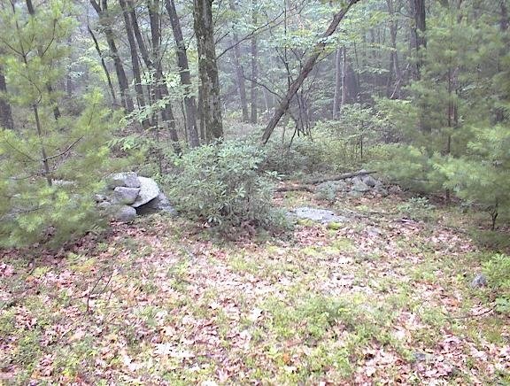
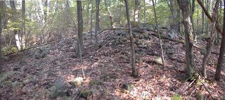
 As we rounded up our walk we came to a place where there was a small vernal pond crosed by a stone wall, with a knoll to the northwest of it and I said: if I was going to expect a rock pile anywhere it would be on top of that knoll. And he said: there are some rock piles up there. Sure enough there were maybe three. One nice example, a little mound in the hay-scented ferns. In the background is a stone wall and beyond that to the southeast is the vernal pond.
 We came across a split-wedged rock we saw years ago on a walk with our boys. Don't know there that photo went but here is the feature today:
 As we rounded up our walk we came to a place where there was a small vernal pond crosed by a stone wall, with a knoll to the northwest of it and I said: if I was going to expect a rock pile anywhere it would be on top of that knoll. And he said: there are some rock piles up there. Sure enough there were maybe three. One nice example, a little mound in the hay-scented ferns. In the background is a stone wall and beyond that to the southeast is the vernal pond.
Hohokam Sun Watch Station
by JimP
Yes, this is a rock pile post. Please bear with me as I give you a little background.
Five minutes from my new house here in Arizona is a mountain range called the White Tanks. The White Tanks are home to some remarkable petroglyphs. In fact, they're so numerous in one area they call it, "Petroglyph Plaza." Just recently, astronomers announced their findings that one of the petroglyphs quite likely depicts the supernova of 1006 AD. Click here for more information about that find.
That would not be the first petroglyph believed to depict a major astronomical event here in Arizona. Another site is strongly suspected to depict the supernova of 1054 AD. Click here to read about that one.
But researchers have also been finding, "Sun Watch Stations," dotted around the landscape. I visited one at Papago Park in Phoenix about a half hour from my house. It's called Hole in the Rock. A rock pile is involved. Click here for preliminary findings.
More study of the site is needed. As soon as temperatures are tolerable I'll take my camera and snap some photos of the rock pile, and try to get better depictions of the various alignments. I can say that in this part of the desert it is highly unusual to find the concentration of rocks you'll see in the photo at the above link.
Thursday, July 27, 2006
Book review
by geophile
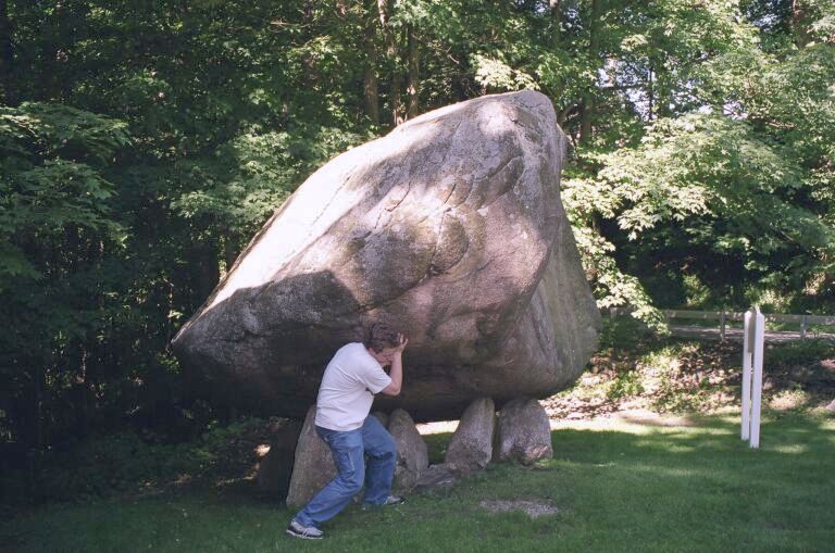 (my son attempting to lift the North Salem boulder)
It is relevant to this blog in that it mentions Gungywamp, Putnam County's chambers, and Balanced Rock at North Salem, NY, as well as mound sites to the west. Also, it jibes with the answer I was once given by a Lenape descendant when I asked about the meaning or use of Oley Hills. He said, hesitantly, he thought it was at least partly agricultural. In light of the magnetite in the rocks there, and its position on the 'Reading Prong,' famous for radon, plus the several creeks that arise from there, it would be interesting to take a magnetometer and electrostatic voltmeter there and do some measuring.
The section on Bear Butte also made fascinating reading.
Wednesday, July 26, 2006
Kentucky Marker Piles?
by JimP
One of Peter's recent posts about marker piles constructed in a line reminded me of an entry I read in a book about the history of Kentucky. Some time in the early 1900's, a man named Pierre Savary delivered a paper to the Kentucky Academy of Science outlining his beliefs that the land had once been inhabited by, "Hindoos." In his paper, he described the following site:
One of Peter's recent posts about marker piles constructed in a line reminded me of an entry I read in a book about the history of Kentucky. Some time in the early 1900's, a man named Pierre Savary delivered a paper to the Kentucky Academy of Science outlining his beliefs that the land had once been inhabited by, "Hindoos." In his paper, he described the following site:
". . . on the farm of Gen, Kennedy and that of Mr. Jones —conch shells have been found in the ruins of circumvallatory temples, and always directly opposite to fountains. These facts lead us to no other inference, than that a people must have existed here, who placed great, we may say religious value, upon these shells. On Stoner's Creek, north of this, are seven piles of stone, placed in a direct line. They are from eight to ten feet high, and from twenty-five to thirty feet in diameter; the base of a circular form, and terminating in a cone at the top. These piles are situated on a commanding eminence, formed by a bluff of the creek."
Tuesday, July 25, 2006
Other odds and ends from the hills west of Leominster, MA
 On the same hill as mentioned yesterday, there was another small site on the southern side nearer the foot of the hill. There were three or four simple rocks-on-boulder, or "boulder piles" at this site.
Then there were odds and ends, like split-wedged rocks, on and off across the south and eastern side of the hill. This side is much more gradual and less steep than other sides and the views from it are mostly blocked by other nearby hills. In one place on this southern slope there was a wet spot with ferns and a split rock. I was almost sure it would be a wedged, and it was. Then in another place, I saw split rock and was not sure until I took a close look. There are rocks packed in there.
 And let me revisit the western side of the hill, at the foot where there was this seemingly fragile structure: All in all the hill is pretty well covered with rock piles. The first time I walked across it, I saw only two.
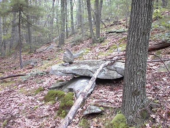
Monday, July 24, 2006
At the edge of the wetland at the foot of the hill...
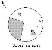
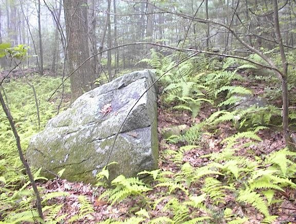
Continuing down to the western foot of the hill I just discussed, there was a low knoll within the wetland. I had to risk going into the mountain laurel to get there but arrived at a nice low boulder with rock piles around it. There were a couple of elongated dirt and rock piles radiating out from the central boulder,
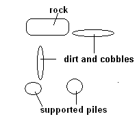 and there were a couple of supported rock piles, also disposed seemingly in relation to the central boulder. Here the boulder is in the background and between the pile shown and boulder is an invisible ridge of dirt and cobbles (it really is there).
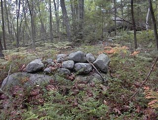 This is not really a different site from the marker pile site higher on the hill. There were occasional rock piles all the way down the slope. The entire hillside was clearly an important ceremonial area and was probably used for many years. But in this part of the site, there was the strong impression of sitting on the boulder looking out at the piles - so a site within a site.
Looking out over Notown Reservoir, Leominster MA
I guess it is no secret I have been exploring the eastern hills of Leominster State Forest and, although I won't say exactly where, here is another clue: I explored a different part of a hill I was on the weekend before last, on a slope facing southwest. The view to the southwest was down the valley filled by "No Town" reservoir and I suspect the view is towards Mt. Wachusett, although it was foggy and cloudy when I was out and I could not see any distance to verify it.
As before, I headed in from the north on the same forest road as before but where I turned left, this time I headed straight, up and over onto the southwestern slope of the hill. At first I passed the two "stone mounds" I photo'd previously, and then I continued. I started seeing faint traces of a rock pile site: some rock-on-rocks and some out of place boulders on the ledges. [Parenthetically, this is same old camera I have been using, and I held it very steady as I took pictures on this rainy day. I think the camera did well.]
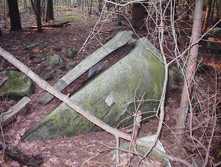
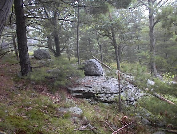
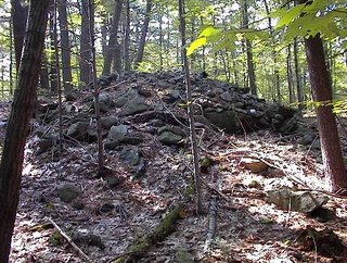
As I continued along the western slope, I tried to keep an eye on the more level summit area to my left but also to check the slope to my right. I suspected I was getting close to rock piles and saw a first one: with a bit of retaining wall and a nice chunk of quartz:
 Here is a detail of the quartz:
 I think of this as being very "grave-like". But as I continued I started seeing other piles, built with uniformly large rocks and with "pointers" sticking out of them. The piles appeared to be lined up and evenly spaced. These, taken together, are exactly what I have been calling the characteristics of marker piles, which are not graves. In fact this site is a classic example of a marker pile site on a somewhat steep southwestern facing slope. In my first real look at the place, here is what I saw:
 This picture shows three piles in a line. The third, furthest back, is hard to see. Here is a closeup of the second pile.
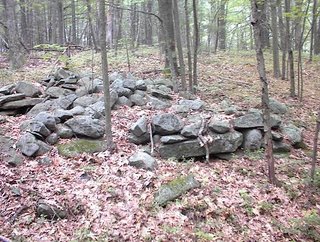
 Going along the slope, the piles seemed to grow larger and more substantial, more rectangular and suggestive of more internal structure. Here are four in a row, along a low ridge.
 They were so close together I was worried I was looking not at piles but at stone wall. In fact I was worried the whole time that I might be looking at field clearing piles. But here are some reasons that convinced me otherwise:

 I felt like I was walking around among the traces of a lost civilization. But it has all been damaged. I see significant and systematic vandalism here. That is why the site should be publicized - because it has already been destroyed. Every one of these larger piles, and most the smaller ones too, have been thrown down. What were they looking for? Why all the bother? There was one smaller pile that was torn up in the last two or three years. You could tell because of the dirt still stuck to the up-rooted rocks. What is it that makes destroying rock piles so appealing? Before I leave the topic of internal structure, let me mention again the "stone mounds" from the previous weekend. The suggestion was that these mounds enclosed and inner stone-lined room, digging down to which might have been the goal of the vandalism. The same pattern seems to be repeated here.
Anyway the site is still there and I think one of its most important aspects is the placement of the piles and the directions indicated by the lines of piles. The pile locations have not changed and I hope there is still a lot of information to be found here. The piles were destroyed but the site is still good.
After this I continued down to the foot of the hill where there were some other things at the edge of the wetland. And I continued my walk over to other hills in the area, until I got tired and too wet and headed out and home.
As before, I headed in from the north on the same forest road as before but where I turned left, this time I headed straight, up and over onto the southwestern slope of the hill. At first I passed the two "stone mounds" I photo'd previously, and then I continued. I started seeing faint traces of a rock pile site: some rock-on-rocks and some out of place boulders on the ledges.
 [Parenthetically, this is same old camera I have been using, and I held it very steady as I took pictures on this rainy day. I think the camera did well.]
As I continued along the western slope, I tried to keep an eye on the more level summit area to my left but also to check the slope to my right. I suspected I was getting close to rock piles and saw a first one: with a bit of retaining wall and a nice chunk of quartz:
 Here is a detail of the quartz:
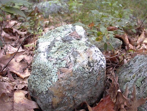 I think of this as being very "grave-like". But as I continued I started seeing other piles, built with uniformly large rocks and with "pointers" sticking out of them. The piles appeared to be lined up and evenly spaced. These, taken together, are exactly what I have been calling the characteristics of marker piles, which are not graves. In fact this site is a classic example of a marker pile site on a somewhat steep southwestern facing slope. In my first real look at the place, here is what I saw:
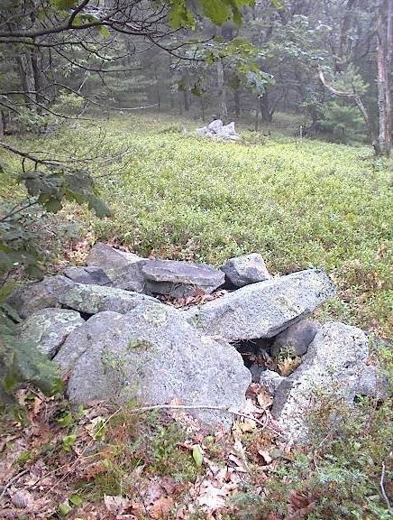 This picture shows three piles in a line. The third, furthest back, is hard to see. Here is a closeup of the second pile.
 Going along the slope, the piles seemed to grow larger and more substantial, more rectangular and suggestive of more internal structure. Here are four in a row, along a low ridge.
 They were so close together I was worried I was looking not at piles but at stone wall. In fact I was worried the whole time that I might be looking at field clearing piles. But here are some reasons that convinced me otherwise:
- there were no small rocks which are always the majority of what is cleared from a field
- all the rocks were uniformly sized
- the piles were once well made and had clear rectangular structure, still visible in the bits of remaining retaining wall that occured around the edges of the piles
- the piles were carefully lined up
- there were larger and smaller piles mixed together at the site
- the piles continued all across the southwestern slope of the hill, from just below the level summit (which could have been a field) down to the foot of the hill and then on into the swamp below. In a true field clearing the piles would all be dumped at the edge of the field not way off at the foot of the hill.

 I felt like I was walking around among the traces of a lost civilization. But it has all been damaged. I see significant and systematic vandalism here. That is why the site should be publicized - because it has already been destroyed. Every one of these larger piles, and most the smaller ones too, have been thrown down. What were they looking for? Why all the bother? There was one smaller pile that was torn up in the last two or three years. You could tell because of the dirt still stuck to the up-rooted rocks. What is it that makes destroying rock piles so appealing? Before I leave the topic of internal structure, let me mention again the "stone mounds" from the previous weekend. The suggestion was that these mounds enclosed and inner stone-lined room, digging down to which might have been the goal of the vandalism. The same pattern seems to be repeated here.
Anyway the site is still there and I think one of its most important aspects is the placement of the piles and the directions indicated by the lines of piles. The pile locations have not changed and I hope there is still a lot of information to be found here. The piles were destroyed but the site is still good.
After this I continued down to the foot of the hill where there were some other things at the edge of the wetland. And I continued my walk over to other hills in the area, until I got tired and too wet and headed out and home.
Saturday, July 22, 2006
Piles in the Mist - previews of more piles from the hills west of Leominster
I took some pictures I am pleased with today. I'll describe the whole place in more detail later. For now, here are some nice photos that capture the mood of a rainy day.


Friday, July 21, 2006
Thursday, July 20, 2006
Turtle Cairns In Rhode Island
by JimP
An obvious pattern is evident in possible turtle cairns found in Rhode Island. I'm interested if anyone out there has seen cairns of similar construction. This first one above is from a site I've called The Queen's Cairns on the Exeter/West Greenwich line. This is perhaps the finest construction of any I have seen. Note the rounded back and distinctive rock protruding from the front which likely serves as the head of the turtle.
 The next one above is a Larry Harrop photo taken at Parker Woodland in Coventry, RI. Note, once again, the distinctive protruding head. This one seems to have been built with a possible niche between what would be the front legs of the turtle.
 Above is another Larry Harrop photo, this one taken at the Miner Farm at Tomaquag. Once again you see the distinctive rock possibly used as the head of the turtle. Having seen this one in person I can say that the head does indeed protrude, but not as much as the others.
 The last one above is a Larry Harrop photo taken at the Watemoonsuck site in Hopkinton. This one seems identifiable only by its distinctive head rock protruding from the front -- a rock very similar to the others pictured above. It appears this cairn has been damaged either by collapse, perhaps a falling tree limb, or someone who removed the stones for some other use. The site does show evidence of multiple uses over multiple generations.
Here's an earlier post from Peter Waksman on this blog regarding this very topic which includes a couple more photos of similar cairns.
http://rockpiles.blogspot.com/2006/01/turtle-piles-v1.html
If anyone knows of more cairns of like construction please contact me by e-mail -- jimporter@NOSPAMmenotomyjournal.com (remember to remove NOSPAM from the address before sending.)
An obvious pattern is evident in possible turtle cairns found in Rhode Island. I'm interested if anyone out there has seen cairns of similar construction.
This first one above is from a site I've called The Queen's Cairns on the Exeter/West Greenwich line. This is perhaps the finest construction of any I have seen. Note the rounded back and distinctive rock protruding from the front which likely serves as the head of the turtle. The next one above is a Larry Harrop photo taken at Parker Woodland in Coventry, RI. Note, once again, the distinctive protruding head. This one seems to have been built with a possible niche between what would be the front legs of the turtle. Above is another Larry Harrop photo, this one taken at the Miner Farm at Tomaquag. Once again you see the distinctive rock possibly used as the head of the turtle. Having seen this one in person I can say that the head does indeed protrude, but not as much as the others. The last one above is a Larry Harrop photo taken at the Watemoonsuck site in Hopkinton. This one seems identifiable only by its distinctive head rock protruding from the front -- a rock very similar to the others pictured above. It appears this cairn has been damaged either by collapse, perhaps a falling tree limb, or someone who removed the stones for some other use. The site does show evidence of multiple uses over multiple generations.Here's an earlier post from Peter Waksman on this blog regarding this very topic which includes a couple more photos of similar cairns.
http://rockpiles.blogspot.com/2006/01/turtle-piles-v1.html
If anyone knows of more cairns of like construction please contact me by e-mail -- jimporter@NOSPAMmenotomyjournal.com (remember to remove NOSPAM from the address before sending.)
From Lewis and Clark in Idaho
This is interersting [Click here] This is in reference to two stone piles:
"The origin of the name Post Office is unknown, though one story is that the Nez Perce Indians transmitted information by piling stones in different ways. This the Indians of today deny, claiming that the mounds are trail markers."
"The origin of the name Post Office is unknown, though one story is that the Nez Perce Indians transmitted information by piling stones in different ways. This the Indians of today deny, claiming that the mounds are trail markers."
Sorghum Flat Cemetery - Murry County, Oklahoma
"Pile of slabbed rocks, believed to be Indian burial of Ishtickiyou". [Click here]
Anarcheology.com
Check out the "Galleries". Some interesting rock pictures but I did not see any rock piles. [Click here]
Other "cashews"
Talking about comma-shaped rocks and boad rudder-shaped rocks [Click here]. I came across this other example from the Conant land in Carlisle: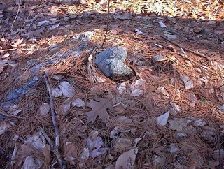 And it occurs to me that another rock-on-rock [Click here] is also of that shape.
 And it occurs to me that another rock-on-rock [Click here] is also of that shape.
Wednesday, July 19, 2006
Damaged Piles in Leominster State Forest
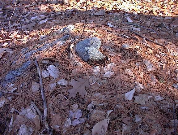
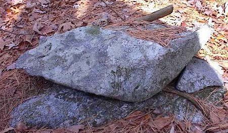
I want to take a closer look at the damaged side of the last pile described in the previous post:  Note the larger rocks. Note the isolated piece of quartz. This is the only quartz I saw anywhere in any of the piles at this site. So it seems special and at first I thought this hollow with the larger rocks in back and to the side was a niche - perhaps for sitting and looking out. But now it looks more like the destination for the damage. This leads to wondering if the Leominster Historical Society has an artifact collection?
 Note the larger rocks. Note the isolated piece of quartz. This is the only quartz I saw anywhere in any of the piles at this site. So it seems special and at first I thought this hollow with the larger rocks in back and to the side was a niche - perhaps for sitting and looking out. But now it looks more like the destination for the damage. This leads to wondering if the Leominster Historical Society has an artifact collection?
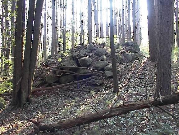
West of Leominster - between the hills
I planned a walk with Joe, my youngest son, to go up one of the hills you see from Rt 2 as you drive west towards Fitchburg. These hills form the west side of the valley of the Nashua River and are the eastern foothills of Mount Wachusett. Most of this area is Leominster State Forest, a dark and gloomy place shut off by thick undergrowth of Mountain Laurel. Two years ago I started exploring Leominster State Forest as part of an experiment where I would pick a spot on the topo map, go there, and try to find rock piles. For the most part the experiment succeeded, more or less, except for a number of places where my efforts were thwarted by not being able to get through the Laurels, which can grow so densely that they are impenetrable. It is an area I am a bit afraid of.
There are a lot of rock piles in Leominster State Forest and it is a good study area as it has been little disturbed in recent times. I am told that it was an area with pestilence houses, an area that was never really farmed but was used as woodlots, as a place for charcoal manufacture, a place for pastures. There is a thin layer of soil over bedrock and glacial till - soil a plow would never be able to get through. Anyway, looking at the topo maps, I picked a place in there with a wetland between some summits and a dirt road nearby - so we would have a chance of being able to get there on foot. It turns out that these eastern hills of Leominster State Forest are not quite so dense in Laurel and a bit easier to navigate than the ones I explored in the past. So actually my son and I had a pleasant walk, but a short walk because I forgot to bring water.
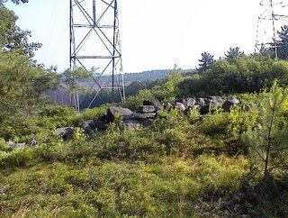
So up we went on a hot day, driving as close as possible, parking, and walking in on a dirt road through the forest. Hot and muggy in the woods but with a fresh breeze on the hilltops. My plan was to explore a few hilltops and around the wet places in between. Before we even got to the first hilltop there were a couple of large "mounds" which I did not think were ceremonial:
 They were not too well made, with different sized rocks, and they were near a power line where I think there must have been plenty of earth moving equipment. Also the piles were isolated and so I wrote them off as something other than ceremonial. A few feet away, under the power lines, was a quarry and another large loose pile which looked like debris from the quarry - another reason for discounting these as Indian piles.
 A bright, sunny, humid, breezy day. The view here is facing north and northwest. Later we found a site with large mound piles and, in retrospect, I think these first piles are part of the same general site. In the end I concluded these were probably ceremonial.
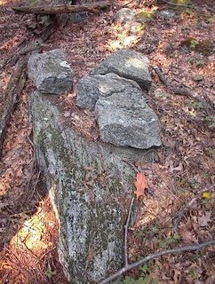
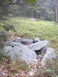
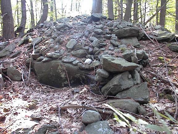
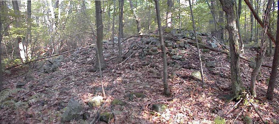
From here we continued up and over one of the hilltops and then went back down towards the valley between summits. There were a few minor things in a water break-out zone, a rock-on-rock here, a split-wedged rock there; and then we are continuing along the dirt road and there was a place where a small side road came in from the right following a stone wall. The wall had a bulge in it which looked suspiciously like an old rock pile, so I asked Joe if we could take a little detour down the side road, and when we did we immediately came to a low flat wet area with some other big mound piles. This was very close to the place I had hoped to get to when studying the topo maps. Here was the first glimpse:
 And here is a closeup of the first pile.
 Note the suggestion of internal structure in this picture. A bit of vertical walling to the right, and a bit of a hollowed out nest to the left.
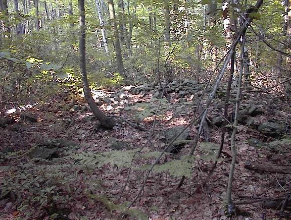
While taking the photo I became aware of other large piles looming in the background:
 In the end there were about six of these large piles around a small wet area which fed into a larger wet area which, in turn, developed into a brook which was the headwater of one of the major brooks in the State Forest, flowing down into the lowlands where there were mills and such. In fact this first minor wet area was just adjacent to a watershed divide such that, a short distance away, the brooks flow in the opposite direction. So this is at the start of two different brook systems, nestled in a level spot between hilltops.
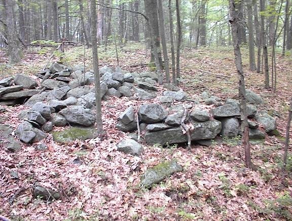
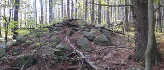
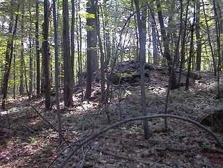
At this point my son was thirsty and after continuing a short ways we turned and started back along the dirt road. A few paces along and there was a small hill we had passed on the way in, and I asked Joe if I could "pop over there" just to check the hilltop. It was a good thing I did because there was one more large "mound" at the top, directly above the low place with the other mounds:
 Here is the view back towards this mound from a short distance away:
 In the end we explored a very small portion of the woods, mostly just along the forest road we had been following. This makes me wonder what lies a bit further along? Are there mounds like this everywhere in there, just hiding behind the Mountain Laurel?
There is a lot more woods to explore but I suspect the wet place and brook, and watershed divide, and view out over the wetland to the northwest and, in the other direction, to the northeast all play a role and make it most likely that the site would be here instead of somewhere else. I am guessing further explorations will not be so fruitful and needs to concentrate on similar topography. As a rule of thumb when you go to explore a new place, you cannot assume the sites will be where you would expect them. But once you have found a site, other sites nearby are most likely to be in similar topographical settings - similar elevation, viewing direction, relation to water, etc.
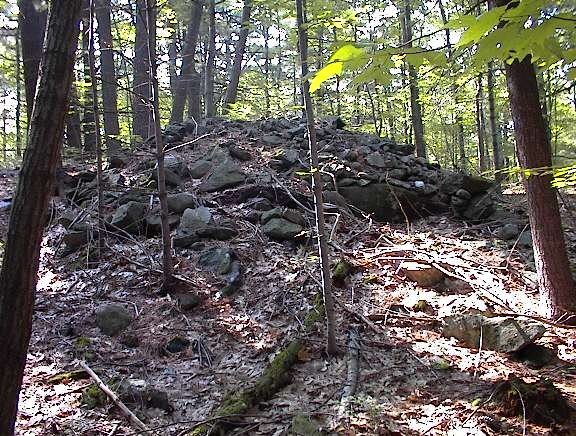
Note that I am calling these large piles "mounds". They do not have retaining walls and have little external structure. They do not seem to be platforms. These are big piles (20-30 feet across). Where have we seen something similar? The closest I can think of is the large piles along the Hobbs Brook in Lexington and Weston. Maybe there is no comparison but I was thinking of Whippile Hill.
In a couple of the pictures, one sees the suggestion of structure within the piles. Looking at all of the pictures I see that every one of the piles is badly damaged and was cratered on one side near the top. It is within this "crater" that I am thinking I see a bit of internal structure. For example, that last pile really looks like it might have had a small inner chamber that was breached by the damage. We'll take another look at this in a moment.
There are a lot of rock piles in Leominster State Forest and it is a good study area as it has been little disturbed in recent times. I am told that it was an area with pestilence houses, an area that was never really farmed but was used as woodlots, as a place for charcoal manufacture, a place for pastures. There is a thin layer of soil over bedrock and glacial till - soil a plow would never be able to get through. Anyway, looking at the topo maps, I picked a place in there with a wetland between some summits and a dirt road nearby - so we would have a chance of being able to get there on foot. It turns out that these eastern hills of Leominster State Forest are not quite so dense in Laurel and a bit easier to navigate than the ones I explored in the past. So actually my son and I had a pleasant walk, but a short walk because I forgot to bring water.
So up we went on a hot day, driving as close as possible, parking, and walking in on a dirt road through the forest. Hot and muggy in the woods but with a fresh breeze on the hilltops. My plan was to explore a few hilltops and around the wet places in between. Before we even got to the first hilltop there were a couple of large "mounds" which I did not think were ceremonial:
 They were not too well made, with different sized rocks, and they were near a power line where I think there must have been plenty of earth moving equipment. Also the piles were isolated and so I wrote them off as something other than ceremonial. A few feet away, under the power lines, was a quarry and another large loose pile which looked like debris from the quarry - another reason for discounting these as Indian piles.
 A bright, sunny, humid, breezy day. The view here is facing north and northwest. Later we found a site with large mound piles and, in retrospect, I think these first piles are part of the same general site. In the end I concluded these were probably ceremonial.
From here we continued up and over one of the hilltops and then went back down towards the valley between summits. There were a few minor things in a water break-out zone, a rock-on-rock here, a split-wedged rock there; and then we are continuing along the dirt road and there was a place where a small side road came in from the right following a stone wall. The wall had a bulge in it which looked suspiciously like an old rock pile, so I asked Joe if we could take a little detour down the side road, and when we did we immediately came to a low flat wet area with some other big mound piles. This was very close to the place I had hoped to get to when studying the topo maps. Here was the first glimpse:
 And here is a closeup of the first pile.
 Note the suggestion of internal structure in this picture. A bit of vertical walling to the right, and a bit of a hollowed out nest to the left.
 While taking the photo I became aware of other large piles looming in the background:
 In the end there were about six of these large piles around a small wet area which fed into a larger wet area which, in turn, developed into a brook which was the headwater of one of the major brooks in the State Forest, flowing down into the lowlands where there were mills and such. In fact this first minor wet area was just adjacent to a watershed divide such that, a short distance away, the brooks flow in the opposite direction. So this is at the start of two different brook systems, nestled in a level spot between hilltops.
At this point my son was thirsty and after continuing a short ways we turned and started back along the dirt road. A few paces along and there was a small hill we had passed on the way in, and I asked Joe if I could "pop over there" just to check the hilltop. It was a good thing I did because there was one more large "mound" at the top, directly above the low place with the other mounds:
 Here is the view back towards this mound from a short distance away:
 In the end we explored a very small portion of the woods, mostly just along the forest road we had been following. This makes me wonder what lies a bit further along? Are there mounds like this everywhere in there, just hiding behind the Mountain Laurel?
 There is a lot more woods to explore but I suspect the wet place and brook, and watershed divide, and view out over the wetland to the northwest and, in the other direction, to the northeast all play a role and make it most likely that the site would be here instead of somewhere else. I am guessing further explorations will not be so fruitful and needs to concentrate on similar topography. As a rule of thumb when you go to explore a new place, you cannot assume the sites will be where you would expect them. But once you have found a site, other sites nearby are most likely to be in similar topographical settings - similar elevation, viewing direction, relation to water, etc.
Note that I am calling these large piles "mounds". They do not have retaining walls and have little external structure. They do not seem to be platforms. These are big piles (20-30 feet across). Where have we seen something similar? The closest I can think of is the large piles along the Hobbs Brook in Lexington and Weston. Maybe there is no comparison but I was thinking of Whippile Hill.
In a couple of the pictures, one sees the suggestion of structure within the piles. Looking at all of the pictures I see that every one of the piles is badly damaged and was cratered on one side near the top. It is within this "crater" that I am thinking I see a bit of internal structure. For example, that last pile really looks like it might have had a small inner chamber that was breached by the damage. We'll take another look at this in a moment.
Stone Mounds at Fort Ancient Ohio
"...These mounds dot the entire landscape inside the "Fort"...."
[Click here]
[Click here]
Tuesday, July 18, 2006
A small "calendar" site in Boxborough - from Journals (2004)
...near the top saw a disturbance of the soil and rocks which I thought at first was a perc test pit but saw was a little break out zone and there were inconspicuous pile there. First a photo taken standing on a larger low rock, viewing up the wet spot, roughly northwest, towards the horizon:
 You can see a pile to the right foreground, a rock to the left, a rock-on-rock in the midground, and another in the background a bit to the right. Here are some of those details:
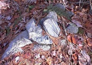
 That direction of view uphill from the rock is -say- northwest. Then I noticed, in a somewhat perpendicular direction east and/or southeast, there was a smidgen of an alignment also visible from the rock where I was standing:
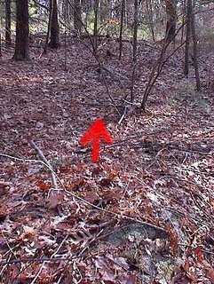 There is a "downhill" horizon in that direction. Seeing this possible alignment, suggested I was coincidentally standing at a designed central viewing point, and also suggested a different meaning for what I was viewing uphill. The pile, rock, rock-on-rocks in the uphill direction were not all in a line. I had been photo'ing them to get a sense of their context. But after seeing the alignment in the other direction, it made me wonder if perhaps these detailed, non-aligned features might have marked various horizon directions also....
 You can see a pile to the right foreground, a rock to the left, a rock-on-rock in the midground, and another in the background a bit to the right. Here are some of those details:
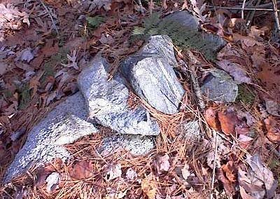
 That direction of view uphill from the rock is -say- northwest. Then I noticed, in a somewhat perpendicular direction east and/or southeast, there was a smidgen of an alignment also visible from the rock where I was standing:
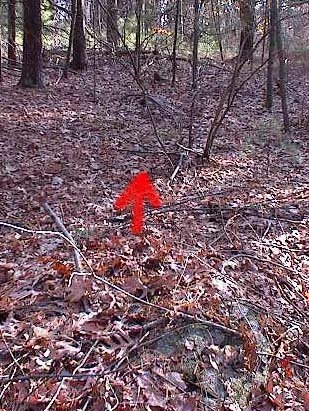 There is a "downhill" horizon in that direction. Seeing this possible alignment, suggested I was coincidentally standing at a designed central viewing point, and also suggested a different meaning for what I was viewing uphill. The pile, rock, rock-on-rocks in the uphill direction were not all in a line. I had been photo'ing them to get a sense of their context. But after seeing the alignment in the other direction, it made me wonder if perhaps these detailed, non-aligned features might have marked various horizon directions also....
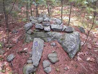
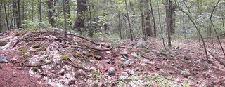
Another site in Carlisle
This site was mentioned by Bruce McAleer a week or so ago [Click here]. He and I went to take a closer look at it last weekend and, as I suspected, this is a site I have been to before. I know someone who played here as a child and who remembers building "stone forts". It is clear that he used material from the numerous piles in the area. There are 20 or so piles on a gently sloping acre, facing westward and leading down to a wetland. Most of the piles are built on supports and most look damaged.
Here is Bruce looking at a pile. He had just finished pointing out an isolated piece of quartz in the pile.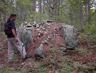
 A friend of the friend (who played here as a child) is camping in the woods there.
 I had not visited this site recently. One thing Bruce pointed out was a shoulder above the wetland, the last bit of slope, consisted of one or more long rock piles - almost the whole shoulder was made of rock pile.
 To me this is the most interesting feature of the site.
Here is Bruce looking at a pile. He had just finished pointing out an isolated piece of quartz in the pile.

 A friend of the friend (who played here as a child) is camping in the woods there.
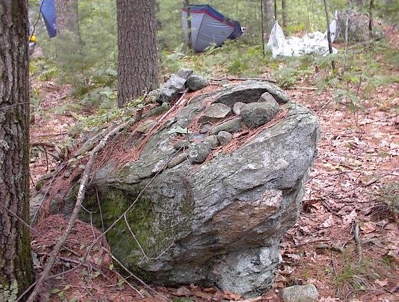 I had not visited this site recently. One thing Bruce pointed out was a shoulder above the wetland, the last bit of slope, consisted of one or more long rock piles - almost the whole shoulder was made of rock pile.
 To me this is the most interesting feature of the site.
Subscribe to:
Posts
(
Atom
)