 This is from the Lincoln Cemetery.
Sunday, November 29, 2009
Rocks express a sentiment
I wonder how universal is the sense that rocks express a meaning that will persist beyond our own time?
 This is from the Lincoln Cemetery.
This is from the Lincoln Cemetery.
Friday, November 27, 2009
Uphill from the see-through niche
by theseventhgeneration
Going uphill from the see-through niche, a small rock pile. Although this picture is a little blurry, I believe it is worth posting to show the line of sight. The see-through niche on the lower rock pile is at the lower left. Below, two views of the same rock pile, for two reasons. This is to show the small hole in the top. The construction is deliberate.
 Then, this view, 90 degrees from the picture above, the top of the rock pile lines up nicely with both the horizon and the rock pile above it.
 This standing stone is one that, in and of itself, I might question whether or not it was placed.
 But here is something to consider. Just above this stone, looking downhill you can see another rock pile in the distance so that the two together have an intentional appearance. If you click on this photo, you may see that distant rock pile just over the dead fall branch.
 This large rock pile is further uphill, at the flat or plateau that is just below a large outcrop.
 A view from the front of the boulder. Notice that, although there are trailing rocks at the back, there are no rocks stacked on top, to the very front of the boulder where it is flat. This would not have been efficient if this was field clearing. There is another rock pile just off to the right from this photo, but too far to fit both piles in one photo.
 This stone is pretty thick, so I can't say whether or not it is intentional as a standing stone, however, notice the two rock piles visible just above it in the distance. Visibility from feature to feature seems to be a theme at this site.
 This last rock pile is within view of a large outcrop (the outcrop is just off to the left). I looked at this pile from different views and it appears to be nothing more than a "heap of stones" until you look at it from this vantage point. It is pretty when looked at from this direction.
 The majority of the site is just behind and to the right of this rock pile.
Going uphill from the see-through niche, a small rock pile. Although this picture is a little blurry, I believe it is worth posting to show the line of sight. The see-through niche on the lower rock pile is at the lower left.
 Below, two views of the same rock pile, for two reasons. This is to show the small hole in the top. The construction is deliberate.
 Then, this view, 90 degrees from the picture above, the top of the rock pile lines up nicely with both the horizon and the rock pile above it.
 This standing stone is one that, in and of itself, I might question whether or not it was placed.
 But here is something to consider. Just above this stone, looking downhill you can see another rock pile in the distance so that the two together have an intentional appearance. If you click on this photo, you may see that distant rock pile just over the dead fall branch.
 This large rock pile is further uphill, at the flat or plateau that is just below a large outcrop.
 A view from the front of the boulder. Notice that, although there are trailing rocks at the back, there are no rocks stacked on top, to the very front of the boulder where it is flat. This would not have been efficient if this was field clearing. There is another rock pile just off to the right from this photo, but too far to fit both piles in one photo.
 This stone is pretty thick, so I can't say whether or not it is intentional as a standing stone, however, notice the two rock piles visible just above it in the distance. Visibility from feature to feature seems to be a theme at this site.
 This last rock pile is within view of a large outcrop (the outcrop is just off to the left). I looked at this pile from different views and it appears to be nothing more than a "heap of stones" until you look at it from this vantage point. It is pretty when looked at from this direction.
 The majority of the site is just behind and to the right of this rock pile.
Thursday, November 26, 2009

Wednesday, November 25, 2009
Old structures along an un-named tributary of Rocky Brook, Stirling MA
A few old things along the edges of the level area by the west side of the brook: Not sure what this might have been:
 Then, on the other side of the brook, a pair of larger piles:
 (from the other side)
 Here is a better view of the smaller one:
 It shows signs of careful construction but I try to be a little suspicious of the rock piles. Uphill and a bit upstream from these were some other more loosely scattered rocks, possibly from field clearing or possibly a smeared remnant of a destroyed rock pile; it was hard to say. There was quite a lot of that tourmaline granite in there.

 (Nice rock in the foreground.)
 Not sure what this might have been:
 Then, on the other side of the brook, a pair of larger piles:
 (from the other side)
 Here is a better view of the smaller one:
 It shows signs of careful construction but I try to be a little suspicious of the rock piles. Uphill and a bit upstream from these were some other more loosely scattered rocks, possibly from field clearing or possibly a smeared remnant of a destroyed rock pile; it was hard to say. There was quite a lot of that tourmaline granite in there.
 (Nice rock in the foreground.)
Small Hillside site in Sterling with Tourmaline Granite
A small hillside site 1/2 mile south of Hycrest Pond. At first glance, an isolated rock-on-rock: Then, further down hill, a pair of rock piles:
 Here is one:
 and a closeup:
 And the other pile:
 and a closeup:
 Both piles had this pale material at the southern side of the pile. This is the same material I mentioned here. It really is used a lot in this part of Stirling.
 Then, further down hill, a pair of rock piles:
 Here is one:
 and a closeup:
 And the other pile:
 and a closeup:
 Both piles had this pale material at the southern side of the pile. This is the same material I mentioned here. It really is used a lot in this part of Stirling.

Tuesday, November 24, 2009
A Symbolic Journey: Returing a Rock Stolen from a Rock Pile
I don't know what came over me but I saw a pretty rock in a rock pile and took it. Doug Harris of the Narragansetts says that moving or taking a rock from a rock pile breaks the prayer. Nonetheless he is seen, in a bit of footage, taking a rock from a pile, examining it and putting it back carefully in the same place. So this occasionally must be allowed. But that is no excuse for my taking the rock that I did. It was a nice granite-y rock with white feldspar and black tourmaline crystals. Later, I found an another example of this kind of rock and this made it easier to think about returning the first piece I had taken from the pile. So last Saturday I went on symbolic journey to return the rock.
Back at the site, which is in Sterling overlooking Hycrest Pond from the southwest, I sought out the pile I had damaged. On the way, I saw a different pile with a white rock in it and,  on closer inspection, comparing what I was carrying to the rock in the pile:
  I could see this same special tourmaline granite was used here as well. I could not resist taking some new photos of the place, noticing new details:
  (I have been paying closer attention to how things are related to splits in rocks.)
Then I got back to the damaged pile, as perfect a spot as you could hope for (view to the north) [Notice what looks like a path in this picture, passing the pile and heading toward the lake.]
Found the hole where the rock was missing: and popped it back into place:
  I know this is not OK but it was the best I could do. A final picture of this beautiful rock, I can tell you that the best surface with the nicest crystal visible was turned uppermost.
 This is not a common material but it seems relatively common in this part of Sterling.
Later, I continued poking around in the woods to the south and continued to find occasional rock piles with this same special tourmaline granite. This rock was a real favorite. Meanwhile, these piles overlooking Hycrest Pond are right next to an old house foundation and a possible collapsed underground chamber. I can easily imagine a person living in the house, having ceremonies all over the neighborhood, using this special material. For example, right nearby:
 Symbolism for me, even if stripped of superstition, is still satisfying. I was glad to return this rock.
 on closer inspection, comparing what I was carrying to the rock in the pile:
  I could see this same special tourmaline granite was used here as well. I could not resist taking some new photos of the place, noticing new details:
  (I have been paying closer attention to how things are related to splits in rocks.)
 Then I got back to the damaged pile, as perfect a spot as you could hope for (view to the north)
 [Notice what looks like a path in this picture, passing the pile and heading toward the lake.]
Found the hole where the rock was missing:
 and popped it back into place:
  I know this is not OK but it was the best I could do. A final picture of this beautiful rock, I can tell you that the best surface with the nicest crystal visible was turned uppermost.
 This is not a common material but it seems relatively common in this part of Sterling.
Later, I continued poking around in the woods to the south and continued to find occasional rock piles with this same special tourmaline granite. This rock was a real favorite. Meanwhile, these piles overlooking Hycrest Pond are right next to an old house foundation and a possible collapsed underground chamber. I can easily imagine a person living in the house, having ceremonies all over the neighborhood, using this special material. For example, right nearby:

 Symbolism for me, even if stripped of superstition, is still satisfying. I was glad to return this rock.
More Turtle Visions
Rob Buchanan writes: 

Here are some images of a turtle-shaped boulder in the Wiccoppee area of the Fahnestock State Park, NY.As shown in 414, there is a small but interesting stack of rocks on the flat top of the boulder. Obviously, this stack has been constructed carefully.
Monday, November 23, 2009

Finding what I was looking for in Harvard, MA
Where Rt 2 crosses Rt 111 in Harvard:  It is hard to believe that the only time I blogged about location "a" was here. It is such a fine pile that I spent considerable effort exploring behind houses uphill (south on the map) and on the same side of the highway. But I never found anything else significant in that neighborhood. Last weekend, driving west, I realized there was perhaps enough woods on the other side of the highway to explore over in there too. I was hoping to find something similar to the "mound" at "a". That mound is about 15 feet long and oval like, perhaps 5 or six feet high. So I went over in there and gave up after slogging through wet areas, crossing a road, and crossing flat areas with no rocks and just pine saplings. But on the way back, I did find another oval mound, perhaps not as long or as high.
  It was near a field (at "b" on the map) and I thought perhaps it was a field clearing pile. But concluded it was not for several reasons:
  But what I found very compelling was two hollows in the pile, visible from the other side:
  They are a bit hard to make out in the light. I believe these are collapsed ,or dug out, inner chambers. Here is a view from on end:
 Here is one more look:
 This large pile seemed to be by itself, but I did find one small auxiliary pile about twenty paces away:
  (The large pile is in the brush just behind.) In the end, this large stone mound is enough like the one at location "a" that I can believe they are inter-related - just the sort of thing I was hoping to find.
Here is something very similar, another "double chambered mound" from Framingham [Click here and scroll to the last photo]
 It is hard to believe that the only time I blogged about location "a" was here. It is such a fine pile that I spent considerable effort exploring behind houses uphill (south on the map) and on the same side of the highway. But I never found anything else significant in that neighborhood. Last weekend, driving west, I realized there was perhaps enough woods on the other side of the highway to explore over in there too. I was hoping to find something similar to the "mound" at "a". That mound is about 15 feet long and oval like, perhaps 5 or six feet high. So I went over in there and gave up after slogging through wet areas, crossing a road, and crossing flat areas with no rocks and just pine saplings. But on the way back, I did find another oval mound, perhaps not as long or as high.
  It was near a field (at "b" on the map) and I thought perhaps it was a field clearing pile. But concluded it was not for several reasons:
 - it was well made
- the rocks were uniform sized
- it was quite tidy
 But what I found very compelling was two hollows in the pile, visible from the other side:
 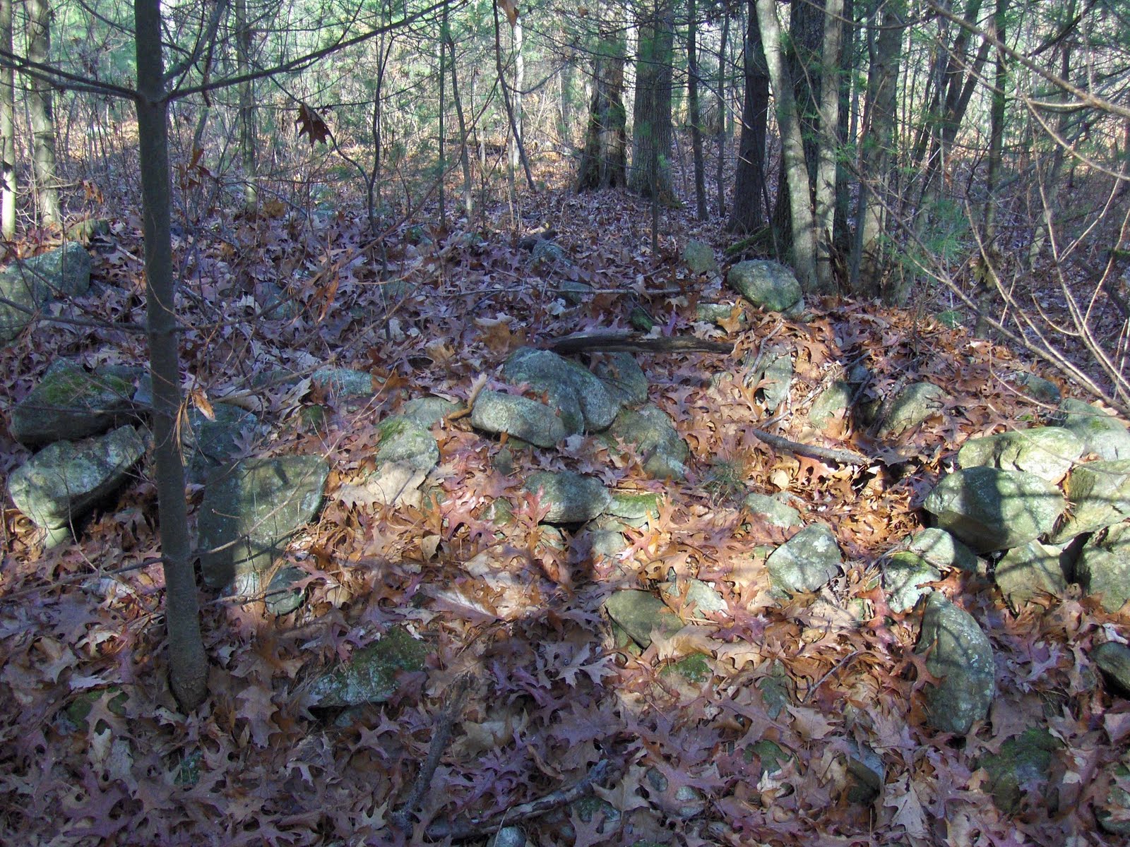 They are a bit hard to make out in the light. I believe these are collapsed ,or dug out, inner chambers. Here is a view from on end:
 Here is one more look:
 This large pile seemed to be by itself, but I did find one small auxiliary pile about twenty paces away:
  (The large pile is in the brush just behind.) In the end, this large stone mound is enough like the one at location "a" that I can believe they are inter-related - just the sort of thing I was hoping to find.
Here is something very similar, another "double chambered mound" from Framingham [Click here and scroll to the last photo]
Fort Mountain GA Stone ROW

Lifted Image from somebody's photos of a hike to the "Stone Wall" from a webpage upon which it is pondered by a person who went along, "Was it worth it?"
Is it Native American made?
Was it done by Brendan the Brave?
The Key to Native American Stonework
- The Turtle -
Answers the Question for me...

From the angle the photo was taken, I see feet, nutchal notch below a carapace stone above the head with eye, beak and "Is that another rock for the lower jaw??"
Sunday, November 22, 2009

The mystery of the mastodons gets a few big clues
[From the Christian Science Monitor] (Not rock pile related, this goes more to the pigheaded-ness of archeologists.)
This is an elegant study of mastadon populations. Apparently a fungus which grows only in mastadon dung has population cycles that match the mastadon population cycles. So, this fungus makes spores that can be counted and compared layer-to-layer in lake bottom sediments; and this documents the increases and decreases of mastadon populations in the past.
As was know, but this substantiates it, mastadon s were already in decline 1,500 years before the so called "Clovis Culture" - the paleo-Indians described as the "great game hunters"...you know the intrepid hunter gatherers who followed the mastadon across the Bering land bridge. Now since we have clearer evidence of this premature mastadon decline, the conclusion from archeologists is that something other than over-hunting must have caused the population declines.
This conclusion is coming from the people who have a hard time acknowledging that man was already here before Clovis. There are only a few people left who still think "Clovis was first". Hopefully they are going the way of the mastadon (or more aptly, the way of that dung fungus). But let me get this argument straight: mastadons dying out before Clovis shows that mastadons were not hunted to extinction because pre-Clovis people did not hunt mastadons. Seems a bit circular.
Don't get me wrong, there is good evidence that other factors caused the decline. In particular but rarely mentioned: there were a large number of non-game species that died out in the same 30K-10Y years ago time interval. For example certain species of mouse and of owl. Hard to imagine all these things depending on a eco-system with mastadons.
Saturday, November 21, 2009
"Historic Truths and Reconciliation: Interpreting Indigenous and Other Difficult Histories"
James Gage writes:
I came across this rather interesting document titled "Historic Truths and Reconciliation: Interpreting Indigenous and Other Difficult Histories" [Click here for the pdf] It consists of five case studies being presented at the 2009 National Council on Public History Conference. The theme amongst all five papers is how to include the Native American perspective in the public interpretation of historic events and sites. It discusses the challenges, successes, failures and the lessons so far learned from these ongoing efforts.
1. "Case Study: The Great Falls as a Contest Landscape" - A very insightful discussion of the Turner Falls Airport decision. It has a lot information and details not covered by Timmerick's film or the newspapers.
2. A synopsis of a dissertation (in progress) on the U.S. - Dakota (Sioux) War of 1862. The dissertation is focusing on how this event is being commerated and the continuing racial tensions that exist 150 years later.
3. This case study discusses the National Park Services efforts to add a Native American interpretative program at the Mount Rushmore site. It is excellent blueprint for how to actively engage the Native American community in the interpretation of Native American culture, history, and events.
4. This case study deals with issues of handling Native Americans materials found in historical archives.
5. "Hassanmesit - Collaboration as a Tool of Reconciliation" - This case study brings us back to New England, specifically the Town of Grafton, Massachusetts. It goes into detail about the collaborative efforts between the Town of Grafton and the Nipmuc Tribe to save and interpret the site of a Praying Village. This case studies concludes with this rather insightful statement "So, what does this tell us about interpreting Native American sites and history? The answer is straight forward: it is all about building collaborative partnerships to share in the story. It is about bringing communities together, based on mutual respect. It is about the use of collaboration as a tool for reconciliation where truths can be revealed when all share in the process." - Chuck Arning, National Park Service
Friday, November 20, 2009
Thursday, November 19, 2009
A rock inscription from Yarmouth Nova Scotia
 From a page of notes. The two symbols were further apart in the original but the left symbol looks like a St Andrews Cross a la Templars and the right symbol looks like feathers combined with a crescent moon. Terry Deveau is the Maritime Canada coordinator for NEARA. The site is called "The Chin" and the rock with the inscription is next to the ocean. Tom Paul pointed out that the holes around the cross are not circular but triangular.
Wednesday, November 18, 2009
Report on NEARA 2009 Fall Meeting
Best I can do:
Pain in the ...I have to type up my notes from the NEARA conference, or at least most of them:
Ukntena = near Scorpio - related to Aug 15 Persied meteor shower.
[At the panel discussion.]
Sitting next to Kevin who has been exploring along Rt 202 (The Moosehorn).
Dry Hill (near Turner's Falls) Cairns. BIG STUFF. (Michael VanCamp found). Always called "Indian's Fort". Oral anecdote = Indians would stop bye, commonly.
Ukntena (Unktena?) = entrance to the underworld.
Boulder with "split pair" at fort drum [pic] closely associated with fire cracked rocks and site 3500 to 900 years old.
"Stars whose names we have forgotten".
Chariman of USET calls in by cell phone (which is held to the microphone) and says:
Alabama Indians did not seem too aware of piles until Doug (Harris) showed them, the preservation at Turner's Falls is "groundbreaking". They are going for National Registration of a site down there. He feels this work is THE most important work we have begun and will take several lifetimes ....amazed @ amount of progress.... passed a (new) resolution calling for more preservation... work has been done in the New England is actually helping down here...Oxford Alabama. One factor in saving the feature was the work of USET...I am honored to be part of this and to speak to you. Thank you. [Hangs up]
Q: Why Natives less reluctant to talk about the true meaning...
A(Bettina Washington): I have had a bad month....Non-Wampanoag doing ceremony....we tend not to talk....it's more than religion...this is who we are.
A(Doug Harris): Why now? We began to realize these were sites slated for development. Our Office started to struggle with this and wnet to the elders...."No leave it alone"..."Why?"..."Leave it alone". More tribal dialog. [Doug wants to show this grandchildren the sites.]
[So that is the myth forming. As far as I can tell they started talking when we told them what we already knew. In Acton Doug said: "ceremonial sites are out of the bag".]
Alan Leveille: the 16 mi radius ceremonial designation around Turner's Falls "scared the be-jesus out of everybody". Turner's Falls, at the Federal level, is the starting gun.
Bettina sees all structures whether coming from man or from Nature are all coming from the creator.
[Concord: needs to pass bylaws D.H. reminds me.]
Jic get's acknowledged by Doug.
Now there are 4 USET resolutions: #1 about the eight towns #2 directed at the FED #3... #4...
[Lisa Gannon asking about Balanced Rock Farm in Berlin, MA]
[Donna Thomspon with map of Indian Rock Rd]
- STATE COORDINATOR REPORTS -
Terry Deveau (Maritime CA) - new Cairnsite. New [wondeful] inscriptions.
Ros Strong (ME)- Cairns, walls, stone seat. More reported sites in Northport, ME
Donna Thompson (NH) site visites, field archeo workshop, GPS workshop. Party invitation for NEARA members.
Lisa Gannon (VT) 3 field trips...numerous features....Calendar I, Lake Willoughby erratics; South Pomfret Steone walls, niches, quartz.
Jim Eagon (RI) recommends books: "History of Narragansett Bay" "Sacred Land of the Eastern Niantic Indians" "Root Cellats in America" [by James Gage]. Francis Carter Memorial Reserce with Larry Harrop.
Poly Midgely reports her files for PUntam county inclulde 215 stone chambers. [This has to stand as the current most accurate estimate for the number of stone chambers where they are densest: in Putnam County, NY]
Peter Anick (MA) - Most stone "U"s face uphill.
[From the audience someone says something kind about PWAX finding the most sites]
Tom Paul (Westford Knight Committee) Mentions a Viking Ship at the bottom of Lily Pond in Newport, RI.
--------later session-------
Peter Anick: California Cairns (Modoc, Klamath had many reported cairns when first encountered by anthropologists).....pictures of cairns and walls looking out over the Pacific, stone structures on mountains and in the desert.
Barbara Threecrow: talking about ley lines, accumpuncture, chi [PWAX wonders how to sit through this politely? Concludes easiest way may be to just listen]...teluric energy [eyes closing]....where would the places to pray be? or to heal the earth....[DANG! this is a sermon...oops] 54 Sacred sites...if a tree falls in the forest [I am not kidding...she brought this up]...thinking about trees, leaves and insanity...[launches into a story about...] pulling into a gas station in New Jersey [Norman Muller leans over and says "that's New Jersey for you", she continues]...and now we were on our third car and said a prayer so we could get out of New Jersey......so about these sites....always when we enter a site we make an offering to the ancestors.
... [TIRED OF TRANSCRIBING].
After dinner a speaker asked if anyone had read Kuhn's "Structure of Scientific Revolution". I was the only one except for a lady to my left.
Pain in the ...I have to type up my notes from the NEARA conference, or at least most of them:
Ukntena = near Scorpio - related to Aug 15 Persied meteor shower.
[At the panel discussion.]
Sitting next to Kevin who has been exploring along Rt 202 (The Moosehorn).
Dry Hill (near Turner's Falls) Cairns. BIG STUFF. (Michael VanCamp found). Always called "Indian's Fort". Oral anecdote = Indians would stop bye, commonly.
Ukntena (Unktena?) = entrance to the underworld.
Boulder with "split pair" at fort drum [pic]
 closely associated with fire cracked rocks and site 3500 to 900 years old.
"Stars whose names we have forgotten".
Chariman of USET calls in by cell phone (which is held to the microphone) and says:
Alabama Indians did not seem too aware of piles until Doug (Harris) showed them, the preservation at Turner's Falls is "groundbreaking". They are going for National Registration of a site down there. He feels this work is THE most important work we have begun and will take several lifetimes ....amazed @ amount of progress.... passed a (new) resolution calling for more preservation... work has been done in the New England is actually helping down here...Oxford Alabama. One factor in saving the feature was the work of USET...I am honored to be part of this and to speak to you. Thank you. [Hangs up]
Q: Why Natives less reluctant to talk about the true meaning...
A(Bettina Washington): I have had a bad month....Non-Wampanoag doing ceremony....we tend not to talk....it's more than religion...this is who we are.
A(Doug Harris): Why now? We began to realize these were sites slated for development. Our Office started to struggle with this and wnet to the elders...."No leave it alone"..."Why?"..."Leave it alone". More tribal dialog. [Doug wants to show this grandchildren the sites.]
[So that is the myth forming. As far as I can tell they started talking when we told them what we already knew. In Acton Doug said: "ceremonial sites are out of the bag".]
Alan Leveille: the 16 mi radius ceremonial designation around Turner's Falls "scared the be-jesus out of everybody". Turner's Falls, at the Federal level, is the starting gun.
Bettina sees all structures whether coming from man or from Nature are all coming from the creator.
[Concord: needs to pass bylaws D.H. reminds me.]
Jic get's acknowledged by Doug.
Now there are 4 USET resolutions: #1 about the eight towns #2 directed at the FED #3... #4...
[Lisa Gannon asking about Balanced Rock Farm in Berlin, MA]
[Donna Thomspon with map of Indian Rock Rd]
- STATE COORDINATOR REPORTS -
Terry Deveau (Maritime CA) - new Cairnsite. New [wondeful] inscriptions.
Ros Strong (ME)- Cairns, walls, stone seat. More reported sites in Northport, ME
Donna Thompson (NH) site visites, field archeo workshop, GPS workshop. Party invitation for NEARA members.
Lisa Gannon (VT) 3 field trips...numerous features....Calendar I, Lake Willoughby erratics; South Pomfret Steone walls, niches, quartz.
Jim Eagon (RI) recommends books: "History of Narragansett Bay" "Sacred Land of the Eastern Niantic Indians" "Root Cellats in America" [by James Gage]. Francis Carter Memorial Reserce with Larry Harrop.
Poly Midgely reports her files for PUntam county inclulde 215 stone chambers. [This has to stand as the current most accurate estimate for the number of stone chambers where they are densest: in Putnam County, NY]
Peter Anick (MA) - Most stone "U"s face uphill.
[From the audience someone says something kind about PWAX finding the most sites]
Tom Paul (Westford Knight Committee) Mentions a Viking Ship at the bottom of Lily Pond in Newport, RI.
--------later session-------
Peter Anick: California Cairns (Modoc, Klamath had many reported cairns when first encountered by anthropologists).....pictures of cairns and walls looking out over the Pacific, stone structures on mountains and in the desert.
Barbara Threecrow: talking about ley lines, accumpuncture, chi [PWAX wonders how to sit through this politely? Concludes easiest way may be to just listen]...teluric energy [eyes closing]....where would the places to pray be? or to heal the earth....[DANG! this is a sermon...oops] 54 Sacred sites...if a tree falls in the forest [I am not kidding...she brought this up]...thinking about trees, leaves and insanity...[launches into a story about...] pulling into a gas station in New Jersey [Norman Muller leans over and says "that's New Jersey for you", she continues]...and now we were on our third car and said a prayer so we could get out of New Jersey......so about these sites....always when we enter a site we make an offering to the ancestors.
... [TIRED OF TRANSCRIBING].
After dinner a speaker asked if anyone had read Kuhn's "Structure of Scientific Revolution". I was the only one except for a lady to my left.
Subscribe to:
Posts
(
Atom
)