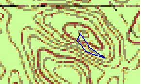
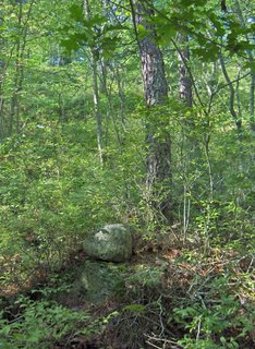
I did, in fact, find a nice rock pile site down in there, as indicated by the northernmost outline on the map fragment. This surprised me because I would expect Mavor to have explored every similar location (i.e. kettle hole) near where they had already found rock piles. But they must not have checked that kettle hole. Why not? My thought is that their theory got in the way. They were too busy chasing alignments and I think a better strategy is to look in all kettle holes. On the other hand there may be something to what they were doing because the layout of this new site is along a rough diagonal from lowest point at the bottom of the steepest part of the sloping sides of the bowl up across that steepest slope in a more or less southeastern direction.
 I think there is a good chance to figure out this site and it is hard to imagine it has nothing to do with the sky. What else could possibly dictate that kind of shape for a site? In more detail, I drove up along a road running with the kettle hole to the northeast, I parked and started in and seeing how steep the sides were, thought: well you are going to have to work for it this time, and how easy it is to go downhill. I went down the southern slope into the hole. A few feet up from the bottom I saw a first rock pile, then a rock-on-rock and started thinking: ah, a real site. Down at the bottom there was a group of rock on rocks, and one boulder pile with more than five rocks. I found the additional piles in a diagonal from the first one and so also explored outward along that same diagonal and found a few more distant piles up higher on the slope to the southeast. Circling back around there was one more isolated pile near the true lowest point. A few odds and ends of rocks around the other sides of the hole could well be additional structure to the site, which I am not sophisticated enough to pick up on.
Here is the first pile and rock-on-rock:

 I was happy enough to see two genuine piles in the right sort of place. Here is another rock-on-rock and a view back up the southern slope:
I was tracking along a diagonal and came to a small group at the bottom:
 Here is another view from the bottom, again to the south:
 The "main" pile is in the background of the first picture behind the foreground pile. In the second picture this same "main" pile is to the right. And here it is in all it's glory:
 Maybe a little "turtle" action there. Maybe it is too badly damaged to tell. I like how my camera is doing. But I was playing with the settings and got some good and some bad pictures without learning much about the best settings. Anyway, I explored outward and found things along the same diagonal but back to the southeast and higher up the slope. Two outliers:
 [The second one is much like the first].
Then I circled down in and back to the group of piles at the bottom. I saw one ground pile at the lowest point and then another ground pile, close to the original group. These were thoroughly buried:

 This would be an extremely good reasearch site. The piles are well differentiated from each other. All the ones I spotted on the slopes were boulder piles but at the real bottom there were a couple of ground piles. So there is different form and possibly different function. All in all a well articulated and integrated site.
No comments :
Post a Comment