Thursday, January 18, 2007

A Boxborough-Harvard conservation land - from May 2005 Journal

I went in at the trailhead, walked uphill with a brook on the left. The trail crosses a wetland where the brook begins and then skirts the left side of the wetland. They are building a huge mansion in there about 1/4 mile in and about there I went off the trail to the right to explore a series of little bumps and little ponds which may give rise to that wetland and brook I followed in. All through there are little piles of a "sky-watching" type- built on the ground, out of large fragments, with markers and occasional apperatures. I saw a couple of suggestive alignments. Also a place where there was a main boulder configuration with, nearby, a couple of rock-on-rocks lined up with it. I continued in here till I got to the backs of some houses and then turned left/west/uphill over and back onto the yellow-spot trail. This led across a beautiful burbling brook and, presumably would have led on to XXX. Instead I continued around to the left turning back in the direction I came in, went back down into the brook's gully and back up to the yellow-spot trail heading back out. Passed an old lime quarry. Came back to familiar territory and made my way out.

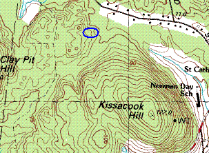
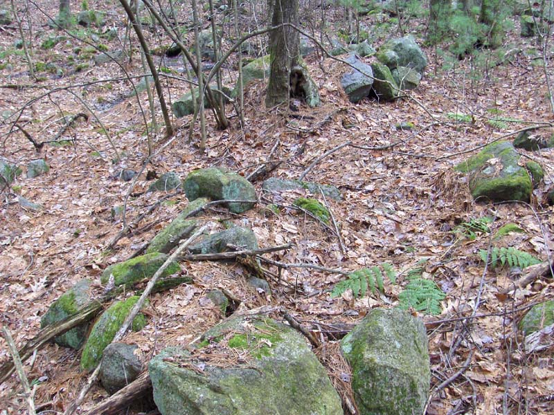
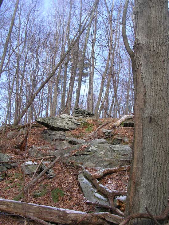
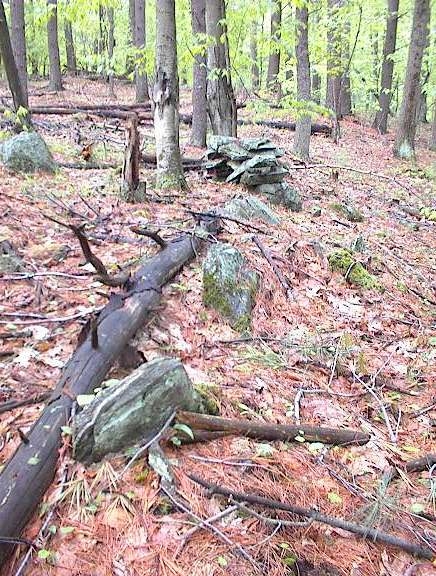
First sign that we are nearing something (coming in the way I did) is a couple of overgrown ground piles and a rock on rock.
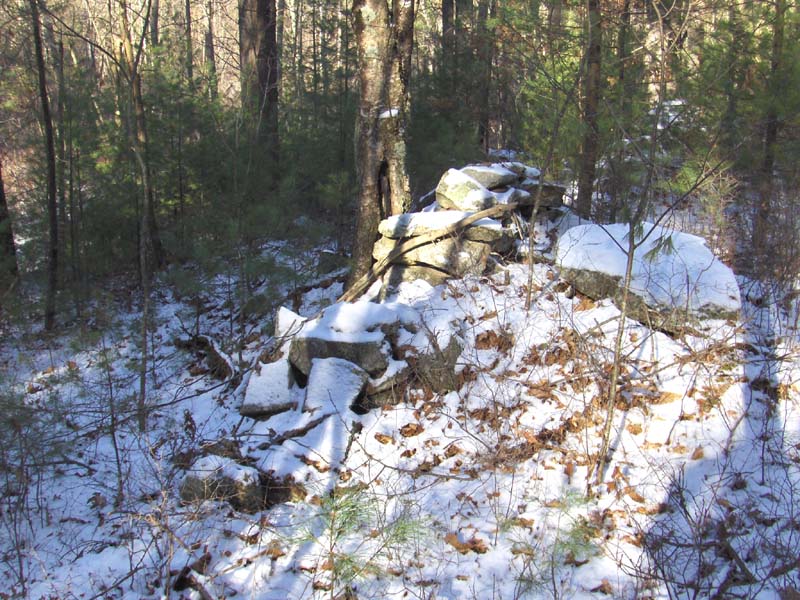
As you proceed in a northerly sort of direction, staying to the right of the main outcrops, you get into an area with more of these larger piles.
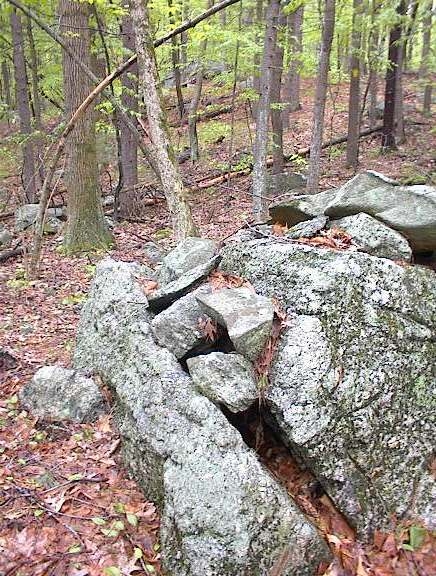
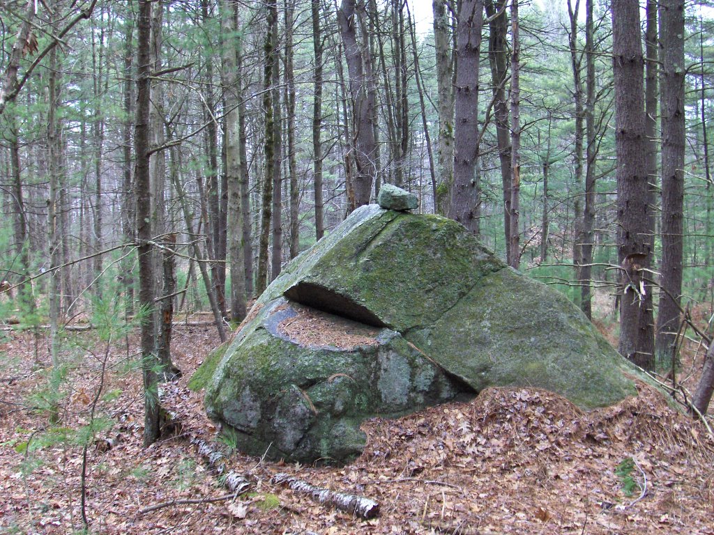
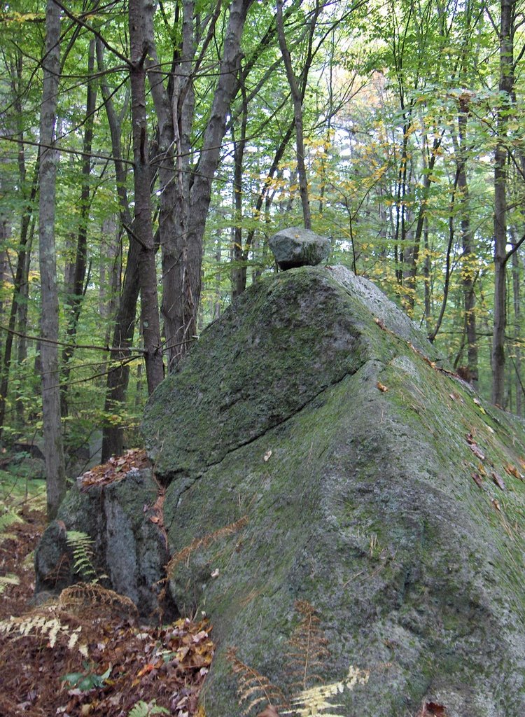
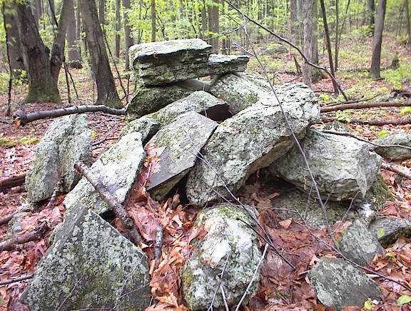
I am struck by the shape of the top rock in this last picture and comparing it to the top rock of the overgrown pile shown in the second picture above. This kind of looks deliberate and kind of looks like "marker" piles. Here follows another nice substantial pile and then a picture of a pile incorporated into the mearest hint of an alignment: 
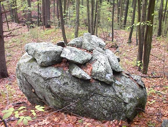
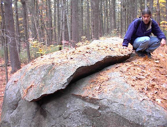
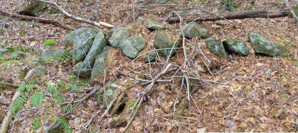
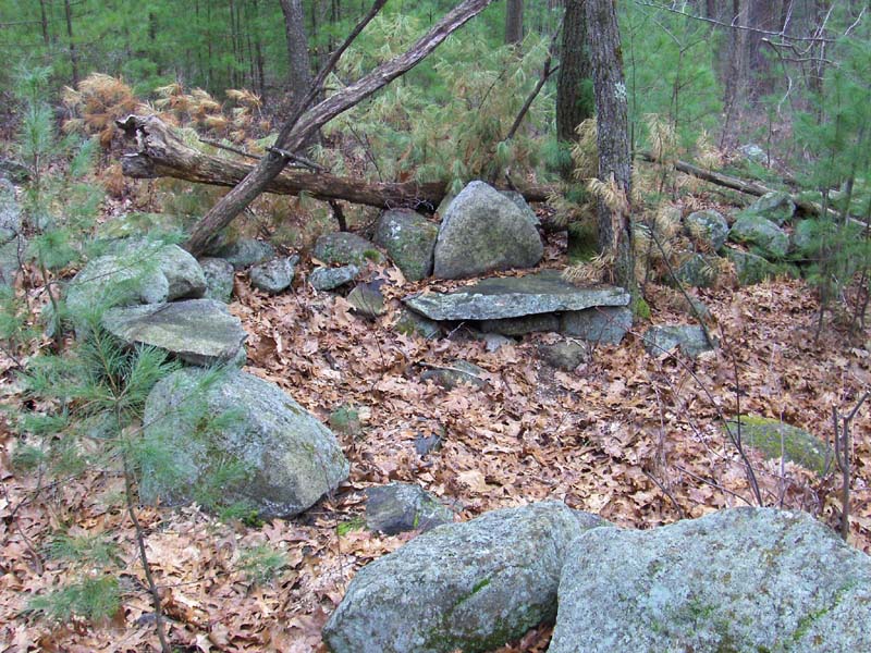
At the center of all this was a noticeable boulder configuration. Also pictured is a rock wedged with something that looks red and burnt used for the wedge.
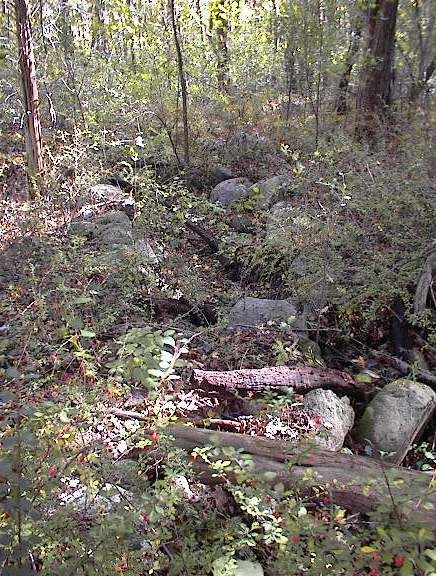
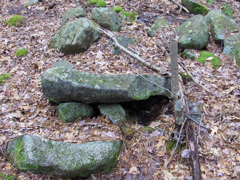
After I swung back uphill and over and down into a gully, following the yellow-spot trail over the brook, and a few moments later there is one pile over in there:
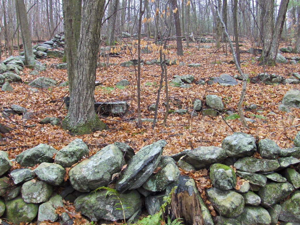
And on the way back, on the initial side of the brook, is a lime quarry cutting a deep trench through the woods.

Impressive split wedged rocks from Stow Conservation Land

Here are three views of the first. Somehow a large fragment has been split off, slid forward, and wedged. Bruce McAleer is showing the rock.
Nearby are lots of rock piles and also this unusual double split wedged rock:

Wednesday, January 17, 2007

Re-evaluating the risk of vandalism

I identify the location of as many sites as I can, usually doing it when a site is already pretty badly damaged. I am more hesitant to identify locations of genuinely delicate sites, with piles in good shape. But how many of the sites already documented on this blog has anyone been to? Probably none. In general, I have a hard time imagining someone deliberately following directions given from here to a rock pile site, only to kick over a rock. Not only does it make no sense that anyone would bother, as a matter of fact no one has bothered.

It is not the publicizing of a site which threatens it, because vandalism is opportunistic. People don't go looking for sites to vandalize; instead they stumble on them and get destructive. The only example of this I have seen was my own fault: I cleaned off a pile near a public trail and someone noticed it, noticed the other piles, and decided to pull one apart. I think it was kids that did it. And kids are not reading this blog. But anyway, cleaning piles near trails and worse yet, making new trails to sites should be avoided to reduce opportunities for vandalsm.

I honestly don't think publicizing sites has much to do with it, however out of respect for the sites, and also out of fear that delicate sites will get damaged un-intentionally by visitors, I'll keep quiet about the location of the most delicate and special places.

Update:Jim P points out in comments that the greatest risk to sites is from neo-pagans trying to re-use a site for their own reasons - leaving a mess and destroying the site in the process. This is worse than vandalism, it is cultural theft. But I am going to stick to my guns to the extent of posing this question: were the sites Jim mentions ruined because of publicity or because a trail led to them? In my experience, neo-pagans do not go off trail much. Maybe they are lazy or maybe they are afraid of the actual woods. So I guess I am claiming sites are protected not so much by their secrecy but by being in-accessible. I don't propose we do a study of such things but perhaps I should repeat that making sites public has a significant upside in terms of public awareness. I argue that people who know a site's location are not in the clear just becase they keep the site secret - because they are helping preserve a status quo which includes continued destruction of sites by the construction industry - something much worse, much more systematic and thorough than any neo-pagans.

A collapsed chamber beside Rt 3?

I don't know if I blogged about this. It is from Oct 2005:
:

I was walking between Rt 3 and Old Billerica Rd and came across what looked like a stone lined brook but, following it uphill a couple of yards, it turned out to be more like the entrance to a passage burial with a walled-off entrance, a collapsed ante-chamber and further deeper chambers also collapsed. It was something like this cutting into a knoll.The upper part of the picture shows the features seen from 3/4 view. To the left is the stone-lined passage which gets deeper uphill - to the right in the picture. The passage is obstructed by a wall and uphill/beyond that is a collapsed structure with a hole hinting at deeper recesses underneath. Still further uphill and in line with that, are several depressions indicating other collapsed spaces. The lower part of the picture shows a "bird's-eye" view of the surface features.

So I tried to take some pictures. Here is my first impression and a detail of the "collapsed hole".
Here are some of the "depressions" uphill above the passage and the collapsed hole.
In the second picture we are looking downhill with the bent over tree above the first collapsed hole.

Here are two views of the stone-lined passage. First shows the view up towards the wall and hole, the second shows the view back downhill.

This last picture, like the first, shows the relation between the wall and the collapsed hole.
I figure this is a chamber and ought to be recorded. Whatever it is, it is mighty peculiar. Perhaps someone will check it out more thoroughly someday. Backside of Rt 3 is not the sort of place you expect to find something interesting.

The Washington Stone in Holliston, MA

The local legend is that George Washington tried to push the rock over when he passed by.

Ancient World Blog

Some articles of interest: [Click here]

The Westford Knight in the news

[Click here]

Tuesday, January 16, 2007

High rock-on-rocks

These are both from Kissacook Hill, Westford. The first one is about 10' tall, which is unusual. It has been illustrated before.
This one is about 5 feet tall, not quite so unusual.
It is possible you could see one of these from the other, if the trees weren't in the way.

Northern Kissacook Hill - Westford, MA

I found a site here on the northwest side of the hill at a place where water comes out of the hill. I have walked past this place at least twice before without seeing anything. As I look at the piles, badly damaged though they are, they remind me of the favorite sites elsewhere in Westford and in Bolton where water comes out of the ground.
I walked over there thinking I would explore Clay Pit Hill but I had forgotten the reason we had not been there before: it is a shooting range. I had to keep the sound of gunfire to my left and, at one point, I thought I was not more than a short thousand yards from a shooter. But I was also close to houses so I was confident the gunfire would not be directed towards me.

Anyway, I have been over there on the north side of the hill and seen an unusually tall rock-on-rock.
A few few feet uphill from it, in the midst of an active breakout zone and boulder field, there were a number of very broken down piles.
Here are some slightly better preserved ones:
And here they are at their densest in the breakout zone:
What a mess. There were a lot of rock-on-rock which could have been simply all that was left of a pile. There were also numerous shadowy overhangs that could have been deliberate or the result of things falling over.
Many of the piles were close together making me pause and wonder if they were actually just tumbled over stone wall. But they are offset from each other, reminiscent of short stretches of wall we have seen lately at other places where water comes out of the ground:

Dolmen Doldrums - Flavin's Corner

Link sent in by Norman Muller: [Click here]

Monday, January 15, 2007

Happy Birthday to this blog

It has been a year since the first post. Thanks for reading.

Old stone rows on Potash Hill - Hudson, MA

A couple of weekends ago we drove past a hill on Rt 62 in Hudson which had what looked like rock piles on it. Last weekend I went back to take a closer look and sure enough there were piles scattered on one part of the slope and adjacent to a loosely defined enclosure of low stone walls. Here are the (respectively) near and far walls of the enlosure.
There were a number of damaged rock piles around and I also saw another loose "wall" going a few yards up the hill:
Nearby on the hill was something a good deal more structured, some terraces:

With a name like Potash Hill, this hill has seen plenty of activity over the last several hundred years and it is hard to imaging a rock pile site persisting there. All the piles are, in fact, in bad shape. Aside from what this implies about the age of the site, with things so badly broken down it is hard to know whether this rock piles site is necessaraily Native American and ceremonial or just the remnants of some activity, possibly practical, that left these structures.

Map of Sharon CT site from Brent Colley


Always nice to see a map. New information added to the website [Click here] . This fits my usage of the phrase "marker pile site".

New Blog about rock piles and stone walls in Nova Scotia

I just added a link to this blog over on the right. Check it out [Click here]
The author makes some interesting observations.

Sunday, January 14, 2007

Stone Seat in the Wall


This is from Kissacook Hill Westford - at the edge of the shooting range land.

Friday, January 12, 2007

Rock Piles in Sharon, CT - from Brent Colley

Brent has been researching this site and describes it [Click here]

Arizona Rock Piles

[Click here]
As usual rock piles are attributed to farmers. In this case Hohokam farmers.

The Ordering of Towns - H. Morse Payne in the NEARA Journal

How did Massachusetts towns end up with the boundaries they have today? Apparently it is the overlapped result of many different surveys done at different times in the state's history. I remember the Morse Payne giving this as a talk which was quite interesting, but did not realize it was available online. [Click here]

More poking around on Google re "Hassanemesit Woods"

Some interesting looking rocks here called "Purgatoire Chasm". Are those man-made?
[Click here]

Archeology at Hassenemessit - From the Grafton Daily

Curiosity piqued by a question from Jim Porter, I was looking on Google for information about Hassenemessit - the third "Praying Indian" village set up in the 1600's - when I came across this:

"From the beginning of October through Nov. 19, Hassanamesit Woods was the site of an archeological investigation led by Mr. Mrozowski and conducted by a group of students and volunteers. The investigation was overseen by field supervisor Jack Gary, a graduate student at UMass-Boston. The team was charged with gathering information that would be used to assist the town in managing the property in the future. They found — signs of habitation from the 18th and early 19th centuries — but traces of life prior to that, specific evidence of the praying village in the 17th century, still eludes them. (Thanks for submission to John LaPoint)" [Click here for full article...and scroll to the bottom for an interesting little document]

I have to chuckle: how many rock piles do you suppose they walked past while looking for archeology? For the record: I have looked in the woods at Sarah Doublet Forest (the Nashoba Praying Indian Village) and I have looked at King Philips Woods (another such village) and, at both places, there were plenty of rock piles. In fact these are generally good places to explore and Jim's prodding will eventually get some action from me- lets plan on going to Grafton in a few weeks.