Wednesday, October 13, 2010

More on Townsend State Forest

I have been meaning to write a little note about the last stages of my walk at Townsend State Forest. I went back to a site I know - on the south and east flanks of the highpoint along the middle forest road (here) and re-visited some old favorites. The pictures were cool (we'll see some in a minute) but I remembered that this site included some marker piles and I went wondering: triangular or rectangular? (The overhead outline of the wedged shaped marker piles I saw recently in Harvard and in -where was it-Tuttle Rd, Sterling was rectangular.) Yes there were some rectangular piles
but also some younger-looking triangular ones:I gotta make a distribution map sometime, including triangular/rectangular and the business with the "hollows" and "tails".

So that's it. Let's look at some pictures from the place.
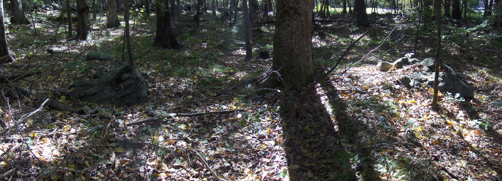
Peter Anick would want me to mention that there was a boulder overlooking part of the site. This was a few feet from the boulder:I think we believe this is both a symbol as well as a location indicator.

Looking back:Someday, maybe someone will talk up there and take a look.

Monday, October 11, 2010

ROGER WILLIAMS

ROGER WILLIAMS & Second Look at Roger Williams

Rock Piles Partridge Run NY

Reader Cully writes:

I thought I would send along some other rock piles that Linda and I came across in Partridge Run Wildlife Game Management Area. No. 1 is at N42° 33.942 W74°08.202. It appears to be dismantled on one side while the rest of the rock piles 2 - 5 seem intact.
#1
#2
#3
#4No. 5 is the only one that seems to be rectangular and a few hundred feet away from the others.
The first 4 are only 25' apart from each other and almost cicular in construction. 4' in diameter and 4' high.

Update (further email from Cully):
The Yellow Diamond is where the Partridge Run Rock Piles are located. They are on a small plateau between a hill and valley, surounded by a rock wall. If the trees weren't there as I would imagine 100 years ago it would be a clear view of the rock piles and the valley.

Holt Hill Andover MA

This was a few feet from where the trail divides into: Margeret, Judy Family, Ward, and Bay Circuit trails. But the rock pile was isolated, I saw no others during a brief scan of the surroundings. It would be interesting to see a complete site over here in Andover (farther east than Concord, and a lot farther east than Fitchburg), to compare with sites in those places.

Saturday, October 09, 2010

More fall colors

Finding pretty colors in October is like shooting fish in a barrel:

Thursday, October 07, 2010

Townsend State Forest - Delusions of Moundhood

Decided to go up the left-most trail following one of the brooks uphill. Saw a short stretch of stone wall:Here is how it terminates:I also saw a suggestive mound of boulders in there:

But after a while, I gave up on this part of the forest and took a cross trail back to the east to the hilltop crossed by the next forest road (that goes under "T" in "STATE"). That is a place I have been before where I knew there was a site. I'll show pictures later.

On the cross-trail I confirmed that a certain leaf was a witch hazel leaf as I found one flowering:
Now I'll recognize these leaves.

Wednesday, October 06, 2010

The gods of color (in Townsend, MA)

On a lighter note, there will probably always be moments like this:closer:

saveNipsachuk.org

Hey this is new http://savenipsachuck.org/

Site protection issues breaking out all over.

EMC - slow motion train wreck in Southborough/Westborough

A reader who lives on Gilmore Rd sent this photo, showing the new road in red. It is being built out daily. I took the liberty of adding some blue outlines for the main rock pile sites, that I know about, and you can see pretty much that the red is going to hit the blue before long.

I sit here helpless, not knowing what to do, watching a slow moving train wreck. The Indians have been notified and I tried, briefly, to figure out some way to get a group of them and some rich potential donors to walk around in there legally (it is private land). Could not do it. Not enough preparatory leg work. How can I kick things up a notch? We need some kind of better organization and I have a long term plan - pretty hard to move forward working 10 hour days to feed the family etc...EMC permitting process was long gone before I heard about this. So you can go back and read about the rock piles that are there (click here and scroll down). I went back to take a goodbye look and saw that it was a late "Wachusett Tradition" site: rock piles with hollows and ski jumps (Now called wedge-shaped marker piles). Can we console ourselves knowing there are plenty of similar sites still undisturbed nearby? I feel like I failed but still do not know what I am supposed to do.

I should add that the smaller blue outline (near the top of the hill) actually may be part of a Sudbury Valley Trustees purchase, so perhaps that part of the hill will remain less disturbed.

Here is what I think we should do:
  • create a sub-committee within a respected land conservation group, like Subdury Valley Trustees
  • create a slush fund (any volunteer donors?) specific to this sub-committee
  • create a network of watchers
  • create a link with Indian Country Conservancy land preservation group of the Native Americans
  • be prepared for rapid response to threats with buy-out options for win-win solutions.

EMC expansion

A new comment on the old post
http://wakinguponturtleisland.blogspot.com/2009/10/emc-expansion-threatens-rock-pile-sites.html
showed up just recently:
"I live on Gilmore Road, and they've started to build the road :-(


By Anonymous on EMC expansion threatens rock pile sites on 10/5/10

Tuesday, October 05, 2010

Brush Hill, Sherborn - part 1

Started exploring Brush Hill in Sherborn. The red outline shows where I looked (on a Sunday walk with my wife). I found three clusters of rock piles in that portion of the conservation land. But Sherborn is a bit of a haul from Concord and there are other places to check. I would be very surprised if there were not also some sites in other places nearby, such as outlined in green. Someone else want to finish the job there? For the most part, what I saw was, by now, a bit routine: piles consisting of a few cobbles on support boulders on the northeastern slopes, a few more piles on boulders near the top, and then marker piles down in the dells and knolls to the east of the hill. Let's take a look at the first two clusters. Climbing the hill from the east, I saw a rock on rock, and saw more and more minimal piles as we got closer to the top of the slope. There was a preponderance of pairs, or piles with a small number of rocks on a support. Many times some of the component rocks were shaped (this is a familiar "cashew" shape): or broken with the suggestion of deliberate shaping: Here it is again:(Note this same shape, in the first picture above, so there were at least three occurrances.) And here is another shaped rock; another "cashew". Long ago I wrote about rock piles with pairs, calling them "twins" and wondering about this shape - cashew, boat rudder, asymmetric manitou. I remain convinced this has a particular meaning.

Bright light and shadow and a camera that is starting to go, lead to sort of washed photos:
The colors were a lot richer in the original.

OK. Now at the top of the hill and a bit on the far side, right behind the houses, were a few more piles:
Closeups:There were a few more piles up there. Then we headed down and east, as I'll describe.

Monday, October 04, 2010

Leominster area field trip

I am leading a field trip on the morning of October 23 to the largest site I know with "Wachusett Tradition" mounds. If you are interested, email me via this blog's contact address (above).

Brush Hill Sherborn - Appetizer

Another weekend, another hill, another cluster of rock pile sites.

Occasionally I bring my wife along on a weekend exploration, and she is getting used to driving for 40 minutes or so, parking, and walking up to a rock pile site. It took about a 15 minutes to start seeing rock piles this time. So I said: "the more I see these sites, the more it is clear that every undisturbed hill has one". I also said something about "south of the Mass Pike, going down into Rhode Island" because, honestly, most of the hills are undisturbed enough for my prediction to be correct. I would go further: these hillside sites all have the same basic layout and function. I know people will disagree with that. But there it is, it is my impression. I asked my wife what she thought and she said: "they are everywhere".

Actually this photo is misleading, it is a break in a delicate stone wall crossing a wetland. Not a rock pile.

What I Found under a Cairn of Stones

What I Found under a Cairn of Stones  By Richard Irving Dodge

Thatcher State Park - NY

Reader Cully writes:
My friend Linda and I came across 4 or 5 of them in Partridge Run Game Preserve in New York. South of Rennslearville. West of Berne. Approximate location is 42° 33.754'N 74° 08.258'W. They are on a well marked trail. We are very curious as to who built them and why? Left over rock from clearing a field? I have also found 2 of them in Thatcher State Park. They are in the middle of the woods. The area was once farm land in the 1800's and since has overgrown as the farmers got tired of dealing with the rocky soil and moved elsewhere.

[He continues in another email...] Images 58 - 61 are of the first pile found. It measures 9'L x 3'W x 4'H.