Monday, May 16, 2011

Bean Porridge Hill Rd - Westminster MA

Just past Potato Hill Rd, heading north on Bean Porridge Hill Rd, there is a stretch with the stone walls on either side of the road, a swamp to west and a brief shoulder and a gradual slope down hill to the east. I thought I spotted some rock piles behind the wall on the west side, and could not decide if they were from an orchard that was in evidence nearby. In the end there were quite a few rock piles in the area, too many, and too diverse to be purely from an orchard...but the thought remained. Actually this is the common impression up here in northern Westminster, including Muddy Pond [see here, etc]: that the piles are barely distinguishable from farm related piles. But I believe it is deceptive and that some of the oldest piles may be the ones easiest to mistake for being agrarian.

Here we see a stone wall on the left, leading down to a swamp. Several piles lie along it.
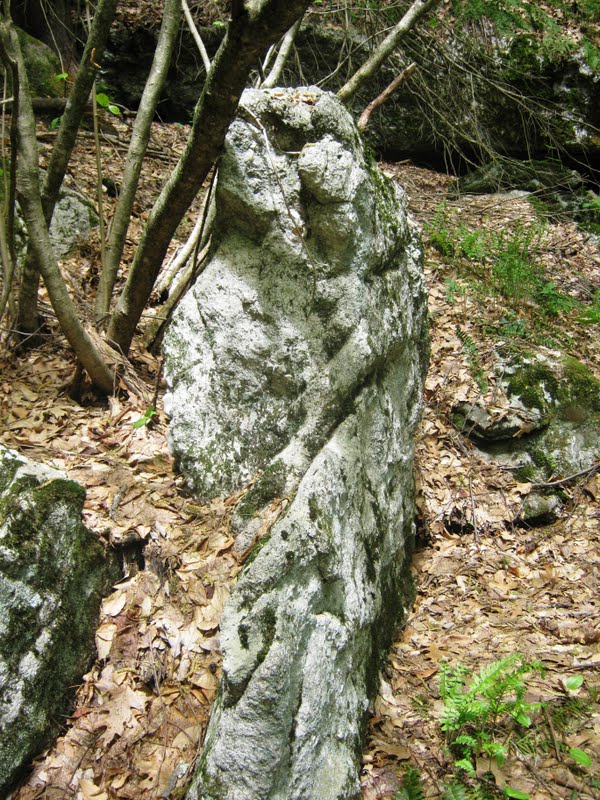
Then a field-clearing like combination of a pile, another pile with bigger rocks, followed by a mound and another rock pile, all kind of in a row. This was impossible to photo because of obstructing foliage. So here is part of it, including the pile, larger rock pile, and moss covered stone mound in the background. And here is the rock pile just beyond the mound, really with its feet in the water, at the edge of the swamp:And here is another view of the first piles leading up to the mound:I try in different ways to convey this, but I think these are old rock piles. 
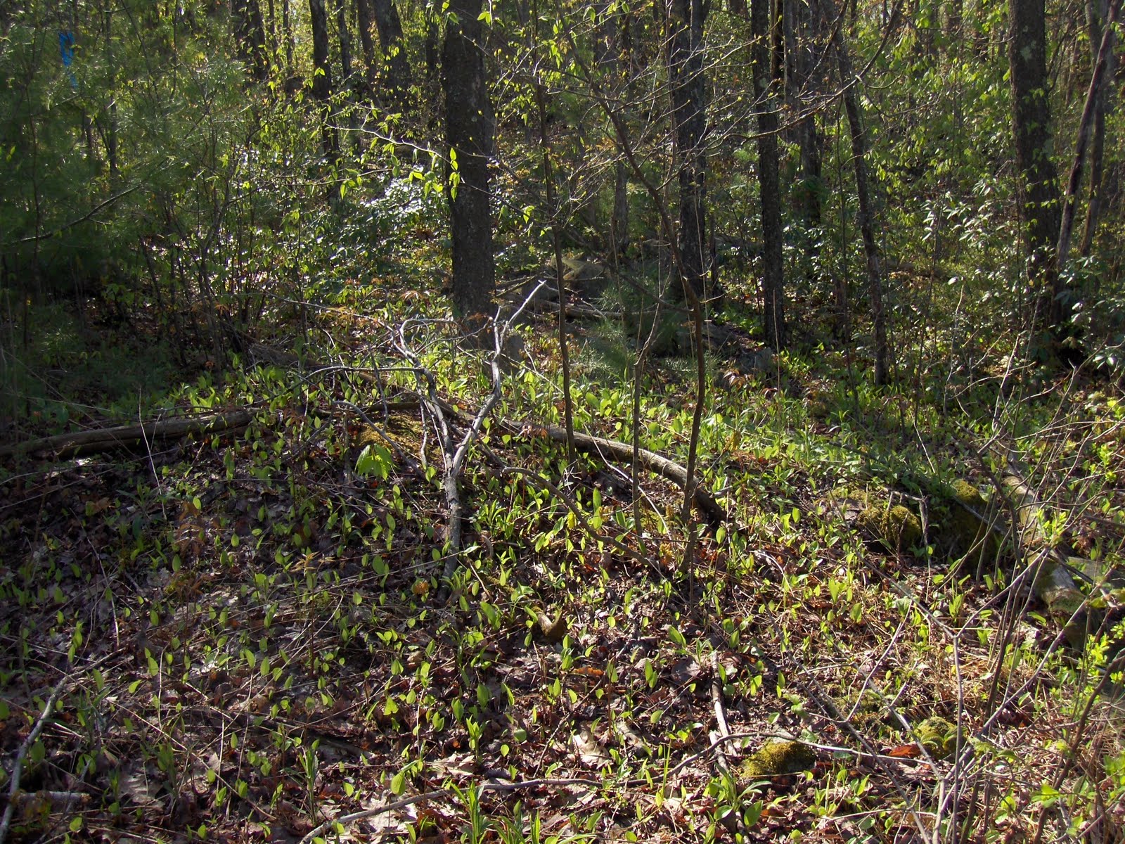
Sniffed around some more in the bushes at the edge of the swamp figuring there ought to be more and, yes, there were another couple of piles hidden in there. The colors are pretty but it is hard to get good information in that light.That all was on the west side of the road. I found more old piles on the east side of the road.

Sunday, May 15, 2011

Peekaboo - rock pile in the laurels

Westminster, MA off Bean Porridge Hill Rd.

Comments were lost

Recently "Blogger", the software behind this blog, has been having outages and weirdnesses. We lost a bunch of articles then - luckily - they came back. But they seem to have come back without comments. So I am going to re-type one of mine. Consider doing that too - as comments are so much part of the articles.

Friday, May 13, 2011

Living with Boreal Forest Fires (and Bears and Thunderbirds)

(Thunderbird Fire - Painting by Mario Peters 2007.)
"Thunderbirds are born in nests located on islands or hill tops where geologic formations consisting of heaps of rounded stones occur. According to oral tradition, long ago there were no trees on the land, so thunderbirds constructed their nests of rocks. These features are locations of power and are treated respectfully. Young thunderbirds arise from these nests in the early summer. Among the stories told about thunderbirds are several in which humans marry thunderbirds (Appendix 5.1). Although potentially dangerous, thunderbirds are generally beneficial for their role in renewing forest growth and for protecting their human relatives from horned serpents who live underground (meshekenaybegook). Were it not for the lightning wielding thunderbirds, these serpents would surface and destroy the Anishinaabeg (Quote 5.4.1 d.)."
From:  Living with Boreal Forest Fires: Anishinaabe Perspectives on Disturbance and Collaborative Forestry Planning, Pikangikum First Nation, Northwestern Ontario. By ANDREW MARTIN MILLER

complete text: http://umanitoba.ca/institutes/natural_resources/pdf/theses/PhD%20Thesis%20Miller%202010.pdf
Some Rock Pile and Cultural Landscape related quotes at: http://wakinguponturtleisland.blogspot.com/2011/05/living-with-boreal-forest-fires-and.html

Surprising Hollow Road Rock Piles

Upper Hollow Road in Watertown CT is an old farm road, still unpaved, a small stream running along it, a border between two former farms now long gone. I was probably on the edge of the former Wheeler Farm and if I looked at old aerial photography I'm sure I'd find I was in a former apple orchard. The remnant trees and their wild descendents were in bloom. But there were some rock piles, like the one above, behind a big boulder, to the east of the stone. It's unlike any other stone heap I've seen before and it took a few moments to realize that all the stones were in the quartz family. It's not likely that the Wheeler Family  removed only quartz and quartzite stones from the orchard or a cornfield and hauled them all the way over here...

There is quite a bit of quartzite in a nearby stone row segment, maybe a little more than is average. The segment is about 100 feet long.

Near where it ends is another stone mound, mostly mixed stones of the cobble size, about 25 feet in diameter...


There is a carefully made outer border, some of them "two people" sized stones, and, walking up onto the mound, it seemed to be composed of several concentric rings and a small circle at the highest point (which wasn't really that high). In the center of the circle there was a "two hands" size silver grey quartzy shining through all the green growing on top of the mound: 


To the South East of the mound was a 4-5 foot circle of stones, sort of like a fire ring as well as another 4-5 foot diameter stone pile opposite that on the North East side of the big mound, just as far from the mound as the circle of stones...
 
Heading down from there I came across a "Rock Pile with a Tail," something I'd only read about here at Rock Piles. A 4-5 foot diameter pile and a tail that looked like it might be a bunch of circular pilings...
Above is looking toward the stone heap from the tail,
Below the other way around:
Above: 1934 aerial photo
Below: stone row remnants and the four stone mounds, largest is the white circle at top (with second pile and hearth in grey), circle with white dot is the quartzy mound, and the other two are the mounds with tails...

Thursday, May 12, 2011

Testing

"Cave of Forgotten Dreams"

Norman Muller writes:

I just saw a fabulous 3D documentary by Werner Herzog titled "Cave of Forgotten Dreams" which focuses on the paleolithic art in Chauvet Cave in France. It is also being shown in 2D, but if you're interested in such things, 3D is the only way to fully appreciate the art in its context. The film is playing in NYC and other metropolitan areas, and may or may not yet be showing in Boston. It is worth a trip.

Wednesday, May 11, 2011

A walk in Bolton

You can duck into the woods off Wataquadock Hill Rd, there where I drew a blue outline on the map fragment, and you are confronted with a rocky wet slope like this (road in the background):There are actually several rock piles here. One:Two (with the first in the background or possibly connected to it):Three:This last might still be in somewhat of its original layout - smeared a bit - but with a ring of large outer stones, smaller stones inside the ring and, at the center, a colored rock, possibly burned:
So...

Further up the valley were occasional traces of other ceremonies:
Finally, deeper in, several rock piles on support rocks:They should make that into a conservation land.

Larry Harrop Outcrop Turtle Vision

Beaks

Above: a cobble with a beak; below: a boulder with a beak on a stone row.
Natural or worked?
Above: a beak on an even bigger boulder, similar to the Larry Harrop photo found here:
and pictured below:

Above: trying to capture the whole stone, just below a large over hang below Black Rock at the CT State Park of the same name. Below: interesting formation, perhaps an enhanced turtle shape, head stone  (looking up) at center with an eye, a left foreleg boulder, and a huge split boulder carapace (perhaps).
Nearby standing quartz stone:

 One more, Porter Hill Road Woodbury, a stone I've passed by numerous times without noticing until I started thinking about these turtle beaks:


Tuesday, May 10, 2011

Marcahuasi Stone Forest

Lost Civilizations of the Andes by David Pratt (January 2010): "The Marcahuasi (or Markawasi) plateau, 4000 metres above sea level, is located in Peru’s Junin province, 80 km northeast of Lima. Hundreds of enormous rocks on the plateau take on an eerie resemblance to animals and human faces when viewed from certain angles and under certain lighting conditions.39 Men and women of various races and nationalities can be identified, along with a wide array of animals such as horses, camels, elephants, lions, frogs, seals, turtles, sphinxes, a hippopotamus, sea lions or seals, a crocodile, and lizards. Many believe that these forms are nothing but naturally eroded rocks, while others contend that humans had a hand in carving them. Though known to the local population, Marcahuasi achieved prominence after being discovered by Peruvian archaeologist Daniel Ruzo in 1952. He claimed that the ‘Masma culture’ had lived there some 10,000 years ago, before ‘Noah’s flood’!"

http://davidpratt.info/andes1.htm

Part 2 of 2 http://davidpratt.info/andes2.htm


(Image above appears to be from: "Markawasi: Peru's Inexplicable Stone Forest" by Kathy Doore, and THE DVD - "The Mysterious Stone Monuments of Markawasi" produced by Bill Cote.

which I found advertised at: http://youtu.be/RdOydKcM7ms)
I originally came across it at:
http://theperuvianbackpacker.blogspot.com/2010/10/marcahuasi-adventure-awaits-you.html

And the "real story" from a totally reliable source called UFO TV, complete with Egyptians and Druids etc. can be found here: http://soundofnepal.com/videos/video/6xoGUg-nF6w/The-Mysterious-Stone-Monuments-of-Markawasi-Peru-Full-Length-Feature.html

And then there's this, near Robbinsville, NC: “This photo was taken at the first site we discovered. We are calling this the 'face' site, only because this sculpted stone resembles a face…”