(This is on the hill west of Fitchburg High School)
Friday, March 23, 2012
On the Antiquity of Man in America - George Carter's rejection by the academic apparatchiks
Via Norman Muller [with apologies for changing the title].
This is a short article by Thomas Lee, supporting George Carter’s research, and commenting on the difficulty of having their ideas published. This little article comes from the Anthropological Journal of Canada, 1977


This is a short article by Thomas Lee, supporting George Carter’s research, and commenting on the difficulty of having their ideas published. This little article comes from the Anthropological Journal of Canada, 1977


Thursday, March 22, 2012

Tuesday, March 20, 2012

Systematic Wall Damage
This is interesting, from the woods south of the NIH buildings on Pine Hill, next to the Sudbury Reservoir in Southborough.


 This went on for maybe fifty yards or so. What do you suppose is up with that?


 This went on for maybe fifty yards or so. What do you suppose is up with that?
Saturday, March 17, 2012
That first moment...
...when you sense something large looming behind the trees.
 (click and zoom in to see what I mean.)
Friday, March 16, 2012
Bulldozing Rock Piles in St George ME
[Reposting to keep this on top] to whom it mayconcern, my name is Craig Scaccia I reside at 74 Snows point road in, St. George,ME. I've lived here for numerous years. as a kid walking the woods around my lot, I came upon several. what I was told, Indian burial mounds. at this time,a logging company has come in to do what they do. and are driving over and tearing up the mounts as I write this email. I've called the town and had an official come out to talk to the supervisor. who stated that he would be as careful as possible but as dawn broke this AM they began cutting around the mounts hauling off the timber with the skidders. I spoke with the foreman this morning as they were driving over these mounts, and landing trees on them. I feel that these sites need to be preserved ASAP. please help before they are all damaged. my phone number is [CONTACT THIS BLOG FOR THE PHONE # if you can help]
Walls as guides for a journey through a site
I wanted to compare my statement:
with something in a Jack Steinbring article about Tie Creek, sent me by Norman Muller:
"walls may have guided a person's "journey" through a site"
"The connection between the main features seems to imply that some kind of movement took place between them. Possibly they were a series of "stations" to be visited by the members of some secret ritual order, or by those hoping to become members."
Thursday, March 15, 2012
Bulldozing Rock Piles in St George ME
to whom it mayconcern, my name is Craig Scaccia I reside at 74 Snows point road in, St. George,ME. I've lived here for numerous years. as a kid walking the woods around my lot, I came upon several. what I was told, Indian burial mounds. at this time,a logging company has come in to do what they do. and are driving over and tearing up the mounts as I write this email. I've called the town and had an official come out to talk to the supervisor. who stated that he would be as careful as possible but as dawn broke this AM they began cutting around the mounts hauling off the timber with the skidders. I spoke with the foreman this morning as they were driving over these mounts, and landing trees on them. I feel that these sites need to be preserved ASAP. please help before they are all damaged. my phone number is [CONTACT THIS BLOG FOR THE PHONE # if you can help]
Top of Hobbs Brook (#3) - The stone walls
With reference to the site described in several previous posts (eg here), my first visits to the place failed to find the nice rock piles but did notice the stone walls. There are several short stretches, like the one you can see on the right from Rt 2, heading west into Lincoln. Here it is from the top, Rt 2 visible to the right.
 But let's take this from the time of leaving those nice rock piles, in retrospect (to the right behind the wall):
 Looking in the other directions there is an opening, and one last rock pile (between the two trees).
 We walk along the wall with the swamp to the left and clockwise with the ridge and higher ground to the right. What's this?
 We walk further, what a pretty little knoll!
 Still further is an "orthostat". I don't know what this means but Mavor and Dix write about them.
 Continuing...we come to another break in the wall and a small U-enclosure on the swamp side:
 And then, I guess, yet another break in the stone wall. You can see the small U-enclosure in the background. Interesting that it opens sort of towards this busy junction of the wall:
 [Parenthetically, I have to say this plays into a sense that walls may have guided a person's "journey" through a site. Can you imagine?]
Continuing, here is another orthostat. This is the only feature I remember from that long-ago NEARA field trip. Just to get the layout, the busy wall junction is to the upper left here:
 Then FFC continued around the edge while I climbed up and over the ridge, and we met at the top of the short stretch.
 This wall is roughly straight down the ridge. At the same time there is a second wall that follows the ridge, perpendicular to the short stretch. Here at the top, it turns a corner:
 [FFC is fiddling with a compass and print of his "STUPID SHEET" (see link to the right)].
After the hilltop corner, the wall heads back downhill to the west. Incorporating a large boulder, look what is on top, in line with the wall:
 Hmph! Historic period. There were a few more, badly smeared, piles in there. I hardly think they are from the historic period.
 But I don't know.
 Here it is from the top, Rt 2 visible to the right.
 But let's take this from the time of leaving those nice rock piles, in retrospect (to the right behind the wall):
 Looking in the other directions there is an opening, and one last rock pile (between the two trees).
 We walk along the wall with the swamp to the left and clockwise with the ridge and higher ground to the right. What's this?
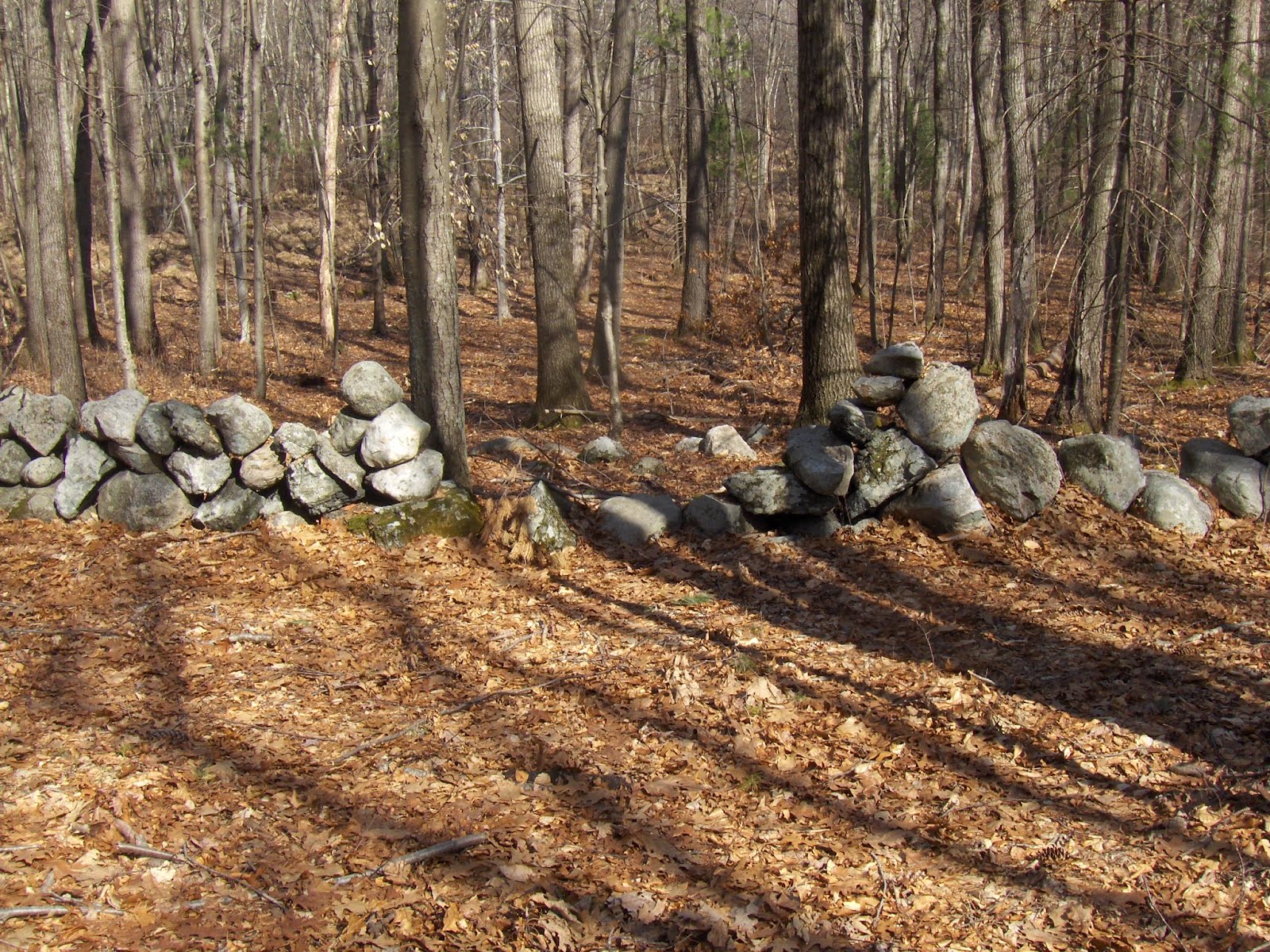 We walk further, what a pretty little knoll!
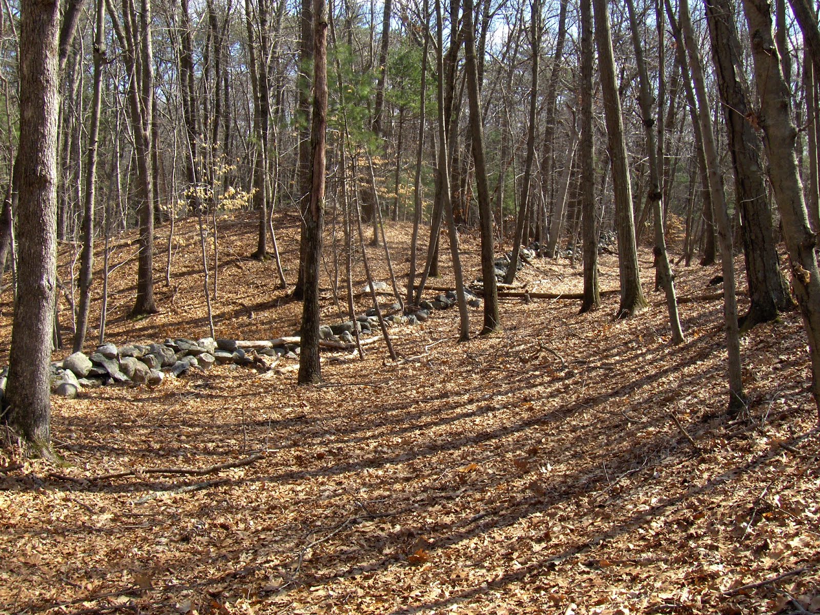 Still further is an "orthostat". I don't know what this means but Mavor and Dix write about them.
 Continuing...we come to another break in the wall and a small U-enclosure on the swamp side:
 And then, I guess, yet another break in the stone wall. You can see the small U-enclosure in the background. Interesting that it opens sort of towards this busy junction of the wall:
 [Parenthetically, I have to say this plays into a sense that walls may have guided a person's "journey" through a site. Can you imagine?]
Continuing, here is another orthostat. This is the only feature I remember from that long-ago NEARA field trip.
 Just to get the layout, the busy wall junction is to the upper left here:
 Then FFC continued around the edge while I climbed up and over the ridge, and we met at the top of the short stretch.
 This wall is roughly straight down the ridge. At the same time there is a second wall that follows the ridge, perpendicular to the short stretch. Here at the top, it turns a corner:
 [FFC is fiddling with a compass and print of his "STUPID SHEET" (see link to the right)].
After the hilltop corner, the wall heads back downhill to the west. Incorporating a large boulder, look what is on top, in line with the wall:

 Hmph! Historic period. There were a few more, badly smeared, piles in there. I hardly think they are from the historic period.
  But I don't know.
Wednesday, March 14, 2012
Top of Hobbs Brook (#2) View of a site from the outside
With reference to the site described here. Some views:
 closer:
 A bit to the side there is a break in the wall:
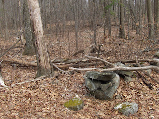 A bit further (the break is behind the fallen log across wall) this anomaly:
 You can see the piles in the interior. All the piles here were inside the outline of the wall, except for the one.
Once you give up the idea that walls and piles are mundane, interesting structure becomes visible.
A walk with FFC at the highest headwaters of Hobbs Brook - Lincoln, MA
 Say about ten years ago, I led a NEARA field trip to this isolated ridge - cut off from the rest of things by Rt 2 and by the surrounding swamp. At the time, I thought it was a nice place and was able to show the group a single "orthostat" - a large rock incorporated into the wall that loops around between the wetland and the foot of the ridge. It was my second visit to the ridge and apparently both times I followed about the only possible route to the place that did not cross a rock pile site. What can I say, I missed it completely.
But going back with FFC, coming southeast along the edge of Rt 2 and cutting in to cross the swamp (into the area indicated by a blue triangle above the red line of Rt 2) we immediately hit rock piles- pretty big, pretty smeared.
 I'll just show you the pictures. FFC and I had a fine time and he said (at the top of the ridge) that it was one of the most beautiful ridge tops he had ever seen.
You can think about this as you drive west on Rt 2 into Lincoln. in the first stretch of the road in Lincoln, after the level straightaway, when you see a first ridge on the right with a short stretch of stone wall coming down towards you. Know that there is a nice site right back there, behind where the pipeline pumps and vents are placed.


 It is not quite a roadside attraction, as you might spot some piles (behind you and to the right as you dip in the road before the traffic light at Tracy's Gas Station). But you would be risking bodily injury to do it as you are going above 55 mph and coming up fast behind cars stopped at the light. Anyway, it is a beautiful spot back there. Here is a short stretch of wall that goes down to the brook.
  Look how the rocks hook around at the near end. We could not decide if it was a later disturbance or the original wall design.
Another part of the site appeared as we went further in away from the highway. This was featured in a recent video (here)

 and
and It is embarrassing to have missed such a fine place on two previous visits. I somehow managed to find a narrow path that avoided all the piles. Here is an interesting structure:
 Note, the three rocks on the right are all white feldspar. Apparently there was no quartz available at this place. FFC thought the structure was connected to a slight pile nearby:
 Here is something else FFC spotted. Three split rocks all together. Gotta believe that is not a coincidence.
  The place had other marvels but I'll save them for later posts.
Note: Hobbs Brook is one of the sources of the Charles River.
Monday, March 12, 2012
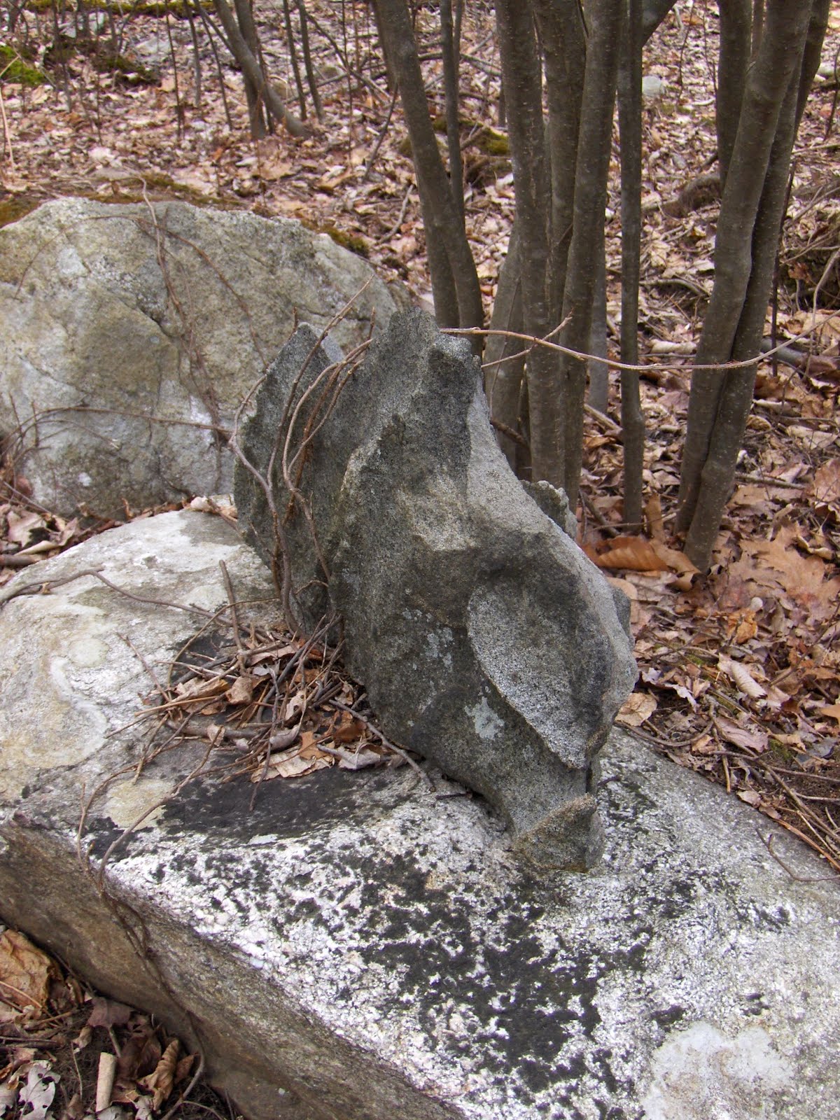
A fish?
The last thing we saw on our way out from a site on Saturday was this rock-on-rock, next to a brook. This is at the highest point of Hobbs Brook, in Lincoln. Click in to get a closer look at the "mouth".


Saturday, March 10, 2012
NEARA Spring Meeting Announcement
The full NEARA 2012 SPRING MEETING Announcment .pdf file is now available on the NEARA web site. Here is the link below:
http://neara. org/NEARA_ conf_Spring_ 2012v1-9. pdf
Also, as background on the research Ted Ballard will be discussing in his Fri. evening talk he suggested an article from the NEARA Journal archives here:
http://www.neara. org/ballard/ wantofanail. htm
Hope to see you all in Concord [NH] next month!
Peter's Hill - Sherbourn MA
You'd think I would have already explored a hill sharing my name. This is in a part of Sherbourn with a lot of conservation land including such places as Paul Hill and Brush Hill (discussed previously). Anyway, I went to check out the Broadmoor Audubon Land and gave up when I saw it was mostly sandy ridges, and drove back to Peter's Hill, which always looked good in passing. Went in at the north end of the hill, headed as northerly as possible. Then, finding my way blocked by houses, circled back up to the summit, across, and down the street side to the south. There were lots more houses than I realized and it is not a big conservation land. I spotted some little stone outlines at a spring near the beginning of the hike; a lone rock pile near the top of a rather flat summit; a small circle connected to a wall. A bit disappointing.
Is this ceremonial? I am not sure this is a familiar structure - which makes me suspicious. Note the spring beginning just below it.
 Here we are on top of Peter's Hill. One pile.
 This was interesting. You see a stone wall and a little diagonal spur coming towards towards you:
 At the center of the bottom of this picture there is a little ring of stone, about 10 inches across. Here it is after taking out some snow:
Is this ceremonial? I am not sure this is a familiar structure - which makes me suspicious.
 Note the spring beginning just below it.
 Here we are on top of Peter's Hill. One pile.
 This was interesting. You see a stone wall and a little diagonal spur coming towards towards you:
 At the center of the bottom of this picture there is a little ring of stone, about 10 inches across. Here it is after taking out some snow:
Subscribe to:
Posts
(
Atom
)
