Tuesday, August 05, 2014


.JPG)
Friday, August 01, 2014
Back on the "lawn"
On Monday evening my friend Dave and I went back the the grassy place where I found the arrowheads in my previous post. Here's another picture that gives a better idea of what the conditions are like there. You can see that the sandy earth is visible in little patches, the grass does not cover absolutely everything. But I'm sure you can imagine how challenging it is to search a place like this.
 The tractor that cut the grass left some ruts with its big tires. In one track, the tire exposed a little piece of a light-colored rhyolite. When I took the picture above, this was at my feet.
 Here's a closer look at that rhyolite piece in the tire track. Looks like an arrowhead...
 It is.
 This is a special find for me. The base shape is called an Orient Fishtail. There is a chip out of one corner of the base, on the right, but most of it is there. I have only ever found one other tool that might be Orient Fishtail (the big broken blade in this post) but this definitely is one, from what I can tell. You can see that this was originally much longer and the tip has been reworked into this shape, probably it broke or wore out and was resharpened into this form. I suppose it still could perhaps have been used as a projectile point but perhaps it was instead used as a perforator or a drill? These points are associated with the period from around 3200 to 2500 years ago. I am happy to have found it. Nearby, Dave found this:

 Last photo, a better view of the flaking on that rhyolite point. I am so pleased with this find.

It's really a shame this is broken because it is nice and thin and would have been a monster of a triangle. We looked for another couple of hours but didn't find anything else.
Wednesday, July 30, 2014
A Fresh Look at Buzzards - from The People of One Fire

The
religions of many indigenous cultures in the America’s have held carrion eaters
in high esteem. American buzzards and
vultures are not related to the birds of that name in the Old World, but are
all cousins of the California Condor.
Color slides of the Rock Eagle Mound and
various species of vultures in the Americas may viewed at: http://www.examiner.com/slideshow/vultures-and-condors-of-the-americas
At
the time of first contact between English colonists and Southeastern Native
Americans only certain branches of the Shawnee People utilized the vulture as a
central theme of religious worship. The Xuale
People, a branch of the Shawnee
living in West Virginia and South Carolina, literally called themselves the
Buzzard People. Suale
or Sule, pronounced Shü
: wä : lē or Shü : lē, means “vulture”
in Shawnee, Cherokee and Creek. The Alabama,
Choctaw and Chickasaw use the words, sayki
or sheki.
Archaeological
evidence suggests that in earlier times, a mortuary cult symbolized by the
vulture, was practiced by many ethnic groups in the Southeast. Priests in this cult, known as Buzzard Men,
never cut their finger nails or hair.
They dressed in black feathered cloaks and used their fingernails to
scrape the smokehouse preserved flesh off of cadavers.
William
Bartram observed in 1776 that several Creek chiefs in Florida kept beautiful
Painted Vultures as pets. The most
esteemed cloaks worn by Creek leaders were made of the colorful feathers of the
Painted Vulture, not eagle feathers as commonly believed today.
The
Rock Eagle and Rock Hawk in Putnam County, GA
Overlooking the banks of a small lake in Middle
Georgia is an enigma. It is a conical mound of white quartz fieldstones with
tail feathers, wings and a head extending outward. The breast of the bird is
eight feet high. The wings have a spread of 120 feet. The distance from the tip of the tail to the
top of the head is 102 feet. For Google Map lovers, the shrine’s location is: Latitude:
33°25'03"N and Longitude: 83°23'17"W.
This famous archaeological site is located in
Putnam County, whose county seat is Eatonton.
Putnam has another claim to fame.
Author and journalist, Joel Chandler Harris (1845-1908) grew up in
Eatonton. Harris originally wrote “The Uncle Remus Tales” as a series of
columns in the Atlanta Constitution newspaper.
In 1946, Walt Disney turned the antics of his Brer Rabbit, Brer Fox and
Brer Bar (Bear) into the hugely successful movie, “Song of the South.” Despite what Harris said when introducing the
newspaper series, he did not grow up on a plantation. He also did not obtain the stories from an
elderly African-American slave, but rather gleaned them from the archives of
the Georgia Historic Society in Savannah, when he was Associate Editor of the
Savannah Morning News. They are Creek
Indian children stories.
The Rock Eagle also has a “hidden history.” Many
references and news media articles tell readers that this bird looks to the
east toward the sunrise and is at least 5,000 years old. No, it looks to the
southeast and the beak is pointed due south. Archaeological studies have steadily shrunken
the age of the Rock Eagle, but it long predates the arrival of British
colonists to the Southeastern Coast.
History has forgotten who first called it the
Rock Eagle. The branch of the Creek Indians, living in that area when the first
Anglo-American settlers arrived, stated that they didn’t build it, but held the
site sacred. However, it was probably built by the ancestors of another branch
of the Creeks, who lived in the region earlier.
During the 1600s and early 1700s the few survivors of European plagues
and English-sponsored slave raids frequently moved across the landscape of the
Lower Southeast.
Many printed sources also claim that the Rock
Eagle and Rock Hawk are the only Indian mounds in the shape of raptors. That is not true either. A much larger bird-shaped mound was built
around 1200 BC at Poverty Point, LA.
There are several smaller raptor mounds scattered around Eastern North
America. However, the two mounds in Middle Georgia are the only bird effigies
built of white quartz stones.
The first book to describe the Rock Eagle was
published by pioneer anthropologist, Charles C. Jones, Jr. in 1873. Jones measured the shrine. He interpreted the Rock Eagle as being of
American Indian origin.
During the 1930s, archaeologist Arthur Kelly
was paid by the WPA to excavate the Rock Eagle to its base. He found a single
human burial underneath it, plus a single quartz spear point. The burial may or may not be related to the
construction of the mound. Unfortunately, forensic anthropology was in a primitive
state during that era, so the ethnicity and age of the skeleton remains
unknown.
While Director of the University of Georgia’s
Anthropology Department in the 1950s, Kelly directed several more studies of
the Rock Eagle. Evidence of a circular
rock around the effigy was found.
Archaeologists found traces of brightly colored non-indigenous clay at
certain locations. Apparently, at least
some of the bird effigy had been stuccoed with clay. They also found the ashes of human remains on
and near the piled rocks. This suggests
that the Rock Eagle was a location for
cremations.
After the 1950s, Georgia archaeologists lost
interest in the Rock Eagle and Rock Hawk, thinking that there was nothing more
to be learned about the site and its unanswered questions could never be
answered. In the intervening years writers
of articles on the site have speculated that the Rock Eagle was a regional
shrine for worship, a mortuary complex for processing the remains of high
status persons, a message sent to the Creator up in the heavens or a navigational
landmark for extraterrestrial travelers.
Some scholars noted that neither effigy
looked like either an eagle or a hawk.
The Rock Eagle looks like a vulture, while the Rock Hawk looks like a
song bird, or perhaps a Carolina Parakeet. The implications of these
observations fell on deaf ears.
A
fresh look at Georgia’s stone architecture sites
The Apalache Foundation was incorporated in
mid-2014 to sponsor professional studies of the hundreds of pre-European stone
architecture sites in the Southern Highlands and Piedmont. All of the sites are located within the
boundaries of the Apalache Kingdom, which predated the Creek Confederacy and
Cherokee Alliance. The Appalachian
Mountains are named after this almost forgotten indigenous people.
The Rock Eagle and Rock Hawk effigies first
caught the attention of this new team of researchers because they are aligned
to a corridor, at around 83° 20-24’ longitude, of stone veneered mounds and
stone cairns. This line is slightly tilted because it is based on True North,
not Magnetic North. The corridor is punctuated
with a complex of stone shrines on Curahee Mountain in Stephens County, GA and
a very large terrace complex with stone mounds, cairns and rectangular building
ruins along Sandy Creek in Jackson County, GA.
Almost all Native American mounds and towns,
built in Georgia between 250 BC and 1600 AD were aligned to the solar
azimuth. The alignment of a structure
can tell much about its builders and use. Rock Eagle is tilted to the southwest at
approximately 16 degrees. The alignment
approximates the sunset on the Spring and Fall Equinoxes at that location. The
tip of its beak points toward True South.
That arrangement would create a triangulation, useful for astronomical
observations and surveying.
Most Native American structures in Georgia
either are aligned with the Winter Solstice Sunset, the beginning of the Maya
Calendar, or at an angle approximating either the sunrise or sunset on the
Summer Solstice. The Summer Solstice is
the beginning of the Muskogean Calendar, which was used after around 1375 AD by
ancestors of the modern day Creek, Seminole and Alabama Indians.
As can be seen in the images associated with
this article, the Rock Eagle is probably a vulture or condor. Buzzard is an
American colloquial name for a vulture. Buzzards
and vultures in the Western Hemisphere are unrelated to the birds with those
names in the Old World. It would be more
accurate to call all carrion-eating birds in the New Worlds, condors.
Buzzards, vultures and condors were
associated with the religions of several indigenous cultures in the Western
Hemisphere. It is interesting that those
religions all contained practices similar to the ancient Zoroastrian religion
of Persia and the upper Middle East.
Zoroastrianism was the first monotheistic religion and dates from about
600 BC. The cadavers of loved ones were placed on wooden platforms, where
carrion-eating birds would devour their flesh.
Once cleaned, the bones would be bundled and placed in jars, wooden
chests or baskets. The Lakota Indians
continued this practice until the late 1800s.
A death-obsessed religion appeared in the
State of Guerrero of southern Mexico over 2,000 years ago. Its primary symbol was am abstract vulture,
very similar in appearance to the Rock Eagle in Georgia. (See image above.) Note that the body of the Guerrero vulture, Tzopilotl, is an exaggerated circle like
the Rock Eagle in Middle Georgia.
Images of vultures can also be seen in the
ceramic and copper art of the Hopewell Culture in the Ohio Basin. It flourished from around 200 BC to 500 AD.
The people of this culture were obsessed with death. Many of their famous ceremonial sites were
built around mortuary temples.
What would vultures have in common with the
Equinox? American Turkey Vultures do migrate southward from the northern
regions of eastern North America in the autumn and return in late March. Until becoming extinct in the late 1700s the
Southeastern Painted Vulture probably migrated from the central Southeast to
the Florida Peninsula in the autumn. William Bartram was one of two
scientists-artists who painted the bird before it disappeared. The Painted Vulture was closely related to the
Mesoamerican King Vulture, but not quite the same in appearance. (See slides
associated with this article.)
The Painted Vulture was yet another victim of
removal of Native Americans from their ancestral lands. A some point in the
past, this magnificent bird became biologically dependent on eating cooked
meat. Many were domesticated and lived in mortuary temples. Some were kept as pets by Native
leaders. Those in the wild lived off the
animals killed when Native Americans burned off the underbrush of forests.
The annual burnings of the forest floors by
Native Americans encouraged grasses to grow. The grasses provided more nutrition for game
animals than mature shrubs. In northeast
Georgia, the Natives even created artificial prairies where large herds of
Woodland Bison roamed. Once European
settlers replaced the Natives, the annual burnings stopped. Almost immediately the Painted Vulture, the
Southeastern Woodland Bison and the Southeastern Elk became extinct.
There is an important feature of the Rock
Eagle that links the mound to the Painted Vulture. Both the Painted Vulture and
its still existent cousin, the King Vulture, have predominantly white
bodies. They are the only carrion eating
birds in the world that have this coloration. The wings and tail feathers of
these two vultures are intense shades of black and bronze. If the Rock Eagle
actually portrays a Painted Vulture, it would make perfect sense for its
builders to use white quartz for the body.
The Rock Eagle Archaeological site is owned
by the federal government and maintained by the University of Georgia. The Rock Eagle Mound is located on the 1500
acre tract of Rock Eagle 4H Camp, which is owned by the University of Georgia.
Admission is free.
The Rock Eagle 4H camp is located southeast
of Atlanta, GA near US Highway 441, between Eatonton and Madison, GA. The mound is fenced. However, visitors may climb the stairs of a
stone tower to get a complete view of the ancient shrine from above.
Eating carrion is a dirty job, but somebody
has got to do it! Support your local buzzards.
Richard Thornton, Architect & City
Planner
POOF Editor
Tuesday, July 29, 2014

.JPG)
.JPG)
.JPG)
.JPG)
Monday, July 28, 2014
Some luck in a grassy place
Look at this place by a river. Freshly cut grass. It looks like a lawn. Would you believe it is possible to find arrowheads here?
 Well, there are little bare patches here and there. I spent an hour there yesterday. Here is something that is not made of quartz.
 It's slate. It's crude, it would be easy to not recognize this as an artifact. The tip and most of the stem are gone but you can still see the shoulders. This might have been a Neville point. Here it is with an asymmetrical little quartz triangle found nearby. Just the very edge was visible when I spotted it, I thought it was a flake.
 This chunky quartz knife or preform is missing a corner.
 This pretty little triangle was easy to spot. I had to move some grass out of the way to take the picture.
 Most of the quartz triangles I find, have an incurvate base. I don't have many straight-edged equilateral triangles like this. The very tip is gone. I'm still happy with this find.
 Not bad for a short walk in the grass.

Friday, July 25, 2014
Stone Circles of S Africa
Sydney Blackwell writes:
The South African artifacts remind me of this youtube video shows views of Southern African stone circles visible from Google Earth. Stone Circles Of South Africa. Narrator Michael Tellinger dates at least one of the VERY many at 70,000 years ago.
The South African artifacts remind me of this youtube video shows views of Southern African stone circles visible from Google Earth. Stone Circles Of South Africa. Narrator Michael Tellinger dates at least one of the VERY many at 70,000 years ago.
Thursday, July 24, 2014
Tuesday, July 22, 2014
Quartz arrowhead finds
Recently I had a chance to view a really fine arrowhead collection from the very area where I spend most of my time searching. Most of the points in the collection were made of interesting regional and even exotic materials like cherts, felsites and rhyolites, there were really old stemmed types- Stark, Neville, a Bifurcate Base- and newer types, too, Orient Fishtail, Fox Creek, through to triangular Levanna points. This collector only had a small handful of quartz triangles and Small Stemmed types, that I have found so many of. It was hard for me to explain how this person could have assembled a collection so varied in types and materials while I find a much more limited variety of tools looking in the same towns, along the same waterways in some cases. But this collector told me that his entire collection was from just a few sites, now virtually all destroyed. Most of my collection comes from a relatively small number of places, too. These sites where I am finding arrowheads seem to have had a lot of people living there during the late Archaic period and for whatever reason it seems that during that time, or at least part of that time, there were people who had a very strong preference for quartz to the extent that other materials were virtually excluded. It has been suggested that these people did not travel as much as other cultures at other times, and did not have much access to regional trade routes. This is not only the case in southeastern New England but also is true in other regions right down the east coast. Quartz is a very hard material to work and making tools out of this material created a lot of waste. Sites where quartz tools were manufactured and maintained are easy for me to identify due to the quantity of waste chips and flakes that were generated. I find fewer flakes made of other materials even at the sites I know where tools made out of different types of stone can be found. Perhaps the vast amount of waste flakes I find in places where this local quartz industry dominated has created in me an unreasonable expectation for how many artifacts (flakes) I should expect to find when surface hunting. I might perhaps be too quick to dismiss sites that may have been occupied by people of other cultures who preferred other materials and may not have generated as much debitage. I will say this much, I am sure that I am not focusing on quartz and missing other materials at the sites I go to. I pick up virtually every broken rock in some places and yet quartz artifacts absolutely dominate my collections from most of my most productive sites. Here are some of my latest quartz finds.
Here is the nicely-made base of an arrowhead sticking out of the dirt. Finely flaked edges, a nice squared-off stem and a clearly defined shoulder.
 I spotted this and imagined two possibilities: either this was going to be a very nice arrowhead, or it would be broken. I was surprised by what I found when I picked it up. It turns out there was a third possibility I had failed to consider: something that had started off life as a nicely made tool, but that was resharpened and reworked before being discarded.
 I feel sure the asymmetrical shape is due to being reworked, probably this was used as a scraper until the blade became so small it could not be resharpened any more. Here is is with other projectile point fragments I found at the same place, also a piece of a clay pipe from later times.
 I went for a quick walk in a productive place. I walked in, found this and left. A typical find for me, in a favorite spot where I have had a lot of luck.
 This is a nice one with a deep basal concavity.
 This past Friday night I was back at that same spot.The piece on the left is interesting, a stemmed point with one shoulder only. The narrow projectile point tip at the bottom is tantalizing. I have a lot of tips from this site, and a lot of bases and points missing tips, too. Some day I will be able to make a point whole again, I hope.
 This was from last Friday, too, in a different spot I stopped by at the end of the day. So fun to find a point just waiting to be picked up like this.
 I'm really happy with this one despite the damage. I like the long stem.
 Sunday I went for another walk. Usually if I spot a little piece of worked stone sticking out of the ground like this it is either a broken arrowhead fragment, or just a flake.
 Only very rarely is it a whole arrowhead. This was a nice surprise!
 I picked up a couple of fragments, too, as usual.
 Well, I did find one special artifact recently that is not quartz. It's not an arrowhead, either. I need to take some better pictures of it before I post it here.
Here is the nicely-made base of an arrowhead sticking out of the dirt. Finely flaked edges, a nice squared-off stem and a clearly defined shoulder.
Sunday, July 20, 2014
Less than 2 weeks until Pocumtuck Homelands Festival
From The Nolumbeka Project:
Of course, we're excited and have so much to do. Attached is a copy of our flyer. If you are in an area that hasn't yet been posted you can help us out by printing the attachment and hanging it. We are
advertising in Boston, Albany and Hartford. Even if you don't live in this area please hang a flyer. We hope this event will attract many people from outside the area. Listed at the bottom are the area towns
we already have postered.
Also, we find that we are in need of at least one more 10 x 10 pop-up tent. If you have one and plan to attend the event, please consider lending it to one of our vendors?
 There are many ways we will need help that day. If you are interested, please contact Lisa at nolumbeka@hemlockhouse.net
Thank you!
Already done or soon to be done: Greenfield, Turners Falls, Amherst, Northampton, Brattleboro, Shelburne Falls, Northfield, Hatfield, Sunderland, Orange, Wendell, Athol, Pelham
Of course, we're excited and have so much to do. Attached is a copy of our flyer. If you are in an area that hasn't yet been posted you can help us out by printing the attachment and hanging it. We are
advertising in Boston, Albany and Hartford. Even if you don't live in this area please hang a flyer. We hope this event will attract many people from outside the area. Listed at the bottom are the area towns
we already have postered.
Also, we find that we are in need of at least one more 10 x 10 pop-up tent. If you have one and plan to attend the event, please consider lending it to one of our vendors?
Thank you!
Already done or soon to be done: Greenfield, Turners Falls, Amherst, Northampton, Brattleboro, Shelburne Falls, Northfield, Hatfield, Sunderland, Orange, Wendell, Athol, Pelham
Saturday, July 19, 2014
Clear Crystal Clovis Point
Arrowhead fans, you'll want to have a look:
http://popular-archaeology.com/issue/06052014/article/archaeologists-discover-one-of-the-oldest-known-clovis-hunting-sites-in-north-america
http://popular-archaeology.com/issue/06052014/article/archaeologists-discover-one-of-the-oldest-known-clovis-hunting-sites-in-north-america
Friday, July 18, 2014
IAIS annual Native American Archaeological round table inWasington CT
Via Norman Muller:
Also, IAIS’s annual Native American-Archaeology round table this fall (Oct. 2529th
at the Institute) will be co-organized by us and CT SHPO. It will be
devoted to “Stone cultural features and ceremonial landscapes”. We have
7-8
speakers lined up and a panel of SHPO, state archaeologist and two
Native leaders. Free and open to the public. I thought you might be
interested.
Wednesday, July 16, 2014
.JPG)
Monday, July 14, 2014
Marana Rock Piles
Evidence for Large-scale Agave Cultivation in the Marana Community -
Suzanne K. Fish, Paul R. Fish, and John H. Madsen (1992)
"Linkage of agave cultivation with a farming technology represented by widespread remains in the Marana Community has been one of the significant consequences of Northern Tucson Basin Survey research (S. Fish, R Fish, Miksicek, and Madsen 1985; S. Fish, R Fish, and Madsen 1990a), illuminating a new dimension of prehistoric agriculture in the Sonoran Desert. Fields marked by rockpiles and low stone alignments cover many hundreds of hectares. Interdisciplinary study of these prehistoric agricultural complexes has detailed the nature and extent of agave cultivation during the later portions of the Hohokam sequence..."
 More: http://www.uapress.arizona.edu/onlinebks/Fish/chapter7.htm
Suzanne K. Fish, Paul R. Fish, and John H. Madsen (1992)
"Linkage of agave cultivation with a farming technology represented by widespread remains in the Marana Community has been one of the significant consequences of Northern Tucson Basin Survey research (S. Fish, R Fish, Miksicek, and Madsen 1985; S. Fish, R Fish, and Madsen 1990a), illuminating a new dimension of prehistoric agriculture in the Sonoran Desert. Fields marked by rockpiles and low stone alignments cover many hundreds of hectares. Interdisciplinary study of these prehistoric agricultural complexes has detailed the nature and extent of agave cultivation during the later portions of the Hohokam sequence..."
Friday, July 11, 2014
Druid's Circle/Boyscout Folly at Spring Hill in Acton
If you follow the trails north from Spring Hill, where Spring Hill and the Boyscout Land touch, you may see this in the woods:
.JPG)
.JPG)
.JPG) I occasionally see opposing stone "U"s suggesting multi-person ceremony [A Larry Harrop picture, I think from Foxborough?]. But those did not have seats and seat backs like here. Of course you should be suspicious of any strange stone structures found near Boyscout land.
I occasionally see opposing stone "U"s suggesting multi-person ceremony [A Larry Harrop picture, I think from Foxborough?]. But those did not have seats and seat backs like here. Of course you should be suspicious of any strange stone structures found near Boyscout land.
More College Rock Photos
From reader Matt H:
The last photo is a stone-row enclosure into a boulder in Milford (Upper Charles Trail), and the rest are in the College Rock woods in Hopkinton. The rest of the photos are examples from a cairn field in the College Rock Woods. The 2nd to last photo is a stone row ending at a ledge, the 3rd to last photo is an unusual stone shape. Am a seeing an effigy statue lying down with no extremities? Has the piece been worked on, the stones below it indicating it was put down like that on purpose, or am I seeing things....


The last photo is a stone-row enclosure into a boulder in Milford (Upper Charles Trail), and the rest are in the College Rock woods in Hopkinton. The rest of the photos are examples from a cairn field in the College Rock Woods. The 2nd to last photo is a stone row ending at a ledge, the 3rd to last photo is an unusual stone shape. Am a seeing an effigy statue lying down with no extremities? Has the piece been worked on, the stones below it indicating it was put down like that on purpose, or am I seeing things....
Old stone tool from the Maine coast
Reader Kae K. writes:
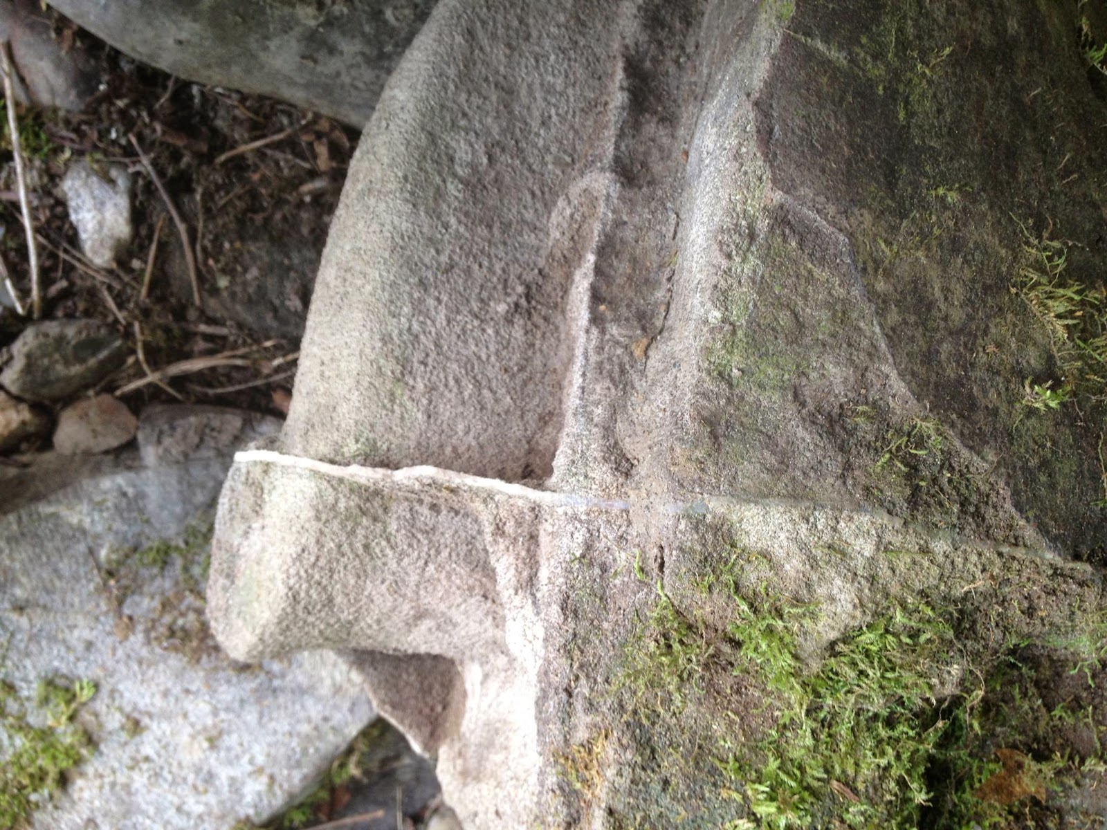
I was reading through your blog, and I thought you might be able to help. Found this rock on an island shore off the coast of Maine. I've searched the Internet, but can't find anything cut quite like it. Perhaps it is natural and no other explanation. On the other side, there are no black edges or residue like on this side, color is light gray. An inch thick and tapers down.

More photos here:
http://psalmboxkey.com/hello-
Wednesday, July 09, 2014
Interesting Stones in VT Stone Piles
A reader of Rock
Piles “for quite some time” decided to “step out of the shadows” and sent me
quite a few photos including those of this interesting stone (sandstone with
quartz veins?) in a stone pile found at the edge of a floodplain along the
Huntington River in Vermont:

A few more views:


Other stone piles etc. nearby:

Above is “sort of before,” below is “after” of a “cobbles on
boulder.”

This reader states that this above is “a photo of what I
think is a turtle form. On our land
(Huntington, Vermont) we have a road that is ancient (although it has been
unfortunately disturbed by logging) that is on a direct way from Lake Champlain
to Camel's Hump…”

(The Abnaki name for the mountain was "ta wak be dee
esso wadso," or "tahwahbodeay wadso" (wadso meaning mountain),
which has been variously translated as "resting place",
"sit-down place", and "prudently, we make a campfire in a circle
near water (and rest) at this mountain." - http://en.wikipedia.org/wiki/Camel's_Hump)
“…Indigenous
folks camped and farmed a bit in the summers around here, including down by the
river on many properties close by…(Several other camps along this river and
other nearby areas have been subjects of digs by the University of Vermont and
the Vermont Archaeological Society.)...On either side of our road are occasional
erratics…many of which seem to have subtle enhancements. Most we have left undisturbed. I found this small arrangement last year,
took lots of photos of it as it was almost completely buried and then carefully
removed most detritus. It is on the edge
of what is now a very boggy area and might once have been a proper small forest
pond. I have many more photos. I've been poking around the 'pond' edges
looking for other signs, and have found a few possibilities, but nothing like
this…”


There is also a “Split Erratic” (above left) described as
“filled with 'chosen' rocks, way too small, I think for a farmer to bother
with, plus the fact that the erratic is on a steep enough incline to make
farming here unlikely (there is a cellar hole about 200 yards above and some
messy stone walls - all larger rocks too - that have an entirely different
feeling to them) The piling is
characterized too by thinner rocks that seemed to have been arranged to 'echo'
some of the quartz bands and the shape of the erratic itself, although some
look disturbed, just by the forces of time.)
It has some astonishing bands of quartz and we're still working on
clearing it, so the whole picture has not emerged. It also has what I think are an unusual
number of 'manitou' shaped rocks in it.... but some aspects of it puzzle me or
haven't come clear. I'll include two
photo of it too in case you have some ideas.
The first one doesn't show that there are two rocks sort of nestled
together, it just shows the one bigger one - but that is what caught my
eye. The second (above right) attempts
to show the 'echo'…”
More views of this:


And a few more photos:


There may be more to follow, but I’d like to include that
the reader also sends this message along: “Thank you so much for your (Rock
Piles) site.”
Subscribe to:
Posts
(
Atom
)
