Tuesday, January 12, 2016

Rock Pile Stock Piles

 
One stone mason's opinion on making rock piles as stock piles:
      “To hear stonemason Nick O'Hara talk about building fieldstone walls, you'd think he was an art preservationist, not a contractor. When he receives sales calls from Massachusetts farmers who've disassembled their centuries-old stone walls and piled them up to be sold, O'Hara scoffs.
       "I tell [them], `I have no interest in that stone, thank you. You've already destroyed it,' “says O'Hara, explaining that piling up stones can break them apart -- and damage the precious lichen that his customers covet. "It's very much a sinful thing to do," he adds. Instead, O'Hara requires handpicked stones that are carefully laid in beds of mulch in the back of dump trucks…”

Sunday, January 10, 2016

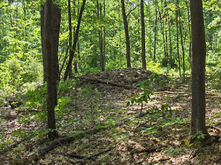
Big mound next to Miscoe Brook in "Kittyville" Grafton

Was driving Rt 140 S. in Grafton, on my way back from exploring near Hassanamessit. Saw this in the woods, but big enough to see from the road:
I did not like where I was parked and left without getting closer. Possibly this is part of the millworks in this spot. Just about where the dot on the second "i" of the word "Kittyville" here:

Monday, January 04, 2016

Triangle of Stones & Mounds at South Hill (Hi Tor DEC Forest) in the Keepers Area

From madis senner (at www.motherearthprayers.org ) [Posted but not endorsed.]:

Last week in the Keepers Area of South Hill of Hi Tor State Forest we found lots of stone structures. Most were mounds located on aspects of Mother Earth's subtle body such as Earth Chakras, Ley Lines and other features in the Energy Plane. There were Fields of Consciousness.

Towards the end of the day we found a triangle of large stones, shown below. 

I have been in the Keepers area dozens of times over the last ten years and never paid much attention to it, even though the stones are large. We all wondered whether there was something to it.

There was. The three stone mounds mark three Ley Lines, or put differently they are connected by three Ley Lines. The black lines in the photo below show the Ley Lines.
Perhaps there is something else to the formation, or that it serves some other purpose. Was it designed to have  people sit in the triangle? 

I point this out to say that what appears trivial, or insignificant may have a higher purpose. We have become so disconnected from Mother Earth that we fail to see Her as ancient cultures did and much is lost to us--even those looking for stone structures. 

Below are a few more pictures from our trips, one shows an orb taken by Jan Woodworth.


Tommy Hudson

Saturday, January 02, 2016

The Lewis Hollow Site survey (NY)

    I'm not sure that this ever popped up as a post (couldn't find it in a search of the blog), but it does have some water related rock piles (and stone walls etc.) sort of thoughts in it, some good photos, and a bit by Curtis:
“In June 2012, Dr Curtis Hoffman, Bridgewater State University, Massachusetts, conducted a blind survey with Johnson at a nearby site, which Doug Harris, Preservation Office, Narragansett Tribe, recognizes as a traditional sacred northeastern Native American site consisting of stone features which include astronomical alignments. Hoffman did not provide Johnson with any information regarding the site. Hoffman comments in his discussion of the blind survey that Johnson was able to find the site and that “I would say that this was a good confirmation of his method.” His report is included below…
    Both the Narraganset and Hopi traditional beliefs recognize sites containing cairns and other stone features as part of their ancestral history. The distance between the Bridgewater University Site and the Hopi Cairn Sites is 2,000 miles. However using the same methodology, Johnson was able to locate both sites, as well as other ancient Native American sites from different historical periods and regions, which strongly suggests they were aligning their habitation and ceremonial sites, as well as stone features, along areas of higher permeability. The results of these blind surveys suggest some of the oral traditions which have been lost to the Hopi and other Native American tribes may be recovered, to some extent, by Johnson’s methodology, as well as other researcher’s investigations of cairn sites (7-8).”
Conclusions
Throughout the northeastern states cairn sites such as Lewis Hollow share a commonality in setting, association with springs, cairns, effigy features and wall types. As more sites are added to the data base, the similarity remains consistent suggesting these sites were constructed by people with a common belief or origin. The site’s features reflect the three dimensional characteristics of earth itself, as well as traditional Native American beliefs. For example, springs with the underworld, surface features such as walls and cairns with the present world and astronomical alignments with the cosmos. Since several of the sites have been referred to by the earliest European settlers as existing at the time of their arrival, and Native Americans associate them with their ancestral heritage, it suggests many of these sites were constructed by the Native Americans who occupied the region for thousands of years (30).

Observations Regarding David Johnson’s Archaeological Site Survey Techniques
 By Dr. Curtiss Hoffman
"Dave Johnson and his wife came to the Bridgewater State University campus, Massachusetts, on Thursday, June 7th, 2012. He had agreed to attempt to locate an archaeological site I know about and which he knew nothing about by locating an area of higher permeability / aquifer using dowsing rods and following it to the site. I led him on a roundabout path through the woods around Great Hill. Actually, I led him to an entrance to the woods distant from the known Native American sacred site and let him find his way from there without guidance from me. He used his dowsing rods to locate 33 several aquifers running off the hill, though the water tower and the cell tower threw some of his results off. We came to the sacred site last, and without my telling him anything about it, he accurately located an aquifer whose edge conforms to the orientation of the stone row. He then went off downhill to find the opposite edge, and was visibly startled to discover the large split rock right at that edge! He traced the aquifer on uphill, and it turns out that there are 2 other aquifers crossing the solstice sunset line, which are also marked by stones. I would say that this was a good confirmation of his method, though I think he can make it more quantitative - for example, his readings on aquifer strength are ranked categories (weak, moderate, strong, very strong) depending on the angle at which the rods cross. I suggested he attach a goniometer to one of the rods to actually measure the angles."
Best regards, Dr. Curtiss Hoffman
 Department of Anthropology Bridgewater State University, Massachusetts

Friday, January 01, 2016

Starting the year with an experiment

Explore a ravine in 2016.

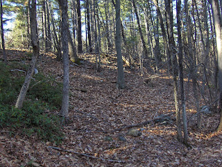
Result:  failure. Nearly killed myself (and son) trying to walk down rocky slopes covered with a smooth ice crust. Did get to the top of the ravine but not by following the brook. Nothing there except the stone wall switched from one side of the ravine to the other. Why the failure to find long mounds? Maybe the stream was not so navigable. Maybe nothing.

2015 - Review

The year started out with heavy snow that kept me indoors for several months. It ended with some new theories and exploration strategies that succeeded, so the year ended well. More details are available in the archive of links to the right.

January:
Just before the snow there were some minor sites and a field trip with Curt H. and Matt H. I found a fine marker pile site at Rocky Pond and Birch Hill in NH:
Later, after the snow melted, I found some fine 'rectangle with hollow' examples there, near the road.

Sitting snowbound at home, in January we saw:
 - new sites reported from CT 
 - strange rocks from Brazil
 - stone walls from CA

February:
As Tim MacSweeney says: "Up to our necks in snow". Sitting at home we saw:
 - rock piles in Alaska
 - other people's photos
 - strange rocks from CT
 - Hopkinton Land Trust buys 13 acres, notable for having "cairns" 
 - Tim sends picture of Nuclear Lake, NY
 - We watch "America Unearthed" - marveling at the degradation of content into drivel, including archaeologists stepping on rock piles while looking for traces of archaeology.

March:
Finally enough snow melted, I started getting in some hikes. Mostly to the south of Concord, as there was less snow in that direction.
 - Finally some "red rock" rock piles in Randolph, on south side of Ponkapoag Pond.
For several years, I had hoped to find piles made of the "Wamsutta Formation" rock.
 - March 28th was the first visible rock pile of the winter.
 - New pictures began to emerge from CT (thanks Tim)
 - Before that we are still looking at old photos ("Petroforms") and foreign photos (rock piles of northern Sweden)
 - strange rocks from NH
 - multiple news items from the Nolumbeka Project
 - more CA stone walls

April:
SNOW IS FINALLY GONE AND OUTDOOR ACTIVITY RESUMES
 - sites along North Str, Upton and along Warren Brook
with old decripit mounds:

  - re-exploring at Holden Rd Shirley, found a new 'mound' by the inland wetland:
  - a lovely mound group by Miscoe Brook in northwestern Upton:

May:
 - a couple of very minor sites at Wolf Swamp, Boxboro. But then, sites are hard to come by in there.
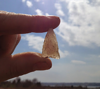
 - Chris Pittman startles all of us with his magnificent arrowhead finds:
 - I revisit George Krusen's "Hill of 500 Cairns", and located a few more on the east side:
 - Petromorphs from Montana
 - At the end of the month I locate a (for me) second (after Miscoe) significant site of the year, at Lovell Reservoir Fitchburg. With a great mound group:
Looking back, I think this may have been the "best" find of the year. But what was most significant was, in fact, the messy berms in the ravine there, which I payed little attention to.

June:
 - minor sites on Merrill Hill NH
 - strange rocks from Hollis NH
 - new finds by the Gumpass in Pelham NH, and A TICK BITE.

July:
Mostly I am going to the beach on weekends and not exploring....this is the dead zone of summer.
 - I found a little rock outline-connected-to-wall about 20 feet from the road at Minuteman State Park. No, the park is not aware of it.
 - The genetic nonsense about Native American DNA rears its ugly head.
 - A big load of nothing at Bordeland State Park (some messy stuff at the southern edge along a brook).

August:
 - more nothing at Bordeland State Park
 - more nothing at Red Brush Hill
 - Norman M. sends this photo of a stone chamber:
 - more nothing at Moose Hill, Sharon MA
 - an interesting boulder with auxiliary piles north of Silver Lake in Hollis NH
 - Mamjohn Pond in Gardner MA. Fine rectangular mounds:

September:
 - Egg Rock in Concord, is a famous spot but no one ever noticed the rock piles in the woods behind there.
 - Tim M. visits the "Judges Woods" behind the house where I lived as a teenager:
(looks like marker piles mixed with [in the rear] mounds).
 - found a rectangular mound buried in the bushes next to the Concord River - a few hundred yards from my house. Never took pictures.

October, November
 - a walk in Mason NH with Carol Montgomery - turns up lots of minor features that "click" together as similar to other sites in this "northern" MA/NH area. For example, little piles with hollows:
 
Also, carefully build rock piles against outcrops. This is a feature that resonates with others places:
 - Various threats occur:
       Algonquin Pipeline expansion
       The Stow Grid (ongoing)
       A (thankfully) false rumor of Parker Woodland destruction.
 - Much exploration at the north end of Horse Hill Groton/Dunstable:
 - The post about Horse Hill captures, or begins to capture, a couple of important theoretical ideas:
  •  that burial mounds will be found at the high point of the path of least resistance from the water up the hill
  • that a mixture of marker piles with larger, lower, mounds is to be expected at the high point.
  • that (at least in the Nashua watershed) the top of the ravine will have long berms with hollows, in place of or in addition to rectangles with hollows.
December:
This theory, results in my beginning a refined hunting strategy: find a major waterway, and a small tributary brook. Follow the brook to its high point and look around. In the northern (Nashua River) areas, look for elongated berms with hollows, otherwise expect rectangular mounds. This burials at headwaters becomes a highly successful strategy for me, for the rest of the year. Would any of my readers care to give it a try? I am able to "squeeze juice from a rock" (or is it "milk from a bull") and find rock piles in Groton near the Throne:
 
 - Amazingly I extract a rock pile from Ballard Hill in Lancaster MA. After all, the Nashua River passes nearby:
 - I re-explore Rattlesnake Hill in Bolton. A couple of brooks lead up from a larger waterway and the same hunting strategy turns up a couple new sites on the hill.
 
 - At Blood Hill I finally become aware of elongated mounds with hollows, found in ravines. They have a characteristic shape, location, distribution in the Nashua and Souhegan watersheds [which is only as far as I have explored]. So let me end this review with the grandest "ravine culture" mound I know - the grand "J" at Blood Hill which captures the essence of this special aspect of stone mound culture in these parts (right click and open in new tab to see magnified):
And finally, this is echoed by a pile along E. Wachusett Brook in Princeton

The sites and ideas that stand out from the rest, over the year, were:
 - Ravine Culture at Blood Hill
 - The pathway up the hill at Horse Hill
 - The Lovell Reservoir Mound Group 
 - A forlorn site near the head of Miscoe Brook

Thursday, December 31, 2015

East Wachusett Brook - long mound with hollow

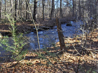
The "mound" archeology may be interesting but I was taken with the brook itself - wide and busy with earth on either bank so impacted by the passage of people that there is almost no undergrowth. I should have taken a more careful picture:
Walking north along a well defined path, I notice a lot of piled rock up on the left:
Is it natural or man made? I decided pretty quickly that it was man made:
This is a large berm made of cobbles. I notice a chunk of quartz, left of center (the observant reader will also notice a small enclosure between the camera and the quartz):
Bear with me....I want to point out that the "mound" continues to the right of this picture. I am standing in a hollow with more of the rock pile behind me. It is hard to see because of the bushes but here is a shot from the end of the mound:
 
This part of the mound has its own chunk of quartz and, in fact the overall shape is this:
The opening faces the brook, seen below:
The hollow, on the left edge of this picture, might also be a ramp down to the brook, but I ignore that interpretation, and assume this is simply the hollow of a different shaped burial mound. Hard to get a picture of the whole thing. From one end:
Goodbye from below. You can still see one of the chunks of quartz:
This is from East Wachusett Brook in Princeton MA, around where the small blue outline is on this map:
This is the Stillwater River watershed. It is the only example of a "long mound with hollow" from south of Rt 2. As I look at the map, the Stillwater River flows south into the Wachusett Reservoir in Clinton, and then into the Nashua. So actually this 'long mound with hollow' is, like all the other examples, a feature of the Nashua and Souhegan watersheds.