[via Norman Muller]
Sunday, August 14, 2022
Friday, August 12, 2022

Tiverton Appetizer
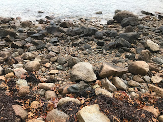
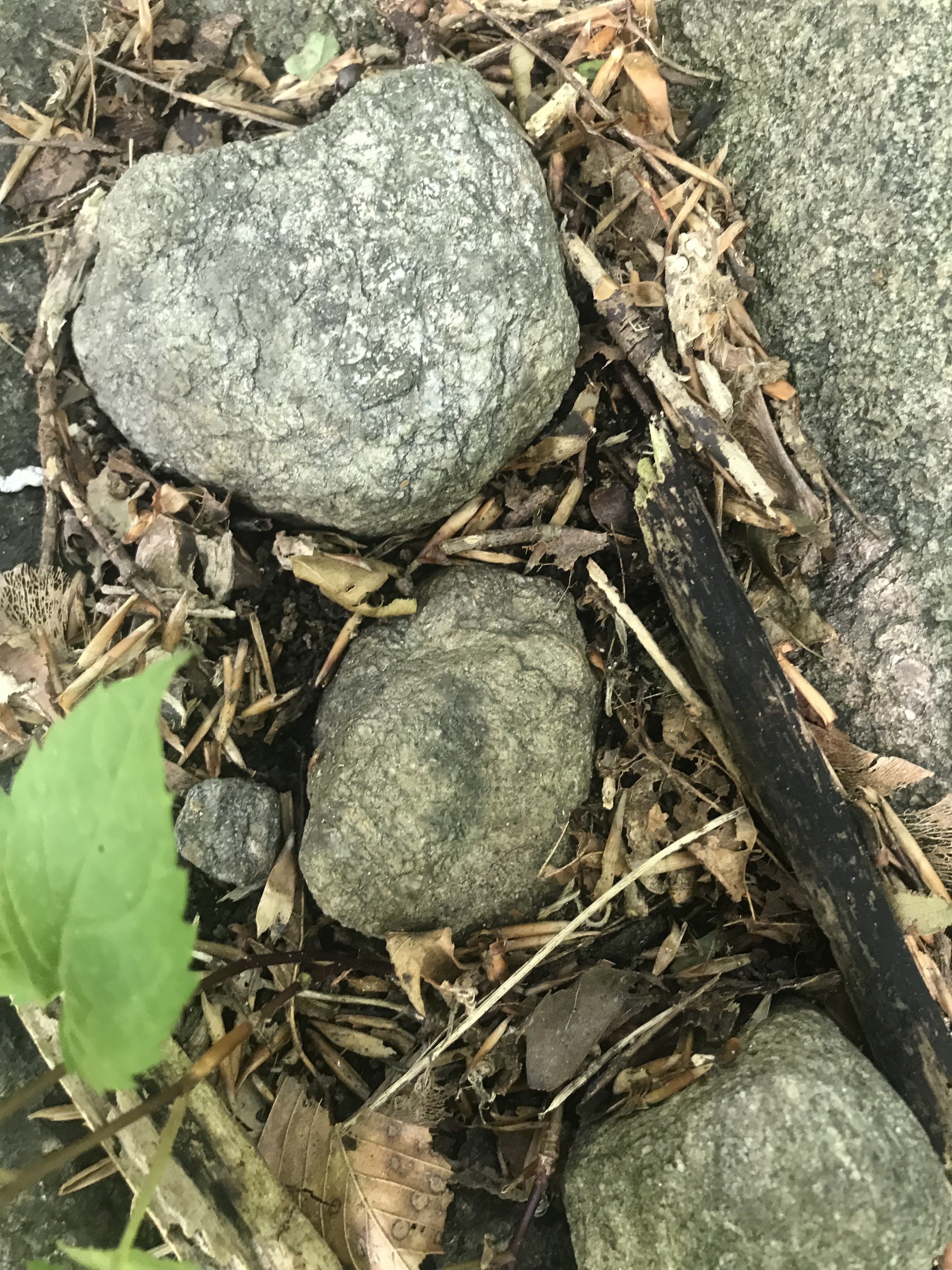
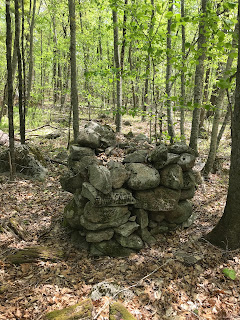
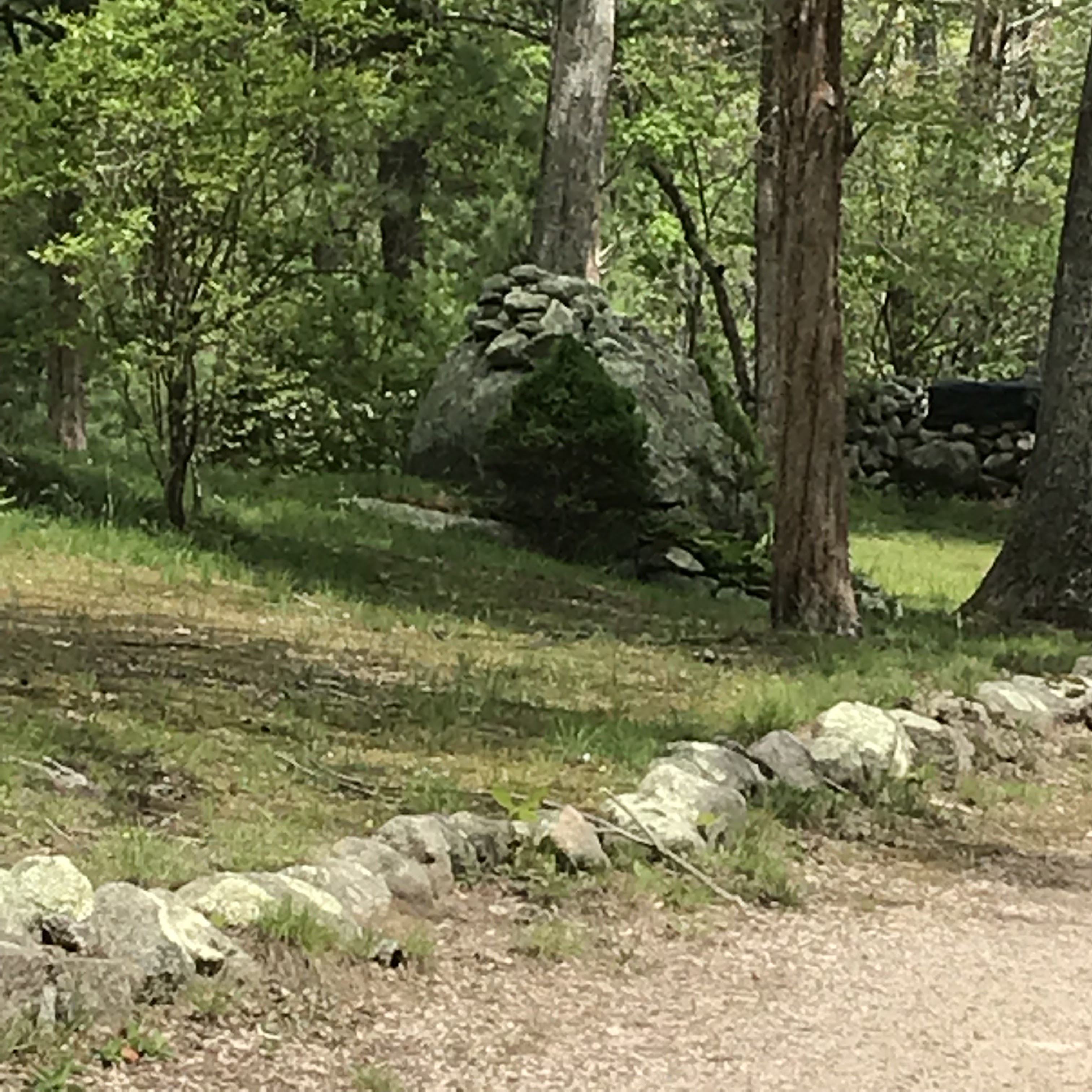
I decided I needed a hike and drove an hour off-Cape to get to someplace interesting. Tiverton turned out to be a good choice and, as I study the map, I see five or so other hikes that look interesting in that town. There is a lot of conservation land, hard bedrock, and water. So I think I'll go back and get to know the place a little.
Thursday, August 11, 2022
Monday, August 08, 2022
Moncacht-Ape 's journey across North America
[Not rock pile related but interesting]
(8) The Incredible Journey of Moncacht Apé Across North America - YouTube
Tuesday, August 02, 2022
37K old site found in New Mexico
New Mexico mammoths among best evidence for early humans in North America (phys.org)
I note a couple of bits of sloppiness in the reporting. Clovis is only around after 14K years ago and there is no mention of the White Sands footprints - also in New Mexico. Finally the idea that it is now OK to accept a second group of "first Americans" to supplement the failing story of "Clovis First" is no less absurd than having a single such group.
Update: It is almost like a "Clovis Second" concept.
Sunday, July 24, 2022
Sunday, July 10, 2022
Rest in peace Larry Harrop
Our community will be sad to hear that Larry Harrop died. No details are available, other than that he died in early June.
Larry was an occasional contributor to this blog and, although I only met him once, I always thought Larry took the best rock pile photographs. He did a wonderful job capturing the mystery, atmosphere, lighting, color, and beauty, of rock pile sites- mostly in Rhode Island. When I think of Larry I will always think of rock piles in the fog. His photos remain imprinted in my mind.
His photo albums disappeared quickly from the internet but we have a few here to remind us of his work. See here.
Monday, June 27, 2022
A hole, trailing cobbles, and adjacent mound.
This is in Wheeler Woods, west side of the new trail made by the Buzzard's Bay Coalition, who bought a heck of a lot of archeology without realizing it. You can see these things from the trail, above the main kettle hole.
Bullseyes and Rings
I saw a couple of ring-inside-ring structures a year or so ago, at Quisset Harbor on Cape Cod (see here), mixed in with some other examples of simpler rings. Here are the photo's I took:

And
Since these are below high tide, I guess they were used when the water was still several feet lower. It gives you a sense of age.
Anyway, I saw another one, not so much a ring in a ring, but you be the judge:

Just for fun: A friend of mine climbed Mt San Gorgonio in southern California. Which drew my attention to the aerial view of that mountain top. One imagines the "ring of stones" concept was pretty universal:

You could probably write a book about what kind of archeology is found on American mountain tops. Possibly similar things were practiced at the other extreme - at the edge of the sea.
A little "spell" in stones
Just being a contrarian, I think there is a slight different between a "spell" and a "prayer". The latter suggests something that is always benevolent; where the former might be malevolent as well.
Nowadays, when I see a little structure like this, I believe it is worth looking carefully at the individual rocks.


I see an old friend here, the cashew/boat rudder that is sometimes called a "manitou" but I beg to differ. As long-time readers may remember, I speculate that this has to do with making an agreement.
The middle rock is pretty non-descript.
 The lower rock has a bit of shape too. Is that a Manitou? A Cashew? Something else?


It may all be nothing, or a meaningful little combination of elements.
This is left of the entrance to the WHOI Quisset campus, about 30 yards from the main road. I would mention that the valley to the right of the entrance is full of dumped rocks. Small rocks, compatible with being from disturbed mounds, I could not quite convince myself the piles were anything other than mundane. On the other hand, this part of Woods Hole is where most of the genuine mounds are, so that suggests they might be worth a closer look.
Sunday, June 26, 2022
Eagle Rock 4H Mounds (GA)

(Replaces a removed post from 6/2016)
Mound Report: The following chapters are
excerpts from a larger report titled: “Archeological and Historical
Investigations for the Proposed Rock Hawk Trail Corridor Adjoining Lawrence
Shoals Park and Little Rock Eagle Mound in Putnam County, Georgia” written by
Jerald Ledbetter:
"Standard survey field methods were employed in
accordance to the scope of work prepared by the Office of Historic Preservation
in consultation with the principal investigator. Information on 28 sites, four
isolated artifact occurrences, and more than a hundred rock piles was recorded within and near the project area."
Tuesday, June 21, 2022
Removing stones from rock piles for "safekeeping"
In the previous post [see here] Norman describes a "Gorget on a Rock Pile" and mentions that there was an unusual "gorget" stone found in the pile. Later the State Archaeologist removed the stone for safekeeping.
I think the ethics of removing a special rock from a pile for "safekeeping" needs some discussion. Does anyone have any opinions about this? I remember Doug Harris, in a YouTube video talking about how removing a rock breaks the "prayer" - only to then watch him remove a rock and put it back. Clearly removing a rock permanently, and taking it off to a place where they have presided over the destruction of many wonderful things, hardly qualifies as "safekeeping".
Like any ethical question, I doubt there is a good answer. I just think the state carting off treasures should be done with reluctance. And who the heck is the State Archaeologist anyway? Why does he get to destroy the rock pile? To me it is inconceivable that these are the right people to make that call, or to be the keepers of special ceremonial rocks. Generally such objects are poorly documented, not accessible to the public and, basically, lost for good. I would give you odds, that a member of the public, today, would have trouble even getting to see the "gorget".
Comments?
Saturday, June 18, 2022
Gorget on a rock pile
From NormanMuller:
In 2011 I was with a small group of NEARA members in Rochester, VT, which was led by Ernie Clifford. We visited site R7-8, which is called the Beaver Pond site, near the larger Smith site. We walked about a bunch of platform cairns and then came upon a low, long cairn on a rise overlooking a small brook and swampy area. One member of our group saw a stone object resting on top of a large stone in the cairn (`02-1702), and lifted it out for all to see (0060). It turned out to be a preform slate gorget. There was a bit of lichen at one end, and the surface that had been resting on the boulder had a rust color, evidently from the fact that slate contains some iron and it had oxidized out over time. The gorget was also of poor quality, and had a number of deep scratches on it. Obviously it was discarded because of this. Most gorgets are perforated, but this one was not.
I returned to the site the following weekend to photograph and study the gorget more carefully, placing it on a grey cloth and photographing top and bottom and one of the sides (0026). I then placed the gorget back to where it was originally found. Later, the National Forest archaeologist removed the gorget for safekeeping in Rutland.
This simply emphasizes that one should study cairns carefully. You never know what you'll find.

%20copy.jpg)
.jpg)
Tuesday, June 14, 2022
Monday, June 13, 2022


Why don't they have stone arrowheads in Europe?
I cannot find any pictures of elegant stonework from -say- France that is any more recent than those fine Solutrean blades. But what were the Europeans doing around 10K years ago? Just a little puzzle. I did see some fine things from Spain, so what is true?
Saturday, June 04, 2022
Our Vanishing Ceremonial Stone Landscape (CT)
Apparently, I’m documenting Our Vanishing Ceremonial Stone Landscape more than anything else these days. Similar to Eric Sloane writing and sketching about a romantic colonial past, I’m instead blogging about and photographing disappearing features of an Indigenous Cultural Landscape that only a tiny percentage of people are aware of, think is somehow “interesting,” much less worthy of recognition, study, and preservation. I’ve been documenting for years the disappearing Nonnewaug Stone Fish Weir, miles and miles of stonework under power lines being ground up for road beds, stones popping out of retaining walls at the family home, and now a simple tree fall that knocked apart a formerly very beautiful “Stone Prayer” on a hillside somewhere close to the Madison/Killingworth town line.
In a
recent Face Book post, Karen Lucibello Daigle recorded a bit of video, perhaps in
late winter or early spring, of some tree damage to this Káhtôquwuk or Stone
Prayer that I took a look at once back in 2016:

Captures from Karen’s
video, cobbled into an image:


Some more images of mine from 2016:

(Note the Manitou Stone above, the "Healing Diamond" below.)


A couple other images in my most recent "K-WORTH 2022" folder:


A Correction:

Káhtôquwuk or Stone
Prayer on S-Hill:
https://www.flickr.com/photos/34580529@N04/albums/72177720299519377
Mid S-Hill:
https://www.flickr.com/photos/34580529@N04/albums/72157665915629962
Upper S-Hill:
https://www.flickr.com/photos/34580529@N04/albums/72157665814497872
Sebaquanash “The Man Who Weeps” by Dale Carson (Abenaki):
http://rockpiles.blogspot.com/2019/04/some-lines-from-hammonasset-story.html
Thursday, June 02, 2022
A last word about Canonchet
In the previous post, we saw a low rectangular mound that was different from the nicely built biscuits surrounding it. I forgot to mention one other out-of-sync pile, consisting of a layer of small rocks on a support boulder:

Friday, May 27, 2022
A trip to Canonchet
Went for a drive with my middle son, David, to southwestern RI and Canonchet. Having heard about Canonchet for many years, I thought it would be worth a visit. As it turned out, we barely scratched the surface. Among other things, I am pretty badly out of shape after 3 years of staying at home to avoid disease.


As soon as we got over to the "hill" - a small outcrop - we started seeing rock piles. I liked the bit of stone wall we saw. Tim M. might call this is a "snake". I was struck by the pointed standing stones at each end (small in front, large in back). I was particularly struck by the third rock from the front - made of quartz. It reminds me of the pearl on Unktena's forehead.

[Parenthetically, I just Googled "Unktena" and it is all over the Internet that it is a "Cherokee Myth". But that is nonsense. The Cherokee were not in Massachusetts, naming the islands and brooks.]
Anyway, we continued uphill, through the site. This is David Waksman:

The piles got bigger and fresher looking, right up into someone's backyard.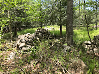 Quite an intense place. I rarely see piles so close together. Also, since these are quite cleanly vertical sided, I suspect them of being a kind of marker pile.


There is a sense that the vertical sided piles were all lined up toward the same direction (note the angle of the tree shadows in these 3 pictures):


Then we got out to the Lawton Foster Rd. Here was another fine rock pile across the street in someone else's backyard:

We trudged uphill, admiring rock piles on either side of the road. Apparently the locals are OK with honoring these things. Here is someone's driveway.
Then we came to another collection of larger piles, on the north side of the road. Note how some of these are older, not reconstructed and covered with leaves, moss, and downed branches.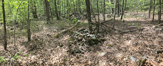

But this one? I think it might have been reconstructed:

In the middle of all these glorious marker piles, something different and less conspicuous: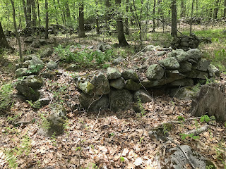 Yep, that's a rectangle with a niche at the lower right. Let's go around to the other side and have a look:

(I got the name of the road wrong, it is not Richardson Rd but Lawton Foster). Another error, is that while filming, I did not notice there was another rectangle to the side - it is right at the end of the video. Also at around 0.14 minutes from the start.
If you watch the video, there is something wrong about the "hollow". I would say that it partakes of the same "newness" as do the reconstructed piles. Except, this looks more like recent destruction than recent construction.
I wanted to go on walking but we sort of got stuck on the road because of not knowing which way to go, and ending up circling back to the parking lot. Sorry I was in such a rush, I really have to slow down and learn how to study places rather than focusing on how to get there and back.
Update: I think Jim P photo'd the same piles long ago:
Subscribe to:
Posts
(
Atom
)
