[Click here]
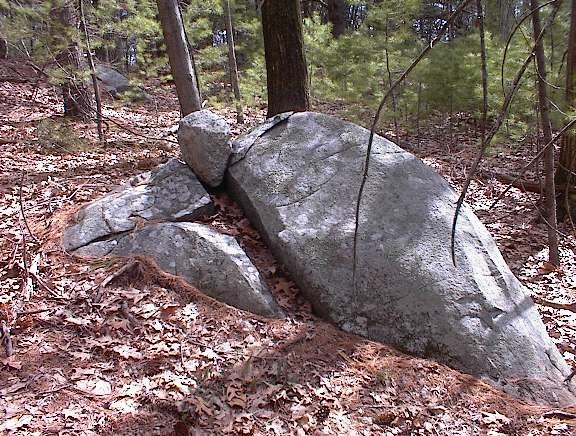
We call these perched boulders.
Monday, April 24, 2006
"Petroform" links
A new day, a new search term. Getting new material on all the search engines using the word "Petroform".
[Click here]
From "Inner Workings Resources"
[Click here]
The Wikipedia entry for "petroforms". Anyone feel like going there and updating the information?
[Click here]
Here is one from Whiteshell I haven't seen photo'd before.
[Click here]
For a discussion of "Petroform Astronomy"
[Click here]
Here is a sadly incomplete web page with photos of Wisconsin Petroforms. Man! They get so excited about a single rock pile. They would tend to lose that attitude after a few minutes in New England. And -yes- I am criticizing this for its lack of mention of things in our area. It seems to lack scholarship for what, on the face of it, is a serious research program.
[Click here]
A petroform swastika- never saw it before.
[Click here]
From "Inner Workings Resources"
[Click here]
The Wikipedia entry for "petroforms". Anyone feel like going there and updating the information?
[Click here]
Here is one from Whiteshell I haven't seen photo'd before.
[Click here]
For a discussion of "Petroform Astronomy"
[Click here]
Here is a sadly incomplete web page with photos of Wisconsin Petroforms. Man! They get so excited about a single rock pile. They would tend to lose that attitude after a few minutes in New England. And -yes- I am criticizing this for its lack of mention of things in our area. It seems to lack scholarship for what, on the face of it, is a serious research program.
[Click here]
A petroform swastika- never saw it before.
Sunday, April 23, 2006
Rt 202 Roadtrip - Lots of new sites to report
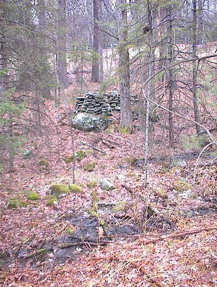
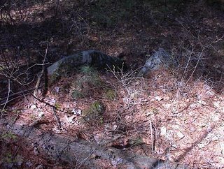
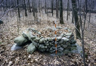
I have to report on about 5 sites from Saturday's roadtrip with Bruce McAleer and one from a short stroll I took with people from Carlisle today. This may keep me busy blogging for most of the week. So to get started, here is the best rock pile I saw all weekend: 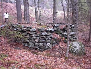 This is an unusual pile because from above, the outline looks like this:
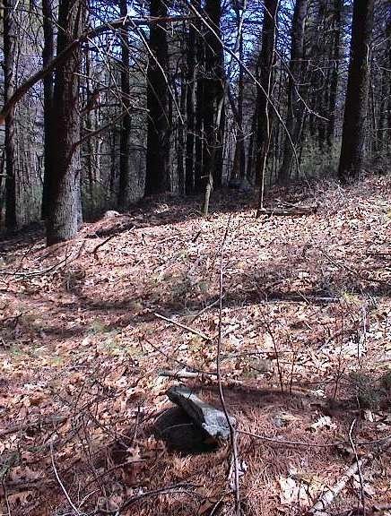
  This certainly is turtle like, although possibly a person could stand on the flat upper surface and go out and stand on the extremity. Here is a view from above, pretty much what I spotted from the highway as we drove past the site:
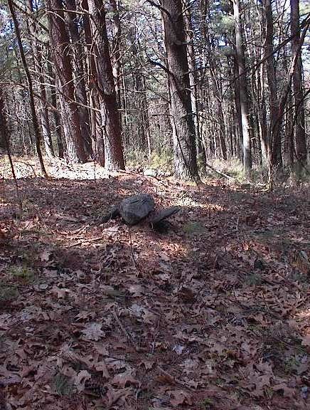
 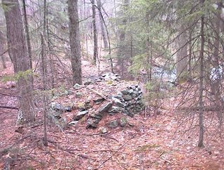 And here is a view of the spring which begins just here, underneath this prominent pile:
  You can see the highway railing in the background.
A bit further downstream there were smaller piles, mostly on supports, clustered around the brook. In this panorama, there is a bit of a dam across the brook, at the right hand end of the picture.
 This is a neat place. Any one of these sites deserves better than to be blitzed like this. But that's what you do on a roadtrip. I hope someone will go spend some time looking more closely at these sites along Rt 202. I'll tell you about the others later.
 This is an unusual pile because from above, the outline looks like this:
  This certainly is turtle like, although possibly a person could stand on the flat upper surface and go out and stand on the extremity. Here is a view from above, pretty much what I spotted from the highway as we drove past the site:
  And here is a view of the spring which begins just here, underneath this prominent pile:
 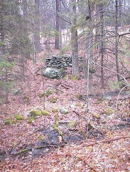 You can see the highway railing in the background.
A bit further downstream there were smaller piles, mostly on supports, clustered around the brook. In this panorama, there is a bit of a dam across the brook, at the right hand end of the picture.
 This is a neat place. Any one of these sites deserves better than to be blitzed like this. But that's what you do on a roadtrip. I hope someone will go spend some time looking more closely at these sites along Rt 202. I'll tell you about the others later.
New Photos from Larry Harrop
Larry writes:
I added a new album http://larryharrop.com/v/NorthWatuppaPond/ . Judging by all the old stone walls in the area, some of this could be field clearing piles.
I added a new album http://larryharrop.com/v
Saturday, April 22, 2006
Back to Moosehorn Rd
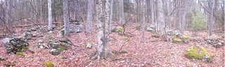
Bruce and I are going on a follow-up road trip, back to the great site we found near Moosehorn Rd. in New Salem, MA. Actually it turned out the be at the origin of "Manning Brook". So today we are going back to explore down along the brook a bit, up to the nearby hilltops and, generally, in the neighborhood of the site we found. The theory is that the eastern hill, constituting the eastern horizon from the site, might have some horizon markers - points of reference visible from the site. Also there are a couple of small ponds along the brook and nearby that I want to walk around. Let's go look for rock piles!
On a more serious note, we found this site with multiple large platform piles - suggested complex and organized use. But for what? Since this region is pretty undisturbed we hope there will be other structures and features connected to the site. So think of this as an experiment in understanding platform pile sites. We'll see if anything comes out of it besides more pictures.
On a more serious note, we found this site with multiple large platform piles - suggested complex and organized use. But for what? Since this region is pretty undisturbed we hope there will be other structures and features connected to the site. So think of this as an experiment in understanding platform pile sites. We'll see if anything comes out of it besides more pictures.
Friday, April 21, 2006
Midway Twins Melting
 Midway is a place in the Acton Conservation lands with a nice site beside a wetland. I like this picture.
The hill across from the bend in the river
In this famous painting [Click here] of a Native American Village at the bend in the Merrimac River at Shattuck Farm, there is a hill in the background just right of the pine tree which is called Poplar Hill. Since I see this every day going in to work, I figured out how to get there and went for a walk Thursday after a short lunch.
 I drove across the river and drove up Poplar Hill Rd and stopped. Walked more or less straight up hill and over and was going to glimpse that side and then return when I did, in fact, glimpse something over there on the northeast facing side of the hill. It turned out to be a little marker pile site made almost exclusively of rock-on-rock. There was one example of a crossed pair, and some other simple piles. This is similar to the hilltop site from Stirling [Click here] I described the other day.


 There was one nice example of a "crossed pair" (front and back):
 Along the slope a ways I saw a split-wedged rock that was well covered with moss and forest debris.
 I maintain that this site is like the site from Stirling and that both are examples of marker pile sites - located on a slope in order to create lines of site to an elevated horizon. Whether this is right or not, there is similarity between the two.
 I drove across the river and drove up Poplar Hill Rd and stopped. Walked more or less straight up hill and over and was going to glimpse that side and then return when I did, in fact, glimpse something over there on the northeast facing side of the hill. It turned out to be a little marker pile site made almost exclusively of rock-on-rock. There was one example of a crossed pair, and some other simple piles. This is similar to the hilltop site from Stirling [Click here] I described the other day.

 There was one nice example of a "crossed pair" (front and back):
 Along the slope a ways I saw a split-wedged rock that was well covered with moss and forest debris.
 I maintain that this site is like the site from Stirling and that both are examples of marker pile sites - located on a slope in order to create lines of site to an elevated horizon. Whether this is right or not, there is similarity between the two.
Thursday, April 20, 2006
Oley Terraced Boulders site - from Norman Muller
The Oley Hills site in eastern Pennsylvania actually consists of three sites on one ridge. Two of them have been briefly discussed in my NEARA article, “Stone Rows and Boulders” (http://www.neara.org/Muller/stonerows.htm). They are the Central Ridge Site, which has the large boulder on the ridge crest, and the South Ridge Site, which is at the very end of the ridge. Both are bookends to the third site, the Terraced Boulders Site (Fig. 1), which is halfway between the other two, and has not been described earlier. As with the first two, this one is also on private land and its location cannot be divulged.
 Fig 1
Fig 1
The Terraced Boulders Site consists of a small grouping of three features, all clustered within an area of 360 square feet. It is considerably different from the other two sites on the Oley Hills ridge, in that the focus here is on the “terracing” of certain features with piled stones, something that is not found at either of the other two sites discussed previously. At feature “A” in Fig. 1 is a large rounded boulder, approximately 12’ long. When I first saw this seven years ago, the surface was covered with briars and vines, and the piled stonework was nearly invisible. But with some clipping and pulling, I was able to clear away the vines (and poison ivy), and reveal the boulder and stonework in all its glory (Fig. 2). I had never before seen this kind of stonework, and it remains unique. What it all means, however, I have no idea. The stonework is clustered mostly on the southeast side of the boulder; this may be significant.
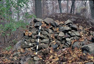 Fig. 2
The next feature, “B,” is the most unusual one at the site, and consists of a grouping of about three boulders, all enhanced with stonework that wraps around it and fills voids (Fig. 3).
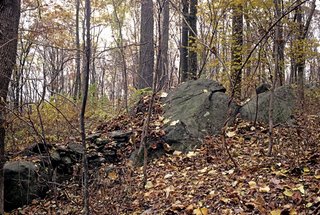 Fig. 3
The outline can be best visualized by a line drawing I made of it (Fig. 4).
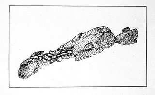 Fig. 4
Note the large boulder to the far right with the small boulder on top. From this view point, it reminds me of a turtle head at a 45° angle, and this could be why this boulder complex was singled out for attention – again the simulacra effect.
As one walks around the boulder clockwise to the east, one comes to a curious stone V-fill between two boulders (Fig. 5 and 6).
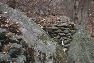 Fig. 5
 Fig. 6
This reminded me of another fill I saw at the South Ridge Site (Fig. 7),
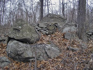 Fig. 7
which again was similar to one I have seen in Newfane, VT (Fig. 8).
 Fig. 8
All of these examples are variations on the same theme: an aesthetically pleasing joining of two forms with a stone fill that also might have female symbolism.
The “turtle head” boulder from this side looks quite different, and on top was placed a small boulder that is shimmed with a smaller stone to keep it in place (Fig. 9).
 Fig.9
Fig.9
We see this kind of emphasis over and over again throughout the Northeast, where some unusual looking boulder or stone feature has a smaller stone or stones on top of it.
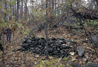 Fig. 10
Feature “C” is the last in this group of three, and rather enigmatic (Fig. 10). It consists of a carefully built stone terrace that frames the some large boulders in back, one of which has a large vertical crack or void in it. This feature could be the reason for this construction, in that cracks, voids or caves were entrances to the underworld and also had associated female symbolism. We also saw this association in Figures 5 & 6.
 Fig 1
Fig 1 Fig. 2
 Fig. 3
 Fig. 4
As one walks around the boulder clockwise to the east, one comes to a curious stone V-fill between two boulders (Fig. 5 and 6).
 Fig. 5
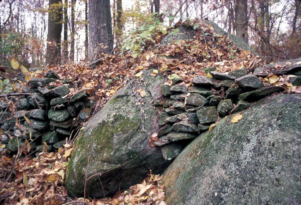 Fig. 6
This reminded me of another fill I saw at the South Ridge Site (Fig. 7),
 Fig. 7
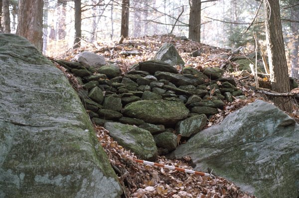 Fig. 8
The “turtle head” boulder from this side looks quite different, and on top was placed a small boulder that is shimmed with a smaller stone to keep it in place (Fig. 9).
 Fig.9
Fig.9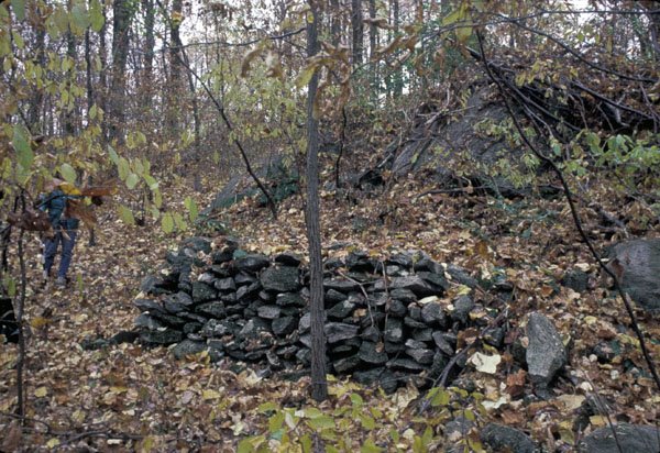 Fig. 10
A Site in Northampton County, Pennsylvania
By Geophile
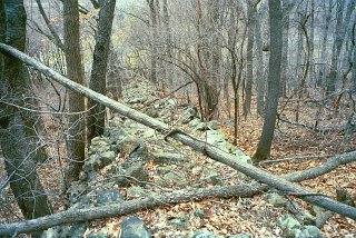
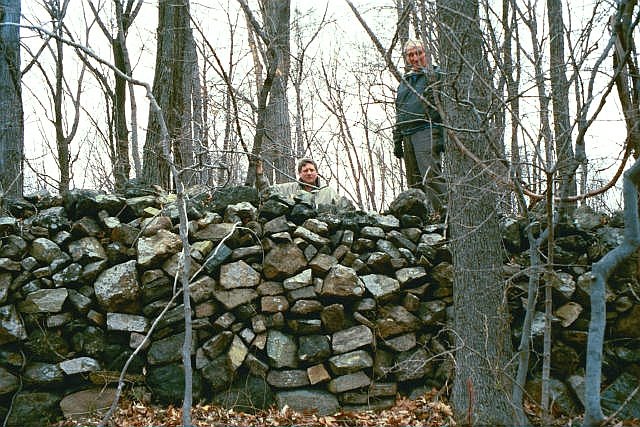
As with many of my pictures, these are a few years old now. I was fortunate to be taken to this site by Fred Werkheiser, whom you see in the center, and his father, here seen on top of the wall--or elongated rock pile as some might say.

The site was on top of a hill. Fred found it by looking from another hilltop site and figuring out where the next site should be.
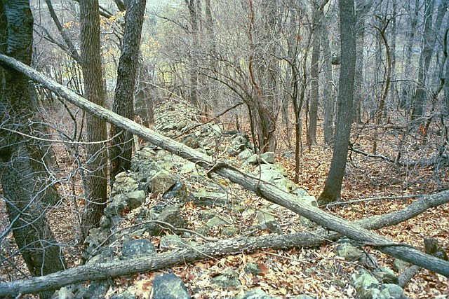
Most of us have seen sites like this, where one or two walls run down steep hills.
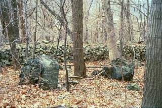
Interesting boulders of blackish stone stood in various places on this hill.
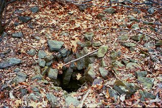
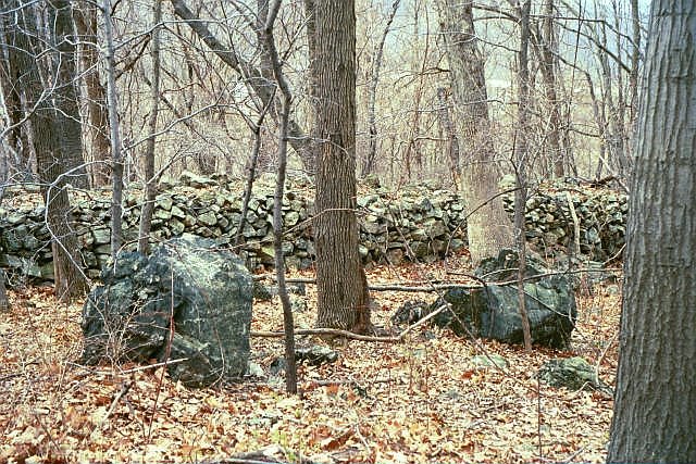
 And at about the very top, there was a rock pile of some size, roughly oval in shape. you can see the surrounding hills very well from here.

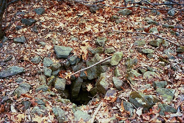
The most interesting feature of that rock pile was a hole near the middle. A person I spoke with, a descendant of the indigenous Lenape, suggested, when I described it to him, that it could have been a sort of sensory-deprivation site for young teen boys on vision quest. Fred thought the whole rock pile with the hole looked like a big eyeball effigy, an eyeball looking up at the sky.
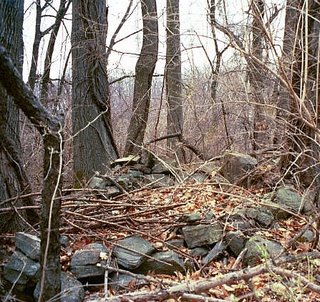
The other major element we saw on the site was a circle of stones. It didn't look as old as the stone pile and wall. Interesting feature, nonetheless.
 Although many miles away, this site was placed on one of the hills that make up the same hill system as those that hold the pits at Vera Cruz and the site at Oley Hills. There's something about these hills . . .
Which reminds me, when I was a child growing up out along the Kittatinny Ridge in eastern PA, the Dutch farmers told my father that the Indians told their ancestors, "If the white man knew what was in these mountains, he would ride down the street without making a sound." That's the sort of thing that makes an impression on a young child.
As with many of my pictures, these are a few years old now. I was fortunate to be taken to this site by Fred Werkheiser, whom you see in the center, and his father, here seen on top of the wall--or elongated rock pile as some might say.
The site was on top of a hill. Fred found it by looking from another hilltop site and figuring out where the next site should be.
Most of us have seen sites like this, where one or two walls run down steep hills.
Interesting boulders of blackish stone stood in various places on this hill.
 And at about the very top, there was a rock pile of some size, roughly oval in shape. you can see the surrounding hills very well from here.
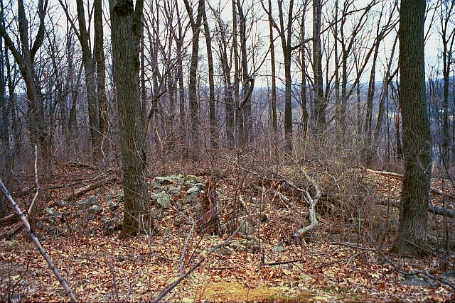
The most interesting feature of that rock pile was a hole near the middle. A person I spoke with, a descendant of the indigenous Lenape, suggested, when I described it to him, that it could have been a sort of sensory-deprivation site for young teen boys on vision quest. Fred thought the whole rock pile with the hole looked like a big eyeball effigy, an eyeball looking up at the sky.
The other major element we saw on the site was a circle of stones. It didn't look as old as the stone pile and wall. Interesting feature, nonetheless.
 Although many miles away, this site was placed on one of the hills that make up the same hill system as those that hold the pits at Vera Cruz and the site at Oley Hills. There's something about these hills . . .
Which reminds me, when I was a child growing up out along the Kittatinny Ridge in eastern PA, the Dutch farmers told my father that the Indians told their ancestors, "If the white man knew what was in these mountains, he would ride down the street without making a sound." That's the sort of thing that makes an impression on a young child.
Turtle Stuff from Tim MacSweeney
Simularocka
I just made up a new word, simularocka.
Thanks Norman.
So speaking of turtles, here’s what I found about one accepted turtle effigy…
From the html version of the file http://www.mt.blm.gov/ndfo/coteau/coteaufeis/appendixd.pdf:
“Stone effigies are arrangements of stones intended to portray specific figures or symbols. Zoomorphic effigies (Davis 1975:32; Hoffman 1953:12) and anthropormorphic representations (Deaver and Deaver 1984:16-21) have been reported at a number of locations….Site 32ME1486, commonly called “the turtle effigy” was determined eligible for listing on the National Register of Historic Places as a Traditional Cultural Property. The site contains an effigy figure that has documented uses for traditional cultural purposes for a minimum of three generations and is actively used today (Deaver 2001).
The Crow and the Three Affiliated Tribes (
My Google search of images got me this one tiny photo:

52. Turtle Effigy State Historic Site -- Located near Golden Valley, Mercer County, this site preserves a twenty-one-foot-long turtle petroform--an animal shape formed of stones. Made by Native Americans prior to European immigration, this type of site is rare and not accessible to the public.
State Historic Sites Administered by the State Historical Society of
http://www.state.nd.us/hist/sites/aborig.htm
And then I found this: Photo by Calvin Grinnell
Within traditional Hidatsa territory, on lands later shared with the
The tribal affiliation of the creators is unknown. Some tribes, however, such as the Ojibway, Blackfoot, Sioux, Mandan
"This is the only effigy I ever saw but heard that the old people knew of many others down the river near their old villages and would go there to make offerings. Anyone could make offerings of knives, pieces of hides, or dry meat and other things to eat when asking for rain or other good luck such as living to be old. If they had children, they would ask the gods that go with the turtle to send good luck. To give to the turtle was the same as giving to all the other gods that went with the bundle.
"While we stopped near the turtle, people made offerings to the turtle and the other gods that went with it. Some left knives but in the olden times the flint knife was given, for the flint was the sign of the big birds who go with the turtle and the other gods in the
"After we moved on from this turtle it was so foggy one day that the leader could hardly find his way. The hunters had to hold each other's hands to keep from getting lost. An Arikara brought a knife and gave it to Clam Necklace (
Turtle and other effigies are rare and fragile resources. Vehicle traffic, unauthorized digging, souvenir collection, and cultivation have destroyed many of these sites.

Photos by Calvin Grinnell
http://www.trailtribes.org/kniferiver/all-my-relations.htm#turtle
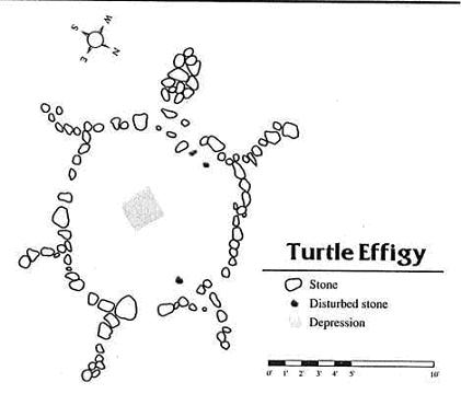
Turtle Effigy Diagram
Courtesy of
From the Link to diagram of a turtle effigy
Wednesday, April 19, 2006
One thing we need to keep in mind when looking for presumably Indian or Native stonework - from Norman Muller
One thing we need to keep in mind when looking for presumably Indian or Native stonework, is that it was constructed in a particular place for a reason, and that might have something to do with unusual characteristics of the landscape. This could be the proximity to an unusual boulder, ridge, nearby cliff, caves, springs, streams, waterfalls – in other words, something that has phenomenal characteristics. To the American Indian, everything in nature was imbued with spirits, and therefore alive, whether it was the wind, rainstorm, brook, cave or boulder. Boulders of an unusual size or configuration attracted the attention of the Indians hundreds or more years ago as they do us today, and the larger and more unusual looking the boulder, the more spiritual energy it contained. To emphasize the uniqueness of a boulder, the Indians sometimes placed small rocks in a space or crack in it, piled rocks against one side, or left some on top. This might have been part of the vision quest ritual, or it was done for an entirely different purpose that is beyond our ken.
There might be peculiar characteristics to certain boulders or cliffs that may evoke the image of an animal if seen in a certain light or at a particular angle. This is called simulacra. We may sometimes pass by something and say it looks like such-and-such animal, be it a turtle, bear, or whatever. To me, this is similar to a Rorshach test, in that everyone may see something different in a particular configuration of lines or forms, and because of this we must be careful in declaring that what we see, and what the ancients must have seen in the same boulder, must be a bear, for example. We do not know what the Indians saw in certain shapes, and if a shape evokes different responses in different people, we need to be careful what we say. If the form is very distinctive, however, as, for example, a clear turtle effigy that I was shown in Connecticut,
 we can be less hesitant in expressing our views. Two years ago when I was at a site in Rochester, VT, I passed by a large, unusual looking erratic that was tilted at an oblique angle. When viewed from the north, the boulder in profile looked to me like a huge turtle with its head and neck extended at a distinctive angle.
 On the other side of the erratic was an unusual tongue-like stone construction, some 4m long, in which the carefully constructed vertical side to the right faced east.
 Did the Indians also see a turtle in this boulder? Perhaps, but I really don’t know. I am pretty certain that the stone construction on one side was placed there because of the boulder’s unusual shape.
I know of two similar boulders with stone constructions at one end in Coventry, RI, one being a smaller version of the other. The larger boulder has a carefully piled stone construction to the left, which faces east, and on top to the right is a smaller flat boulder.
 And not more than thirty feet away is a smaller version of this erratic: a round boulder not more than 5’ high, a small curved pile of stones to the left, and a cluster of rocks on top, one of which is quartz.
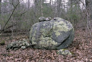 Four years ago I visited a friend in northwestern Georgia, who showed me a very extensive lithic site on one side of a mountain. About a mile to the south, on the same side of the mountain, was another area with additional cairns and terrace walls. Against one side of a very large boulder that had come loose from a high cliff in back and tumbled down the slope, was a carefully constructed terrace/wall..
 When I saw this for the first time, I was reminded of similar constructions in New England, and now, with other examples I know of, I am quite sure that this construction, as with the ones I have just illustrated, were all constructed because of the unusual shape and size of the boulder, in which an animal form was probably perceived.
There might be peculiar characteristics to certain boulders or cliffs that may evoke the image of an animal if seen in a certain light or at a particular angle. This is called simulacra. We may sometimes pass by something and say it looks like such-and-such animal, be it a turtle, bear, or whatever. To me, this is similar to a Rorshach test, in that everyone may see something different in a particular configuration of lines or forms, and because of this we must be careful in declaring that what we see, and what the ancients must have seen in the same boulder, must be a bear, for example. We do not know what the Indians saw in certain shapes, and if a shape evokes different responses in different people, we need to be careful what we say. If the form is very distinctive, however, as, for example, a clear turtle effigy that I was shown in Connecticut,
 we can be less hesitant in expressing our views. Two years ago when I was at a site in Rochester, VT, I passed by a large, unusual looking erratic that was tilted at an oblique angle. When viewed from the north, the boulder in profile looked to me like a huge turtle with its head and neck extended at a distinctive angle.
 On the other side of the erratic was an unusual tongue-like stone construction, some 4m long, in which the carefully constructed vertical side to the right faced east.
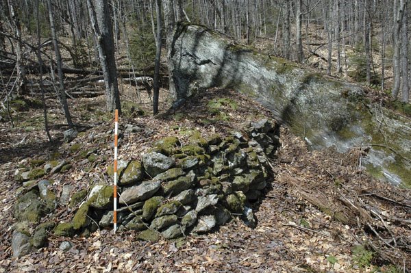 Did the Indians also see a turtle in this boulder? Perhaps, but I really don’t know. I am pretty certain that the stone construction on one side was placed there because of the boulder’s unusual shape.
I know of two similar boulders with stone constructions at one end in Coventry, RI, one being a smaller version of the other. The larger boulder has a carefully piled stone construction to the left, which faces east, and on top to the right is a smaller flat boulder.
 And not more than thirty feet away is a smaller version of this erratic: a round boulder not more than 5’ high, a small curved pile of stones to the left, and a cluster of rocks on top, one of which is quartz.
 Four years ago I visited a friend in northwestern Georgia, who showed me a very extensive lithic site on one side of a mountain. About a mile to the south, on the same side of the mountain, was another area with additional cairns and terrace walls. Against one side of a very large boulder that had come loose from a high cliff in back and tumbled down the slope, was a carefully constructed terrace/wall..
 When I saw this for the first time, I was reminded of similar constructions in New England, and now, with other examples I know of, I am quite sure that this construction, as with the ones I have just illustrated, were all constructed because of the unusual shape and size of the boulder, in which an animal form was probably perceived.
Rock piles for the general public
Geophile brings up a topic I have been puzzling about: how to lead the public to an understanding about rock piles. No offense, but they are not too likely to come to this blog and somehow get the basic introductory information.
The main flaw with the blog as a medium is that it is not good as a fixed reference. For example it worries me that the data is completely unstructured. If you want some information about -say- the Turtle at Great Brook Farm in Carlisle then you can find it easily by using the "SEARCH THIS BLOG" feature at the top. But where is a reader supposed to go to find out, in general, about the relation between rock piles and Native American spirituality? Between rock piles and Land Conservation? Unless that was the specific topic of a posting, there is nothing available. Or, suppose you want to see an organized Index of what material has been covered in the blog - where do you go? Suppose you want to see the information hierarchically? All of these are problematic for the blog as a medium.
So, may I suggest that a solution might lie in the direction of printed "Guide to Rockpiles" book? So why don't I just write it? Aside from being busy with the blog, with some talks I am planning in local towns, with some housework, and with my 9-5 job, I don't have much time. More critically, I tend to do a bad job with large scale expository writing. I tried writing a book and could only manage to express the key points - not appealing well to a general reader.
So let's think about this. I know several of us have tried writing more sustained expositions of the subject but possibly they will all suffer, as did my effort, from not being appealing to a general reader. One thought I had was that with a good editor organizing the effort [hint, hint] we could do it as a colaboration. So what do you think? Use the comments.
After all, why this blog? Not just as a place to publish site descriptions, I also hoped to use it as a platform for creating changes in current land use practises. But that won't happen if we just go on with the site descriptions.
Tuesday, April 18, 2006
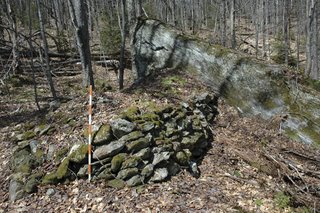
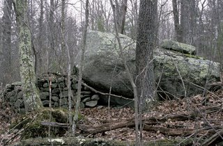
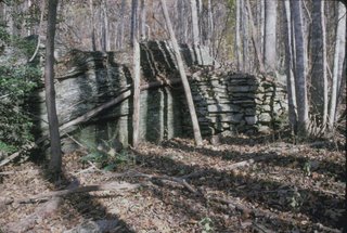
The origins of Rocky Brook Stirling MA
 On Sunday, before I got stopped by the police, I was driving slowly eastward on Upper North Row in Stirling and, coming into a dip in the road (around A), I saw a rock pile off to my right. So I parked and hopped out to take a quick picture.
 Once there I thought I would go just a little further into the white pine saplings and surprise! There is a genuine "cairn" - big game.
 A little further downstream was a humbler example:
 And those were the only two like that I saw. I did not explore in all directions though, since there were houses.
Also along the stream, some of the piles were effigy-like.
 And here also was the example of the rock-on-rock with black crystals, (near B):
Finally, at C, on the hill shoulder, there were a few wedged rocks and some low piles that might suggest lines of site.
 I don't know what to conclude about the wide variety of rock pile types we see here. The brook is certainly getting a send-off.
Because I was accosted by the police on returning to my car, I did not get a chance to explore all around the little swamp north of the road or on the hill above the word "North". I should go back.
James Gage discusses Mystery Hill
Hi Peter,
In a previous posting, an issue was raised about the reconstruction of Mystery Hill site (a/k/a America's Stonehenge). I would like to address this issue in some detail.
The first modern alteration to the site occurred in the early 19th century when Pattee built a small house on top of the ruins of the sunken courtyard area. The construction involved the addition of one foundation wall, the construction of a brick chimney, and household refuse disposal. The next two alternations occuring in the mid-1800's and in 1916 with two separate quarrying operations. Modern literature on the site says as much as 40% of the site was quarried and hauled off. This estimate is badly inflated. Ongoing research demonstrates the quarry damage was minimal (for a full report see http://www.stonestructures.org/html/quarrying.html ). In the early 20th century, the town of Salem sealed up several of chambers for safety reasons. The Oracle chamber entranced was sealed and the watchhouse chamber was filled in. Vandals enlarged an opening on the east side of Oracle chamber creating a new entrance (currently the exit entrance on the self-guided tour). In the 1930's William Goodwin purchased the property and began formal archaeological investigations. Goodwin has been much maligned in the literature for his archaeology and preservation practices of the site. Criticism that is sadly misplaced. Goodwin hired a crew of experts to work on the project. He brought in professional archaeologists, a professor of architecture, profession photographer (Malcolm Pearson) to document all the work, and professional stone masons to stablized the stonework. The use of multidisciplinary research team was unheard of in the 1930's and 1940's. Goodwin was 20 to 30 years ahead of his time in this respect. Goodwin's crew cleared accumulated debris from the site, excavated and sifted removed soils, and documented their work. Goodwin's crew restored the top portion of the Tall Wall, the top portion of the Mensal Stone structure, and east end of East-West chamber. The restoration work on the East-West chamber was the only errorenous restoration work. This is understandable given the this portion of the structure was badly damaged by the quarriers. Overall, Goodwin's preservation, stablization, and restoration work was remarkable conservative. Many of restorations problems currently seen at the site date from the 1960's through the 1980's after Goodwin had sold the site. A brief run down on the restorations problems. The Sundeck, specifically the passage structure on top of it is incorrect in its current configuration. This structure never had a roof. The courtyard like area adjacent to oracle chamber alcove is formed by a L-shape wall. A photo from 1900 does show evidence of a short section of wall extending a few feet from the entrance to alcove but it never extend as far is currently is. This restoration work was done in the 1980's. The area between the mensal stone, the V-hut, and a enclosure is currently missing several stones shown on early site maps. In addition, two large stones in the area have been moved several times and are not in their correct positions. In addition, the central wooden platform for viewing the astronomical alignments is incorrect (For more information see http://www.stonestructures.org/html/solar_alignments.html ).
In summary, the Mystery Hill has beend altered by preservation and restoration work. The quality of that work varies greatly. However, careful study of archaeological reports, old maps and photos of the site, and physical evidence provides the researcher the necessary tools to sort original stonework from the later repairs. Despite the damage, stablization, preservation, and restoration work the central building complex retains much of its original configuration.
In addition, it is important to point out that entire site covers approximately 100 acres. Besides the famous central building complex, the site contains stonewalls, a cairn field, outlying standing stone features, at least two springs, and many other smaller but important ceremonial features. Much of these outlying features are in a remarkable state of preservation.
James Gage www.StoneStructures.org
Monday, April 17, 2006
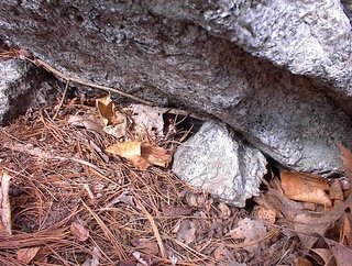
Some geology examples from Stirling
While exploring around in Stirling, as described in my previous post, I came across a couple of examples of use of a rock with some kind of special characteristic. One was a split-wedged rock that had a granite wedge that was covered with reflective micah.
 The second was a rock-on-rock where the upper rock had some elongated black crystals in it.
 Both these examples are so noticeable, I cannot imagine them not being used quite deliberately.
 The second was a rock-on-rock where the upper rock had some elongated black crystals in it.
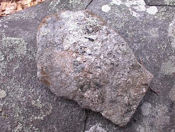 Both these examples are so noticeable, I cannot imagine them not being used quite deliberately.
Subscribe to:
Posts
(
Atom
)
