skip to main
|
skip to sidebar
Small Sites along Rock Brook in Stirling MA
I decided to "get out of town" and go on my own roadtrip, and picked a piece of Stirling that looked appealing. Although I didn't plan it, I ended up seeing several little sites along one brook called Rocky Brook. So I started at one place "A" and walked in along the dirt road and found an extremely minor summit site. When I got back to my car there was an angry/suspicious landowner there to tell me it was private property. It was not marked "No Tresspassing" so I made a mistake. I apologized and was on my way. But apparently this landowner also called the police, so later on a third walk in the area, when I got back to my car there was a Stirling Police cruiser and a polite young officer to ask me questions. What a pain! I don't know if I'll ever get used to this - although it obviously comes with the territory. Yes, I am a "suspicious person". After leaving the first place I drove a short ways until I crossed the brook and took another short walk at "B". Crossing a stone wall I thought there were some field clearling piles up against the wall and then - what is this? Three rock piles in a deliberate group. From there I went back to the car, continued driving west to an intersection and turned east till I got to another low place on the road. This is where the brook begins at "C". I spotted a rock pile from the car, went to get a photo and ended up finding one really nice "cairn", all by itself. I spent another 1/2 hour finding piles downstream along the brook and uphill on a small hill shoulder that overlooks the stream. When I got back to my car, there was the policeman. If he had not been there then I probably would have done my job and circled the little wetland there, north of the road, which is the ultimate source of this brook.
Hilltop site A:
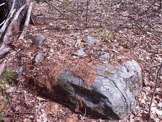
We are on a secondary summit of a hill, with a view west to Mt. Wachusett. Directly below the summit are about 8 small piles and rock-on-rocks:


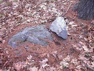
 These were all very inconsipicuous.
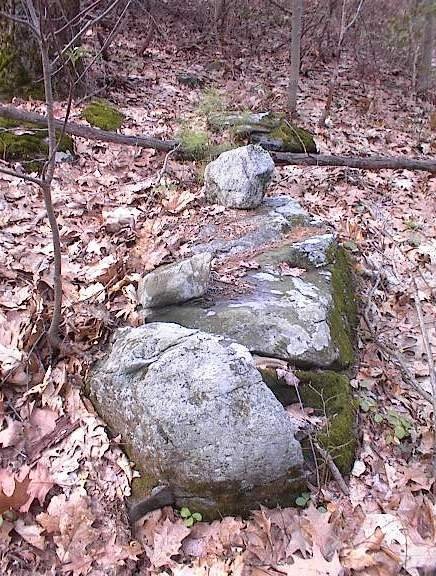
Sloping field site B:
Down near where Rocky Brook meets the next named brook, there were three rock piles in a group. They formed a rectangle facing south towards the brook confluence.
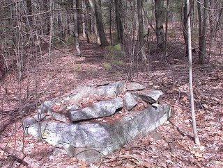

 The middle one looks a bit symmetrric.
At the origin of Rocky Brook: I'll post that next.


 These were all very inconsipicuous.

 The middle one looks a bit symmetrric.
No comments :
Post a Comment