
Monday, May 16, 2016
This just looks old.


Sunday, May 15, 2016

Saturday, May 14, 2016
Pushing back the antiquity of man in America
About the dig in Florida, putting a solid nail in Clovis's coffin:
http://phys.org/news/2016-05-evidence-humans-southeastern-earlier-previously.html
http://phys.org/news/2016-05-evidence-humans-southeastern-earlier-previously.html
Thursday, May 12, 2016
Foot of Blodgett Hill - Merrimack NH


A bit east of there, also in the lower slopes of the Blodgett Hill was this one (repeating a picture):


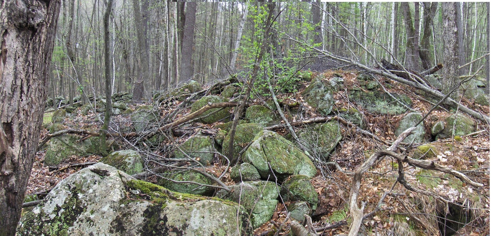


This is consistent with other areas adjacent the Merrimack River and I assume we can find these mounds all up and down it's watershed.
Wednesday, May 11, 2016
Burns Hill Conservation Land - Dracut
I had not been there but was not surprised to find a couple of small sites - much disheveled, perhaps old marker piles. Near the water in one place, and near a golf course in another:
 Near the water:


 And near the golf course:


 Saw this pleasant scene, typical of the edge of a swamp:


Tuesday, May 10, 2016
Check out this facebook album - Gabes Mountain Trail
https://www.facebook.com/photo.php?fbid=10153338586276931&set=pcb.914872138609162&type=3&theater
From https://www.facebook.com/search/top/?q=rock%20piles.
I see there are several people reporting sites on Facebook.
From https://www.facebook.com/search/top/?q=rock%20piles.
I see there are several people reporting sites on Facebook.

Friday, May 06, 2016
The rumor of larger 'mounds' near Gates Lane in Stow
I heard a rumor during the various proceedings, so I went over to take a look. Sure enough, in a corner that looks to be part of a development plan (there were pink ribbons and blue ones) there was one old rectangular bump,
 divided in two parts:


 Along the slope, which was not too far from Elizabeth Brook, there were a few smaller piles and this interesting soil/rock line:
 and this more conventional pile with hollow:
 This is a faint trace of a familiar structure. There were also rock-on-rocks:


and some loose piles against the wall nearby:


Thursday, May 05, 2016
The Threat At Gates Lane Stow
Is illustrated with pink ribbons in the background:
 I wonder if they mean "build a road here" or maybe "don't build a road here"? Either way, there are rock piles along there.

Wednesday, May 04, 2016
Curious "Farm" site in Ashburnham
Where the power lines cross Old County Rd:
 A number of structures under the power lines:
 I don't know what this is:

East of the power lines, there are some piles on the slope. Non descript:

 And other curios:
 This one reminded me of a "pylon" we saw years ago, that was said to be a support for a structure.
 I could believe these rock piles are not ceremonial. But the nature of the place with its walls, supports, occasional low ground piles, etc, is curious. There were occasional rock piles off in the woods behind that seemed genuine, and other piles further up the power lines.


East of the power lines, there are some piles on the slope. Non descript:


Tuesday, May 03, 2016
Faint traces of mounds in eastern Townsend
Access to a small conservation land at the foot of Haynes Rd, made it possible to get back in there exploring.
 Somewhere around where that cross appears in the center, there was a small pile next to a wall:
 and then some of the faintest traces of "rectangle-with-hollow" I have seen. Here is one, up against the wall

Here is another, also up against the downhill side of the wall:
 Thought I should mention it. I should go back and explore more in that area sometime. Also a few steps further along the wall:


Here is another, also up against the downhill side of the wall:


Arrowhead Hunting Season Begins
First the plow, then the rain. Now arrowhead hunting can begin in earnest.
Monday, May 02, 2016
Overcoming the Ambiguity of a Rock Pile

"Only when rock feature sites are regularly recorded in a thoughtful and knowledgeable way, we will be able to identify meaningful patterns and better understand the past through the application of archaeological theory..."
Overcoming
the Ambiguity of a Rock Pile: Their Examination and Interpretation in Cultural
Resource Management Yesterday, Today, and Tomorrow
By Charity
M Moore and Matthew Victor Weiss
This paper
was presented on January 9, 2016 at the SHA 2016 Conference on Historical and
Underwater Archaeology.
Tuesday, April 26, 2016
East of Lake Whitehall (again)
Previous stories here, especially this one. There are good sized conservation lands east of the lake and I went to the northernmost part, finally finding a "marker pile" site at the blue outline.
 This has several typical features I won't point out, but note the way the water is at the low point and center of the site. We enter:
 At the bottom, at that moment when you realize it is a rock pile site:
 And the way the piles cross the slope above:
 The "money" shot:
 Nice individual piles:


 Here are 4 in a curved "row". The water is downhill to the left.
 This is similar to the site I reported recently from Princeton, where the piles also were clustered above a small spot of water. One more detail of the water:


Subscribe to:
Posts
(
Atom
)
