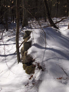
by theseventhgeneration
Here is a rough diagram of the site in the photos from the previous post. The distances are not to scale and the exact positioning of each of these stone piles is also subjective, based on field notes. Click on the image to enlarge it, and to get a better view.
In the previous post, I did not include pictures of rock piles 4 and 5 (from the diagram above). I have a photo of rock pile 4 here, with rock pile 3 just off to the right in the same photo.
Rock pile 5 is a low pile and I did not get any photos of it on my last visit out. It appears to have 2 vertical faces, but I'd like to get some good solid photos to back this up. That will have to wait until after the snow melts here.
Friday, February 29, 2008
View from vertical faced stone piles - NY
by theseventhgeneration
Here are some views of stone piles with vertical faces at the site I frequent the most in NY.
This is the largest stone pile at the site. The view is looking toward the water source, with the vertical face on the right side of the pile. That's a 4 ft walking stick on top of the pile.
Looking away from the water source, there is a view with the large stone pile to the right and a smaller stone pile to the left. Can you see anything up there in the back, between the piles?
I went back out after a snowstorm to confirm my suspicion, that I was seeing it right. Here is a view closer to the smaller stone pile. The vertical face of the smaller stone pile seems to run in the direction of that nice stone pile in the back.
Another view, from a much smaller, less organized stone pile at this end of the site reveals something very similar. The smaller stone pile in the foreground has a vertical face. Because it's so low in the snow, I added markings to the photo to highlight the vertical face and the stone pile in the background.
Looking back at this photo (above), the stone pile in the background, being slightly to the right of the vertical face, is not what I would expect to find. But, it is what it is. There are other stone piles at this site, but I focused on these 4 because the view from one pile to the next, through the snow and pines, was clear. So, although accuracy may be lacking, the photos don't deny that there may be a relationship between some of the vertical faces and the large, beehive shaped stone pile in the background.
Here is a photo of that beehive shaped stone pile:
One last view. The most recent stone pile I found at this site and the wall bulge. A tree blocks the view from the short vertical face to the wall bulge, so I stood in the middle, by the tree and took two photos in opposite directions. The first photo is cropped to try to focus in on the short vertical face.
Thursday, February 28, 2008
Another link from Bruce McAleer
Here's a link to an archaeological report with stone walls, stone enclosures, cupules, petroglyphs and other features in association with each other.
http://www.indiana.edu/~e472/cdf/reports/volcan/archaeology.htm
Colorado stone structures
Bruce McAleer sent this:
Here's a google link. Pages 9, 10 and 11 (I haven't read further yet) have photos and archaeological reporting on stone enclosures called "vision quest sites" in proximity to rock shelters with rock art. Also mention of cairns and walls and a few mis-assumptions about their likely being colonial. Worth a look when you get time.
Wednesday, February 27, 2008
More Google searching for rock piles and "Nebraska"
As noted above, the top of Powers Bluff is extremely rocky. At many locations there are piles of rocks composed of small and medium sized pieces of quartzite, that appear to be the result of human actions. The piles range from circular arrangements several feet across to linear and curvilinear arrangements up to 20 ft. long. In some instances the piles are associated with modern trails and roads and obviously are the byproducts of clearing of the area to create these features. Some of the other rock pile concentration areas are on the fringes of the main community clearings shown on a 1938 aerial photograph. These represent clearing activities associated with the community. At least some rock features represent the activities of workers who are said to have “cleaned and brushed the woods” at Powers Bluff.
Wood County acquired Power’s Bluff and the remnants of the Skunk Hill Community in 1936 for the development of a park. Ski and toboggan runs were developed on the north...
[Click here for PDF]
Wood County acquired Power’s Bluff and the remnants of the Skunk Hill Community in 1936 for the development of a park. Ski and toboggan runs were developed on the north...
[Click here for PDF]
Sorry no new sites to report...
...but there has been a lively discussion going on below in the comments to Dr. Meli's question.
Monday, February 25, 2008
Single rock on rock in the snow
Nagog Hill in the Snow
Dr. Meli writes in
Rock Pilers:
I have been for some time checking out your page, there is often very interesting photos and comments, I however do not always agree, with the general interpretation of the features in question and do I like the word cairn. It is a very mis-leading term. However, I must applaud the efforts of the group.
Two things; I will be giving a presentation at the spring NEARA Conference on my work at Nipsachuck Swamp, of course within the limits of what I am able to disclose, seeing that main land in question is still in litigation, and the other land is under a gag-order.
Secondly: dose anyone have an idea how many stone piles and features there are in New England, not including those that have been developed. Any help will be greatly appreciated.
Thanks Fred Meli.
Archaeological Services and Consulting
Frederick F. Meli Ph.D Director
Archaeologist/Anthropologist/ Historian
Post Office Box 522 North Kingston, RI. 02852
401-965-7802
www.archaeologicalservicesandconsulting.com
fred@archaeologicalservicesandconsulting.com
Member: Archaeological Institute of America, Massachusetts Archaeological Society, Eastern States Archaeological Federation.
Sunday, February 24, 2008
Snow, mist, and a sunset
by theseventhgeneration
This cairn is in a large cairn field in Delaware State Forest, NY. For all the visits I've made to this site, I didn't know it was there until just last week.
After this last snowstorm, I revisited the site and paid greater attention to some details, not only to this cairn, but also to some of the other cairns here.
This cairn has, what I would describe as two vertical faces, which is not unusual at this large cairn site. This is the longer of the two vertical faces:
This is the shorter vertical face:
The sun was just starting to set when I captured it peeking through the pines. The cairn is barely visible as a white hump in the foreground. But, the vertical face is evident, if you look close, in the general direction of the sunset.
Friday, February 22, 2008
More Snow
After 5 days of nice weather during the work week the weekend arrives on the heels of a new snowstorm.
Thursday, February 21, 2008
Birch root shaped like an elephant
Wednesday, February 20, 2008
Vertical Sided Piles in the Snow
I picked a good looking bit of un-developed hills and wetlands, about 40 minutes south of here, and went out Saturday to explore. Drove to the end of an access road (red dot on the map fragment) behind an industrial park, got out, stepped into the woods (directly southwest of red dot) and saw a snow covered bump. Turned out it was a nice rock pile:
You can see a bit of a valley on the right side of the picture. This is one of the feeder valleys to the wetland at the center of the map fragment and surrounded by low hills.
I went across this little bit of a valley to get up the hill on that side and did not see much - just one stone wall going around an obtuse angle.
Mavor and Dix, in Manitou, comment on how acute or obtuse angles in walls are always of interest as they suggest the astronomical rather than the agrarian.
After that I went back to where I found the first rock pile to look more carefully in the area. Let's take another look at that first pile:
Here we are looking along the pile's one vertical face, towards a large boulder on top of the slight rise or knoll. The line of sight along the vertical side does not go through the boulder but, rather, to the side of it. Lines of sight passing just to one side of a high point is something I was noticing the other day in Wamesit/Tewksbury. (I know I wrote about it in the last two weeks but this is the only link I can find quickly [click here]. Oh yeah, here it is "In the Circle by the Line" [click here]. Also of interest is this recent discussion of vertical faces [click here]).
Over on the other side of the knoll there were about 8-10 other rock piles. Here we are looking back towards the boulder on top of the rise but it is only faintly visible between the trees. In the foreground is a pile and behind it a slightly smaller boulder. The large boulder is visible through the trees as a white thing just to the right of the smaller boulder. Can you see it? I mention this because a number of things would have been visible from the top of the rise or, perhaps, from the top of the large boulder.
Most of the rock piles were on this southwestern side of the knoll where the view would be west and southwest. Here are some of the nicer piles from that side of the knoll.
Nice eh?
I was noticing the vertical sides but not paying as much attention as I should have. As soon as I got home I was wondering: were all the vertical faces of different piles parallel with each other, i.e. pointing in the same direction? But I think I can almost re-construct it, although I should have payed more attention in the first place.
So let's talk layout.
In this picture you see what appears to be a line from the left-most pile, through a smaller pile, a rock, and then a larger pile. Please note the vertical face on the left-most pile. Gasp! It is roughly perpendicular to the direction of the line. In fact I get a sense that each of the structures along the line might have a similar bit of vertical side, also oriented roughly perpendicular with the line. So at least these piles have their vertical faces parallel with each other. Here is another "layout" shot:
The pile on the right (also shown in the fifth picture below the map fragment above) seems to have two vertical side, just to make sure we remain confused about this topic. Anyway, I am getting a picture something like this:
Here there are four "piles" in a line, with vertical sides oriented roughly perpendicular to the line of the piles. Let me recommend, that the next time you are out surveying something like this where the piles have one good "vertical" side: pay attention to the direction and the relation between different piles. I am going to. One more picture may illustrate this a bit better.
This is another look down one of the lines of piles (the first of the two shown earlier). This shows that the line is actually only three (not four) structures long. The smaller pile behind this first large one has a hint of vertical facing and it is parallel with the vertical face of the first pile.
Off a bit by itself on the eastern side of the rise was one larger rock pile. Right on the brow of the knoll. This was the one I showed the other day as an "Appetizer".You can see a smidgen of a trail goes by there. A few yards further along to the east there were a couple of substantial 17-18th century foundations. There is also a larger road down there and obviously there was a lot of post-colonial activity here. Before or after the rock piles were built?
There were also smaller piles, harder to see in the snow;
but still pretty, and also hinting at some organized layout.
I have called this kind of site a "marker pile" site. Which doesn't say much other than that some of the piles seem to have vertical faces and occasionally the piles are layed out along lines. But I believe there are different layouts and different types of marker pile sites. Some, like this, have a few lines of piles. Other sites seem to have a "grid" of piles. Still others seem to have lines of piles radiating from a high point. There is a bit of a high point here but no radiating lines that I could see. So there seem to be different layouts used and, if I could just pay close enough attention, it might turn out that some regions favor one type of layout, other regions favor others. There is a lot more observing to do.
Of course, I never got past that first knoll. There is plenty more hill and swamp down in there and I'll go back and look for more things at the next opportunity.
You can see a bit of a valley on the right side of the picture. This is one of the feeder valleys to the wetland at the center of the map fragment and surrounded by low hills.
I went across this little bit of a valley to get up the hill on that side and did not see much - just one stone wall going around an obtuse angle.
Mavor and Dix, in Manitou, comment on how acute or obtuse angles in walls are always of interest as they suggest the astronomical rather than the agrarian.
After that I went back to where I found the first rock pile to look more carefully in the area. Let's take another look at that first pile:
Here we are looking along the pile's one vertical face, towards a large boulder on top of the slight rise or knoll. The line of sight along the vertical side does not go through the boulder but, rather, to the side of it. Lines of sight passing just to one side of a high point is something I was noticing the other day in Wamesit/Tewksbury. (I know I wrote about it in the last two weeks but this is the only link I can find quickly [click here]. Oh yeah, here it is "In the Circle by the Line" [click here]. Also of interest is this recent discussion of vertical faces [click here]).
Over on the other side of the knoll there were about 8-10 other rock piles. Here we are looking back towards the boulder on top of the rise but it is only faintly visible between the trees. In the foreground is a pile and behind it a slightly smaller boulder. The large boulder is visible through the trees as a white thing just to the right of the smaller boulder. Can you see it? I mention this because a number of things would have been visible from the top of the rise or, perhaps, from the top of the large boulder.
Most of the rock piles were on this southwestern side of the knoll where the view would be west and southwest. Here are some of the nicer piles from that side of the knoll.
Nice eh?
I was noticing the vertical sides but not paying as much attention as I should have. As soon as I got home I was wondering: were all the vertical faces of different piles parallel with each other, i.e. pointing in the same direction? But I think I can almost re-construct it, although I should have payed more attention in the first place.
So let's talk layout.
In this picture you see what appears to be a line from the left-most pile, through a smaller pile, a rock, and then a larger pile. Please note the vertical face on the left-most pile. Gasp! It is roughly perpendicular to the direction of the line. In fact I get a sense that each of the structures along the line might have a similar bit of vertical side, also oriented roughly perpendicular with the line. So at least these piles have their vertical faces parallel with each other. Here is another "layout" shot:
The pile on the right (also shown in the fifth picture below the map fragment above) seems to have two vertical side, just to make sure we remain confused about this topic. Anyway, I am getting a picture something like this:
Here there are four "piles" in a line, with vertical sides oriented roughly perpendicular to the line of the piles. Let me recommend, that the next time you are out surveying something like this where the piles have one good "vertical" side: pay attention to the direction and the relation between different piles. I am going to. One more picture may illustrate this a bit better.
This is another look down one of the lines of piles (the first of the two shown earlier). This shows that the line is actually only three (not four) structures long. The smaller pile behind this first large one has a hint of vertical facing and it is parallel with the vertical face of the first pile.
Off a bit by itself on the eastern side of the rise was one larger rock pile. Right on the brow of the knoll. This was the one I showed the other day as an "Appetizer".You can see a smidgen of a trail goes by there. A few yards further along to the east there were a couple of substantial 17-18th century foundations. There is also a larger road down there and obviously there was a lot of post-colonial activity here. Before or after the rock piles were built?
There were also smaller piles, harder to see in the snow;
but still pretty, and also hinting at some organized layout.
I have called this kind of site a "marker pile" site. Which doesn't say much other than that some of the piles seem to have vertical faces and occasionally the piles are layed out along lines. But I believe there are different layouts and different types of marker pile sites. Some, like this, have a few lines of piles. Other sites seem to have a "grid" of piles. Still others seem to have lines of piles radiating from a high point. There is a bit of a high point here but no radiating lines that I could see. So there seem to be different layouts used and, if I could just pay close enough attention, it might turn out that some regions favor one type of layout, other regions favor others. There is a lot more observing to do.
Of course, I never got past that first knoll. There is plenty more hill and swamp down in there and I'll go back and look for more things at the next opportunity.
Monday, February 18, 2008
Sacred Landscape in New Mexico
Not rock pile related, this is about recording petroglyphs in New Mexico [Click here]
But it raises the question: would archeologists know what to look for besides petroglyphs? Would they notice rock piles, split-wedged rocks, rock-on-rocks, little stretches of wall?
Sunday, February 17, 2008
New "Stupid Sheet"
Saturday, February 16, 2008
Thursday, February 14, 2008
Black Creek, NJ - another archeo preservation success
[Click here]
Of some interest is the mixing of arrowheads and cairns in one article about one site that was put on the NJ register of historic places.
Blackwood Farm - North Carolina - an archeological survey
"...A large amount of metal was detected on top and within a stone cairn (Cairn #4) located at the western edge of the floodplain and upslope. Metal items at the cairn include cast-iron (most likely cooking) vessel fragments. " [Click here]
Delaware State Forest - NY
by theseventhgeneration
This was the last "thing" (for lack of a better word) I found on my most recent hike.
Before I could snap one more photo, the snow came in so heavy, it was a white out. Walking around the left side of this structure, and up hill, there is a clear view under that large top boulder. It's not a view to the horizon, just through to the other side. I sketched it on the computer to try to show how that top boulder was positioned:
This area was recently clear cut. I tried to walk through it once in the fall, but it was impossible to get around and/or see anything under foot due to the low brush cover. To try and give you an idea of context, this photo, which was taken in the fall, is labeled to show the grid and large cairn area nearby:
This structure is located in the brush, closer to the bottom of the hill, near the large cairn side of the photo.
One thought that comes to mind, looking at this structure as a whole, is the "heart" or open L shape.
Wednesday, February 13, 2008
Tuesday, February 12, 2008
More nice rock piles in the snow, from Carlisle, MA
I know it means little to just look at the pictures of rock piles. I wish I had something intelligent to say about them. The best I can offer is that this was a site where the underlying bedrock was exposed in multiple little ridges creating corridors between the ridges, set off here and there by rock piles with a strong sense of there being deliberate lines of site following the natural bedrock. Like the pig skull site (as I said) and like the site from Harvard where it seemed the outcrops blended in with artificial terracing. All similar ideas of incorporating the direction of the bedrock.
Anyway, here were some of the nicer piles:
Subscribe to:
Posts
(
Atom
)