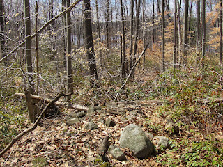
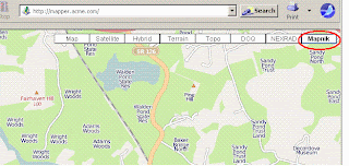
 This was one of those times when you step into the woods and immediately see rock piles. But throughout my visit I was unsure if I was looking at post colonial anglo structures in ruin or rather something older. You'll understand my confusion - rock piles mixed with stone walls (linear arrangements of stones), strategic bits of quartz, more walls, some obviously ceremonial structures, what looked like a cart path with a loading dock. My instincts, or at least my prejudices, lead me to think this is a ceremonial site: I does look out towards Wachusett, there are some obvious "graves" nearby. But I remained unsure. For example, I took FFC and my wife to have a look at the site the following weekend, and FFC said many of the stone walls run magnetic north/south. That would suggest a more anglo feeling to the place. So let's have a look.
[Update: rereading the above, the north south orientation of the stone walls here might be because they are pointing at Mt. Wachusett.]
I stepped into the woods on a dirt road, starting at a little Muddy Pond Conservation Land turnout, and there was a rock pile next to the path:
 This pile had its feet in the water, at the source of the water, so this is a very typical Native American rock pile placement. The pile had one, noticeable chunk of quartz:
 But also next to the pile was another, made with slightly smaller rocks:
  Auxiliary satellite piles made with smaller rocks are a typical pattern of field clearing. First they cleared the larger rocks, then they cleared the smaller ones. So this pile left me pretty confused. And a few yards further along the dirt road there was another. But this one seemed part of a stone wall, until I looked more carefully.
 Actually this is separate from the wall and angled differently (you see the wall off to the to the left above and to the right in the picture below). Note the pot to the left of the pile.
 This pile also had a single piece of quartz in about the same relative position as on the first rock pile, but smaller, perhaps inconsequential:
Continuing, I started seeing much more typical smaller rock piles under the hemlocks:
 [These ones looked evenly spaced and in lines - if you know what I mean]
 And I started realizing a personal aesthetic ideal: the rock pile poking out of the mountain laurels. Here was another:
 So at this point I am getting ready to believe I am at a ceremonial site when I come up to some more walls and tumbled ruins that confuse me with their hints of the agrarian.
Here is something we discussed long ago (I think it was first mentioned by Geophile?): flat sided piles built into the side of a hill:
 One the one hand, this pile had a piece of white rock (feldspar in this case) at its center:
 But on the other hand, directly in front of the flat surface of the pile was a trench that followed along the slight concave curve of the pile. As if narrow cart could be driven up to this pile and then loaded. So what are we to think?
In one direction is a very typical ceremonial pile:
 an effigy perhaps.
 In the other direction were some tumbled walls:
 Look at that internal structure though. This was not a wall, instead we are looking at some kind of ruin.
 I should say that the other "major" sites facing Wachusett also contain large piles and linear, tumbled down features. In my own little theory: out west of the Nashua, we have more monumental-type piles and sites having piles with different characteristics mixed together in a complex organization suggesting overall site architecture. This site at Muddy Pond fits that description. I wonder sometimes if this might be the Nipmuc whose territory included Westminster.
Pushing along further (I was walking south along the "Midstate Trail") I got to a final lookout over the pond to the southwest. Wachusett would be visible here to the left, if the trees were not in the way.
 This was at one end of another tumbled down linear arrangement of wall and pile. Where it is not stone wall, it becomes earthwork.
 Near the other end was this lovely pile on a boulder:
 I'll post some more about this site later.


 Some rock piles:


