Wednesday, January 31, 2007

A site by a brook at "The Desert" - Marlborough, MA

I am allowing myself to make public the location of this site following the guidelines that it has already been destroyed and is in plain site anyway. However if you visit, try not to make a path to the site.

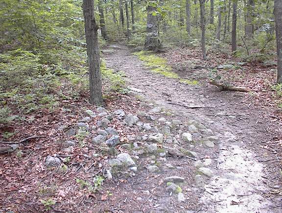
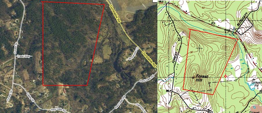
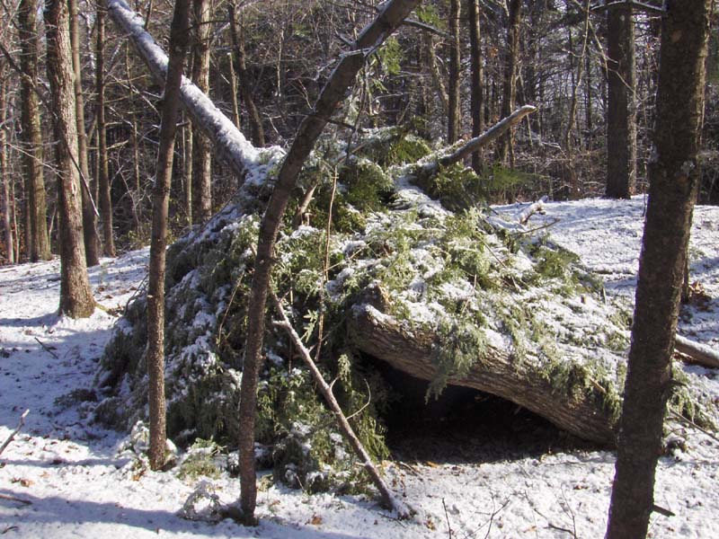
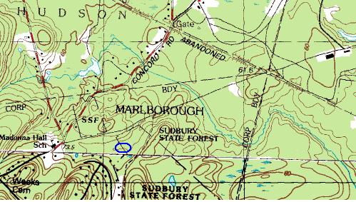
I visited this place a few weeks ago (see here) and I again parked on Concord Rd just left of the first "S" in "SSF" on the map fragment. At this point, you can see a couple of rock piles next to the road. From there I walked south east and downhill till I crossed the main dirt road through there. There was a stone wall parallel to the road and, downhill beyond it, what looked like an isolated bit of wall by itself - possibly a rock pile. When I went down to take a closer, sure enough, it was a pile.
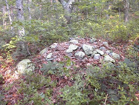
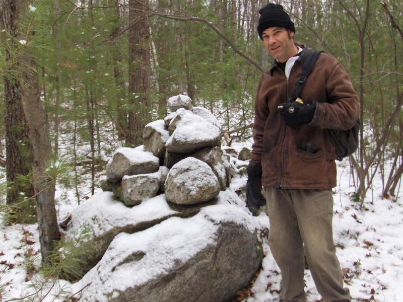
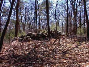
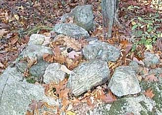
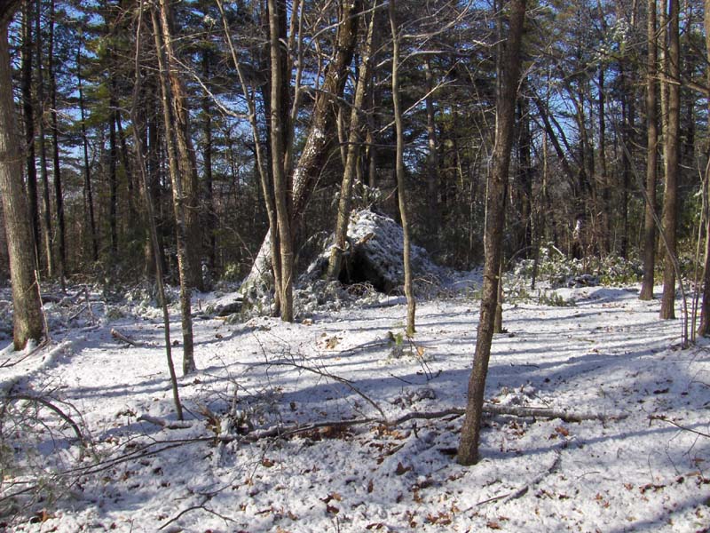
We are at the edge of the conservation land and you can see the houses in the background. The view is roughly to the south. There were three of four piles like this, badly damaged, on a small knoll, nestled in a little bend in the brook. It was a place where you could hear the water gurgling in the brook (see here)..
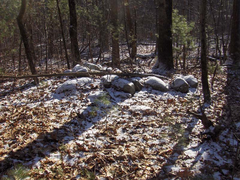
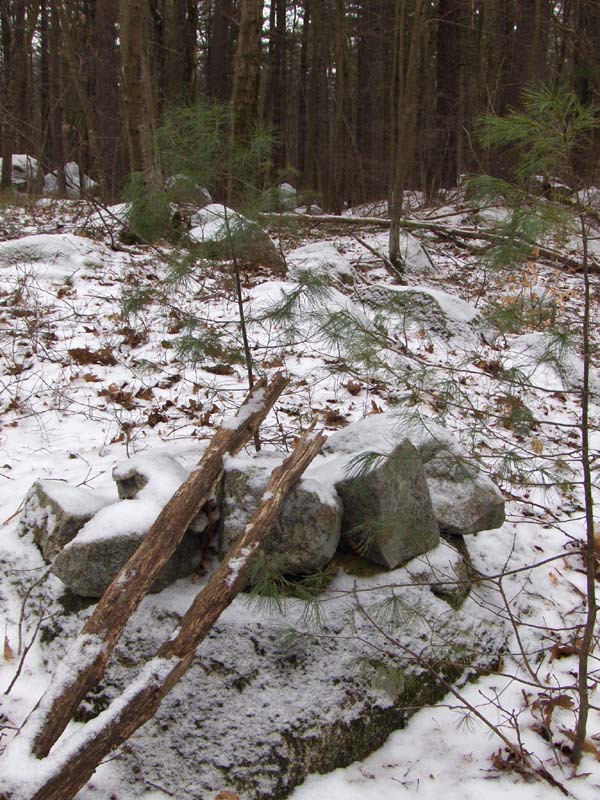
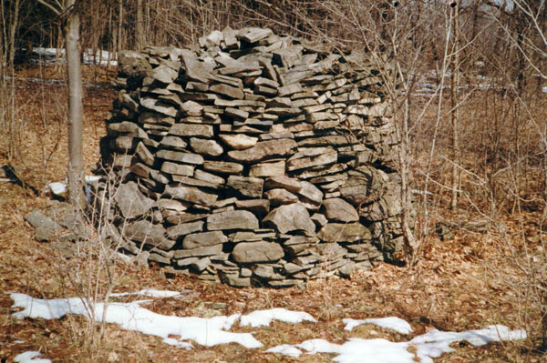
As you can see, these would have been reasonably large piles made from larger rocks about 10-20 inches in diameter.
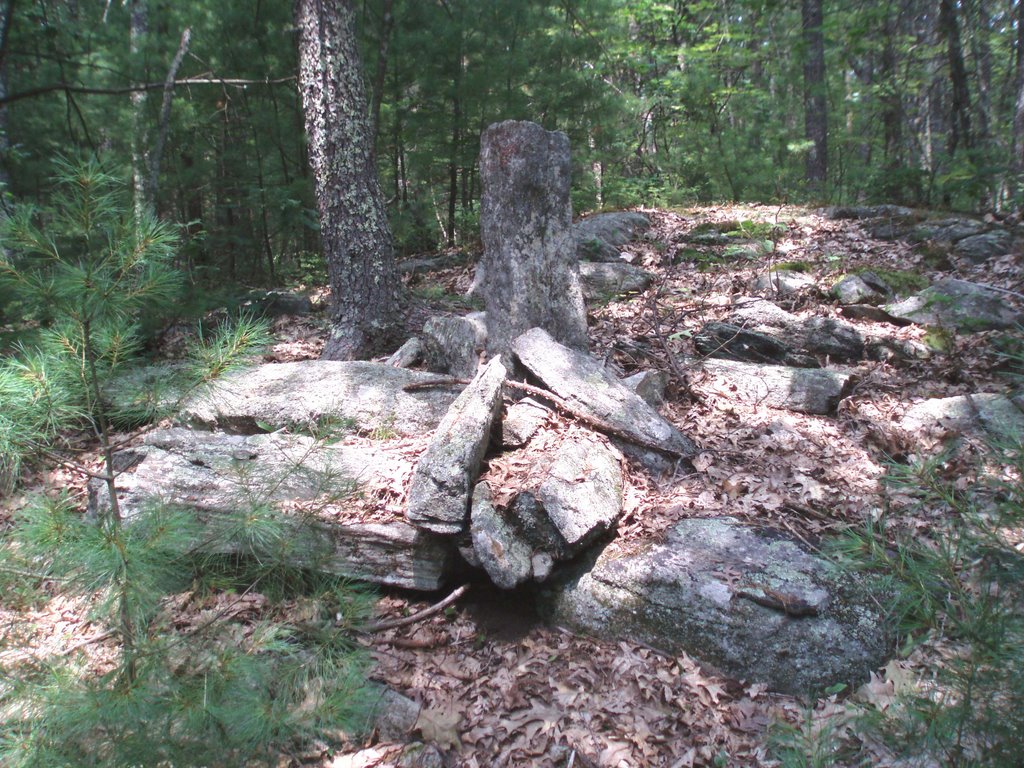
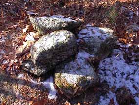
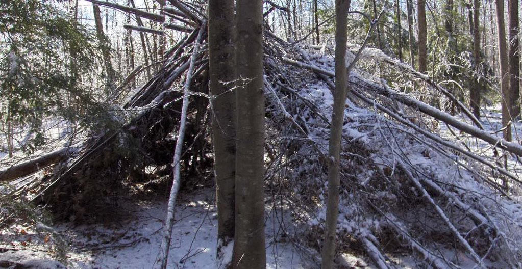
There was one little wedged split:
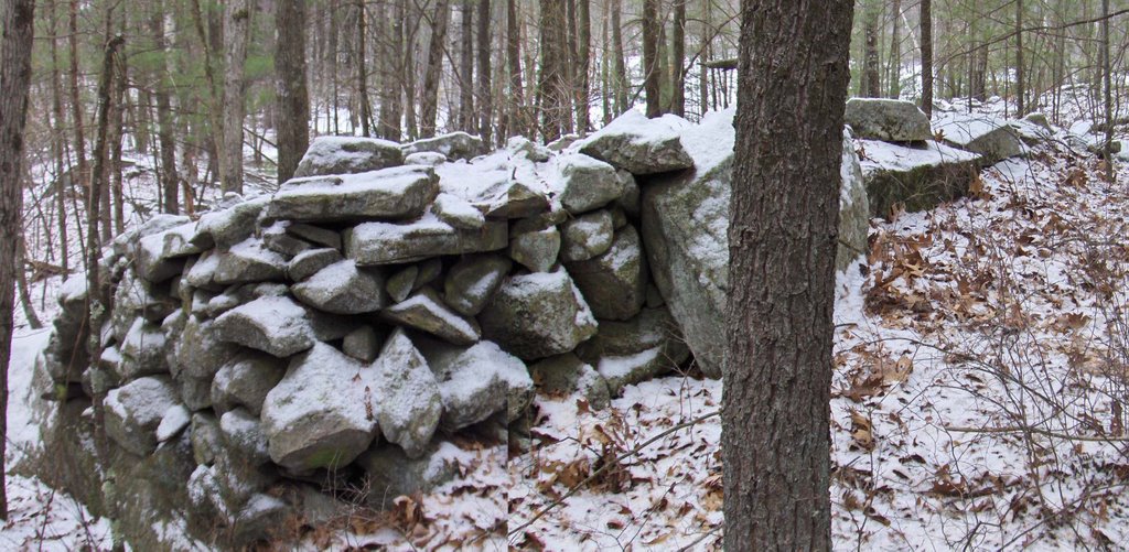
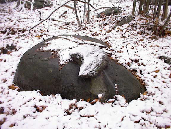
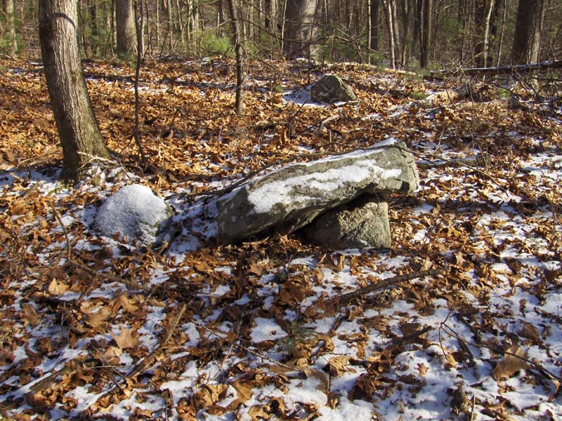
There were also a number of things so badly damaged and running together that I could not make out any part of what the structure was before.
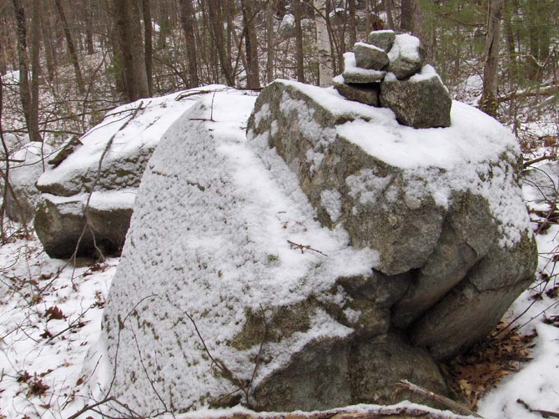
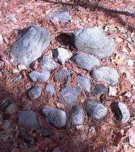
I have a number of other pictures from this site but they do not seem to tell much.
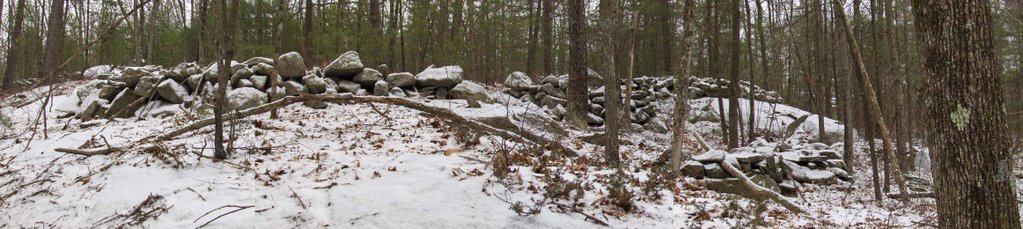
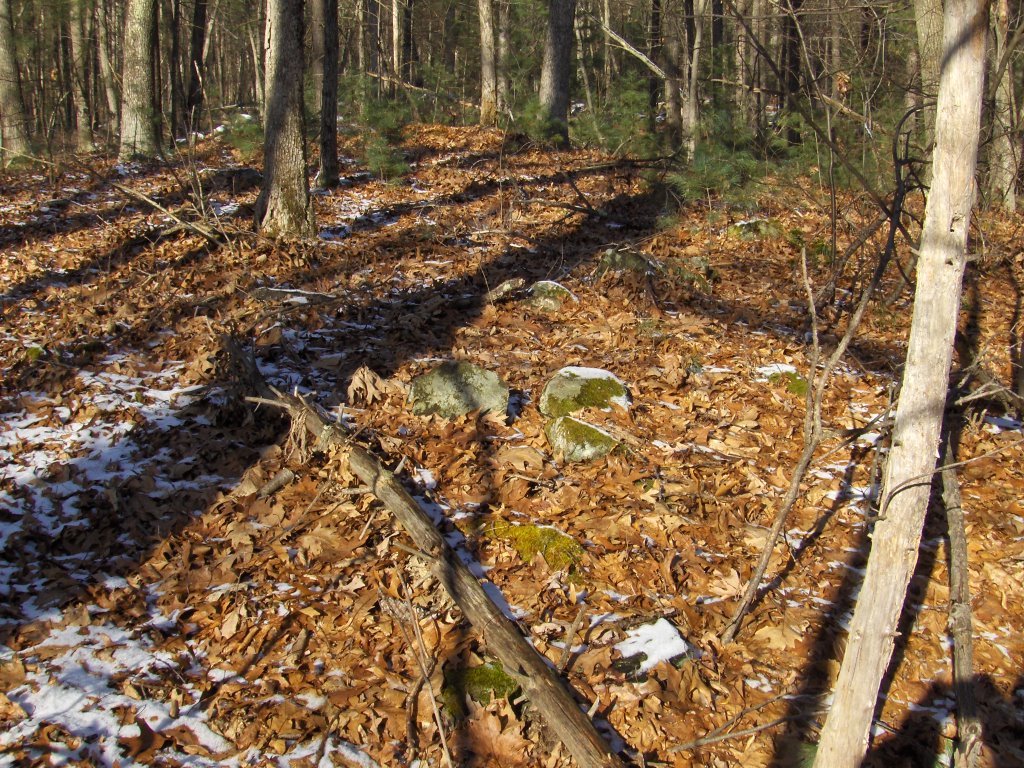
At some point there should be an accounting for the different proportions of rock piles at different sites. Here the piles are -so- big with component rocks on the average -so- big. And these proportions are typical of rock piles found from -here- to -here-. Also, if we add in the metric of pile "half life" [which I wrote about earlier but I cannot find the link for], we can imagine a quantitative study of sites even though they are as badly damaged as this one. In fact when so little is left of a site, it sheds a harsh light on what is left to study: counting the rocks, counting the piles, measuring the rocks, examining the topography, cataloging the locations.

More of those fish traps (?) from Quantas Airlines - just in time for Valentine's Day

Since this is an advertisement I assume they do not mind my re-publishing it. Photos on this blog are a bit dun and drab lately. Perhaps we all long for those tropic seas - and having some connection to rock piles is just an excuse.

Tuesday, January 30, 2007

Near the Ice Pond- Beebee Woods Falmouth, MA

This is from a couple of summers ago. What I would call a Turtle Pile:It is near this pile in the path:

Somewhere in Stow

Just for some color:

On the fringes of a favorite site in Tyngsboro

I have written before about this place. The main feature is an aperture pile with a hole pointed directly at a propped boulder. You can just make out the aperture in this pile. The next picture shows the boulder you can see through the aperture:
I turns out there are quite a lot of piles near the aperture - It is worth identifying the place as an individual site. Here are a couple of other nearby features:
And there was at least one more substantial pile (damaged).
This is Bruce McAleer. He noticed a large number of "pairs"at this site. I like this example:

"Upper" site in Tyngsboro

I mentioned this site as possibly a former mill and as being in Tyngsboro [Click here].
Showed the site to Bruce and took some new photos.
Here is the pile in the upper right of the previous photo
Here is one more view. The piles seem "parallel" to each other. Something to keep an eye out for at other sites:

Taiwanese Fish trap

...another in the continuing series on rock piles around the world. These guys know how to build a fish trap. [Click here]

Monday, January 29, 2007

Within earshot of the gurgling brook - the Desert Marlborough

A "U" structure facing west

A suggestive structure from this weekend. Bruce said the direction outward from the "U" structure was due west.

Friday, January 26, 2007

Abulsme album - nice petroforms in the snow

When I linked to their "petroform" photo, they left a comment with a link to more photos
[Click here]

Franklin NY Cairn and others from Norman Muller

Norman writes:
Attached are some images of cairns in New York State. The first is the tallest cairrn I have ever seen, either in person or in photos. It is at least 11' tall and is located in the town of Franklin. It reminds me of a tall cairn that was illustrated in an article that Tom Brannan wrote for the NEARA Journal some years ago, in which he proposed that the tall cairns were used as trail and ley line markers. Whatever their explanation, the one in Franklin is very impressive.
The other two cairns illustrated are no longer. In an article Don Windsor wrote in 2000, titled "Stone Piles in Chenango County" (Archives of the SciAesthetics Institute 2000 Dec; `1(2): 33-50), he wrote the following about a group of cairns near Buckley Hollow along the Finger Lakes Trail south of Oxford, NY. Underneath the bold heading THESE PILES HAVE BEEN DESTROYED!! on page 36, he writes: "On Tuesday 22 August 2000, I received a phone call from Ed Sidote telling me that Rufus Perkins reported that these large stone piles were taken apart and sold for stone. Delayed by a trip to Florida, I photographed the remains on Thursday 31 August. At that time the 4 cylindrical piles were just a rubble of unmarketable stones. The large triangular center pile was still intact. It probably is gone by now. That same morning George Kolb spotted a pallet of stones on the side of Winner Road, east of the site. Not only were the piles gone, but the impressive stone fences nearby had been taken also.
"This loss is an incredible blow to our local heritage. The landowner apparently values money over all else. However, those piles would have been worth much more intact. What was done was similar to chopping up an antique table and selling it for firewood.
"Nevertheless, here are descriptions of what they were. A photo of the southernmost pile appears in Figure 4. The 5 piles here were laid out in a circular arc, spaced at 68, 68, 120, and 77 feet apart. The largest pile is triangular, unlike the cylindrical two on each of its flanks. Its apex points easterly toward the imaginary center of the arc's circle. The view extends to the hills about 4 miles across the Chenango River valley."[Note from PWAX. It is clear what kind of legislation rock pile enthusiasts should be working towards - whether town, state, or federal: A variance should be required to move any stonework that pre-existed the current landowners tenure.]

Archeology in Newfoundland and Labrador

Unlike American Antiquity, these guys put their magazine issues online. Some of this may be of interest. (Photos are usually towards the end of articles). [Click here]

And check out the Provisional Archeology Office Newsletters [Click here]

Thursday, January 25, 2007

Friends of Pine Hawk

by Jim P
I stumbled on this link about an archaeological site in South Acton, MA. Many of you probably know about it, but I thought the link might be interesting to blog readers from elsewhere. I had not heard about this site myself.

http://www.actonmemoriallibrary.org/pinehawk/home.html

Wednesday, January 24, 2007

Friends of Bear Paw, Big Hole & Canyon Creek Battlefields

"...In addition to having been constructed by historic and prehistoric native peoples, cairns were also constructed by historic Euro-Americans-particularly while clearing cultivated lands of stone. In determining whether specific cairns are associated with the activities of past Native Americans or historic Euro-American activities Rennie and Brumley (1994) define four primary characteristics of a cairn: 1) the location of the structure in relation to evidence of other prehistoric or historic materials or activities; 2) the extent of sodding around the stones comprising a cairn; 3) the extent of lichen cover on the exposed surfaces of the stones comprising a cairn; 4) the nature of any associated cultural materials..."
[Click here for full article]

A favorite picture of a rock-on-rock

The curved shape in both upper and lower rock may be significant.

Commemorative Cairns in Saskatchewan (not ceremonial)

[Click here]

Saskatchewan Erratics

[Click here]

Group Walk in Estabrook Woods

From April 2004 Journals:
Went out with Ed Myskowski, Norm Muller,and Steve Ells to show them the YYY site and to pick Steve's brain about aspects of Estabrook woods. I had a pretty good time showing off the site, walking and chatting. From YYY we headed west and south across HHH hill past the ... north of Mink Pond, to a knoll looking southeast back at the pond, continuing past Boaz Borwne's, and over and downhill to something called "Cornel Rock" - an outcrop at the edge of the open fields.

We saw several interesting things along the way but, for me, the highlight was the knoll looking back over Mink pond: there are two large rock piles on top at the edge of the overlook. Don't know how I missed that, I have been around that knoll more than once. Here are two views of the main pile:
There is also a third pile that belongs to this group, which I must have seen before, on the north side of the hill, easily visible from the path. This is a path I have been on before, cutting west off of the main Estabrook Rd near the north end of Mink pond. Several times ago, when I first explored Estabrook woods, I photo'd a large propped rock on a support boulder which looked like a turtle's carapace. Tim McSweeney had some fun with that photo. This time, when the group got to this point we all took another look at this propped up rock and commented on it. Apparently it is a feature that caught Steve's eye in the past, that Norman knows about too. Steve Ells was amused at the idea of 4 old guys, who know each other only slightly, walking around in the woods in something like the middle of nowhere and coming to a rock which three of them have a personal connection with.

The Educated Horse - Camp Acton, Acton MA

This rock is out in the woods back there.

Mound links from the Megalithic Portal

Some of these may be of interest.
[Click here]

Tuesday, January 23, 2007

Unexplored hill in Tyngsboro

This is called "Forest Hill". According to my intelligences, this is an un-disturbed hill.

Update: I went up there and it was a sandy hill with at most a couple of rock-on-rocks. I conclude that up there at the edge of Dunstable it may be mostly too sandy for rock pile sites.

Unexplored hill on the northern border of Westford

According to my latest intelligence, this is an undisturbed hill in a place where there ought to be rock piles. Anybody want to go check? Seems too surrounded by houses.

Carlise site - Dec 2000

Tim Fohl of Carlisle showed me another localized group of rock piles overlooking a small swamp to the southeast, on the XXX Conservation land in Carlisle. On approaching we see a, by now, familiar wedged up rock.There are thirty or more small rock piles in a two acre patch of woods. To me the most spectacular pile is this one:Another view:
Another feature of the site that catches my eye, when I get back home to look at the pictures (some of which were taken by Tim), is the common juxtaposition of a black and a white pair of rocks at the edge of a rock pile. Here are three clear examples:


Then there were other structured piles like this one with nice symmetry:
Showing a little offering place:
Showing more symmetry:

Monday, January 22, 2007

Native Stones list of links

[Click here] for a nice collection of links.

Possible Bird Effigies

From April 2002:

This weekend we went on a couple of desultory explorations Saturday and today, Sunday, went on a slower walk out behind FFC's house. Found a couple of really very nice examples of rock piles. The first is a perfect triangle with head and shoulders and a white apex:
The next is a very symmetric winged figure. It was large so I held the camera overhead. Unfortunately this cut out one of the most interesting aspects of the pile, which was two triangular rocks at the bottom, pointing downward like swallow-tails. Look carefully at the other rocks, especially the left and right "wingtips".
(These piles are in a small woods that is frequently hit by lightening.)

Light posting after a weekend with no finds

Photos are going to have to be all from Journal notes this week, because for the second time (is it?) in a year of posting on this blog, I did not spot any new rock piles over the weekend. Part of what I set out to show by writing this blog is that sites are so dense you can go out and find a couple any weekend that you try. Lately, of course, I have been running up against the limit on how much unexplored woods there is within a half hour's drive. I think, in Manitou, Mavor and Dix make it seem like sites are sparse. Anyway, here is something from April 2002. It is a sincere effort but not done very rigorously.

I have now located 57 sites of rock piles, some with only one or two piles, others with 50-100. It just occurred to me as I look at the topo maps for "Billerica" and for "Maynard" that most of the sites are located with views to the Southeast or Northwest. To prove this I went through all the sites and counted, discounting sites where there is a 360 degree view, and putting 3 sites in a dual category I find that the tally of site view directions is:
#NW = 25
#SE = 21
#S = 4
#SW = 3
#NE = 3
#E = 1
#W = 1
#N = 0

Sunday, January 21, 2007

Cairns in the arctic (not Inukshuk)

[Click here and scroll down]

Paper announcement - sent in by Fred Martin

Abstract Title:
Atlantic Trace Settlement Update: Geography, Cartography and Archaeoastronomy

is part of the Illustrated Paper Session:
Student Illustrated Paper Competition Session 2

scheduled on Thursday, 4/19/07 at 15:00 PM.

The preliminary program and schedule of sessions for the 2007 AAG National Meeting in San Francisco, April 17-21, is now available online at http://communicate.aag.org/eseries/aag_org/program/index.cfm?mtgID=52. The full agenda, including plenary sessions and specialty group meetings, can be found in this web-based timetable.

2007 Annual Meeting, San Francisco, California Online Program


Author(s):
Noel Ring, Retired university instructor* - Private Consultant
Elaina Hyde, Astronomer - Max Planck Institute of Astrophysics
Ken Goss, Retired General Mgr. - AeroGraphics Corp.

Abstract:
Seventy stars replicated in stone on landscapes in maritime Canada, New England, Great Britain and Ireland form the central pattern of the Atlantic Trace Settlkement, first identified by air photo interpretation in the mid-1970's. Likely the largest maps on earth, the lithic celestial charts are of as yet unknown cultural origin. They are predictably located near Bronze Age copper mines, carbon-dated ca.3000B.P., in western Europe and copper ore outcrops in northeast North America. To date, API and groundtruth field surveys place ATS stellar maps, constructed of large boulders often connected by stone walls, at over 25 sites in New Brunswick, Nova Scotia, Maine, Vermont, Ireland, England, Scotland and Wales. Two wedge-shaped and a kite-shaped feature comprise the repeated ATS pattern, which spans an annual view of the night sky. Native American star lore encompasses portions of the ATS complex, such as the Big Dipper (Plough), Polaris, and major planets along the Line of the Ecliptic, also discerned via API. Nothing in European cosmological cartograsphy or colonial cadastral traditions provides precedence for the ATS pattern. As reported at the 2004 AAG Annual Meeting, land use development continues to endanger ATS sites on both sides of the Atlantic. They merit urgent multi-disciplinary research funding for additional detection, dating, GIS application, and site preservation. The co-authors hope the AAG will support efforts to investigate and preserve these unique cartographic monuments.
Keywords:

TransAtlantic Stone Star Charts

Friday, January 19, 2007

More neeto arrrowheads

Thanks to Larry Harrop for this link. This shows arrowheads in their original locations "in situ". [Click here]