(via Curt Hoffman) Saturday night's meeting in Worcester is cancelled.
I hope to hear about re-scheduling.
Friday, March 31, 2017
Tuesday, March 28, 2017
Broad Cove, Dighton, Massachusetts
A satellite image of a salt marsh shows a stone wall that terminates with stone circles on each side, at the edge of the water. What could be the agricultural purpose?
 North side:
 South side:
 In the marsh, nearby:

 Pretty.
 Plenty of quartz flakes eroding out of the bank of the cove, nearby.


Monday, March 27, 2017
Doug Harris's "Phone In" Talk
I didn't phone in but have a report that Doug discussed the protection of sites and how the tribes want to work with the towns. This is pretty much the message of the USET resolutions.
Notes from Brian McClain:
Notes from Brian McClain:
- Starting in 2011, Doug was involved in some submerged landscape
study/policy(?) with David Robinson - maybe a publication “Submerged
Cultural Sites and Landscapes”?
- Doug has worked on setting policy (for 4 yrs?) for offshore
projects (windmills, etc) on how to handle cultural artifacts in
conjunction with the U of Rhode Island School of Oceanography?
- Wants to work on the town level with landholders and -
especially - Town Historical Commissions since they are the ones with
the power to stop development on recognized sites. (Thus maybe we should just by-pass the Conservation Commission, etc…
since that fight is probably unnecessary).
- local tribes have decided on a unified approach to protecting sites- i.e. no one tribe will claim a site as their own
-mention of the film “Great Falls” by Ted Timrek. Can find at hiddenlandscapes.com … might have to purchase…
- when talking about stone piles “prayers in stone”, mentioned Ezra
Stiles writing in the 1700’s that an Indian friend would avoid those
sites by 1/4 mile purposely to avoid the obligation to attend to it/them
when passing. :)
- Otis State Park - 73 stone piles - development (pipeline?) would
require removal of 1/3 of them. Doug says the prayer is broken when the
piles are disturbed.
- The process of officially registering an Indian stone works as a
religious site always requires at least one tribal specialist for
evaluation. Thus others can make the official ID, but they (we) can’t
make the final decision without a tribal official
as part of the process.
- Mentioned the fantastic effigies up in Carlisle
- Had good things to say about NEARA for the most part - they have
kept focus on the ceremonial stone works - although sometimes stoneworks
get ascribed to possible early European contact which annoys Doug…
Friday, March 24, 2017

Spring Events about Rock Piles
It seems this is a spring full of events. I gave a talk last night to the Lions Club of Harvard - a nice group. As I count the events, there will have been five of them in March-April. That is quite a lot and represents a healthy acceleration in the public development of the subject of ceremonial stone structures.

Doug Harris - Phone In Discussion

Mass. Forest Rescue is pleased to
announce this phone seminar Sunday evening at 7 pm with Doug Harris,
Deputy Tribal Historic Preservation Officer of the Narragansett Tribal
Historic Preservation Office.
Register for Call - in Information at:
massforestrescue@gmail.com by Saturday noon.
Or call/text at: 413-522-7505
PLEASE NOTE:
We are setting up a MFR Legal
Defense Fund to protect Native American sacred stones in Massachusetts
forests and forests themselves from ecocide and future generations from
the worst effects of climate chaos/ecological destruction. Stay Tuned.
Beth Adams - Mass. Forest Rescue Campaign massforestrescue.org
Like our Facebook Page:
The photo used above is from Killingworth CT:
[In case you do not know: Doug Harris is the person in the Narragansett Tribal Historic Preservation Office most involved with interpreting ceremonial stone features and interfacing between the tribes and the local communities.]
Thursday, March 23, 2017
A Quantitative Assessment of Stone Relics in a Western Massachusetts Town
[From Bruce McAleer:] This Meeting is Open to the Public
April Meeting, Sat. April 1, 2017, Zion Lutheran Church, 41 Whitmarsh Avenue, Worcester MA
Remember to enter the Whitmarsh Street side of the church
AGENDA
7:30 Business Meeting: Janet Bessette
7:45 Refreshments: Alan Smith and Curtiss Hoffman
8:00 Lecture:


April Meeting, Sat. April 1, 2017, Zion Lutheran Church, 41 Whitmarsh Avenue, Worcester MA
Remember to enter the Whitmarsh Street side of the church
AGENDA
7:30 Business Meeting: Janet Bessette
7:45 Refreshments: Alan Smith and Curtiss Hoffman
8:00 Lecture:


Tuesday, March 21, 2017
Black and White Stones (Woodbury CT)
Or "The Kid with the Snowplow"
and switching the position of two stones to make a Stone Serpent "come alive" by making a realistic eye - even a light colored spot on a dark stone that mimics the reflection on the iris...

Saturday, March 18, 2017
Ceremonial Stone Landscapes Presentation by Doug Harris (MA)
"Seventy-three Native
American sacred ceremonial stone landscape features have been identified by
federally-recognized Tribes along the proposed pipeline route...."

Just in from the Nolumbeka Project:
"Even if you cannot attend this presentation, please consider making a financial donation for legal fees. Remember, it was not that long ago that we faced a similar battle with Kinder-Morgan in this immediate area and throughout Massachusetts and New Hampshire. The ugly head of that black snake can re-surface. Much depends on the success of this Sandisfield campaign to set a precedent and save the forest and the ceremonial stone features. We witnessed the bulldozing of similar features at Standing Rock. Please help prevent any more desecration!"
Information excerpted from fundraising letter follows:
“There is currently an effort to explore legal avenues to protect this ceremonial stone landscape from being destroyed by the pipeline. The Nolumbeka Project supports the effort to protect these sacred stone structures. The estimate for the first phase of this legal work is $3,500. If you are able to contribute to the initial cost of this undertaking, please make your check payable to “Creative Thought and Action,” the fiscal sponsor for Climate Action Now, who is specifically amalgamating funds for this effort. Please be sure to put CSL in the “memo” line and mail your check to CAN’s treasurer:
Rene Theberge
250 Shutesbury Road,
Amherst, MA 01002
Thank you for your kind attention to this urgent and time sensitive request.
Susan Theberge, Climate Action Now
David Brule, Nolumbeka Project President
Via Rich Holsuch at Sokoki Sojourn
Friday, March 17, 2017
Where do blog visitors come from?
Since I get to look at the visitor logs, I can answer this question a bit.
- Most readers are from MA
- Next most are from states neighboring MA
- Next most are from NY
- Next most are from GA
- Next most from Ontario
- Next most are from MI
- etc, and places around the world.
This inspires leaping to the conclusion that GA, MI, and Ontario are the places where the most rock piles occur - outside of New England. But, I seriously doubt that is correct. It is easier to believe that -for unexplained reasons- states south of NY and north of GA have fewer individuals out looking at rocks in the woods. Let's see...what do we know about those intermediate states?
I think this is one of the big (but resolvable) issues: why don't they find rock piles in -say- the hills of Carolina? Is their a "mid Atlantic cultural vacuum"?
Wednesday, March 15, 2017
Protective Strategies for Ceremonial Stone Structures

Ezra
Stiles Illustrations (Great Berrington “Monument of Stones”)
At the blog Sokoki Sojourn, my friend
writes, “A short article by Lisa McLoughlin of the Nolumbeka Project, outlining
a number of useful strategies to recognize and preserve existing Native stone
assemblage sites. Ongoing land development and a general lack of public
awareness, not to mention ignorance or dismissal, brings constant destructive
pressure upon these ancient interactions of land and spirit.” He adds this
quote from Lisa McLoughlin:
“…I’d say
that while many stone features have been destroyed, there are still thousands
left. They are hiding in our back yards, in our state forests, along our
waterways — everywhere in plain sight. Help others realize why they should be
respectful of these when they find them, help them imagine what it might mean
to have a religiously-important structure (e.g. something built to honor
someone in your family) technically belong to someone else, or be at risk from
vandals, pot-hunters, and developers. These stone structures are examples of
how humans found a way to interact respectfully and in a mutually-beneficial
way with nature. They are Natural Cultural nodes, blueprints for how we will
need to think in the future if we are to survive and allow our natural world
survive. They are important beyond the specific, and they should give us hope.”
Taken From:
Ways you
can help stop destruction of the few Indian features left in Massachusetts
by Lisa
McLoughlin of Nolumbeka Project
• preserve
land for whatever reason — environmental preservation usually means that
cultural resources are preserved on that land too. Support your local land
trust.
• support
Tribal efforts to protect their traditional cultural properties — protest
projects that will bulldoze them, and make connections with Tribal Historic
Preservation Officers if you have
found some stone structures that need protection (either through your historical commission, Nolumbeka Project, or similar group or reach out to them directly)
found some stone structures that need protection (either through your historical commission, Nolumbeka Project, or similar group or reach out to them directly)
•
influence the workings of your town, state, and national governments toward
protection of cultural resources — introduce and enact laws that put in place
protections and processes that require traditional cultural properties to be
taken into account, that encourage smart development (or less development),
that take a wholistic approach.
• learn
about cultural resources and the governmental agencies that manage them — the
writings of Thomas F. King are especially good at helping non-experts understand
what’s at stake and how to go about protecting it: Saving Places that Matter,
and the National Park Service Bulletin 38 are 2 good places to start.
• read
history, especially local history, and collect stories from older people,
hunters, and farmers (people close to the land) in your community — find out
and document what was/is there so that if it is threatened you can speak to its
importance. This applies to the land pre- and post- colonist—an important part
of doing this work is setting the record straight and reclaiming the history of
the first people before we came, and our interactions with them since. It will
tell us a lot not just about them, but about us and issues we still have not
resolved about how we treat others as a culture.
• talk to
others about why these features matter.
Finally,
I’d say that while many stone features have been destroyed, there are still
thousands left. They are hiding in our back yards, in our state forests, along
our waterways — everywhere in plain sight. Help others realize why they should
be respectful of these when they find them, help them imagine what it might
mean to have a religiously-important structure (e.g. something built to honor
someone in your family) technically belong to someone else, or be at risk from vandals,
pot-hunters, and developers. These stone structures are examples of how humans
found a way to interact respectfully and in a mutually-beneficial way with
nature. They are Natural Cultural nodes, blueprints for how we will need to
think in the future if we are to survive and allow our natural world survive.
They are important beyond the specific, and they should give us hope.
» Learn
more about Ceremonial Stone Landscapes impacted by Kinder
Morgan’s CT Expansion Pipeline path in Massachusetts
This entry
was posted in Uncategorized on February 19, 2017 by Rosemary Wessel.
Tuesday, March 14, 2017
A good read for a snowy day: Leo Pettipas's "The Petroform Phenomenon of Southeastern Manitoba and Its Significance"
For your reading appreciation click here.
How do you like this quote: ” Turtle effigies, on the other hand, “exhibit a 90% consistency of orientation towards the west” (Buchner 1976:11-12).
How do you like this quote: ” Turtle effigies, on the other hand, “exhibit a 90% consistency of orientation towards the west” (Buchner 1976:11-12).
Saturday, March 11, 2017


Thursday, March 09, 2017
Rock Piles and Possible Rune Stones - Hillman, Minnesota
Hello,
... I Too have strange rock piles in my
woods. One day While exploring a remote part of the 320 acres that I own
in central Minnesota, I came across a series of 4x9 rock piles and a
low boulder/ rock wall approximately 350 feet long. Most of the rocks
weighing 200-300 lbs. With in proximity of this wall is a square rock
lined hole, and a boulder flat topped. Upon closer inspection of the
rock piles I found rocks that had been fashioned for specific purposes.
There also is an ancient tote road used for a trade route cutting
through. (perfect camp spot) I have attached pictures of some of the
artifacts that I have found. I'm trying to find someone to examine the
rock with the markings on it. ( I think that they represent "rune"
writing) Which being that my land is very close to the "Kensington"
rune stone, could be possible they are connected. When researching
"Rune" symbols, the word "Barrows" popped up.
The word "barrows" means rows of rocks and Celts were predominately
wall builders. I think that these rock piles might have been
constructed with nordic influence in the late 1300's, based on the
inscribed date on "kensington Rune Stone" 1362. I have more pictures
if interested, and also open to any comments or theories.


In a later email:
My
land is in Hillman about 10 miles from Mille Lacs lake. As far as the
pictures go, i'm all for it . Maybe somebody else has found things
similar tying it to the same period, and It would be great if maybe
somebody can translate the markings and/or determine a purpose? Sorry, i
did not explain in the previous email that I found the rock with the
rune symbol with my metal detector scanning a rock pile. picture 2 is a
lower "paleolithic' oil lamp. And the other rock appeared to have
twine wrapped around it ,since fossilized.


Stand With Standing Rock (Greenfield MA)
Rally to Stand With Standing Rock and Native Nations
Saturday, March 11, 2017
12 PM - 1:30
PM
Greenfield
Town Common
14
Court Sq, Greenfield, Massachusetts 01301

Gather
on the Greenfield Town Common for a Rally to
Stand
With Standing Rock and Native Nations.
All
are invited to gather on Saturday, March 11 at noon at the Greenfield Town
Common to stand together in community prayer, song, and peaceful action in
support of Standing Rock Water Protectors and Indigenous people.
Standing
Rock and Native Nations have called for solidarity actions to support their
March 10th Washington DC march in prayer and action.
The
Standing Rock and Native Nations who are organizing the DC March say: “We ask
that you rise in solidarity with the Indigenous peoples of the world whose
rights protect Unci Maka (Grandmother Earth) for the future generations of
all.”
The
Native Nations' demands for the peaceful DC March include respect for tribal
rights and the protection of the environment and future generations.
Via Diane Dix
Wednesday, March 08, 2017
A New England Woodland
Added a permanent link to this blog. Don't know why I missed it 'till now:
http://newenglandwoodland.blogspot.com/
http://newenglandwoodland.blogspot.com/
Studying rock piles is not limited to ethnography and scholarship
I was reading an article Norman sent me:
JOA 4:39-71, Rock Piles of the Upper Ohio Valley Moore and Weiss
THE CONTINUING "STONE MOUND PROBLEM": IDENTIFYING AND
INTERPRETING THE AMBIGUOUS ROCK PILES OF THE UPPER
OHIO VALLEY
Charity M. Moore and Matthew Victor Weiss
I was unable to get past this sentence of the introduction:
Only through a comprehensive, programmatic approach, informed by indigenous knowledge, can archaeologists overcome the ambiguity of rock piles
Direct observation is another possibility and the authors seem unaware of the thousands and thousands of sites that can be studied. Wasn't archeology supposed to be science? Around here, I watched the "indigenous knowledge" go from nothing to a specialized "rock" vocabulary in just a few years (putting the root for "rock" as a prefix on other words). For example, out in the southwest where the tribes have genuine cultural continuity: do you think those "sun daggers" were uncovered through ethnography?
They continue discussing the many scholarly attempts to understand rock piles. For what it is worth: there is a subject here that is not scholarly but empirical. To know it, you need to head for the woods not the library.
Patch Hill Boxboro
Dave Alling writes:
I have spent some time in the patch hill area recently and found a few items that may interest you. Due [to] picture size limitations, I have to divide this into 3 parts.
The following serpent effigies are connected by a stone wall. This section of stone wall is described as having peaks in previous blog post ( http://rockpiles.blogspot.com/2015/07/patch-hill-equinox-revisited.html) or it could be interpreted as the body of a serpent. There are other rock piles in stone wall corners that could be interpreted as platforms.
Serpent #1


This turtle effigy is located uphill between two sections of stone walls. It looks down towards a vernal pool.

I have spent some time in the patch hill area recently and found a few items that may interest you. Due [to] picture size limitations, I have to divide this into 3 parts.
The following serpent effigies are connected by a stone wall. This section of stone wall is described as having peaks in previous blog post ( http://rockpiles.blogspot.com/2015/07/patch-hill-equinox-revisited.html) or it could be interpreted as the body of a serpent. There are other rock piles in stone wall corners that could be interpreted as platforms.
Serpent #1


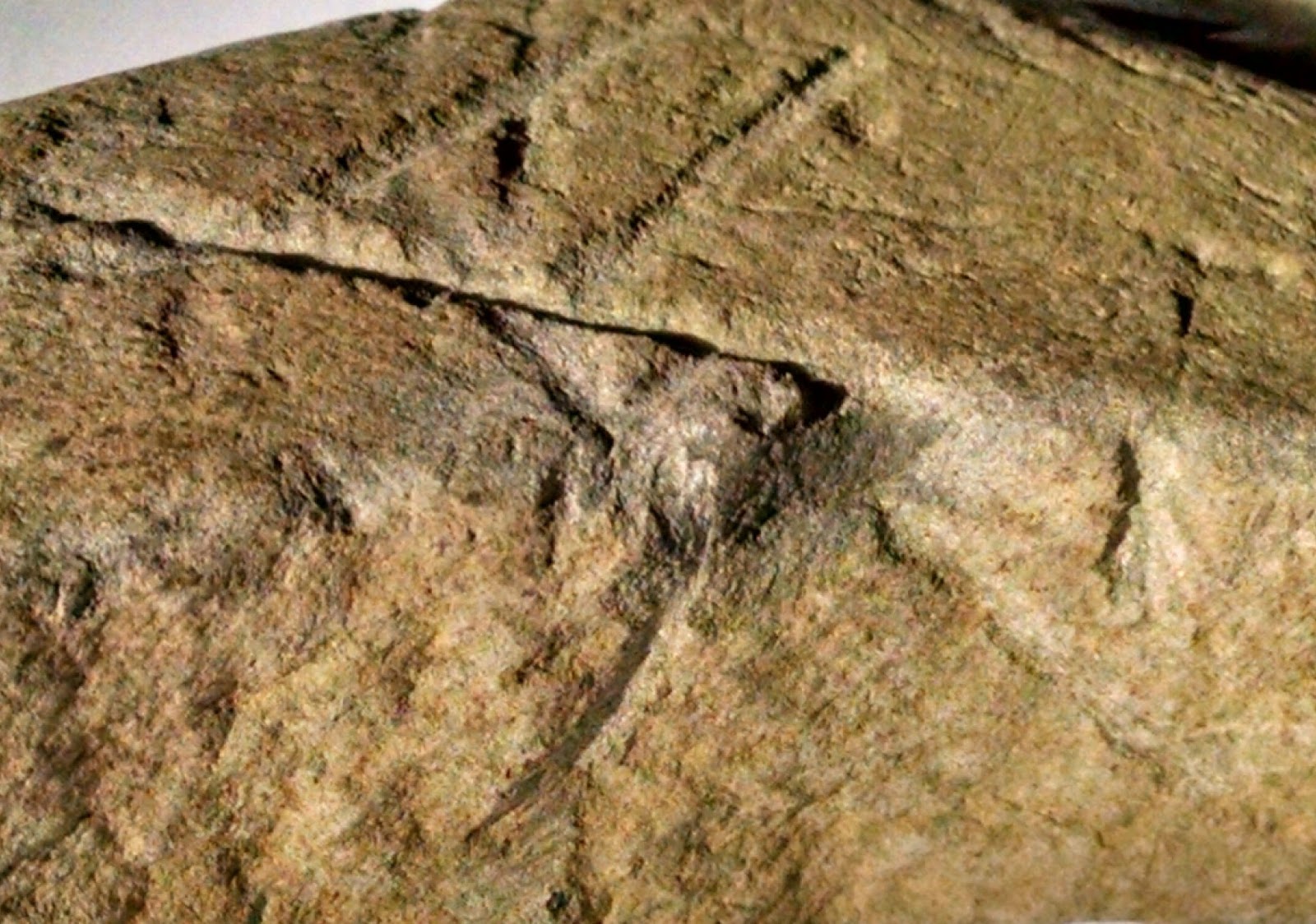
Serpent #2. Zoom in to see the eye.

Prayer seat? This feature is located about 10 yards away from a rock pile/stone wall corner. There is a rough triangular point to to the rock pile.


This turtle effigy is located uphill between two sections of stone walls. It looks down towards a vernal pool.

Sunday, March 05, 2017
Restoring the link to Fort Devens Stone Wall Map
Is this a working link?
Here is PDF
https://drive.google.com/open?id=0BwrDMBHkivezS3NOMmlndndsVE0
or better
HERE IS A PNG rotated correctly:
https://drive.google.com/open?id=0BwrDMBHkivezVGtHMzBQX0xsc1U
Here is PDF
https://drive.google.com/open?id=0BwrDMBHkivezS3NOMmlndndsVE0
or better
HERE IS A PNG rotated correctly:
https://drive.google.com/open?id=0BwrDMBHkivezVGtHMzBQX0xsc1U
Friday, March 03, 2017
The corridor from Hobbs Brook up to Sandy Pond, Lincoln
In a place you were hoping to find rock piles, you come across a tumble of rocks:
 Your eye makes no sense of it. You look at it from another angle:
 And...yeah...it does look like there is a straight side (on the left) and maybe some other structure.
There is a stone wall in the background that separates the lowest wet area from higher ground. The piled rocks are on the wet side and are well separated from the stone wall. Also you can see there is a smaller pile nearby:
 Taken together, the smaller pile and the setback from the flanking stone wall are "strategic" reasons for thinking this tumble of stones is the mound you are looking for. Another view:

This is about where the 'C' is in 'LINCOLN' on the map:
 At the NE end of the valley (under the word 'LINCOLN') is the top of Hobbs Brook, which is a source for the Charles. You go up the valley to the SW and end up at Sandy Pond. It appears Sandy Pond now drains to the south but there must have been a connection down this valley at some time. I know a site at the NE end of this valley and I thought it would be a good idea to explore up towards the SW. After finding the first piled rocks (above) I did not see much. The area is full of things like this:
 I turned around and went back via the highest ground, by the letter 'I' in 'LINCOLN', and at the high point there were several damaged rock piles. Some had been recently bulldozed and it made me suspicious of the lot. Still I strongly suspect there was a site here in the past.


 Hard to see this as bulldozer damage:


There is a stone wall in the background that separates the lowest wet area from higher ground. The piled rocks are on the wet side and are well separated from the stone wall. Also you can see there is a smaller pile nearby:


This is about where the 'C' is in 'LINCOLN' on the map:


Subscribe to:
Posts
(
Atom
)