From People of One Fire.
http://peopleofonefire.com/map-indigenous-stone-structures-in-the-southeast.html
Saturday, October 31, 2015

Friday, October 30, 2015
Drone Photo (Canada)

- drone photo from Canada that I lifted from Rob Buchanan and don't know the details of - yet.
Update: And a wiser man than I asked, "Is it genuine or photoshopped?"
Wednesday, October 28, 2015

Great Turkey Pond in Concord, NH
From reader Tom S.
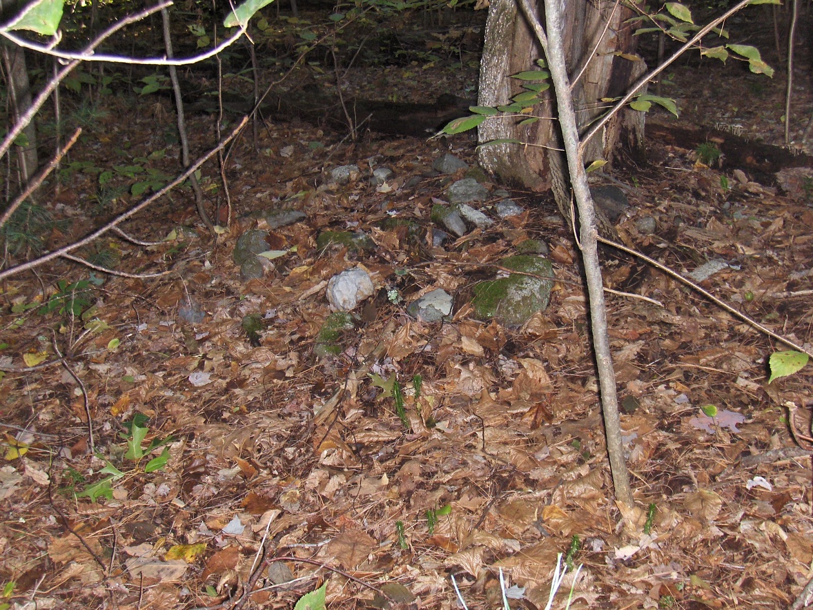
I wanted to mention an interesting rock pile I found on a recent ramble along Great Turkey Pond in Concord, NH. I have a blog -www.newenglandrambles.com - in which I post detailed descriptions with photos of my rambles at open space properties throughout New England. This recent ramble was along trails from the Audubon Center off Silk Farm Road and the rock pile is adjacent to the pond and actually quite extensive with interesting formations indicating that they aren't just rocks randomly strewn about. I thought of your blog immediately and even mentioned your blog and put a link to your blog in my site.


I wanted to mention an interesting rock pile I found on a recent ramble along Great Turkey Pond in Concord, NH. I have a blog -www.newenglandrambles.com - in which I post detailed descriptions with photos of my rambles at open space properties throughout New England. This recent ramble was along trails from the Audubon Center off Silk Farm Road and the rock pile is adjacent to the pond and actually quite extensive with interesting formations indicating that they aren't just rocks randomly strewn about. I thought of your blog immediately and even mentioned your blog and put a link to your blog in my site.


Tuesday, October 27, 2015
Monday, October 26, 2015
A picture tells the story
A railroad track built over an old road. The road had stone walls on either side. They were built over older walls:
 In the foreground you see a "new" wall. If goes over an older one that ends at the railroad "cut".

Stone Mounds, White Quartz and More (Woodbury CT)
Standing at the southwest corner of what was the "Old Horse Field" on my Great Grandfather Giovanni Rinaldi's farm, looking into the neighbor's yard, I thought to myself that even though I've seen this "heap of stones" so many times in the last 50 years that it was sort of funny that I had never actually thought about it as a possible Indigenous stone pile before the other day when my Uncle Bob asked me to see if I could find the survey markers for the property lines:


Over the last few days I've been back to Uncle Bob's, helping him out at the house, hearing old stories of family history - which includes my Great Grandfather's and Great Uncle's stone work in the area - and talking about this business of identifying Stone Ceremonial Landscapes and Features. I've written about this "Horse Field" before, as well as the stone wall edge of it that in no way resembles any "Decorative Estate Wall" Giovanni Rinaldi ever built. It centers on a stonework spring in the "Horse Field" and radiates into the stony outcrops to the west of it, interesting stonework 'decorating' it, so to speak, there on the edge of an area named for the White Deer Rocks mentioned by the Woodbury Historian William Cothren: “…White Deer Rocks are about
two miles farther on, near the head of Quassapaug Lake. These were so named
from the numbers of white deer that made these rocks their hiding place, and
found their way cautiously to the lake, to obtain water (History of Ancient Woodbury, Connecticut: From the First
Indian Deed to the Present, Volume 2 (1872) - page 850).
There is a lot of stonework and I'm trying to map it. So far I've got this:

The Medhurst Family Home:

That stone pile in the first photo closer:

Step back and there's another stone mound just barely visible through the leaves:

Closer - cobbles on a boulder:

There are many smaller piles, faint outlines of a trail south and west that passes by this:

Farther on, another boulder with interesting additions, behind it are at least two other stone rows and a big split boulder, again just sort of visible to the west:


If you see the arrow pointing to the "Quartz Workshop Boulder" and are wondering just what I mean, this is the boulder:

Could this be a source for projectile points?
Could there be something of a relationship with this White Quartz and the White Deer?


Another view of the same:

And I'll add this: It should say "Ridge-top Stone Serpents" by that uppermost "gateway" that looks like this, several Stone Serpents at a ridge-top:

More serpents and overlays here:
Friday, October 16, 2015
Ninham Mountain (NY)
Manitou Stone and a disturbed Stone Mound?


There's a "mysterious" stone chamber or two on the mountain and probably more stone features, but almost all the images I can find that aren't from pagan and celtic related websites are from UFO people monitoring sightings or mountain bike enthusiasts riding trails along interesting stone walls as well as off trail images where mountain bikers are using stones as jumps...

Still photo from: https://youtu.be/hdg3VGy-NLI

Tuesday, October 13, 2015

Monday, October 12, 2015
Can't seem to avoid finding rock piles
After a pointless exploration on Saturday, and family activity on Sunday morning, the afternoon was so nice I convinced my wife to take a stroll in the "Great Meadows" next to my house - a conservation land along the Concord River. I decided to enter the woods by an old trail I remember from my children's childhood, and we went in to see if the "Opus Bench" [a name we used] was still there. We felt nostalgic seeing this place from twenty five years ago. It hasn't changed much but is more overgrown than I remember. (For reference, the "old trail" starts at the railroad track and is farthest east of any other entrance to the Great Meadow. The "Opus Bench" is a hundred yards in.)
There are some substantial pits along there that were excavated sometime in the past and, judging from the quantity of soil removed, it must have gone to making the railroad bed. It is all solid sand under foot, although there are some outcrops about 50 yards away. I noticed a short stretch of stone wall, which I tracked into the bushes a bit, thinking that such short stretches are often associated with rock pile sites [something I commented on twice in the last several weeks] and then got back out to the main trail. Just down towards the edge of the river there was a little side-trail where I wanted to take a quick peek, and going a few steps in that direction (east from the trail) there was a large low pile of rocks. They were mostly "carry" size and I thought there might be a bit of structure visible. But the whole thing was so totally masked by vegetation and downed trees, I could not get much sense of it.
Later I was thinking about reasons to believe it was a ceremonial pile or something more mundane. The semi uniform rock sizes is one thing. The fact that the pile was spread out and not mounded towards the middle is another. Finally the absence of natural rock under foot suggests the rocks came from the nearby outcrop and not - as one might suppose - from the pits that could have been sifted to remove such rocks. I don't know. I'll go take a closer look sometime and maybe sneak a saw in with me to try to clear the thing off a bit. It is pretty exciting to think I have one of those low mounds in walking distance from my house, in my own neighborhood. Like a couple weeks ago when I found rock piles along the river at Egg Rock and now, maybe, here too. I never would have noticed this structure or had the experience to go into the bushes looking for it twenty five years ago.
Sunday, October 11, 2015
Largest Stone Mound in CT?
This may or may not
be it.

More: "Viking Longboat Effigy, Natchuag
State Forest (CT)”
Lots more here:
Scenes from Holden Cons. Land, Shirley


Here is a rare thing (around here), an all quartz rock pile:


It was off by itself on a little knoll just west of Center Rd.

Thursday, October 08, 2015
A special mound in Shirley
This is the largest berm/mound I know. It continues for while, develops craters, and ends in a stone wall. This is just a few feet south along the trail from the Holden Rd conservation land entrance. The Ft Devens stone wall survey shows this mound as a small "knoll" on the topographic map. Long low berms like this are familiar from northwest of Shirley in southern NH (see Wittmore Hill and Blood Hill posts), but this is the farthest south I have seen such things.
 I snapped a picture on the way by, spent most of the walk exploring.

The Oldest Ritual (Space)?

“An interpretation of new data suggests that ritual activity
took place in southern Mexico more than 9,000 years ago. But the interpretation
has sparked a debate among Mesoamerican scholars.
The debate centers on a nondescript agave field just off the
highway that runs from Oaxaca City to the town of Mitla. During the mid-1960s,
Flannery conducted a survey of the region, and noted a scattering of flint
tools at the site, called Gheo-Shih by the locals. (The name, in the Zapotec
language, means “River of the Gourd Trees.”) Flannery asked Yale University’s
Frank Hole if he would oversee an excavation there given his expertise in stone
tools. Hole, a lanky and quiet man, agreed, using his vacation time to do the
work.
After digging several test pits, Hole found a few big
stones. "I followed the line of rocks, and the line got longer and
longer—and then I found a parallel line of rocks.”
The Whole Smithsonian Article:
Does that sound familiar to anyone else, that “following a
line of rocks” thing?
Or the arguments, such as: “How do they know the rocks weren’t moved?” he asks. Winter
notes that the area was settled in the late Post Classic period, and he
suggests that what appears to be an Archaic ritual space might be a road built
in Spanish colonial times.
Friends of Pine Hawk in Acton - archeology program
Friends of Pine Hawk mailing list sends this:
Attached is the flyer of October & November events sponsored by the Friends of Pine Hawk in Acton MA. You can also fine them on the Friends of Pine Hawk Web Site.


Attached is the flyer of October & November events sponsored by the Friends of Pine Hawk in Acton MA. You can also fine them on the Friends of Pine Hawk Web Site.


"Hidden Landscapes and Stone Features" (New Preston CT)

I crossed into a riparian zone bounded by stone walls, short sections of walls here and there, small ground piles of stones and eventually spotted this one from a distance:

This was on the way closer, heading south, if I remember correctly:


The westerly view:

In the split:

Looking northerly:

Farther along the eastern riparian border as I circled back from another wall of stones farther east (the border of the School property, I think) and headed back up to the parking lot, I spotted a big boulder incorporated into the wall of stones:

The words "Manitou Stone" crossed my mind:

I'm guessing it's a boulder, (but maybe it's an outcrop?) easily eight feet tall above the present level of the soil. I didn't push aside those fallen leaves and sit down there but if I had four or five or six friends, we could all sit there, maybe seven people if we were really good friends.

Dr. Luci's talk was very good, featuring photos of features that fascinated the audience members - especially that Norman Muller photo of the Turtle Petroform - and an audible gasp was heard when she mentioned that several near it would be destroyed for a development project.
More about it here:
http://wakinguponturtleisland.blogspot.com/2015/10/a-good-question-afterwards-again.html
Subscribe to:
Posts
(
Atom
)