This is an email Tim Fohl wrote to several of the people involved with protecting rock piles sites in Carlisle, MA - which he refers to as "Indian issues". If the Carisle Mostquito, which is a newspaper, has an archive (I don't know), there are a number of interesting articles there about "Benfield A" the land parcel puchased by Carlisle for affordable housing but on which there were rock piles. Carlisle is an important test case - the first time the "Indian Rocks Defense" has been tried as a means of protecting and conserving land. As you'll see, blue spotted salamanders are an easier sell.
Greetings,
At the recent Selectman's meeting John Ballantine, the former chairman of the development Task Force, presented the results of studiesrelating to the blue spotted salamander that was found there. Look in this weeks Mosquito (www.carlislemosquito.org) for details. The bottom line is that most of the land they have allocated for building is off limits. The architect presented some potential workarounds but they have huge complications.
What the mosquito does not emphasize is that the architect, the selectmen and others all emphasized the importance of taking the Indian issues seriously. Last year they were completely oblivious and puzzled by the question. Clearly our views are gaining traction. Going forward I think the best strategy is to keep informing eople in town about ceremonial places in general. Emphasis should be on places in and around Carlisle but not exclusively on Benfield A.
To that end I am putting information on ceremonial areas into our Land Stewards Committee reports on Carlisle's conservation lands where appropriate. I think more of the sorts of thing we have been doing in the way of presentations is also useful.
In other news the Potato Cave restoration in Acton is nearly complete. You can see stuff about it on the Acton Land Stewards web site.
Best,
Tim
Friday, June 30, 2006
Indian Knob stone tower site - near Marietta OH
"There is also an array of ancient stone towers on the bluffs overlooking Moundsville and the ancient earthworks. These are basically giant stone cairns now and reportedly were towers. Hively and Horn have shown the relationships of prominent hills and the features of the earthworks in Newark. Did similar relationships exist here?" [Click here]
Also it might be worth keeping track of this person's blog [Click here], which looks focused on moundbuilders but uses the blog format with photos.
Also it might be worth keeping track of this person's blog [Click here], which looks focused on moundbuilders but uses the blog format with photos.
Cannon Valley Trail , Minnesota
[Click here for the complete text and scroll down for the cairn photo]
"Stone Cairns- Archaeologists have yet to unravel many mysteries, one of them is one that surrounds a series of stone heaps or cairns found on some bluffs overlooking the Cannon and Mississippi Rivers. Similar stone mounds are common in places like Illinois, Kentucky, Indiana but they are extremely rare in the upper Mississippi country. There has been no professional archaeologist able to investigate theses stone Cairns and today they have been vandalized or destroyed by modern activities."
"Stone Cairns- Archaeologists have yet to unravel many mysteries, one of them is one that surrounds a series of stone heaps or cairns found on some bluffs overlooking the Cannon and Mississippi Rivers. Similar stone mounds are common in places like Illinois, Kentucky, Indiana but they are extremely rare in the upper Mississippi country. There has been no professional archaeologist able to investigate theses stone Cairns and today they have been vandalized or destroyed by modern activities."
Some comments by Doug Schwartz about cairns on a listserv
Although I often do not agree with Doug Schwartz's emphasis on rock piles as burials, he is writing nicely here on a Archeology List [clike here for the full comment and also note the literature cited]:
"The stone cairns in the Southeast are identical to the stone cairns in
the Northeast, and the extant examples of the latter now number easily in
seven figures.  Most mark Native burials..."
Thursday, June 29, 2006
Cobbles, stone tools, and California during the ice age - from Journals
[Not rock pile related]
I'll tell a story:
A long time ago during an ice age, so much water was frozen over land that the ocean was two hundred feet lower and the Sacramento River was a fast rushing river carrying rocks down from the mountains, grinding them, smoothing them, and rounding them into cobbles. Later when the weather warmed, the ice melted and the ocean level rose back into San Fransisco Bay, backing up the Sacramento, slowing it down and creating a slow moving estuary to fill in with mud. It is a bit complicated but this is something to be understood: ice age means low sea level which means fast river and rounded cobbles being formed; warm period means high sea level which means slow river and cobbles silted over with mud.
They say this cycle has happened three times in the last 100 thousand years. One ice age is said to be about 25 thousand years ago, another 60 thousand years ago, and I don't know about before that. That is three separate times when cobbles were formed.
If you visit Silicon Valley today, you can see it is an estuary where the Sacramento flows into San Fransisco Bay. The cobbles buried in the mud are still there, more than 10 feet below the surface of the dirt. Local landscapers dig them out and use them as decorative borders around shrubs and trees, in parking lots and around hotels. The rounded cobbles are very pretty, like something you expect to see in a Japanese Garden.
 That is the background I understood when I was in Silicon Valley and I found stone tools made out of the cobbles and mixed in with them. Those tools were probably made during an ice age. That is not too surprising, that people were in California making stone tools about 25 thousand years ago. The first things I found looked pretty "fresh" and were all of a certain style. But there were other heavier axes in there too, of a different style that were a bit rounded and smoothed - part way back to being cobbles. If you think about it, this means they were part of the cobble production of the last ice age, which means they were tools made during a previous ice age - around 60 thousand years ago. That is a bit more surprising.
So that's my story: stone tools made from glacial cobbles which themselves got turned back into cobbles. It means there were people in California making stone tools two ice ages ago.
Site Report Form
A few years ago, this is what I thought was relevant for summarizing a rock pile site.

Site Name and GPS | |
| Type (from a though f) | |
| Type of Water, distance to water | |
| Slope | |
| Prospect direction toward water | |
| Number of rock piles | |
| Area covered (or density) | |
| Pile Type | Attributes | Subtypes | Tally |
| Effigy Piles |
|
| |
| Ground Piles |
|
| |
| Stacks |
|
| |
| Platforms |
|
| |
| Auxilliary Features | Found near rock pile sites | Split-filled rocks | |
Wednesday, June 28, 2006
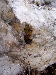
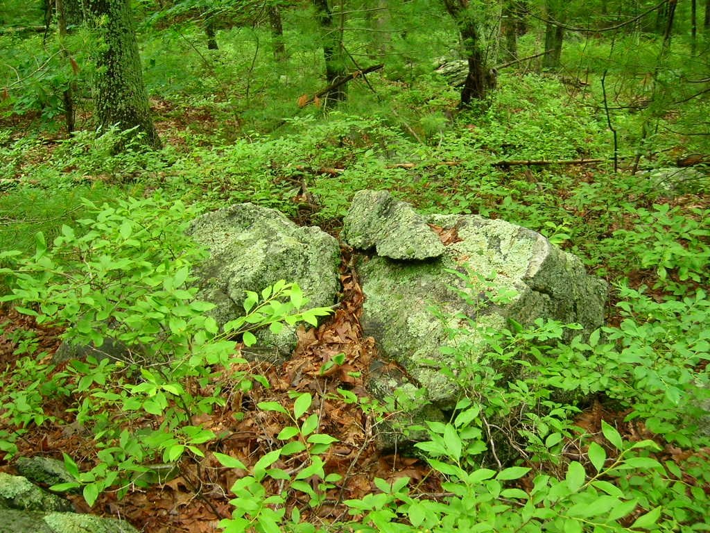
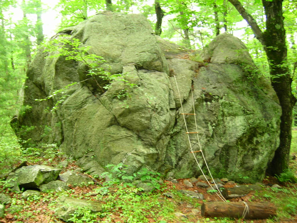
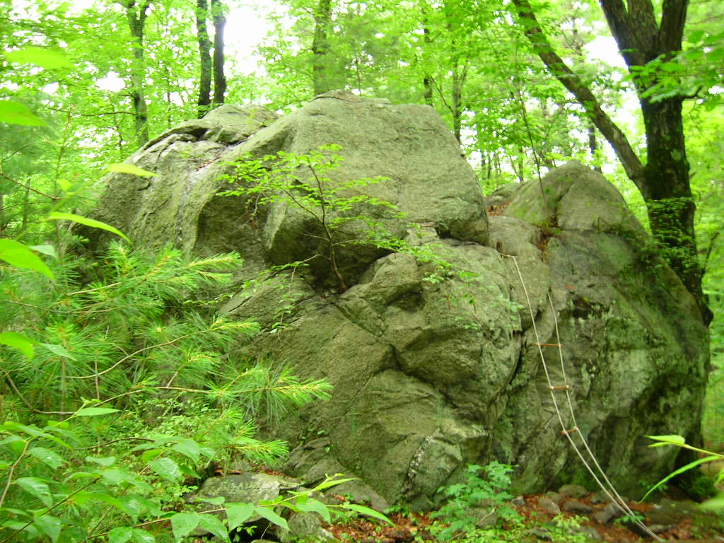
Heath MA rock piles - sent in by Bruce McAleer
There are about 20+- rock piles on this hill. I just took photos of a couple. Here is a ground pile.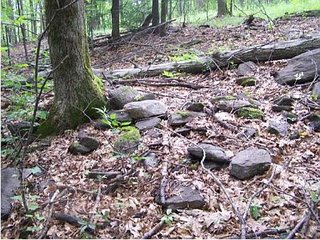 Here is a rock pile on a boulder/exposed ledge.
This was the most interesting feature. Note the piece of quartz in the foreground and the trail of stones leading up the hill behind it. More on the quartz in the next few photos. Note the black streak with the hole in it in the upper left of the quartz stone. Then, looking to the right of it on the downslope, note the other hole in the stone.
 Close-up of the 2 holes.
 This is the hole on the right in the previous photos.
 This is the hole in the left in the previous photos.

 Here is a rock pile on a boulder/exposed ledge.
This was the most interesting feature. Note the piece of quartz in the foreground and the trail of stones leading up the hill behind it. More on the quartz in the next few photos.
 Note the black streak with the hole in it in the upper left of the quartz stone. Then, looking to the right of it on the downslope, note the other hole in the stone.
 Close-up of the 2 holes.
 This is the hole on the right in the previous photos.
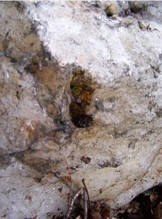 This is the hole in the left in the previous photos.
Native American Times
[Click here]
A recent reader got to this blog via a Google Search for "Native American Rock Stacking". Always on the lookout for new search terms, I tried it in Google and got some interesting results. I am going to go check this one out.
A recent reader got to this blog via a Google Search for "Native American Rock Stacking". Always on the lookout for new search terms, I tried it in Google and got some interesting results. I am going to go check this one out.
"Brewerton" arrowheads
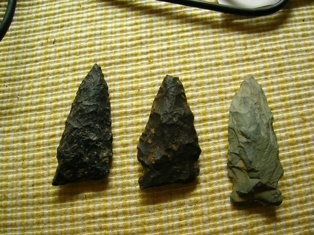 Concord does not have many rock piles, its archeology is of the more "classic" sort. Here is one of the two basic "Concord Arrowhead" designs. These are known as "Brewerton" points and are from the middle Archaic, say 3K BC.


Unseen Neighbors by Thomas L. Doughton
by JimP
The following are three short excerpts from an excellent monograph written by Thomas L. Doughton called Unseen Neighbors: Native Americans of Central Massachusetts, A People Who Had "Vanished"
The monograph can be found as a chapter in a book entitled After King Philip's War: Presence and Persistence in Indian New England (1997 - University Press of New England - Colin G. Calloway, Editor)
There is much more.
[Click here to read more in a lengthened version of Mr. Doughton's chapter courtesy of Nipmucnet and Mr. Doughton]
The following are three short excerpts from an excellent monograph written by Thomas L. Doughton called Unseen Neighbors: Native Americans of Central Massachusetts, A People Who Had "Vanished"
The monograph can be found as a chapter in a book entitled After King Philip's War: Presence and Persistence in Indian New England (1997 - University Press of New England - Colin G. Calloway, Editor)
Acquiring real estate in the Washakamaug Pond area of Framingham, near a site of Native American occupation, an earlier town resident, Thomas Eames, "found everything as the Indians had left them." The fields nearby were "ready for the plow, from previous cultivation by the squaws," with "meadows…ready for the scythe." Scattered about were "fresh signs of savage life," including wigwam poles, heaps of firestones, open granaries . . ."The main gist of the research Mr. Doughton completed was in establishing that Native people didn't vanish from Central Massachusetts as so many scholars from the past have written, but that they are and always have been living right in our very communities. It is a terrific piece of scholarship.
At Long Pond, for example, there were remains of an "Indian fort," a circular earthen work, covering an acre and a half, ditch in front of it, enclosed by a wall some four feet high, a raised mound at its center. Several "cellar holes" were built into the embankment.
The history of Sudbury describes another twelve comparable Native habitation sites, quoting the nineteenth-century owner of one of these locations: "I have plowed over seven or eight collections of paving stones that were discolored by fire, that I suppose were the hearthstones of Indian wigwams."
There is much more.
[Click here to read more in a lengthened version of Mr. Doughton's chapter courtesy of Nipmucnet and Mr. Doughton]
Tuesday, June 27, 2006
Excavation and Dating of a Stone Pile
by Jannie Loubser and Tommy Hudson, from the "The Profile" a newsletter of the Georgia Archeological Society. [Click here and go to page 8]
"In other parts of Georgia, prehistoric pecked rock art and stone pile sites also occur in or near mountain gaps through which old trails passed. Viewed in terms of Southeastern Indian beliefs, such locales are very likely transition points on the landscape between the world of the living to the east and the world of the dead to the west."
Georgia seems to be one place where rock pile studies and public awareness have advanced farther than anyplace else in the US.
The Folk Nature of Sacred Stones
The Folk-Nature of Sacred Stones
By Gary R Varner
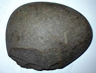
"...Thunderstones are stones reportedly found only where lightning strikes, are black in color with white streaks running through them. They also have great power for healing and strength. They are effective in the treatment of jaundice, lameness, cataracts, convulsions, consumption, goiter, snakebite and childbirth and, if carried on the person, relieve rheumatism...." [Click here] for a larger excerpt.
FFC always says it is special when a block rock with a white stripe is found as the wedge in a split-wedged rock. The book excerpt also mentions rocks guiding people to the underworld.
By Gary R Varner
"...Thunderstones are stones reportedly found only where lightning strikes, are black in color with white streaks running through them. They also have great power for healing and strength. They are effective in the treatment of jaundice, lameness, cataracts, convulsions, consumption, goiter, snakebite and childbirth and, if carried on the person, relieve rheumatism...." [Click here] for a larger excerpt.
FFC always says it is special when a block rock with a white stripe is found as the wedge in a split-wedged rock. The book excerpt also mentions rocks guiding people to the underworld.
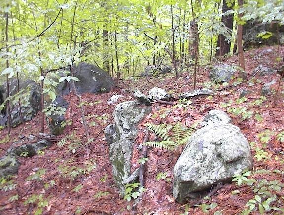
Southern hillside above the brook Confluence - Bolton, MA
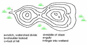
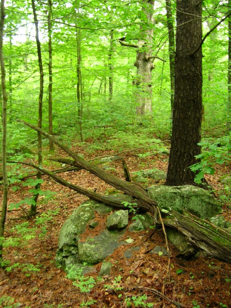
On Sunday I tried some other places that looked good on the Bolton Conservation Land maps. For example I thought "Rocky Dundee Road" was almost a guaranteed winner - with a name like that. But it was a disappointment. So I went somewhere else on the map and it was all blocked off by new housing. I had in the back of my mind that I could go back to the brook confluence and explore outward and, in particular, uphill from there. I did that and, getting past the initial site, found myself climbing up to where the hill leveled off, where I started seeing some "maybe" rock piles. They were not well formed and I was not sure I was at a site. I noticed a huge grandmother white oak (the kind people call "Council Oak") and figured "if I see one more rock pile I am going to believe this is a site". I saw another a few moments later. Unfortunately I was using the new camera so almost all my pictures were throw-aways and very few are worth reproducing here. Here is a pile beneath the white oak.  You can see the white oak trunk in the background. This is a tree about 3 feet in diameter, which I take to mean the tree (a slow growing white oak) is more than 100 years old. It seems likely it was there when the rest of the hill was clear of trees - perhaps when the rock piles were constructed. Now, as I look at these pictures with green color values close to the color of toxic waste, the color which the popsicle label calls "watermelon green" or "bubble gum", I cannot imaging why this Nikon camera gets good reviews. Luckily I did not buy it and can try some better models. Guys at work have lots of different ones to examine. Yet, surprisingly, every once in a while you get a decent picture:
  The resolution is fabulous and the colors are not bad. This pile seems to have a lot of symmetry along the horizontal axis which runs through the middle of the pile. Here is another: a view of a pile glimpsed through the leaves:
  And then, just a bit higher on the hill and still close to the white oak, was this beautiful one - I love these piles on support. This one looks like it has sustained some damage.
  There were a number of other piles around but the pictures failed - they were too blurry. It turns out that at "low light levels" i.e. in the rain under the forest canopy, these digital cameras are having a hard time getting enough light to function properly. The autofocus fails and the colors go askew. I consider Larry Harrop's pictures to be the golden standard for rock pile photos but I think I saw one picture where the greens started to go and I am guessing this was another low light level situation. Apparently the solution is a camera with a long exposure time, a white point balance adjustment (combined with knowledge I do not have about how to use it) , and a very stable platform like a tripod. Lacking these I was only able to get a couple of other shots:

 There is a distinct sense of shape to these piles. Note again, this is uphill from a brookside site. Similar topography to what we saw on the Westford/Groton line along Rt 40.
The final straw about this Nikon "Coolpix" dog of a camera is that after two days of minimal use, it ran out of batteries, without the advertised warning. This distracted me from paying much attention to what I was looking at. I tried to shoot some video clips (this was posted earlier)
This site runs back downhill until the sound of the brook - loud from all the rain - was audible and, with a continuum of rock piles, goes on down into the low wet area next to and between the brooks there, in areas where the sensitive eye sees that every single rock is part of a manipulated scene. These are shrines of one sort of another.
Sometime I will go back when I have learned how to take better pictures.
 You can see the white oak trunk in the background. This is a tree about 3 feet in diameter, which I take to mean the tree (a slow growing white oak) is more than 100 years old. It seems likely it was there when the rest of the hill was clear of trees - perhaps when the rock piles were constructed. Now, as I look at these pictures with green color values close to the color of toxic waste, the color which the popsicle label calls "watermelon green" or "bubble gum", I cannot imaging why this Nikon camera gets good reviews. Luckily I did not buy it and can try some better models. Guys at work have lots of different ones to examine. Yet, surprisingly, every once in a while you get a decent picture:
  The resolution is fabulous and the colors are not bad. This pile seems to have a lot of symmetry along the horizontal axis which runs through the middle of the pile. Here is another: a view of a pile glimpsed through the leaves:
 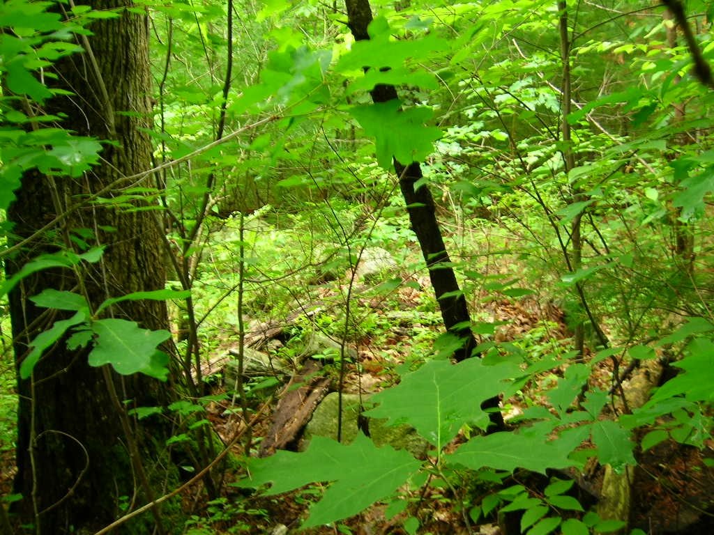 And then, just a bit higher on the hill and still close to the white oak, was this beautiful one - I love these piles on support. This one looks like it has sustained some damage.
  There were a number of other piles around but the pictures failed - they were too blurry. It turns out that at "low light levels" i.e. in the rain under the forest canopy, these digital cameras are having a hard time getting enough light to function properly. The autofocus fails and the colors go askew. I consider Larry Harrop's pictures to be the golden standard for rock pile photos but I think I saw one picture where the greens started to go and I am guessing this was another low light level situation. Apparently the solution is a camera with a long exposure time, a white point balance adjustment (combined with knowledge I do not have about how to use it) , and a very stable platform like a tripod. Lacking these I was only able to get a couple of other shots:
 There is a distinct sense of shape to these piles. Note again, this is uphill from a brookside site. Similar topography to what we saw on the Westford/Groton line along Rt 40.
The final straw about this Nikon "Coolpix" dog of a camera is that after two days of minimal use, it ran out of batteries, without the advertised warning. This distracted me from paying much attention to what I was looking at. I tried to shoot some video clips (this was posted earlier)
This site runs back downhill until the sound of the brook - loud from all the rain - was audible and, with a continuum of rock piles, goes on down into the low wet area next to and between the brooks there, in areas where the sensitive eye sees that every single rock is part of a manipulated scene. These are shrines of one sort of another.
Sometime I will go back when I have learned how to take better pictures.
by JimP
© Mashantucket Pequot Museum & Research Center
Above is a photo (posted with permission) of an excavation near an evident rock pile at the Lake of Isles on the Mashantucket Reservation. Not too much is revealed about rock piles in the articles, except an excavation of a mid-19th century chimney fire-box. Nonetheless, it does make for interesting reading. I thought the photo itself was worth posting. Twenty-one archaeological sites were excavated at Lake of Isles dating from 9,000 years ago up until the early 20th century. Other sites on the Reservation are also discussed.
[click here] for the full story.
Monday, June 26, 2006
Googling: stone cairns Alberta
Medicine Wheels and more about Native American astronomy from Crystal Links [click here]
From An Ancient Highway
"Walking parts of the trail, he has discovered stone cairns and animal effigies that link to Blackfoot folklore" [Click here]
From An Ancient Highway
"Walking parts of the trail, he has discovered stone cairns and animal effigies that link to Blackfoot folklore" [Click here]
Brook Confluence in Bolton MA
 I was looking at the topo map for Bolton, having found the Bolton Conservation Land maps on-line, and noticed a likely place near another place where I found rock piles in the past. Where should I expect to find rock piles in there? Right at the confluence of the brooks. I went there Saturday in the rain. Walking up the trail and up the common brook from the south, I started seeing small rock-on-rock and other typical "brookside" features, looked around, and realized I was already at the confluence. The site continues a hundred yards or so in all directions and, in particular, continues up the hill between the two branches of the brook. I was mostly pre-occupied (and I still am) with the new camera technology, so attention to the details at the site itself was at a minimum. But I got a couple of nice pictures. Here we are looking upstream towards the confluence.
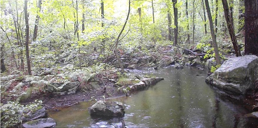 My old camera can take decent pictures occasionally.
The piles were small, on supports, and mostly seemed to be grouped with rock-on-rocks. I have never seen so many rock-on-rocks. They appeared to be functioning in various ways such as being part of little groupings:

 or being part of a line of rock-on-rocks connecting one part of the "site" to another.
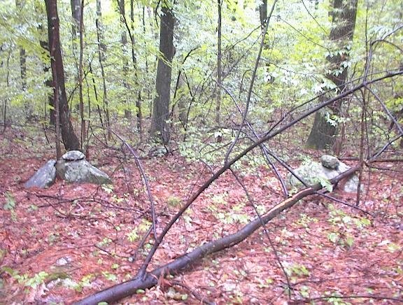 [and I already showed you this from the new camera].
Directly up from the confluence, and between the two brooks, is a wetland full of little things which were hard to photo on a rainy day under the leaves.
 For example this last photo shows a very minor gully with a pile above it, looking down on it. As you walk through the wetland, keeping your eyes open, everything looks manipulated and re-arranged.
And there are some nice piles in there. Delicate little structures:

 It was raining the whole time and difficult to manage an umbrella, two camera, etc. So I came back out after getting a sense of the scope of the site. The next day I went back and explored uphill.
Sunday, June 25, 2006

Video Clips of rock-on-rock groups
[Click here]
[Click here]
[Click here]
[Click here]
With that camera it is impossible to photo something as dark as this last scene unless you use the flash. I am disappointed.
[Click here]
[Click here]
[Click here]
With that camera it is impossible to photo something as dark as this last scene unless you use the flash. I am disappointed.
Initial video efforts - by pwax
The new camera allows taking video clips. Not as poetic as FFC, I thought I would try this as a way of documenting features. Still trying to get the camera to work.
[Click here] to see a rock pile video clip.
[Click here] for a line of rocks leading to a rock pile group.
[Click here] for another rock pile
I am just trying this out and the image quality is pretty bad. For all that, it still can give a better sense of relations between grouped features.
[Click here] to see a rock-on-rock on the right hand termination of a line of dirt and cobbles that is like a faint berm with a ditch on the uphill (foreground) side which runs along like a "defensive" trench, past a small boulder, seems to curve and snake a bit and then peters out around the side of the slope.
I restored some of the videos
I do not know what happed to the pictures with "click here" to start a video so I went back and added some links to the more recent video clips. Now you can at least watch them.
But now I cannot get "Comments" to work. Did I do this or is it being done to us by Blogger?
But now I cannot get "Comments" to work. Did I do this or is it being done to us by Blogger?
Saturday, June 24, 2006
A new camera
 A bit off my rhythm today while exploring a site in Bolton. The new camera I borrowed has the worst user interface imaginable but it does have incredible resolution. Also the colors are much better in the kind of low light levels we have been having in this rain. For all its bells and whistles the camera, a Nikon "Coolpix", has a lot of trouble communicating with me about autofocus. The result is that 1/2 the photos today were totally blurry and only about one in four was really in focus. But if you look in the backround of this picture, you can see a second rock-on-rock. This depth of field was not available on the old camera: an HP "C-30".
 Again the colors are a bit off since I have not mastered the button for putting the camera into a mode where it will correct the colors, auto-focus, not flash and compensate for hand movement. I have a lot to learn about getting the most out of it.
About the first picture: This is a picture of a ledge next to a brook - or a place where water comes out of the ground and starts to be a brook. The ledge has a split which is wedged and, in line with the split, a rock pile is built on a rock at the edge of the water. The sense of alignment is heightened by the pointed wedge which sticks out.
Video clips not working
Something happened to the video repository I have been using: photobucket.com I sure hope the videos start working again.
Stone Masons of the Narragansetts
by JimP

One of the earliest Presidents of Warwick was a man named John Smith (1652-1653). Interestingly enough, Smith was a stone mason by trade. Historians generally believe that in 1649 John Smith was responsible for building the famed, "stone castle," in Warwick, RI -- a building that played a historic role in King Philip's War. It certainly isn't a stretch to theorize that the castle might have been the melding of the knowledge of both Smith and the Indians, and built with mostly Indian labor. The stone castle was demolished in 1795.
Following King Phillip's War, Rhode Islanders no longer had to pay for Narragansett stone masons. Instead, they enslaved them. Many of those who were not enslaved were forced into, "involuntary," indentured servitude. Narragansett children were placed into English homes not only to be Christianized, but to work as apprentices to English masters. Many of them remained indentured well into their 20's. More than one historian has written that most of the stone walls built in 17th century Rhode Island were the work of Indian laborers, slaves, and servants. I find nothing in early colonial records that refutes such a claim, but plenty of data that supports it.
The cairn pictured above was taken at the Francis C. Carter Preserve in Charlestown, RI. The preserve is only a few miles from present-day Narragansett Tribal Lands. On display there is an undeniable history of Narragansett masonry. An array of eras is evidenced by the many features, from ancient stone rows, cairns, and split-wedged rocks, to 18th and 19th century drilling techniques. This site, better than any other in Rhode Island, tells the story of the stone masons of the Narragansett Indian Tribe.
Larry Harrop's excellent photo gallery is far more extensive than mine, and therefore (with thanks to Larry) I point you there:
http://www.larryharrop.com/main.php?g2_itemId=552
Stone masonry continues to be a traditional craft of the Narragansetts. For example, Narragansett masons were employed to build the stone walls that criss-cross the Pequot Reservation, home of Foxwoods Casino. The Narragansett Indian Church was burned to the ground and rebuilt twice using granite shaped by the hands of Narragansett masons. Present-day Narragansetts are able to trace the craft back several generations in their families. The skills are handed down from grandfathers, fathers, and uncles.
Many years ago, a wonderful Narragansett woman told me a story of a crowning achievement by ancestors of Narragansett masons that still stands today in Newport, RI. She explained that it was symbolic of a short period of time when the English and the Narragansett lived in peace and worked together. I'll leave it to brighter minds than mine to figure out what structure she may have been referring to -- all I will say is that the history and the evidence has been under our very noses for centuries, and it has gone largely ignored.
Stone Walls And Good Neighbors by Michael Bell -
http://www.quahog.org/factsfolklore/index.php?id=87
One Nation, Two Worlds - Providence Journal Series (registration required - but it's free)
http://www.projo.com/extra/2004/tribe/
But yet let me add this by way of commendation of the Narragansitt and Warwick Indians, who inhabit in the jurisdiction, that they are an active, laborious, and ingenious people; which is demonstrated in their labours they do for the English; of whom more are employed, especially in making stone fences, and many other hard labours, than of any other Indian people or neighbours.Narragansett Indians were employed by the earliest settlers of Rhode Island to make stone fences. As we discover more and more remarkable dry stone work in the remaining wilderness, it becomes quite apparent why the English paid them to do such work -- it was most likely a skill they already possessed. The amazing examples found in cairns all over the state, from the Tomaquag site in Hopkinton, to the Queen's Cairns in Exeter, to Parker Woodland, and many more -- few can deny that building these structures took time and hard work. A testament to the workmanship is how these structures have survived hundreds of harsh New England winters, various hurricanes, and countless nor'easters.
- Daniel Gookin, Historical Collections of the Indians in New-England (1674)
One of the earliest Presidents of Warwick was a man named John Smith (1652-1653). Interestingly enough, Smith was a stone mason by trade. Historians generally believe that in 1649 John Smith was responsible for building the famed, "stone castle," in Warwick, RI -- a building that played a historic role in King Philip's War. It certainly isn't a stretch to theorize that the castle might have been the melding of the knowledge of both Smith and the Indians, and built with mostly Indian labor. The stone castle was demolished in 1795.
Following King Phillip's War, Rhode Islanders no longer had to pay for Narragansett stone masons. Instead, they enslaved them. Many of those who were not enslaved were forced into, "involuntary," indentured servitude. Narragansett children were placed into English homes not only to be Christianized, but to work as apprentices to English masters. Many of them remained indentured well into their 20's. More than one historian has written that most of the stone walls built in 17th century Rhode Island were the work of Indian laborers, slaves, and servants. I find nothing in early colonial records that refutes such a claim, but plenty of data that supports it.
The cairn pictured above was taken at the Francis C. Carter Preserve in Charlestown, RI. The preserve is only a few miles from present-day Narragansett Tribal Lands. On display there is an undeniable history of Narragansett masonry. An array of eras is evidenced by the many features, from ancient stone rows, cairns, and split-wedged rocks, to 18th and 19th century drilling techniques. This site, better than any other in Rhode Island, tells the story of the stone masons of the Narragansett Indian Tribe.
Larry Harrop's excellent photo gallery is far more extensive than mine, and therefore (with thanks to Larry) I point you there:
http://www.larryharrop.com/main.php?g2_itemId=552
Stone masonry continues to be a traditional craft of the Narragansetts. For example, Narragansett masons were employed to build the stone walls that criss-cross the Pequot Reservation, home of Foxwoods Casino. The Narragansett Indian Church was burned to the ground and rebuilt twice using granite shaped by the hands of Narragansett masons. Present-day Narragansetts are able to trace the craft back several generations in their families. The skills are handed down from grandfathers, fathers, and uncles.
Many years ago, a wonderful Narragansett woman told me a story of a crowning achievement by ancestors of Narragansett masons that still stands today in Newport, RI. She explained that it was symbolic of a short period of time when the English and the Narragansett lived in peace and worked together. I'll leave it to brighter minds than mine to figure out what structure she may have been referring to -- all I will say is that the history and the evidence has been under our very noses for centuries, and it has gone largely ignored.
Stone Walls And Good Neighbors by Michael Bell -
http://www.quahog.org/factsfolklore/index.php?id=87
One Nation, Two Worlds - Providence Journal Series (registration required - but it's free)
http://www.projo.com/extra/2004/tribe/
Friday, June 23, 2006
Skull in a streambank
By geophile
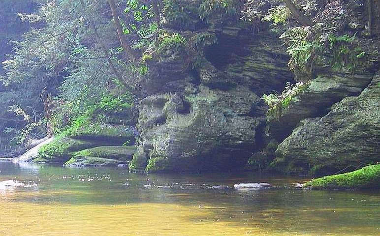 Photo by Earl Dundore
Forgive me if I've posted this before. I don't think I have but maybe I've forgotten. This stone formation is about five miles from my home. When I first saw it, the 'chin' was still intact, but unfortunately I didn't get pictures then.
It is especially peculiar in that the skull image is apparent only from one angle. From directly across the stream, the rock looks nothing like this, but appears to be a normal worn rocky bank. When I was told about this and shown a picture, I was incredulous. It is in a very popular place I had been to many times and even had considered for the site of our wedding, yet I had never seen anything any hint of it. When I went to the spot to investigate, I located the place in the stream where I had to stand in order to see it by noticing a circle and then a line of stones in the stream, leading out toward a whitish stone well out in the flow. I followed the stones out into the stream and was able to see the skull from the white stone. This picture was not taken from just the right spot, so the skull looks a little misshapen.
I must add it is an odd sensation to stand looking at a five or six foot high skull while all around are families with children and dogs, laughing and playing, none of them suspecting that the skull exists right before them. Whether it was done recently or anciently or in between, it was cleverly done.
Further down the bank is a place where there is a sort of window similarly carved in stone in such a way that you can stand on the bank and look through it. I would not have noticed that if seeing the skull hadn't alerted me to look for lighter places in the rock, the lighter color apparently being the result of a darker patina being scraped away.
Back deep in the woods at Spring Hill in Acton, MA
A couple of split-wedged rocks:

 The first is really more of a "table" and has a second support in the shadow. You may recognize the second split-wedged rock as the subject of this video clip.
 The first is really more of a "table" and has a second support in the shadow. You may recognize the second split-wedged rock as the subject of this video clip.
John Warner Barber - from Norman Muller
Norman writes in:
The Barber mentioned by Tim is John Warner Barber, and the book in question is Connecticut Historical Collections...New Haven, 1836. On page 475 Barber writes: "They dwelt chiefly along the intervale by the river, a part of which intervale is to this day called Indian Field; and several of their burial grounds are yet to be seen in various parts of the town. Their graves are of a circular form, and the persons were buried sitting up, as in a natural position, on the ground." There was no illustration accompanying the description of the graves.
In perusing some issues of the Collections of the Massachusetts Historical Society from the 1790s, I came across this from Jeremy Belknap and Jedidiah Morse, titled "The Report of a Committee of the Board of Correspondents of the Scots Society for Propigating Christian Knowledge, who visited the Oneida and Mohekunuh Indians in 1796." The date of the original publication was 1798, and this is found on pages 14 and 15: "He regarded the Oneida Stone as a proper emblem or representative of the divinity whom he worshipped. This stone we saw. It is or a rude, unwrought shape, rather inclining to cylindrical, and of more than a hundred pounds weight. It bears no resemblance to any of the stones which are found in that country. From whence it was originally brought, no one can tell. The tradition is that it follows the nation on their removals. From it the name of the nation is derived, for Oneida signifies the upright stone. When it was set up in the crotch of a tree, the people were supposed invincible. It is now placed in an upright position on the earth, at the door of the old man's house. A stout man can carry this stone abourt 40 or 50 rods, without resting; and this is the manner in which it may be said (with the help of a little priestcraft) to follow them in their removals." The authors are certainly referring to a godstone or Manitou stone.
Thursday, June 22, 2006
Stone Mounds in New Milford - from Tim MacSweeney
 Tim writes in:
From the History of the Indians of Connecticut by John DeForest first published in 1851 (reprinted 1964 by the Shoestring Press in Hamden CT).
In Chapter “X,” “History of New Tribes formed in the North and West of Connecticut (DeForest claimed that this part of the state was previously uninhabited by Indians and was a great “desert”),” I found this stone mound reference:
“The sites of Indian cemeteries are still pointed out in New Milford. One is on the west side of the river opposite the village; another is on the east side at no great distance from the ancient residence of the sachem. Many of the graves have trees of considerable size growing up out of them. The mounds are circular in shape, and, on opening them, the skeletons are found in a sitting posture. The grave of Weraumaug is still supposed to be known, and differs from the others only in being of larger dimensions (398).”
There is an asterisk after the last word in the paragraph and the footnote reads, “Barber, pp. 475,476.”
There must be an illustrated version because this is included in Enduring Traditions, edited by Laurie Weinstien (1994) in the section by Trudie Lamb Richmond: see attachment.
A porthole along (not through) the wall
Some nice people from Harvard invited me to come over to see if there was any interesting stone work on their property along Rt 2. I saw three things and am afraid I did not do a decent job calling attention to them. For example there was a stone wall made of ledge rock and running along the crest of an outcrop. Someone had built a little porthole perpendicular to the wall and it looked like the wall had been borrowed from to get the stones used in the porthole.
 Here was another very minor but pretty feature right up near Rt 2. I suppose this is a spirit door.
 The third thing was a rock-on-rock. Simple and elegant. The upper rock looks red and burnt.
 These folks do not have a lot on their property but it looks like a little of each of the basic types of feature.
Roadside attractions, Harvard MA
On one of the roads leaving Harvard center, at the foot of the hill, is a wetland on the right with a dirt mound. I think the wetland is on private property. I have always been curious about that mound and on Sunday I was driving by and had my camera, so I parked and went a few steps into the woods to get some pictures. Well for some reason I did not take a picture of the mound. But I did take pictures of rock piles around it on the large boulders. 
 This suggests that a rock pile builder thought the mound was significant.
I should have taken a picture of the mound but dogs came down from the house and were barking.
 This suggests that a rock pile builder thought the mound was significant.
I should have taken a picture of the mound but dogs came down from the house and were barking.
Sacred Video Clip - 125 degrees magnetic
My friends and colleagues who are interested in alignments say they keep finding things which point towards either 125 degrees magnetic or to its diametric opposite (125+180= 305). But what is that direction? Apparently 305 degree magnetic is the August 14th sunset direction. But why is that significant? And why is 125 degrees important? August 14th was important to the Mayans [I am told] but what is with 125 degrees? Is it something to do with the Milky Way? This is an answer looking for a question and I hope my friends and colleagues eventually come up with an explanation. For now, it is simply an observation that these directions are frequently indicated by stonework in the woods. So here is a video which tries both to capture the direction from the Stupid Sheet and show an example of a very subtle stone construction which does point in that 125 degrees magnetic direction.
[Click here]
[Click here]
My Own Personal Rock Pile
by JimP
 I wanted to tell you all about my own personal rock pile. While you New Englanders were shoveling snow this past January, I was busy building a backyard pond and waterfall.
I learned a couple of things about rock piles in the process. First, how difficult it is to stack rocks. I definitely got a new appreciation for the time and effort it takes to put together a well-made cairn. It takes patience and hard work without question. It took patience and hard work just getting the jumbled pile that I made to be stable, although admittedly I had nothing but river rock to work with.
Another thing I learned is how capable we are of moving rocks of enormous size. The huge cobblestone I used for my waterfall weighed around 500 pounds apiece. I was able to lift them, carry them to the pond, and put them up on the waterfall terraces all by myself. It was definitely tough, but I did it without help. And I know how much they weighed because I had to buy them by weight. (After 36 years in New England, I never imagined I'd have to BUY rocks).
Here's a link to a photo album of my progress. The pond and waterfall both look different today, but I'm waiting for some plants to grow in and bloom before I take another picture.
http://members.cox.net/jimtheump/pondwaterfall/
I wanted to tell you all about my own personal rock pile. While you New Englanders were shoveling snow this past January, I was busy building a backyard pond and waterfall.I learned a couple of things about rock piles in the process. First, how difficult it is to stack rocks. I definitely got a new appreciation for the time and effort it takes to put together a well-made cairn. It takes patience and hard work without question. It took patience and hard work just getting the jumbled pile that I made to be stable, although admittedly I had nothing but river rock to work with.
Another thing I learned is how capable we are of moving rocks of enormous size. The huge cobblestone I used for my waterfall weighed around 500 pounds apiece. I was able to lift them, carry them to the pond, and put them up on the waterfall terraces all by myself. It was definitely tough, but I did it without help. And I know how much they weighed because I had to buy them by weight. (After 36 years in New England, I never imagined I'd have to BUY rocks).
Here's a link to a photo album of my progress. The pond and waterfall both look different today, but I'm waiting for some plants to grow in and bloom before I take another picture.
http://members.cox.net/jimtheump/pondwaterfall/
Wednesday, June 21, 2006
Inuit Cairns and stone structures
[Click here then click on the photo]
Places of Power, Objects of Veneration in the Canadian Arctic
[Click here]
Places of Power, Objects of Veneration in the Canadian Arctic
[Click here]
California rock pile links
Volcan Mountain, San Diego County:
"...These shrines could be represented archaeologically as rock piles or platforms (Bean 1976:415; Hudson and Underhay 1978:68-70)." [Click here for the full article]
[Click here] for Modoc County Landmarks.
Yellowstone:
"...Battles were fought in what is now park territory, according to evidence revealed by rock piles and other apparently human interference with natural conditions that cannot be traced to white settlers...." [Click here]
Plenty here :
"Returning to the unexplained stone cairns in the Pacific Northwest, Frederica de Laguna (1971:82) in her amplified edition of George Thornton Emmons' The Tlingit Indians: provides the following details:
More baffling than petroglyphs and stone carvings are cairns of piled stones to be found on the mountains well above timberline, both on the mainland and on offshore islands. They have no relation to the Russian occupation, and are not boundary marks. They are away from any trails or lines of travel, at altitudes of from two to three thousand feet, located on clear stretches, generally on mountain tops. The oldest natives can give no explanation of them, beyond the story that when the great Flood covered the earth, those who survived in canoes floated up and moored their craft here with great bark ropes, the decayed ends of which it is claimed can still be seen. [Cairns like these were said by the Tlingit of Angoon and Yakutat to be "nests" or forts made by survivors of the Flood to protect themselves from the bears that were driven to the summits of mountains by the rising waters (de Laguna and McClellan, field notes, 1950, 1952). Stone piles have been noted by some members of the U.S. Geological Survey, who offered no explanation for them. My archaeological party of 1935 explored a pile of stones on a high ridge above the middle Yukon River, between Nulato and Holy Cross; this "cairn" was due to frost action, according to our geologist, Jack Eardley. But this explanation may not apply to all such piles.] The following locations of such cairns are known, others may still be discovered: On a mountain 2,500 feet high, above Union Bay and Ernest Sound, on Cleveland Peninsula, there are four or five pyramidal or circular piles of stones. Watson, half-breed, knows about this. On a mountain on Etolin Island is a cairn of boulders. At Gambler Bay, on Admiralty Island, on..."
California's mysterious stone walls
There were no colonial farmers to claim these [Click here]
Also, if you like tales of the weird, check out the parent website: The Fortean Times [Click here].
Rock piles are considered "tales of the weird" by some, "tales of the foolish" and worse by others.
Also, if you like tales of the weird, check out the parent website: The Fortean Times [Click here].
Rock piles are considered "tales of the weird" by some, "tales of the foolish" and worse by others.
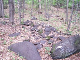
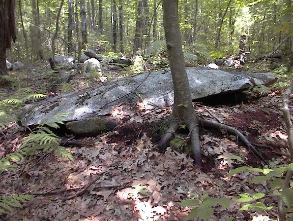
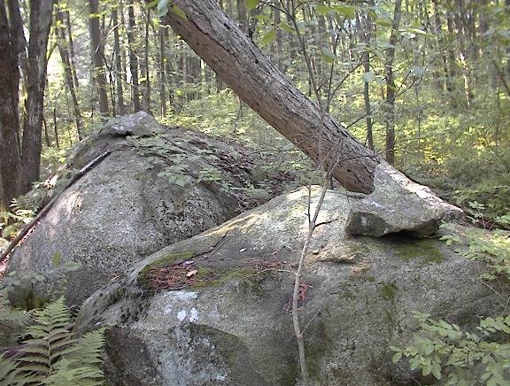
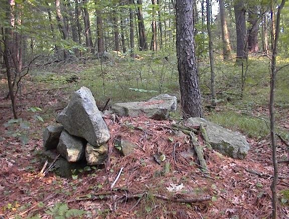
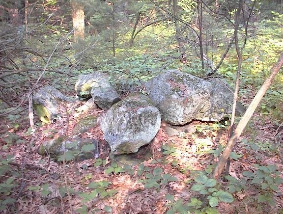
Turner Lane Harvard, MA - Three piles near a field.
Sunday, after a Saturday of odds and ends in Bolton, I went to Harvard to look at some places by invitation and ended up seeing more as I drove around between visits. I was told by Sue R. about a conservation land trail off Turner Lane, and spent 10 minutes checking it before I had to be somewhere. There were three rock piles within a few paces of the trail head. Although this first one looks like it has been modified more recently, all three piles were made from a small number of quite large rocks (too big for one person to lift).
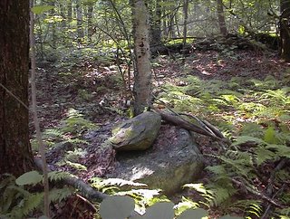
 I did not recognize this type of pile. They are in pretty bad shape and I was undecided about whether they might have been farm related. They are right near an open field. But in the end because there were three separate piles, and they were actually built up a bit (not just tossed) I ended up thinking they might be ceremonial.
 Although this first one looks like it has been modified more recently, all three piles were made from a small number of quite large rocks (too big for one person to lift).
 I did not recognize this type of pile. They are in pretty bad shape and I was undecided about whether they might have been farm related. They are right near an open field. But in the end because there were three separate piles, and they were actually built up a bit (not just tossed) I ended up thinking they might be ceremonial.
Tuesday, June 20, 2006
Behind the house of the the people with the lost arrow
 That first time out to the Bolton Conservation Land we met a lady who claimed the arrow FFC found in the woods. This time out, on the opposite site of their house as I was passing by, I noticed a couple of other structures. Thought I should mention them.
Subscribe to:
Posts
(
Atom
)