Tuesday, February 28, 2006

More from Tim MacSweeney

Continuing a story begun here.

I thought that the grave was in a secret place. I’d seen enough TV and movies to know that the graves of chiefs, like Crazy Horse, were in secret places.

Yet in 1991 I found a woodcut of Nonnewaug’s Grave:

Of course I showed my brother John the book and the woodcut. We looked out my workshop door and, on the first terrace of the hill on the opposite side of the floodplain, we spotted a big hemlock and some very tall wild cherry trees, a good sign of a property line and perhaps more.

We found a barbed wire fence running close to magnetic north, over a linear row of stones, old chestnut posts placed in the stones. Under it was a low serpentine row of stones; there were some really old apple trees and others that looked to be suckers from old stumps grown into trees. There was an elevated circular sort of clearing above the apple trees with three large stones that appeared to be placed in a triangular arrangement.

I remember thinking who else other than Indians would build a decorative sort of border of stone around an old burial ground.

Years later a 100 year flood kept the Burial grounds from flooding, and revealed more of the serpentine row.


Years later I found there were other smaller stones in between the large ones in that triangle; on the Vernal Equinox in 199(?), I watched the sun set on the hillside over the southern most stone from the eastern most stone. With a compass in hand, at the same stone, I figured that on the Summer Solstice the sun would set for several days right above the northern most stone.

A pile, a wall, ...

A pile, a wall, a road, a slope, a pond, a woods, a sky.

Roadside Attraction along Rt 3 north

There are quite a few things along Rt 3, some visible. I am saving most of them for a rainy day. But if you happen to be driving north on Rt 3, approaching Treble Cove Rd, you should know that in those rocks on the right there are suggestions of prayer seats. There was quarrying and afterwards some repair. I got the impression there were four seats facing in four directions. If you press me on it, I'll look up the picture.

Roadside Attractions - Rt 495 Median in Tewksbury

There are two places where the median is wooded between Rts 133 and 38 along Rt 495 in Tewksbury. Near the southern tip of each bit of woodland, there is a rock-on-rock. I mentioned this earlier [Click here]
Here is a view from the south of the northern piece of median woodland.

Aside from it being amusing to hunt for rock piles while commuting, what does it mean to spot a second rock-on-rock in the 495 median strip? I think it only means that there were sites at these locations. It also means that the woods on either side of the highway are worth exploring, and so is the median itself if you could figure out how to get there. As you can see, this is something called the "Great Swamp" in Tewksbury.

CORRECTION: I was wrong, there is only one wooded median strip and both rock-on-rocks occur at its southern tip. There is a little bit of a diagonal stone wall in there, one feature is on one side of the wall, the other on the other. The "southern" outline in the map fragment above was bogus and does not exist. The "northern" one is correct.


Or this dead juniper on rock pile

Burnt rock and quartz - Did I post this one?

South shoulder, Robbins Hill, Chelmsford MA.

Little Mulberry Park, Georgia

Another day...another search engine. I tried Lycos and a different search term. Look what I found. [Click Here] The question is: where is "Little Mulberry Park"? Answer: In Georgia.

Some other comments about Little Mulberry Park are [here] at dancoy.com. Let me quote their text about the interpretive sign at the Park:

Stone MoundsDo not climb on or disturb the stones
These piles of stone range from neatly stacked cubic assemblies to scattered piles of rock (that appear to formerly have been neatly stacked). Some are stacked five to six feet tall. There are hundreds of these mounds scattered in various clusters - all are protected within our park.
The precise age of these assemblages has not been determined, but they are almost certainly associated with native American cultures. Archeological investigations have failed to uncover artifacts as necessary to definitively attribute the mounds to a specific time frame or culture.
No artifacts or human remains have been found in association with the mounds. Hence, there is much speculation as to the stones ritual or other practical utility. Nevertheless, today we may reflect upon the considerable time and effort.

Cothren Thoughts or Grandfather Stories - by Tim MacSweeney

“Histories, like Cothren’s,” the archeologist said to me, “Are what we call “Grandfather Stories – they may or may not be true.” He stirred his coffee and went on to tell me about empirical evidence, excavation of mounds with no bones inside them, and about repeated patterns being the basis of Archeology.

Later I drove back to my barn, past stone fences of several different styles – or patterns – to my furniture restoration shop where I was trying to recreate some pieces of missing carvings that decorated a chair back.

Looking out across the floodplain, across the overgrown field and the river and yet another field beyond that, I could see the apple blossoms of that orchard Cothren mentions, the big isolated hemlock that shouldn’t really be there, big and as old as some of the hemlocks that shade the Falls up on the hillside above the orchard.

That was just about 15 years ago, here in this section of town still known by it’s Indian name. I’ve lived here for over 25 years now, watching the sun rise over that hill that the Grandfather Stories say was once the “Nonnewaug Wigwams.”

I’m a Grandfather now too, so I guess it’s about time to tell the story…

35 years ago a friend brought me up to the falls for the first time. Big metal posts for big huge power lines were lying on their sides looking a lot like missiles or spacecraft. We walked from the field to the shade of the hemlocks and looked down to see cows in the pool of the upper Falls, the black and white sort of reminding us of nuns. I read the plaque set into the stone. It said:

Monday, February 27, 2006

A split-wedged rock from Richard Potts

Stone Mounds in West Virginia

[Click here]
"Throughout this entire range of mountains Indian mounds are numerous, and a comparatively unexplored field of archaeological treasures awaits development. The frequency of stone graves may in some degree be accounted for by the abundance of material suitable for their construction, by their proximity to fields of contest, to village sites, and to a most abundant hunting ground. They are found in much greater proportion in this than in any of the neighboring ranges. Their position cannot be restricted to any particular locality, for they are found on either side, on top, at the foot of the mountain, and in various places throughout the valley, sometimes on the river bank or on some small stream, or even in the central portions of the bottom lands. They are, however, less numerous on top of the ridges than in lower situations."

Nice Picture

[Click here] Now that's a cairn

More from Herman Bender

Herman writes:
I researched and then wrote a whole report ten years ago for the Chippewa concering the Strawberry and hierophany and the tree and Milky Way and all for a court battle which we won using the information. Here are some scans of some of it as it appears in the sky and on the ground!
This is fascinating, I know I would like to read the whole report.

Cedar Trees and Rock piles - Information from Herman Bender

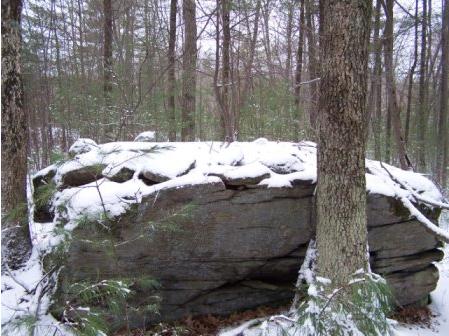
This is relevant to the topic discussed here that cedar trees were sometimes planted as memorials. Herman Bender, a researcher working in the upper midwest, sent some interesting information about trees in the Ojibway idea of Paradise.

The text reads:
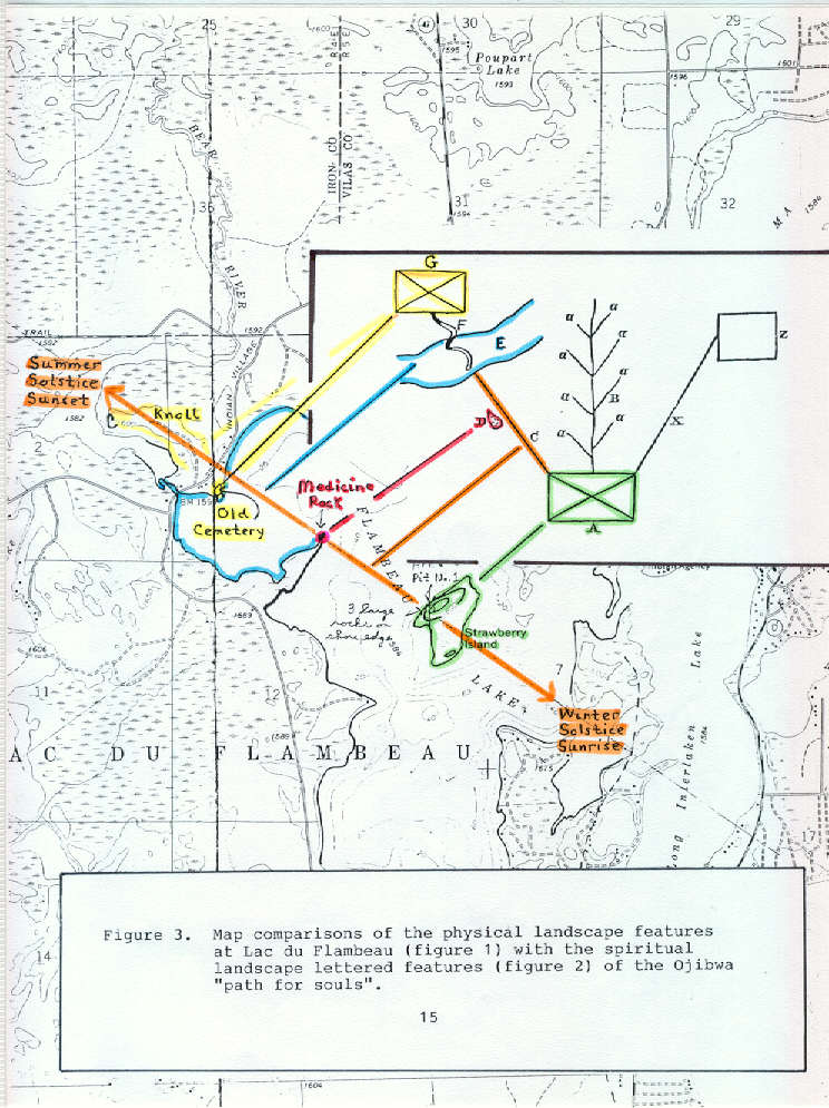
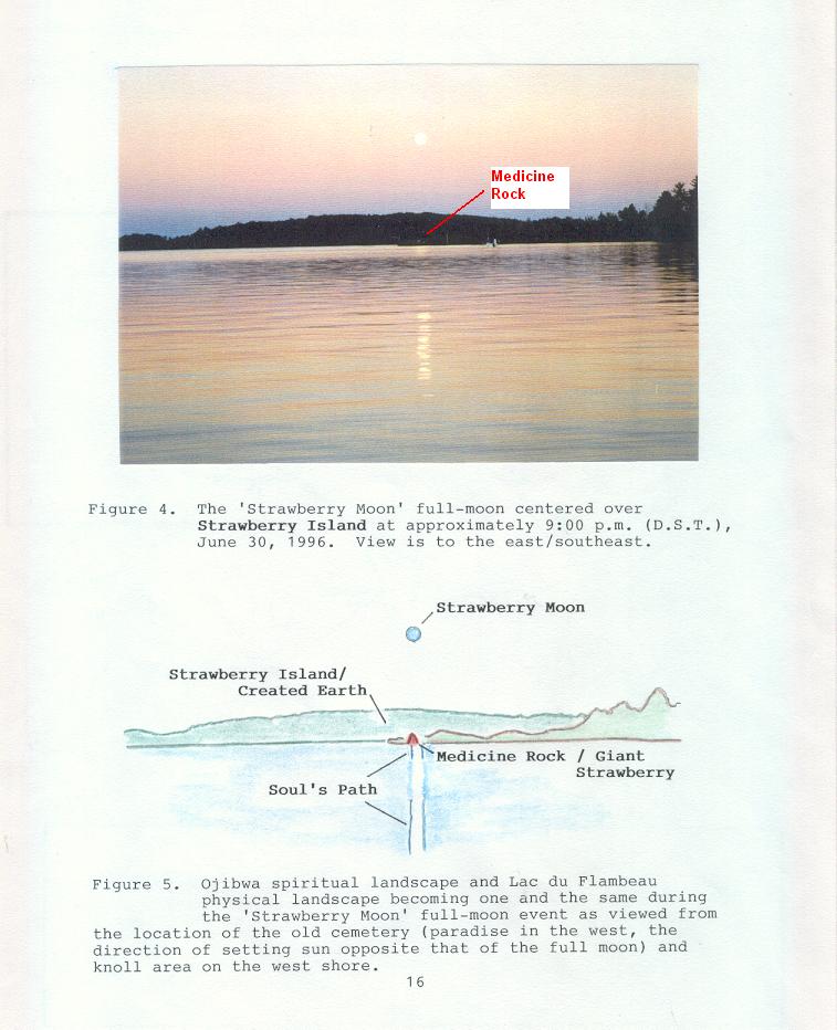
Figure 2. The Ojibwa map of the "path for souls" or the road to paradise drawn for J.G.Kohl in the mid-19th century. Slightly different versions but always with the same elements appear in the Mide Ghost Scrolls. Explanation is as follows: 'A' is the (created) earth upon which "God has planted his law, like a tree (B) straight updwards". "Some wander the right path (B), but many get on the side-paths of the lane (a a a a). These run into the desert". "When men die, they all go, after death, along the path of souls (C). On the center of this path (at D) thou seest the strawberry lying on one side. It is extraordinarily large..." After a "journey of from three to four days...a large broad river (E) bars the way. Over it there is no regular bridge. Something that looks like a great tree-stump (F) lies across it...In reality, it is a great serpent, which has its tail on the opposite shore, and thrusts forth its head to this side. On this head the souls are obliged to leap". The Great Spirit grieved for men and "ordered Manabojuto prepare a paradis (G)...in the west", or "the direction of the setting sun" accoriding to the Mide Ghost scrolls. The name for Paradise was "Wakui or Wakwi".

"With that, the Indian told me [he] wished to designate the paradise of the Christians. They...had also a paradise (X and Z) ...He knew nothing at all of its nature, but he [drew] it for the sake of giving me a perfect idea" Kohl 1860:215-219)

------------------------------------------------------------------

Herman also sent the following references to cedar trees in texts about the Indians. I apologize for not being able to read all the notes:

The Shaman (by John Grim)
CEDARS - SPECIFICALLY RED CEDAR

pg. 6 (footnote) or actual Manitou

pgs.78-81 Cedar (?) tree used for Cosmic Axis see: (pg.77 of History of the Ojibway People by William Warren) (pg.481 of the NAtive Americand of N.A. by Str... and Taylor)

pg.132 (picture caption) Cedar boughs 4 ft. thick ... Mide Lodge ([80'x20']) floor

DE-COO-DAH (propogated on graves)

pg.111 as a sacred tree (to Winnebago)

pg.77 "Medawautig, a cedar post...in center of lodge..." by Selwyn Dewdnypg. illustration of Mide Scrolls by S. Dewdny

pg. Manitou - Scared Landscape...MAvor & Dixpg. cedar burned to divine future (see also pg.354 in Indians of the Western great Lakes.

* In Oakfield Township, cedars appear to be especially prevalent conspicuous at ...

----------------------------------------

Writing about these notes, Herman adds:
The De-Coo-dah reference from the 1840's was pretty straight forward. The cedar he was talking about was planted on an earthen mound, but I can see where the trees might symbolize the 'axis-mundi' on a cairn which could represent the turtle or earth.

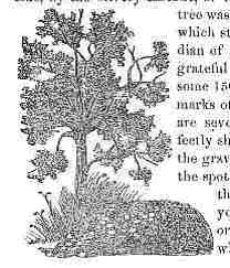
Furthermore, I have attached and illustration of the Ojibwe 'tree' which is symbolic of a man's life and is a directional indicator to the north which is also the axis-mundi or place where all the stars revolve around the 'hole in the sky'. This map came from an 1860 text, but the concept is far older and I read it as recorded by Jesuit missionaries in the 17th century. It is also prominent in the Mide lodge which can be very directional and originated about 400 years ago.

[Click here] For more information about Herman Bender's research - Petroform-Mound Linkage in East Central Wisconsin
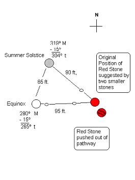
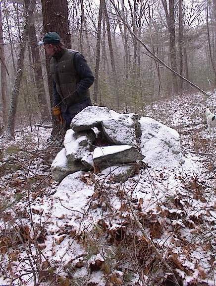
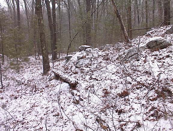
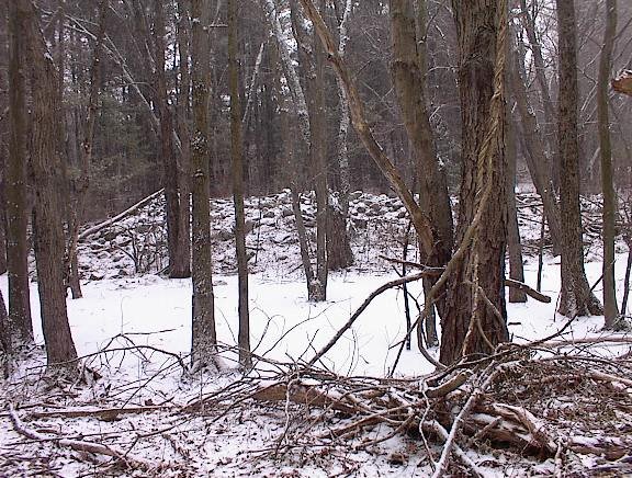
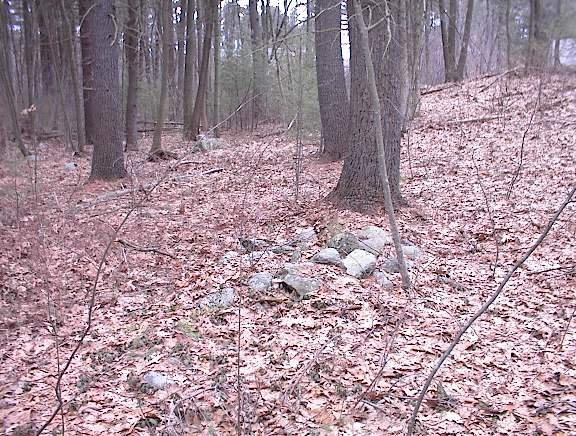
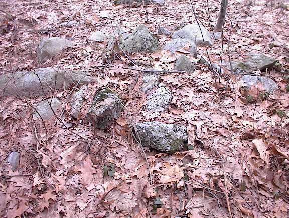
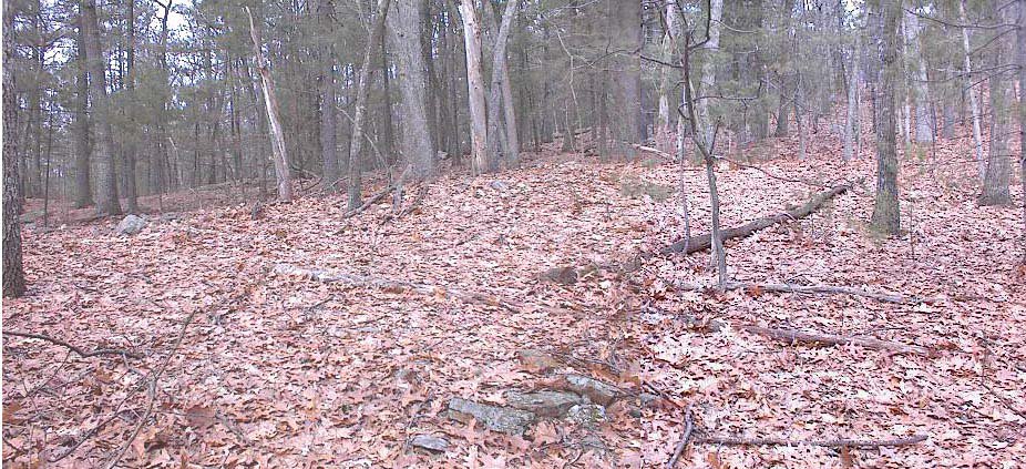
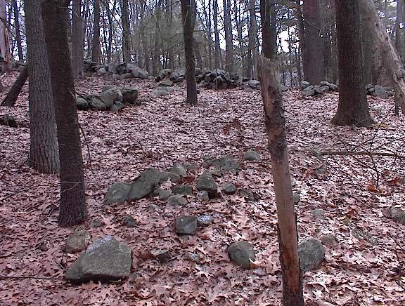
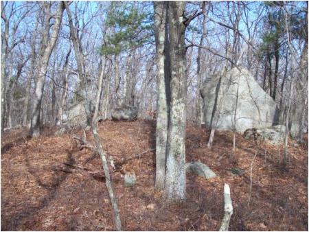
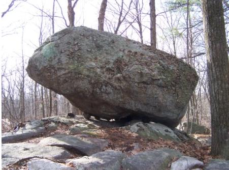
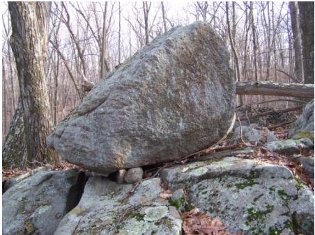
Update from James Gage

***New*** Webpage - Stone Walls (nice photo of a serpentine wall) http://www.stonestructures.org/html/stone_walls.html

Our latest publication - A Guide to New England Stone Structures http://www.stonestructures.org/html/guide_book.html

Gungywamp / Thames River Valley - We added a new section to the end of the Thames River Valley webpage on "Moon Ceremonialism." This section provides historical references to moon ceremonialism amongst northeastern woodland Native Americans.
http://www.stonestructures.org/html/thames_river_valley.html

Caddy Park & Titicut Site - A short article on the similarities between the two sites. http://www.stonestructures.org/html/titicut_site.html

Recommend Books - I am consolidating all of "Further Reading" materials onto a single webpage for easier reference. This is a work in progress.

http://www.stonestructures.org/html/recommended_books.html

Sunday, February 26, 2006

Visit Larry Harrop's website

If you haven't already, check out some of the fine photo's on Larry's site, linked to on the right [or at the bottom for IE users]. I particularly liked this panorama from Freetown State Forest [Click here]

Trash Dump Details

OK, I guess this was last summer that I found the site described in the previous post. At the time I was very impressed with the trash dump. Here is a detail of the platform pile right next to a bit of rusted bucket.
Here is a detail of that trash - but it is not a bucket.
You can see it is closed at the larger end, a shape more reminiscent of a "tankard" than a bucket. That seems like it should be a datable artifact. The same goes for this cast iron stove-top.
I particularly liked this and dug it up out of the leaves to get a better photo.

A perfect small site in Acton

Not too far from the horse stable and big piles mentioned in the previous post, there is a south-facing rock pile site which icorporates an aperature pile, several marker piles with "pointer" rocks, what could be a broken down viewing platform, a number of subtle and delicate features which are undamaged and in place. I took my friend from Carlisle and he was impressed with how everything is still in place. None of the piles seem damaged and the site appears to be pretty recent. This is a site I found a couple of summers ago. So I wanted to show it to my friend. Let's take a look.

Here is what I interpret as a broken down platform pile.
If you stand near this pile, all the other piles are visible as features on a near horizon. You can see an aperture pile:
I don't try to measure alignments accurately but the view through the hole is towards the southwestern horizon.

Also, from the central location, you can also see this marker pile with pointer rock.
Again, viewing from the central location, looking a bit more westerly, you see several minor pointer rocks (the kind that get interpreted as turtle heads). Each pointer marking a slightly different position of the far horizon.I was out of "film" in my digital camera and needed to erase shots from Chelmsford in order to make room for these. In the last picture we are viewing along the left side of an outcrop. There were several more delicate arrangements on this outcrop. Friend from Carlisle says: "these are birds". We both notice some little curved line arrangements of small rocks, highlighted in the snow, but I had not film left for that.
Exploring a bit further downhill, there were some outlying features like this "manitou stone". I had to photo that.

So I think this is a sky-watchig site. It has all the features except noticeable inter-pile alignments, which I have come to expect - aperatures, platforms, lines of site past marker piles with pointer rocks.
Leaving, we discussed the age of the site. It is still in good condition, so perhaps the site is no more than 100 years old. There is also a trash dump at the site. This could be "offerings" or could just be a dump. Some of the trash in the dump seemed 19th century to me. I'll hunt up the pictures I took previously.

Big Piles in Acton

On Nagog Hill Rd in Acton there is an entrance to a conservation land, just to the left of a stable. on the east side of the road. If you follow the trail straight back across an open field and into the woods, you will see two very large piles with rectangular retaining walls, each as much as forty feet across.
You look at these piles and can see all different sizes of rocks dumped into the interior. So it seems pretty clear that a field was harvested of rocks to fill these outlines. Are they perhaps ceremonial? Could they have once been ceremonial and then been re-used for dumping field cleared rocks? One slight peculiarity is that both of these piles have their "feet in the water". A brook goes down underneath or along the side of one of them. On the balance, since these piles are right next to farms and old cleared fields it seems pretty likely these are examples of the elusive "agrarian" rock piles. Nonetheless it is fun to speculate that they could be more. If you poke around in the adjacent areas you may see there is a small, third, rectangular pile in on of the lots just beyond the spot of these two big ones.

Another minor site in Chelsmford

Yesterday I found three minor rock pile sites in Chelmsford. Here is a brief report of the third one, located approximately as shown in the upper one of three blue outlines on the map fragment ([Click here]) I suppose there are several ways into this strip of woods between Rt 110 to the south and Rt 494 to the north. I went in by parking at the rearmost condo among the "Woodview Condominiums - Littleton Rd" and then explored eastward through the woods.
I was looking at this twisted sapling wondering if this was man-induced or natural. As soon as I turned away I saw a pile, near the beginning of a small wetland.
I went to take a closer look
And saw a white feldspar "blaze" in the pile. So I think this is a broken down platform pile, with the same kind of white material I was seeing all morning in Chelmsford. Exploring down along the side of the wetland: here is a rock-on-rock group, someting traditional at a "brookside" site.
That was about all I saw there. It is probably only remnants of a site.

There were more woods to explore back in there but I kept feeling lost under an overcast sky with only the traffic sounds from the two highways as guides, So I headed back towards my car.
There was one final pile I saw, just before getting back to my car.

The History of Old Woodbury

Tim MacSweeney found the whole book online. [Click here]

Saturday, February 25, 2006

Robbins Hill (2) Chelmsford - some lovely details

For me the neatest thing at the Robbins Hill site, described in the previous post, was this niche made from burnt (rusted) stones around a white feldspare "cue ball"In another spot there was what could have been a broken down platform pile, or it might have been a ledge of rock all broken up into cobbles from the heat of the fire. But all these rocks looked burnt. Then someone made a little nest on top of the pile. The little nest looked relatively new although the platform (if that is what it was) was as old as the rest of the site - pretty old I would guess.
How about this spot? The pointer rock sticking up from the wall is the same burnt looking rusted rock that is in all the piles here. Overall this site on the southern shoulder of Robbins Hill is a small site with perhaps 20 rock piles piles.

Robbins Hill Chelmsford (1)

Robbins Hill is the highest point in Chelmsford and is reputed to be "made out of limestone". I did see some lime quarries over in that part of Chelmsford today but clearly the hill is mostly made of granite. The second site I saw today (middle blue outline in the map fragment below) is on a southern shoulder of Robbins Hill. I was heading up and across the southern flank of the hill and glanced back more westerly and saw what looked like it just might be a rock-on-rock, so I turned in that direction to get a closer look. As soon as I stepped over a stone wall, there was a platform pile (shown above) - broken down but with that blaze of quartz which you can see in this second picture.
Glancing uphill, I could see other low ground piles, somewhat evenly spaced, arranged on the slope. These are marker pile site characteristics.
The piles were mostly low to the ground incorporating elongated or "pointer" rocks. All with rust covered rocks, most with a single piece of quartz.
I have come to believe that rust stained rocks are usually an indication of fire. Tim Fohl and Jic have done the experiement and we are pretty confident that fire causes oxidation of iron in the rocks around here. So these pile today all looked to me like they had been through a fire - or had a fire burnt on top of them. This is one of things I speculate was common at marker pile sites. One type of marker pile seems to be a composite like this: burnt (rusted) rocks combined with quartz blazes - sometimes with pointer rocks sticking out from the pile. There were several other beautiful things at this site, I'll put them in the next post.

Small sites in Chelmsford

I found some minor sites today in Chelmsford. They are already pretty broken down and not too delicate, so I see no harm in identifying the locations.

The first site is a remnant of a few things at the G.W.Wright Reservation off of Parker Rd (lower right blue outline in the picture). Most of the rock pile material I saw was focused around a large boulder in there.

Notice the structure at the left end of the boulder. Here is a closeup. You can see that this is in fine repair and my guess is that this is very recent. In fact throughout the day I was looking at things that included recent structures built over older ones.
In addition to this there was one alignment leading away from this boulder. And nearby one or two broken down platform piles.
Here is a detail of the near platform.
Note the quartz and/or white feldspar in the detail. Quartz "blazes" like this were another theme of the day. Everywhere I went the rock piles had a blaze like this, usually with a single quartz or feldspar cobble.

I was thinking it is likely that quartz (or feldspar) occurs with a certain frequency in the glacial cobbles of this area. So it follows that you expect to see it mixed in with other rocks in a rock pile with about the same frequency. So if you suppose the rocks of a rock pile to be a random sample then there will be a natural variation found in how many quartz cobbles occur per pile. For example at low frequencies you expect a number of piles to have no quartz at all, and a number of piles to have two or more. One can then calculate the likelihood of seeing a pile with no quartz and compare that to what is actually observed. Standard hypothesis testing will, I believe, prove that the "random sample" hypothesis for rock piles is not a good hypothesis. This is one way to make the argument quantitatively - should anyone care to do the work.

Friday, February 24, 2006