The first in a perhaps continuing series: I was phoning around about other matters (Pratt Hill) and several of the people I talked with had interesting unrelated stories to tell. I should phone around more often. So "A little birdie told me..." will be code for the latest gossip.
Ken Leonard told me that language has been introduced into the standard Conservation Restriction ("CR") documentation (the "boilerplate") in Massachusetts that gives stone structures similar protection to wetlands - if I understand that correctly. Congratulations Ken!
Linda McElroy from the Acton Land Stewards reports a small vandalism at the rock pile site we cleared along one of the trails at Nashoba Brook Conservation Land. Someone built a couple of those increasingly ubiquitous vertical rock stacks using material from one of the piles there. Hopefully the rocks were put back where they belong as quickly as possible.
Several people tell me Pratt Hill is now officially part of a district (which includes the Upton Chamber) eligible for listing in the National Register of Historic Sites. They say this is a first, except I think Turner's Falls precedes it.
Thursday, May 31, 2012
A reflection
I do have a sneaking suspicion that bad science can be blamed in part for the Pratt Hill tragedy. Clearly the place got lots of attention from people because of their initial interest in the Upton Chamber. I also think that getting it wrong prepares people for long term battles with false knowledge and therefore weak knowledge. And these scientific confusions spill over into the minds that are listening; becoming the false history of the moment.
Luna Moth
 I am seeing more Luna Moths than when I was a kid. But I haven't seen a Cecropia or a Polyphemus for many years.
What remains at Pratt Hill
Are many stone piles around the summit and down the sides, well built, with a single piece of white rock (mostly quartz but some white feldspar)
 closer:


 Also some low, nearly circular or triangular piles. These might just be older but there is little evidence of smearing and these may have been placed differently or may have served some different purpose.


Much further down the southeastern side of the hill I saw something quite unusual: a split rock wedged with quartz. closer:
 A brief review of quartz: it seems to have no character of its own but to function as an amplification of something else. Used in a rock pile, it would be like relaying something through the pile. Used (in this rare case) to wedge a split rock would amplify and project the rock's spirit outward. My guess is that a split rock, wedged with quartz, is rare because projecting the spirit of the rock outward would generally not be a safe.
 closer:


 Also some low, nearly circular or triangular piles. These might just be older but there is little evidence of smearing and these may have been placed differently or may have served some different purpose.

Much further down the southeastern side of the hill I saw something quite unusual: a split rock wedged with quartz.
 closer:
 A brief review of quartz: it seems to have no character of its own but to function as an amplification of something else. Used in a rock pile, it would be like relaying something through the pile. Used (in this rare case) to wedge a split rock would amplify and project the rock's spirit outward. My guess is that a split rock, wedged with quartz, is rare because projecting the spirit of the rock outward would generally not be a safe.
Wednesday, May 30, 2012
Angry Landowner Bulldozes Indian Mounds
Pratt Hill, Upton MA.
I am upset and I am angry. I was going to write up a detailed summary of what I have been able to find out about how and why the site was bulldozed but I run the risk of expressing my anger; so I am going to keep it simple and give you a quick run down. I have spoken to or emailed several members of the NEARA board about this, I have spoken with people who accompanied the Narragansetts on their first and also later visits to the site. I have spoken with the man who bulldozed the place. Now I want to put it behind me. None of this is going to bring the site back.
However, I do want to mention that this rape, this murder within our community, needs to be mourned properly. We should be gnashing our teeth, pulling out our hair, wearing sack cloth, singing funeral songs, blaming ourselves and asking what we could have done differently. Later we can try to learn something from the experience and let the happy talk resume. That is why I find it all the more strange that this crime against the past happened so quietly and went so unmentioned. There were a number of bystanders but the rest of us never heard about the events.
Somewhere before 1989, Mavor and Dix surveyed the site on top of Pratt Hill in Upton MA. It consisted of several large mounds of stone, sited along the summit outcrops. The mounds were irregularly shaped. Surrounding them were numerous smaller rock piles in a standard format that I call "marker piles" - often found as satellite piles to larger, centrally located mounds. Mavor and Dix believed the Pratt Hill site was related to the Upton chamber and wrote extensively about it in Chapter 2 of Manitou "A Pleiades and Sun Sanctuary at the Source of Waters". NEARA people helped survey the place and it sat their quietly over the years. No doubt a few snuck up there - on private property - to have a look.
Then, more recently after ~2000 the place got a lot more traffic. NEARA field trips were taken to the site; at least one person got arrested for trespassing and at least one other (who was visiting there with the Narragansett Indians) got kicked off the private property and threatened with arrest. A strong component of archeoastronomy runs through the story and through the site, and its connection with the Upton chamber must have been mentioned in connection with (then ongoing) efforts to preserve the Upton chamber. There was a lot of interest. From what I can gather, the land owner was not happy about the trespassing and may have had trouble taking Native American spirituality seriously.
Then comes the money and the real trouble starts. A cellphone company wanted to place a tower on top of Pratt Hill. This would usually require surveys and permissions from the Native Americans as it involves the FCC, a federal agency. I don't know if this was before or after Indians had been up on the hill looking around. But the landowner sure was not going to have an easy time selling or leasing the land. [He said "If I had known what I was getting into, I never would have bought that property"]. After that, around summer of 2008, the main mounds at the site were bulldozed. Still later, the Narragansetts finally did purchase the land and the astronomical surveying resumed.
So a quick review of possible reasons why the site was bulldozed:
- greed and pride, a way to facilitate selling/leasing the land;
- anger at all the unwelcome trespassing (and possibly unwelcome news stories, of which I am guilty since I blogged the field trip before being told I had to take my photos off the web);
- religious intolerance, denying the existence of Indians and their ceremonies by eliminating the physical representation of those beliefs.
Take your pick, I think it probably is a bit of all three. I feel pretty bad about it. Apparently when a group of Indians arrived on the hilltop, just before they purchased it, they found it bulldozed. Imagine their grief.
A few last words. NEARA should publish some information about Pratt Hill. They have maps and photos. They should re-enforce a (long since established) bylaw of not condoning field trips without landowner permission. There are enough parallels here with what happened at Bare Hill, in Heath MA, that it should be cause for reflection. We should probably work towards some means of ensuring that land transfers include ceremonial site descriptions along with other site/resource survey information. So potential purchasers will not be caught by surprise. Also it was NOT the written publication of this site that caused it to be destroyed.
There are lots of other stray thoughts on the subject. For instance, those might have been horizon piles, as described by M&D. But they could also be burial mounds - the site, as a whole, is not so unique and there are many others on nearby hills where the collapsed inner chambers are plain enough. NAGPRA anyone?
Tuesday, May 29, 2012
Weekend reptiles
[Not rock pile related...but you see these things while looking for rock piles]
A small snapping turtle: A similarly small garter snake:
 No excuse for the lack of focus, I get nervous trying to catch things before they move.
A small snapping turtle:
 A similarly small garter snake:
 No excuse for the lack of focus, I get nervous trying to catch things before they move.

Pratt Hill Tragedy
This used to be a famous rock pile site in Upton MA. More later, as I pick up more details of the story.
 More later, as I pick up more details of the story.
Saturday, May 26, 2012
SPLIT ROCKS, WHERE THE WIND BEGINS

Photo from: http://indianvalleychamber.snappages.com/An%20Ancient%20Trail%20-%20A%20Maidu%20Auto%20Tour.htm
"1.3 miles north of Indian Falls to spot where canyon widens - pullout located on west side of road near a clump of small oaks. At the edge of the pullout, look up to the rim rock to the southwest and you will see a large split boulder. The canyon you have just passed through is known for its strong winds, and the split rock is "where the wind begins". The Maidu in Indian Valley controlled the wind during late summer when the acorns were ripening. If the wind knocked down the acorns too early, the acorns would not grow to an adequate size for food preparation. To prevent the wind from reaching the oak groves, they plugged the crevice in split rocks with large stones. The rocks were removed during the winter, else it become angry." 
From: "An Ancient Trail - A Maidu Auto Tour; WORLDMAKER'S TRAIL"


"When Worldmaker came to Devil's Corral, he found the canyon was filled with hoards of little devilish imps. They hid out in all the crevices in the rocks and crags. Worldmaker called to the mud swallows for assistance, and they came to him from up and down the Susan River. The swallows gathered mud from the river and sealed up all the cracks and crevices and trapped those little imps in the canyon walls. You can still hear the little devils wailing and moaning in the rocks, especially by night..."
Friday, May 25, 2012
Stone tool from Mt Madison NH
 I found this some time ago on the airline trail a few hundred yards downhill from the Madison Springs AMC hut. Other views:
 This shows a very classic patter of flaking, executed in a crude material.
 There is a big difference in the wear of this side of the tip, versus the picture after next:
 I am not holding it funny - that side is rounded off and relatively smooth.
 So you tell me: who was doing what up there? Recall this from the pass between Adams and Madison.
Wednesday, May 23, 2012
Final Upton Flowers
Does anyone know the names of these?
A little snapdragon:
 A little pink flower I had trouble focusing:
 And a similar flower but blue:
A little snapdragon:
 A little pink flower I had trouble focusing:
 And a similar flower but blue:
New fame
Got a link from Reddit and this article on the Bayer's Lake Mystery Walls is getting a lot of traffic and comments. Fun to revisit. Also, here is another link on the subject.
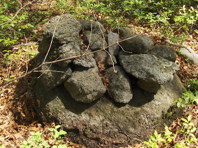
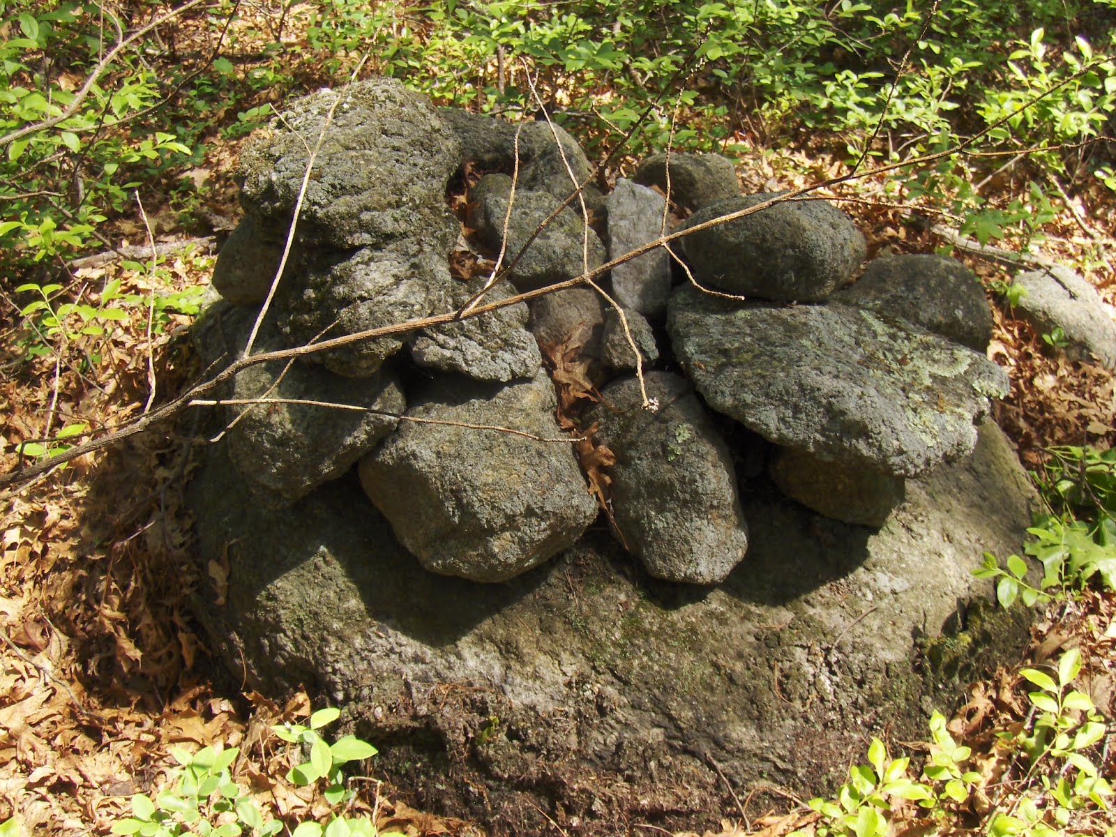
Southern Upton State Forest
 The southern end of Upton State Forest, across the road from Pratt Pond, is too far away from the entrance at the northern end, so I parked at the Church (with permission) and walked in under the power lines. I meant to head north but followed the power lines too diligently and ended up on the flanks of Pratt Hill - a place made famous by Mavor and Dix in discussing the stone mounds on the summit that you can see out the entrance of the Upton Chamber. Well, there are rock piles in other parts of the hill - but old, smaller, decrepit, covered with forest debris.
So here is an assemblage of three piles, almost impossible to see, from he location indicated by the smaller blue outline above.
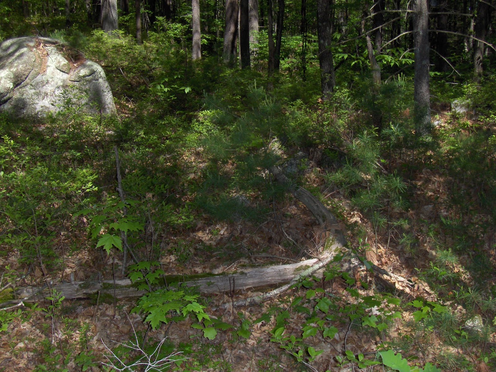 The pile hidden under the dead log is reasonably big, under the debris.
Here is a small structure from beside the brook in the same valley. I should have continued up that valley - something to do on another weekend. See the outline of the rocks?
 Here is a view up the power lines towards Pratt Hill:
 Some colorful fungus:
 Some odds and ends:
 [A familiar shape, from what I called "twins".]
Then, on the far side of the first main rise (I think in about the position of the larger blue outline but it could be one shoulder over) I found another rock pile, under the power lines:
 Pretty damaged:
 I looked high and low on the slope near this pile and could not see any other rock piles. So I looked carefully in the woods behind the power lines and did find another; then a short stretch of wall; then one more. Later when I crossed back (westward) under the power lines, and climbed the hill, there were signs that this site continued on both sides of the power lines.
Here is the second pile I found. I felt quite smug finding it after persisting with the search. It would have been a good sized pile some time ago.
 Another view hints at some structure:
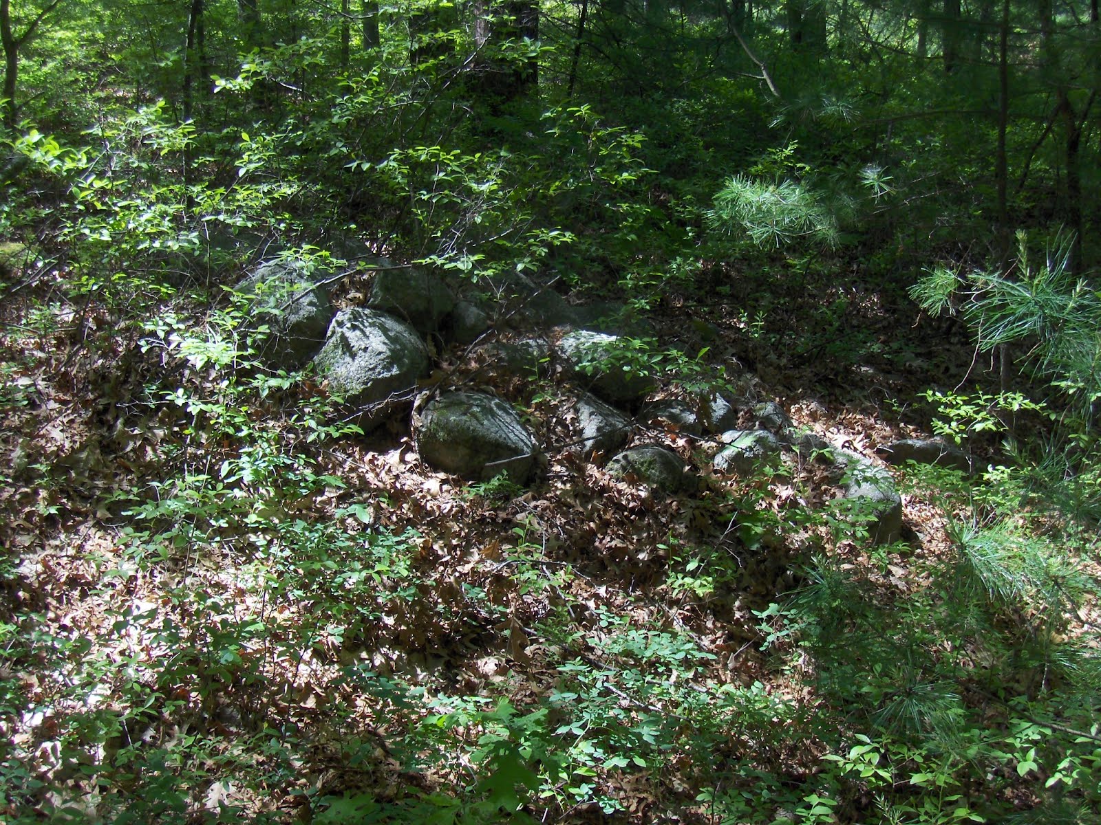 I do not much understand this site. Why are there a few piles at this one spot on the hill? If this second pile had a small hollow (I did not see one), that would make some sense. There was a nearby stone wall, so low to the ground as to be almost invisible. It has a short perpendicular side wall ending in a rock pile and a rock. I tried to video it but it remains invisible in the dappled light. So there are no pictures of this feature.
Then I looked around some more and found one more rock pile, completely buried like the piles on Cape Cod. I decided to groom it slightly:
 After that I headed back out to the power lines and uphill. There were a couple of other piles in the woods on the other side of the power lines. This one has a bit of shape to it, like an effigy:
 From above:
 Another one nearby, also has some shape to it.
 After that, back across and down. Out to the power lines and back to my car:
 I'll have to go back to this area again. There are plenty more woods to explore there.
Monday, May 21, 2012

Sunday, May 20, 2012

Barry M in Manitoba


A lot more can be found here: https://www.facebook.com/#!/groups/4585999861/
Subscribe to:
Posts
(
Atom
)