A new book published by Mark Starr, Ceremonial Stonework I'm sure would be of interest to the readers of your blog.
Wednesday, November 30, 2016

Tuesday, November 29, 2016
coming up
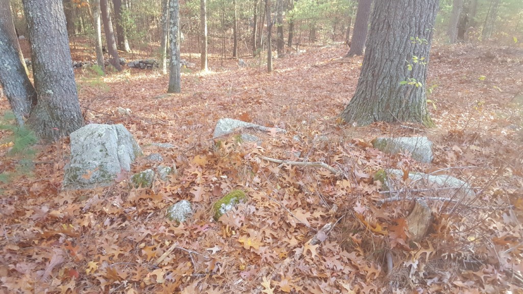
I vegetated over Thanksgiving. Got out with my son, though:
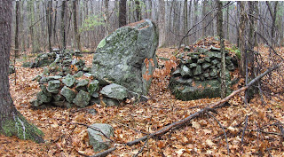 And showed him some of my favorite things.
Perhaps a view from another direction would be helpful:


Perhaps a view from another direction would be helpful:

Short spurs of stone wall at Half Moon Meadow - Boxboro
Off Sargent Rd in Boxboro you can see the rock piles from the road at Half Moon Meadow conservation land. We saw some piles (see here) and some short stretches of wall. Thought I would pass these along:
 And:
And:
 These were on top of the last rock there, which...yeah...I guess it looks like something.
 Whether that is a "head" or just a resting place for colorful rocks, I don't know.


A fieldtrip in Boxboro


We also saw some piles over by the railroad, that did not photo too well. I had explored in there before but Dave found some things I missed right next to the brook.


Sunday, November 27, 2016
Saturday, November 26, 2016
How the archaeological review behind the Dakota Access Pipeline went wrong
by Chip Colwell
November 20, 2016 8.21pm EST
“This summer, Tim Mentz Sr. took to YouTube to
tell the world about the destruction of his cultural heritage. A former tribal
historic preservation officer of the Standing Rock Sioux, Mentz wore a baseball
cap, rimless glasses and two thin braids of graying hair. He was upset and
spoke rapidly about the area behind him, an expanse of the Great Plains cut by
a new 150-foot-wide road.
Two days before, Mentz
had testified to the D.C. District Court to report the area that lay
in the path of the controversial Dakota Access Pipeline (DAPL) corridor holds
82 cultural features and 27 graves. By the next day, DAPL construction workers graded
the area. Behind where Mentz stood in the video was a place known as the
Strong Heart Society Staff, where a sacred rattle or staff was placed within
stone rings. Here members of the elite warrior society would come to make
pledges. Mentz explained the site is tangible evidence that Strong Heart
members followed a “spiritual path...

Zuni elders Octavius Seowtewa and John Bowannie, and
archaeologist Sarah Herr, look at a shrine archaeologists misidentified. (Chip
Colwell photo)
On another project
I conducted with the Zuni tribe, I watched as elders explained to the
archaeologists excavating a site in the path of a new Arizona highway that they
had placed a survey flag in a semicircle of rocks – which was likely a shrine
used to bless and protect the ancient village. When it comes to traditional
practices, Native Americans see what archaeologists overlook...”Monday, November 21, 2016


Sunday, November 20, 2016
I'm not an archaeoastronomer but ...
The southern summit of Saddle Hill in Hopkinton, sure looks arranged:
 I am just saying...

Thursday, November 17, 2016
Shaker Lands in Harvard, MA
North of Rt 2 the hills and swamps, near the center of the Shaker historic area in Harvard MA, are full of rock piles. I stopped there on the way home from Groton where I made the mistake of planning a walk - it was a dud and I knew I'd find something, just driving around in that part of Harvard.
Probably the most interesting thing during the weekend happened when I pulled to the side of the road and another car stopped in front of me and parked at the same time. I got out, looking inquisitive, and an elderly guy got out of the other car and asked me "is you car alright?", then "you aren't stealing rocks from the stone walls?", then I answered "of course not, I am taking pictures of them". After hearing that, the man goes: "oh. good, good....I didn't know about it but now I am in the know....". He seemed to be speaking about rock piles but I did not bother mentioning that I knew about them too. Just took pictures. It is certainly gratifying that a random old guy from Harvard knows about "hush hush....it is special". That would be near the lowest blue outline:
 Typically:
 After that I walked around the edges of a swamp and saw some other minor features at the upper blue outline.
 Witch Hazel is blooming:

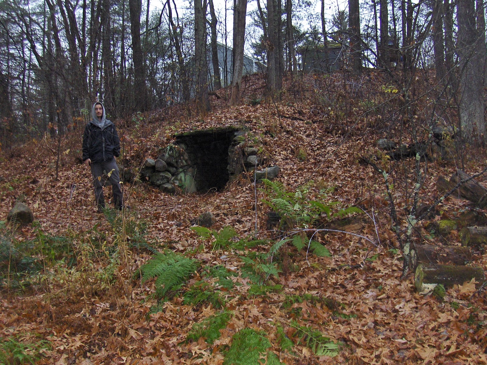
I did find something unusual at the spot indicated with a red "?": an enclosure at the end of a wall.
 This is shaped on the interior, very much like the chamber incorporated into a wall on Hubbard's Hill in Concord. But there is no evidence of corbelled roofing here.
 And, also like similar enclosure from Lincoln [can no longer find the article], there was a bit of a niche or cupboard inside:
 from above
 Having now seen two or three of these structures, I think there is a pattern here. These are not underground chambers, but not too different.
Probably the most interesting thing during the weekend happened when I pulled to the side of the road and another car stopped in front of me and parked at the same time. I got out, looking inquisitive, and an elderly guy got out of the other car and asked me "is you car alright?", then "you aren't stealing rocks from the stone walls?", then I answered "of course not, I am taking pictures of them". After hearing that, the man goes: "oh. good, good....I didn't know about it but now I am in the know....". He seemed to be speaking about rock piles but I did not bother mentioning that I knew about them too. Just took pictures. It is certainly gratifying that a random old guy from Harvard knows about "hush hush....it is special". That would be near the lowest blue outline:


I did find something unusual at the spot indicated with a red "?": an enclosure at the end of a wall.


Photos from Boxborough
Reader David, sends photos and text:
The following photos were taken in Boxborough in the general vicinity of Patch Hill. There are at least 3 more piles in this area that I did not photograph.
Fortunately, I had some time to clean the area.

This is the second pile that I cleared but found it far more interesting. This particular rock has been split into multiple pieces, some more obvious than others. Located in the center of the photo, is one of the splits and notice how it is filled with rocks of a consistent size. To the left of this split, there is another collection of rocks, this time they are much smaller in diameter and would fit easily in the palm of your hand. These rocks are not visible in these photos. I did not inspect all of the smaller rocks, but I was able to find a nice piece of white quartz.
Behind the tree on the right, there is a line of small rocks that look like they step down the hill for about 3-4 feet. Pile # 3 is about 10 feet downhill from the left side of this pile.

Pile #1. After I cleared this pile, I decided it was a good idea to take before and after photos. This particular pile was completely covered with leaves and scrap pieces of chopped wood. It continues beyond the frame for another 5 feet.

Pile #2 is in the foreground and Pile #1 is behind it to the right. They are about 20 feet apart from each other.
Pile #3. This particular pile is downhill from pile #2.

Pile #4: This pile is located on the edge (ledge?) of a little ridge and this is the view looking uphill. Notice the white rock in the foreground.

Pile #4: Here is the view from above pile #4. It looks like there is a hollow in the middle of the pile.

Fortunately, I had some time to clean the area.
This is the second pile that I cleared but found it far more interesting. This particular rock has been split into multiple pieces, some more obvious than others. Located in the center of the photo, is one of the splits and notice how it is filled with rocks of a consistent size. To the left of this split, there is another collection of rocks, this time they are much smaller in diameter and would fit easily in the palm of your hand. These rocks are not visible in these photos. I did not inspect all of the smaller rocks, but I was able to find a nice piece of white quartz.
Behind the tree on the right, there is a line of small rocks that look like they step down the hill for about 3-4 feet. Pile # 3 is about 10 feet downhill from the left side of this pile.

Pile #1. After I cleared this pile, I decided it was a good idea to take before and after photos. This particular pile was completely covered with leaves and scrap pieces of chopped wood. It continues beyond the frame for another 5 feet.

Pile #2 is in the foreground and Pile #1 is behind it to the right. They are about 20 feet apart from each other.
Pile #3. This particular pile is downhill from pile #2.

Pile #4: This pile is located on the edge (ledge?) of a little ridge and this is the view looking uphill. Notice the white rock in the foreground.

Pile #4: Here is the view from above pile #4. It looks like there is a hollow in the middle of the pile.

Tuesday, November 15, 2016
Save the Stones (Italy (NY)
From: Logging and related activities in the state's wildlife
management plan have stewards of land and water asking questions

“Work has begun. On
Sunday, Rushville resident David Schewe and a group of friends took a look.
Walking an area of High Tor in the town of Italy (NY), Yates County, not far
from Conklin Gully, it was clear where loggers had been.
Concerns range from runoff polluting the lake to the use of
pesticides, and the disturbance of what some believe are historic and
culturally significant rock formations...
Schewe, a technology teacher at Marcus Whitman, said he is
not against responsible logging. But he wants the DEC to recognize — and place
off-limits to loggers — areas where he and others believe are stone structures
of historical and cultural significance.
A number of years ago, Schewe began researching and
documenting these stone piles. He has pinpointed some 300 in the region. There
is no proof, but he believes plenty of evidence suggests these structurally
impressive rock formations, which fit patterns in size and shape, were manmade
during a prehistoric period...
Local expert weighs in on stone piles:
Kurt A. Jordan is director, Cornell Institute of Archaeology
and Material Studies (CIAMS); and associate professor, Anthropology, American
Indian and Indigenous Studies at Cornell University. He writes: "There is no question that there are large numbers of
human-constructed rock piles in various areas across the Northeast; it’s quite
obvious that these are cultural features rather than 'random piles of rock.' In
most cases, the jury is still out on who constructed them. While there is
widespread local fervor for attributing them to Native Americans, we must
remember that very close to the entirety of the Northeast was farmed at one
point (there is significantly more wooded area today in the Finger Lakes region
than there was in 1880, or even 1920). Most of the rock piles are quite distant
from known Native sites. In terms of knowing that there were people out on
these landscapes, then, it is more likely that they were placed by
Euro-Americans for purposes of getting the rocks out of fields, whimsy, or
other reasons. But we shouldn’t be too quick to eliminate the possibility of
Native construction, however.
"The vast majority of rock piles are not obvious
“sites” as there is little cultural material associated with them. The origin
and timing issues are difficult to resolve because archaeologists would need to
find artifacts directly associated with the rock piles, and/or associated
charcoal that could be radiocarbon-dated. This happens very, very rarely, which
means there is no good way to determine when, or by whom, the piles were
erected. Investigating rock piles is therefore extremely low on most
archaeologists’ priority lists because the research process is extremely likely
to be frustrating and inconclusive. There are simply many, many, many more
avenues of research that are more likely to generate interesting results than
rock piles.
"There is some possibility that eventually people may
be able to tell who made the rock piles on the basis of their characteristics —
some, for example, have asserted that construction of parallel lines represents
Native construction. This type of research is not very far along and I don’t
think anything definitive has come from it as of yet.
"One other possibility that hasn’t been adequately
explored is that the rock piles are intercultural creations, resulting from a
combination of Native and settler elements unfolding over time. This avoids the
'either/or' thinking most commonly applied when discussing rock piles.
Hypothetically, I suspect this is the case for many formations."


Thursday, November 10, 2016
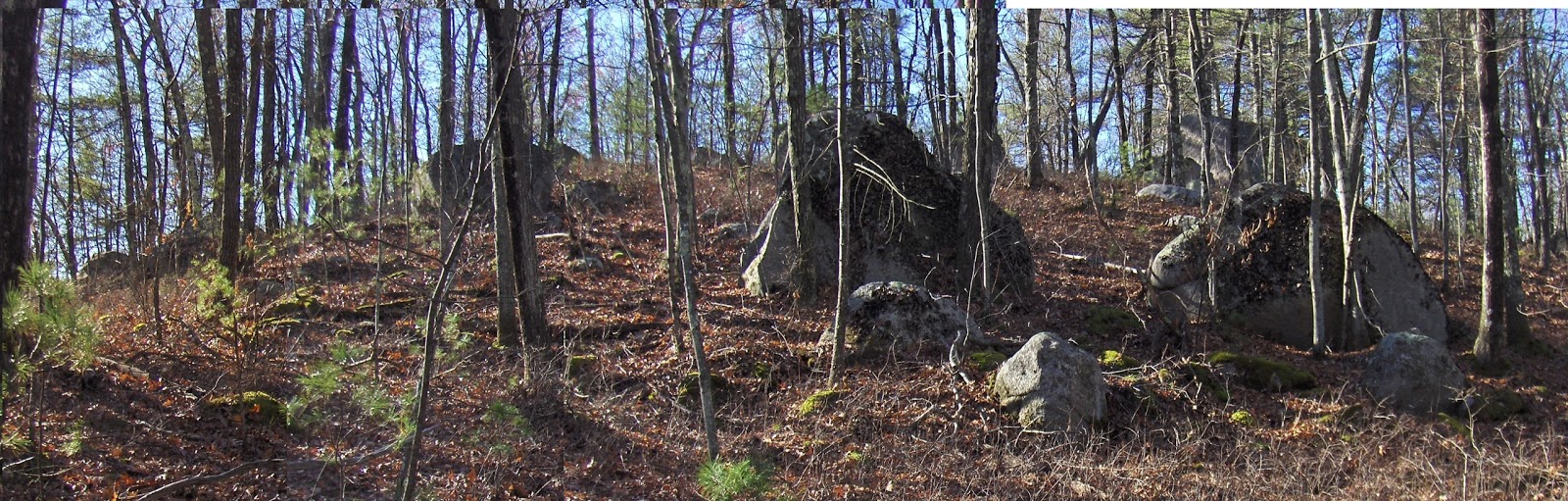
A small pile at Codman Hill


Something new at Codman Hill - Harvard, MA
I mean the hill east of Murray Lane in Harvard and it is covered with rock piles. Bruce MacAlleer found it. Last weekend, I took a short hike with my wife to follow the southernmost contour of this hill. In one ravine, I found something new:
 a little closer
 and more
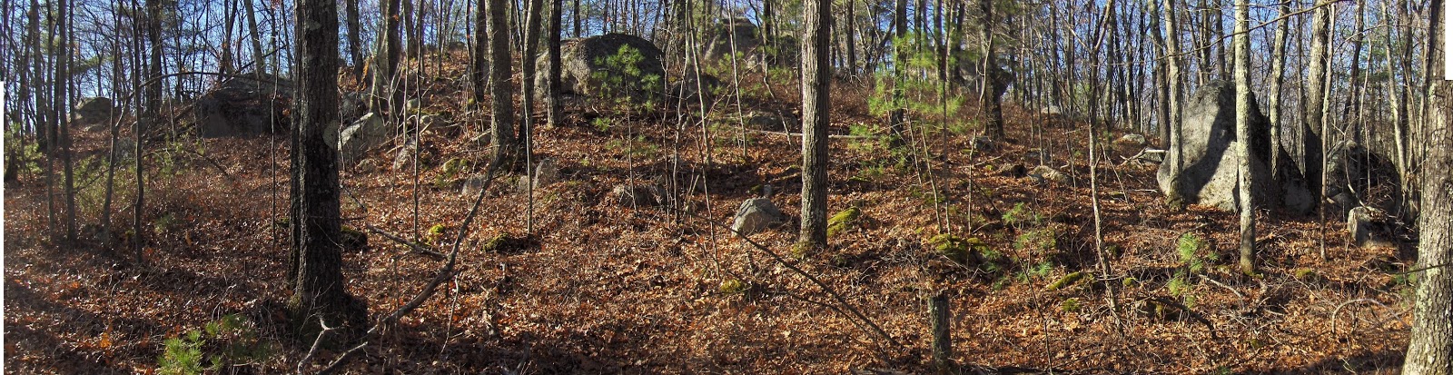
 From above, it looks totally collapsed:


In light of its situation: at a first level above a tributary to Beaver Brook, it fits well within the broader pattern of such rectangular piles in these watersheds.
The pile is in two pieces and reminds me a bit of the "J" at Blood Hill (on a less grand scale). A more pertinent comparison, is with a pile less than a mile away at a different place in Harvard [click here.].
How lucky am I to live in an area where these things are all over the place? And nobody even sees them!
Subscribe to:
Posts
(
Atom
)