Monday, June 19, 2006

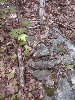
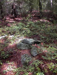
Piles incorporating wire

A couple of examples. These seem to illustrate a point made by Mavor and Dix in Manitou that every day "junk" might have been used for offerings during Native American ceremonies.
Here is a rock pile incorporating a coil of barbed wire like a "wreath". Tim Fohl found this in Townsend.

Here, a tangle of straight wire sits on top of the pile and collects debris.I found this one in Bolton in the same conservation land as the broken plow tip pile.

The stupid sheet

It is hard correcting for the difference between true north and magnetic north. Around here (Massachusetts) they are about 15 degrees different - but who can remember which way? The idea of the stupid sheet is to show the major celestial events: solstices and equinoxes - as they would appear in their relative positions on a magnetic compass. This way you do not have to be too smart to use it. Just set the compass down on top of the paper so that the vertical "north" matches the compass north. Then you can read off the directions to various celestial events. In the winter soltice video, you can pick off the solstice sunrise direction as about "4 oclock" - which is supposed to match the direction of the "head" sticking out of the rock.

Saturday, June 17, 2006

Thiebaud Property, Switzerland County Indiana

[Click here]
Includes some rock piles of unknown purpose.

Judaculla Rock, North Carolina

Did you see this? [Click here]

Site protection via superstition

In England (not rock pile related)
[Click here]

Winter Solstice - another sacred video clip by FFC

[Click here]

Burnt Rock and Cedar

by pwax

Sacred Video Clips by FFC (Spirit doors)


[Click here]

[Click here]

Virginia Stone Altars

Excerpt from The History of Virginia by Robert Beverly ca. 1673-1722

"The Indians have posts fixed round their Quioccassan*, which have men's faces carved upon them, and are painted. They are likewise set up round some of their other celebrated places, and make a circle for them to dance about on certain solemn occasions. They very often set up pyramidal stones and pillars, which they color with puccoon, and other sorts of paint, and which they adorn with peak, roenoke, &c. To these they pay all outward signs of worship and devotion, not as to God, but as they are hieroglyphics of the permanency and immutability of the Deity; because these, both for figure and substance, are of all sublunary bodies, the least subject to decay or change; they also, for the same reason, keep baskets of stones in their cabins.

Upon this account too, they offer sacrifice to running streams, which by the perpetuity of their motion, typify the eternity of God. They erect altars wherever they have any remarkable occasion, and because their principal devotion consists in sacrifice, they have a profound respect for these altars. They have one particular altar, to which, for some mystical reason, many of their nations pay an extraordinary veneration; of this sort was [a] crystal cube**

[ . . . ]

When they travel by any of these altars, they take great care to instruct their children and young people in the particular occasion and time of their erection, and recommend the respect which they ought to have for them; so that their careful observance of these traditions proves almost as good a memorial of such antiquities as written records, especially for so long as the same people continue to inhabit in or near the same place."


*according to E. G. Squier, Quioccassan means, "temple of the idol."
**Beverly talks about this crystal cube in an earlier chapter and says it was a much-venerated altar, but he was never able to find it.

Friday, June 16, 2006

Yawgoog Trails

I know we did this before but let's do it again. [Click here]

Cobbles, Cairns, and Manitous: An Examination of the Use of Stone in Native American Landscapes

[Click here]
Title: Cobbles, Cairns, and Manitous: An Examination of the Use of Stone in
Native American Landscapes

Authors: Sean B. Dunham (Commonwealth Cultural Resources Group, Inc.), Janet
G. Brashler (Grand Valley State University), and Charles E. Cleland (Michigan
State University)

Abstract: Enigmatic cobble piles and walls have elicited a variety of
interpretations throughout the Great Lakes region, e.g., astronomical
calendars, henge monuments, and burial mounds. While most of these features
reflect early historic Euroamerican agricultural practices or natural
phenomena, certain of the sites can be attributed to prehistoric and historic
Native American land use. Both archaeological and historical sources have
indicated a variety of possible interpretations for such
features, including burial cairns, votive precincts, and the byproduct of
agricultural field clearing. This paper will present a discussion of these
stone features in the Upper Great Lakes from a variety of sources, including
ethnographic, ethnohistorical, and archaeological.

Paper presented at the 43rd Midwest Archaeological Conference, Muncie,
Indiana, 21-24 October 1998.

Silver Star Mountain WA

A well known system of pits and rock piles exist on the ridge south of Silver Star Mountain, just east of the Clark County/Skamania County line in southern Washington.....[click here]

First Nations Burial Cairns on Great Racerock Island

This is near Vancouver:
[Click here]
Thanks to Norman Muller for the link. Wonderful photos.

Ancient Monuments - c. 1847

by JimP
The following is an excerpt from a report found in the Smithsonian Contributions To Knowledge, Vol 1 - published in 1847. The report is entitled Ancient Monuments of the Mississippi Valley by E. G. Squier A. M., and E. H. Davis, M. D. This is from a chapter called Stone Heaps, and the excerpt begins as the authors describe rock piles that overlook a valley called Salt Creek in Tarlton, Ohio.

Smaller and very irregular heaps are frequent amongst the hills. They do not generally embrace more than a couple of cartloads of stone, and almost invariably cover a skeleton. Occasionally the amount of stones is much greater. Rude implements are sometimes found with the skeletons. A number of such graves have been observed near Sinking Springs, Highland County, Ohio; also in Adams County in the same state and in Greenup County, Kentucky, at a point nearly opposite the town of Portsmouth on the Ohio.

Heaps of similar character are found in the Atlantic States, where they were raised by the Indians over the bodies of those who met their death by accident, or in the manner of whose death there was something unusual. Dwight, in his Travels*, mentions a heap of stones of this description which was raised over the body of a warrior killed by accident, on the old Indian trail between Hartford and Farmington, the seat of the Tunxis Indians, in Connecticut. Traces of a similar heap still exist on the old trail between Schenectady and Cherry Valley in New York, with which a like tradition is connected, They were not raised at once, but were the accumulations of a long period, it being the custom for each warrior as he passed the spot to add a stone to the pile. Hence the general occurrence of these rude monuments near some frequented trail or path.

*Travels in New-England and New-York, 1821-22 by Timothy Dwight (published posthumously)

Thursday, June 15, 2006

Another sacred video clip from FFC

More on "The Smoking Place", Lolo Trail, Bitterroot Mountains, Idaho

From a Time Magazine article about Lewis and Clark [Click here for full article]

Today the view is still as breathtaking — little has changed here in 200 years, except the cairns. Last August vandals threw half the rocks from the three 4-ft.-high cairns down the mountainside. Fairchild found the damage on a trek with eight clients, and they spent time retrieving some of the stones and rebuilding the cairns. "What type of person would do this? Search me," he says.

A grid site in Stow, MA - from Journals

by pwax
This is the most complete, well-defined site which I have found in Stow. It is one of the very best examples of a "grid"/"marker pile" site and it is on land that is threatened with development. If any readers are from the Stow area and wish to know more details, please contact me (rockpilesmail@gmail.com).
Like so many sites around here it has these noticeable characteristics
  • occurs on the southwest side of the hill
  • piles evenly spaced
  • piles in lines
  • some piles have a single quartz "blaze"
  • all piles have approximately the same dimension except one larger "platform" cairn at the lower edge of the site
  • piles built on a somewhat steep slope
  • many piles are triangular
I first found this site when I took a wrong turn, ending up taking a quick peek into the woods and found it where I would not have expected to see a site: on a pretty steep slope.

Quoting from my Journal: "It is unusual for a site to be situated on such a steep slope. Here the piles are almost in a grid and are a bit reminiscent of several sites I have been looking at recently - including Bruce's Beaver Pond in Milford and the Sherry Road sites. There are also similarities with the Acton Spring Hill grid and the Boxborough Patch Hill grid. I think there is a class of sites with stack piles and somewhat even spacing and the kind of occasional alignment of multiple piles which I have been calling a "grid". And I think the nature of the slope is a key to understanding what might be more than one kind of grid. This XXX Hill site is on a pretty steep slope facing southwest over a lowland leading to Elizabeth brook about a 1/4 mile away. Water is here but not that close. I think a pattern is starting to emerge for this kind of site."

Here is a closeup of one pile - I cannot see the quartz in this picture but I know this pile has one piece of it.
One pile was different:
Quoting: "Some piles appear to have a retaining wall or almost vertical sides. Others lack that feature or are too tumbled over. The pictured tumbled pile looks like someone might have pulled apart one example of a stack. On the way in, this tumbled pile is the firsts pile you see and is the closest pile to the road. So it is likely to be a vandalized pile. Some (undamaged ones) are triangular or shaped a bit like teardrops and these are reminiscent of the Acton Spring Hill grid. One pile was significantly larger than others and might be a platform pile:"
In retrospect, I conclude that this pile is the viewing position from which the other piles are visible uphill. Here are some other views:
Quoting: "I guess the site is shaped like a piece of pie cut out from the hill. In the previous picture you can see one of the walls that runs up either side of the site to the top. I did not notice it when I took the picture, but this pile has a white rock to lower right in the picture. Note also the rock-on-rock in the background. Here is a detail:"
The lines of evenly spaced piles is characteristic enough of the site but I think the real clues to what is going on here are in the minor details like this rock-on-rock and the platform pile below. I think I have already written about this rock-on-rock. I hope I do not have to point out that the upper rock looks as if it might represent an animal. I think this cedar tree was planted next to the rock-on-rock and have a guess that this might be a monument to a fallen warrior. Why think that? Because there is a famous Indian battlefield in Sudbury at "King Philips Woods". Those woods are filled with rock piles and a number of rock-on-rock next to cedar trees. So I make a connection with battles - perhaps completely wrong, but it is a hypothesis worth keeping in mind.

Here are a couple more views:
Here is one more from the top of the site where the slope has leveled out a bit. You can see that the spacing between piles is consitent over the whole site. This is a key characteristic.
Quoting: "So there you have it, a very fortuitous find, a lovely site with good integrity, a new type of rock pile site emerging: the stack grid with one (or more?) blazed piles. I counted 41 piles in all. Looking back over what I wrote I see that there are basically stacks with possible viewing platform(s). There is a possibility of other types of piles - more burial like - mixed in between the stacks; alternatively these are simply damaged stacks."

Wednesday, June 14, 2006

Cairns in the National Register of Historic Places

From the National Register of Historic Places:


Archeological Site CA SBR 3186 ** (added 1981 - Site - #81000170)
Also known as Aboriginal Rock Cairn Complex
Address Restricted, Silver Lake
Historic Significance: Information Potential
Area of Significance: Prehistoric
Cultural Affiliation: Shoshonean, Yuman
Period of Significance: 6500-6999 BC
Owner: Federal
Historic Function: Funerary
Historic Sub-function: Graves/Burials
Current Function: Other

The Smoking Place - Bitteroot Mountains Idaho

[Click here]

"Bear claw" from Friend from Carlisle

This is a small rock pile. FFC believes it represents a bear footprint.

Nice Larry Harrop photos

What can you say but: "great"
[Click here]

[and here]

or go look at the whole album

Table Mountain Cairn Ellsworth KS

[Click here and scroll down]

State high points

(Not rock pile related). Here are photos of a number of state highest points. [Click here]

Acton "Potato Cave" - an archeologist's opinion

Thanks to James Gage for this link
[Click here]

If you feel like reading about how archeologists confuse assumptions with conclusions, this article will serve as a good example. Note for example the assumption: if it is 18th century then it is not Indian.

Why cannot these "experts" get it through their thick skulls that Indians still exists today - yes in the 21st century! How amazing is that? I guess it is hard even for me to grasp this but it needs to be repeated over and over: Indians are still around now.

Tuesday, June 13, 2006

Poor Farm Rd - continued

We left off with what appeared to be a line of rock-on-rocks heading off eastward from the first hill I climbed. There was a smaller secondary summit and I climbed it and glanced down its eastern side and saw a prominent rock-on-rock at the edge of the drop-off:
This is very reminiscent of a rock-on-rock I found at the top of the site on the eastern side of the hill of 500 cairns [Click here]. Anyway, looking down from this spot there were other rock piles visible. Down and to the right I could see a pile next to the conservation land trail:
To the right, an outcrop (visible in the background of the above photo) ends in a tumble of rocks down to a stream. There was not much in that direction except for that nice moss-covered split-wedged rock [Click here].

And to the left, down the notch separating this smaller hill from the larger one where we started, I could see some other piles and rock-on-rocks. Down that way I came into an area with large ground piles built with large rocks. Here is one view:
Here is another - a panorama showing about five piles in the ferns:
I believe these are old knocked over piles. You may be tired of hearing about "marker piles" (click here) but, in the end, that is how I would guess this site should be classified. I was thinking that the number and size of constituent rocks in a pile remains unchanged when the pile is knocked over. So the only argument which could indicate a similarity with other, less damaged sites, would be based on counting and sizing the rocks in the piles here at this site. In particular, these dimensions reminded me of the Acton grid [Click here]. But I did not do any counting or sizing. Too lazy I guess. Anyway, it is very intriguing to imagine that the clusters of piles found on these Poor Farm Rd hills, are all loosely connected with lines of rock-on-rock. So we could call it one large site or several inter-connected smaller sites.

It is such a treat to see new piles.

These piles seemed to stretch out across the hillside, all at the same level. I would call it a line of rock-on-rocks joining together this first cluster of piles with another; but it was not just rock-on-rocks, some of the piles had multiple rocks:Actually, also below this imagined line there were other piles down to the stone wall at the edge of the wetland. Aside from that, following the piles across the slope (still going counter-clockwise around the hill but now heading north) led to some nicer piles up on support boulders:
And finally over to the nicest view of the day:
This is as good as it gets for me. The tranquility of the place contends with my excitment about finding it.

Note the stone wall in the background of the above photo. It ends right there, behind the evergreen, and it has a curious termination. Here we are looking back towards the piles:

That is a precariously balanced arrangement. Is it related to the site? Hard to believe it would not be.

Stealing stone walls

[Click here]
Thanks to reader saxaphonejones for the link.

Monday, June 12, 2006

Poor Farm Rd, Harvard MA

by pwax
Harvard, MA is a town west of Boston. If you look at the topo map of Harvard, where Poor Farm Rd crosses Rt 2 you'll see lots of suggestive looking places where hills meet water. I climbed one hill from the north and was thinking how my "eastern" strategy is to look for where hills meet water but that that here in Harvard it might make more sense to follow a "western" strategy involving climbing the hill and checking the southwestern side of the hilltop. Coming in from the north, I turned right at the top of the hill and pushed towards the west through a veil of white pine saplings, and came to an area with larger boulders on the surface and saw a first rock pile:
After that I saw about twenty other piles. Most were on the ground under the larger pine trees but the site also had simple piles on support rocks like the first one.
The more common type of piles were trangular ground piles that looked thoroughly broken down retaining only a faint sense of the shape. There was a suggestion of a white rock (made of feldspar in this case, not quartz) at the center of more than one. One pile almost looked like it had a bit of vertical facing. This makes for four of the occasional characteristics of marker piles:
  • teardrop shaped
  • 'blazed' with white rock
  • vertical facing?
  • on a slope
I am torn as to whether these piles might be burials but, in the end, figure them for marker piles.

After taking some pictures, I circled south, counter-clockwise around the summit and saw a few more piles
and a line of rock-on-rock inviting me to explore further down in on the eastern side.
In the end, I did go down that way and found another cluster of rock piles where the hill ended at a brook. So both the "eastern" and "western" strategies would have worked.

This is all at the heart of the Shaker area of Harvard. I drove around a bit more over the weekend and there are rock piles visible from the car at about five places along Shaker Road. Mavor and Dix speculated that there was a connection between Shakers and Indian ceremonialism. This is supported by a high concentration of rock piles in the area.

Old mossy split wedged rock

by pwax
Not sure if this is natural or man-made.
This is in Harvard, MA at the edge of a site I will describe.

Debitage Website - Cairn Field

[Click here]
This is in Canada

Also [Click here and scroll down]

Sunday, June 11, 2006

Rocks In Exeter, RI

from JimP


These photos are from a site in Exeter, RI. Features here seem both very ancient and quite modern, and this site may serve as a possible example of an ancient site with New Age disturbance. For that reason I am not disclosing its location. I can personally attest to the fact that the current configuration of rocks has been relatively undisturbed here for roughly the last 20 years.

For more photos of features from this site please visit this gallery: http://www.menotomyjournal.com/exeter/

This site is also home to the possible duck effigy I posted on this blog back in early May here: http://rockpiles.blogspot.com/2006/05/effigy-work-of-art-work-of-spirit.html

Meanwhile, check out what Tim MacSweeney has been writing

[Click here]

Appetizer

The sun came out long enough for a little exploring. Found a couple of clusters of rock piles in Harvard.We'll take a longer look during the week.

Friday, June 09, 2006

Near Usquepaug, RI

From JimP


Another newly-opened conservation land near Usquepaug, Rhode Island yields a site with features that seem both ancient and relatively recent. Like many sites in RI, this one also lies in conjunction with colonial-style farm features. This site is also home to a propped boulder that I posted about on this blog back in early May here:
http://rockpiles.blogspot.com/2006/05/comparison-of-two-ri-propped-boulders.html
The majority of this site is still pretty much unexplored and I'm sure much more will someday be rediscovered here.

About Petroforms - sent in by Tim MacSweeney

Petroforms
As It Is Above, So It Is Below
By Patricia A. Kurtz
Throughout the ages, mankind has created relationships with the stars. Cultures wove their beliefs and traditions into stories told around campfires or inside their homes. While modern man typically considers this sharing process to have been mostly an oral tradition, perhaps some enterprising ancient North Americans also put their cosmology into a more permanent record. Instead of paper, they used the ground; instead of pens and pencils, they used colored stones…
Many ancient Native Americans were dedicated and discerning observers of the sky. We know that some of them built elaborate devices with which they could predict solstice, equinox, stellar risings and settings, lunar standstills and eclipses. In 1997, Herman Bender of Fond du Lac, Wisconsin, discovered an assembly of rocks, called a petroform, near Horicon Marsh that was created by a prehistoric culture. With color-coded rocks--particularly white granite and red rhyolite--and meticulous precision, the people had laid out a human-shaped effigy 55 feet in height that, when viewed from the air, eerily resembles a mirror reflection of the constellation Scorpius.

By definition, a petroform can be one of a number of different kinds of rock or lithic formations, including stone circles, such as the well-known Bighorn Medicine Wheel in Wyoming. Often found on hilltops, petroforms can be as simple as a cairn of rocks, or as complicated as lines of rocks and figures arranged on the ground in the form of animals and/or humans. In addition to their spiritual associations, the petroforms and related mounds and circles can function as a form of calendars, pointing to summer and winter solstice and equinox sunrises and/or sunsets, the cardinal directions, eclipses and other cosmic events. The largest found to date—nicknamed Star Man—measures 62 feet. Individual elements in the groupings can measure from a few feet to many feet in size. According to archaeologist Dr. Jeffrey Behm of the University of Wisconsin, petroforms have been found in Wisconsin, the Ohio Valley, the Northeast, the Southeast, the northern Plains, and in the inter-mountain West. He suspected they were once widespread throughout North America.


http://www.nativepeoples.com/article/articles/197/1/Petroforms/print/197

Very light blogging through the weekend

Family duties surrounding graduations are going to prevent much blogging in the next several days. Also it is just raining, raining, raining.

Thursday, June 08, 2006

Glaciers don't make rock piles

Last weekend when I took a neighbor to see a rock pile site, when we first parked there was a small site with minor rock piles, just next to the parking lot at the wetland's edge. It was here, while I was taking some pictures, that the neighbor was saying: "couldn't people who were building stone walls nearby have made these?" and then trying again with "couldn't these just be where the glacier left the rocks?" I would like to show pictures from the site but it is almost more important to address these questions a bit. So let's look at some pictures and discuss this.
The first question is kind of bogus. The sizes of rocks here have nothing to do with the sizes of rocks used in stone walls and there are no stone walls around, so why even ask about a connection?
The second question is considerably more interesting. What my neighbor actually said was more to the effect that his understanding of the glacier was that it contained rocks of all sizes and simply dropped them willy-nilly into the positions that they currently occupy. To this there are a number of answers. One is that there have been way too many more recent agitations of the land surface, much more weathering, and much more forest "violence", which need to be accounted for. In fact the rocks are not currently in the position they were left in by the glacier.
And here is how I know this. Go most anywhere and these types of small rocks lying on top of larger rocks simply do not occur. It is not a matter of random events occurring at a certain frequency. If rocks did start out piled up on top of each other after the glacer, forces since then have brought down those piles. So when you see a large number of violations of this probability, and all occurring within a few feet of each other (and in particular surrounded by areas of rock with no occurrances) this is not something which could have been done by the glacier.
It is also worth mentioning that in many of these pictures there are non-glacial rocks with sharp edges. So no, these could not have been dropped by the glacier in this way.

Now that I think about it, I missed a trick. I should have looked to see if there was organic matter under some of the upper rocks. So much for the discussion. I should finish up by pointing out that there are minor piles (effigies), rock-on-rock, and split-wedged-rocks in these pictures. This is a common combination of types found near springs and at the edge of wetlands. I call these "brookside" sites.

Wednesday, June 07, 2006

Let's Face It

by geophile

One of the realities we face in this research is that many of our suppositions and theory formulations about sites and elements of sites are likely to remain forever unverifiable. No book or bark scroll will ever be dug up that will contain lists of sites, what they stood for and were used for, and what elements of them represented what important persons, gods, or concepts.

A human face simulacrum very similar to one found at the Oley Hills site

For example, while we can be sure that simulacra were noticed and honored if not worshipped by many ancient people, we can't be certain that those we find at any given site were noticed or a part of ceremony.

Here are three pictures taken at one New Jersey rock outcropping, maybe twenty or thirty miles east of Oley Hills on one of a related set of hills. From this outcropping, there was a clear view of Delaware Water Gap. At the same site we noticed a paw-shaped cut-out, possibly a mortar, a photo of which I have posted previously, in a flat rock near the precipice.

A possible visage in the mountain-face itself, looking toward Delaware Water Gap. The tree in front of it is large, not a sapling.

Are these face forms of any significance at all? They say the human mind automatically tries to find faces in everything it looks at. Maybe my seeing these things in rock is more related to excess dopamine (cause of much 'inappropriate salience attribution') in my brain than to anything related to the sacred landscape. On the other hand, I have among my files many, many pictures of stones taken at outcroppings and at stone pile sites, but those that appear to be representational are very rare.

A third face. It may be facing north or northeast.
The woman in the picture is named Mary.


Maybe the faces do have something to do with what the site stood for in the time of the stone builders, or maybe not. Three obvious ones at a small site seemed unusual at the time, but that doesn't rule out chance.

The best thing we can do is keep alert and try to notice these and other forms and phenomena whenever we visit sites. As we compile this information, patterns may emerge.