Thursday, October 16, 2008

Henry's Hill - Framingham, MA

I believe this is Sudbury Valley Trustees land. I was off trail and then back on again as I approached a knoll and spot a rock pile (there are at least two in the picture):How can I describe this place? Here is a view of the knoll and, to the right of it, a vale between it and, still further to the right another hill.I saw rock piles on the knoll and went up to see, first some simple arrangements:Then a clearing with some rock piles in lines - rock piles with near vertical sides:All the piles were visible from a high point. A short stretch of wall led up to this highpoint from the west:Here is a view of it's upper end. Here is the top of the knoll with the upper end of the short stretch of wall the the rear left.And a view back down the wall, facing west:
And below this summit, all to one side of the line defined by this wall were rock piles. Not to either side of the wall just -is it- north of it. Some of them were still in nice shape:
You can go to a hundred places like this - woods with little undergrowth and trails between knolls with outcrops but never see rock piles. Look at this place with the early fall light:Here is a view to the north down into the vale between this knoll and the other larger part of the hill.I walked down that way because I thought I saw a pile on the other side. I found something I have not seen before:This pile is at the foot of an outcrop and it was the last of a sequence of rock piles, that looked like marker piles to me, evenly spaced in a curve going up the side of the outcrop. Here are the best pictures I could get of the overall collection.You get a sense of how these piles lie in this detail of the upper end of the line (left in the panoramas above):I like how the light falls along the lines of the piles. It is suggestive. These piles, almost in a line, are not forming a line of sight. Perhaps,instead, they are subdivisions of a horizon seen from near where I photo'd the overall outcrop?

Back down to take a last look at the knoll. With the nice piles there:Here is a picture of three pile, in an exact line:This was the second marker pile site of the weekend. Surprisingly similar to but in better shape than the outcrop site ("Far Golden Run") in Bolton from the day before.

Wednesday, October 15, 2008

Henry's Hill Framingham - video

Vertical Faced Piles - a clue?

This picture suggest the idea of sunlight passing along the "clean" vertical face of a rock pile, causing a shadow:See diagram here.

Pre-clovis site videos from Virginia

Not rock pile related:

[Click here for videos]

(Link thanks to Archeologica)

Monday, October 13, 2008

Far Golden Run - the upper site.

Here are some photos from the knoll above the brook shown in the previous post. First the prominent boulder looking down over the lower site:As soon as I topped the ridge I started seeing rock piles. A little outline or enclosure: The yellow leaves are pretty. Look at the spacing, position, and directionality of these piles: Something going on there. Here are a couple of panoramas.Let me emphasize the pile positions:The piles line up along lines radiating from the high point.
Some more shots:A quiet spot.

Far Golden Run - the lower site

I parked in Bolton and cut into the woods heading north. I saw a few tumbled boulders that might have been rock piles but mainly just zig-zagged back and forth between the brook to the east and the houses to the west, looking for rock piles. When I got to the northern extremity of this (inside the curve of the brook shown in the topo fragment) I saw a few traces of things: a large rock on rock, and another.Then just where the brook was pinched out from a higher swamp, just in the narrows before opening up into a lower swap, there was a rock piles or three. First we see the tumble of rocks where the brook comes down:

We climb up this a little higher and there are some piles. I thought I saw a pile-gap-pile arrangement.Here is another view from in there. The sound of gurgling water was never far. Other places in Bolton have the same sounds of water nearby. Another view:And we come right up against a rock outcrop, towering over this tumble of rocks in the brook. And we look up there and see this looking out over the rock piles:This boulder is shimmed into position.


We'll climb up there in a second. On the far side, beyond the boulder, are about twenty or so rock piles in lines.

Marker Pile sites galore

For the last nine years I have been reporting on rock pile sites where the rock piles lie in lines and are more-or-less evenly spaced along those lines. As someone who has looked at more than 300 rock pile sites I can add that these types of rock pile sites are not just abundant but are actually the most common sites to be found, especially the further south I go exploring from here in Concord. I have also speculated about how these sites are calendrical. The most convincing evidence is the hypothesis confirmation as shown for example here.

Last weekend I found two sites with rock pile lines on the slopes of a knoll. At both sites the rock piles lay all to one side of the high point. At one site there was a brook nearby with some other rock piles there; at the other there was a short stretch of stone wall leading up to the high point. So the sites had their differences. Rock piles in lines often are constructed with one good near-vertical face while the rest of the pile tapers off with less structure. So when I see piles like that, and see a high point, and sense the piles being in lines, I am sure I am looking at an example of the same kind of very specific rock site function. Saturday I saw one site like this in Bolton. Sunday I saw another in Framingham. Let's have a look.

COLUMBUS AND THE INDIANS

"When we read the history books given to children in the United States, it all starts with heroic adventure--there is no bloodshed-and Columbus Day is a celebration..."
Howard Zinn
"Columbus, the Indians, and Human Progress,"
A People's History of the United States.

Sunday, October 12, 2008

Thursday, October 09, 2008

A small site in Hopkinton State Park

I am having a "dry spell". I spent last weekend driving about 70 miles, twice, looking for a decent woods to explore. The first one turned out to have all sand/no rocks and driving extra miles didn't bring me any closer to something noteworthy. The second woods, in southern Hopkinton State Park, turned out to be full of rocks but they were thoroughly quarried and broken up. Finally, on the way home, stopping at an extreme northern part of that park, a small site.This is a view uphill. A split rock is seen in the foreground with rocks piled next to and in the split. In the background, a nicer pile built on a rock with a space underneath the rock:A view from above with the split rock in the background:And a few other outliers, to the left in the first picture above:I do not recognize this as any particular kind of site. Perhaps the "outliers" were slightly lined up with the larger pile.

Rumblings of important events - The Turner Falls Rock Piles

Some years ago, during planning for an airport extension in Turner Falls, MA, a survey found a rock pile site. Since the extension involved Federal funds, the Native Americans had to be consulted and they objected to the extension because of the presence of the rock piles. This is something that might not have happened a few years ago and it created an opposition between the Narragansett Indians and the FAA. I am not sure if NAGPRA was invoked.

I am told by Tim Fohl that the National Park Service (NPS), in Washington, has been discussing this with Doug Harris of the Narragansetts and possibly also our favorite archeologist Curtis Hoffman, and that people in the NPS watched Ted Timreck's Hidden Landscape Film (click here) and somehow got interested. They contacted the Massachusetts State Archeologist, Brona Simon, and asked her about the rock piles. According to the story, she told the NPS people that rock piles were of agrarian nature and of no interest. They asked her for her references and, when she gave them, reviewed those references and either concluded they were invalid or that they did not support Brona's conclusions. So now the NPS is supporting site preservation at Turner Falls and has, I guess, finalized the discussion with the FAA, setting a precedent for government agencies cooperating in protecting rock pile sites. There was even mention of an interpretive center at Turner Falls. Great!

Wednesday, October 08, 2008

Busy at work

and only one small site to report, tomorrow.

Monday, October 06, 2008

More on Indiana stone mounds

Searching on Google.
From "Indiana and Indianans" [Click here] See page 10. There is, first a discussion of "many small stone mounds" which then shifts to a discussion of donation memorials. Is this an un-intentional slide into a new topic?

What stone mound problem?

From the bibliography of "An Introduction to the Pre-history of Indiana" online.

Kellar, James H.

1960 The C. L. Lewis Stone Mound and the Stone Mound Problem. Indiana Historical Society, Prehistory Research Series, Vol. 3, No. 4. Indianapolis.

Does anyone have access to this article?

Sunday, October 05, 2008

Stone Johnnies

These are also called Sheepherder's Cairns [click here].

A particularly nice one here.

Short stretches of stone wall, rock piles, mounds, and inscriptions from Missouri

From "Rock Art of Missouri" [click here]

Several photos or rock piles. These items from Missouri look no different from things I see around here in Massachusetts. But we do not have the inscriptions or arrowheads like that.

Return to the Mortar/Turtle (Part Two)


I expected to document the colors of the leaves along the linear stone rows that lead to the zigzag rows surrounding the wetland areas up where I found the Turtle Mortar Stone. I really didn't take many photos of the rows last time I was there. I had planned to, later in the month, return after the leaves fell, to photograph and explore, but looks like somebody has a different plan...
More Photos: Photos Return to Turtle Mortar Stone .

Thursday, October 02, 2008

Land use and rock piles at Long Hill Bolton, MA

Looking at the map of this hilltop,you can see the orchards, which are in use today. When I stepped into the woods near the blue outline the hilltop was wetland consisting of wet mud over rocks with some blueberry bushes and laurel and trees not too densely spaced. It did not feel natural, clammy under foot, and my guess is that is was agricultural land before. But walking further into the woods, there was the beginning of a gully and I came into an area with more dense ferns......down into the brook proper; where there were rock piles. In addition to the piles being down in the brook area, the evidence is that this is the one part of the hilltop which remains undisturbed.

Here is the first pile I saw:
There are several rocks scattered up and to the left of the obvious rock-on-rock here. A detail of one:
FFC swears by these, calling them by turns "ice cream sandwich" and "spirit rock".

Another pile in the ferns:Here is a view towards the very headwater of the brook:I was happy to see such a clear pile. Note also what looks like a flat plate on top of a rock in the background - a faint shadow on the rock. Take a closer look:How about that pattern of smaller rocks in the foreground?
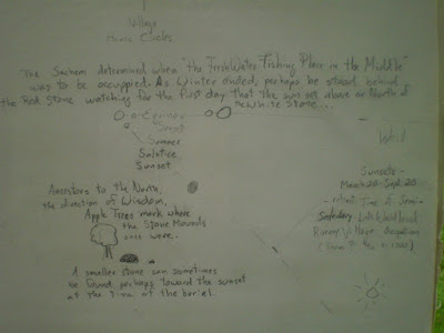
Besides the small rock piles and structures down at the very head of the brook there was also a big old pile that might have been pure field clearing debris or something more structured. So the smaller piles are easier to identify as Native American. Here is the big pile seen beyond a stone wall, on the side of the gully at the very top of the gully:Here is another view from the side, facing back down the valley:It might have been a platform pile. It is certainly located where other platform piles occur at the headwater of a small brook. Or is that internal structure I see in the tumble of rocks?The point I wanted to make was that land use can be seen in the ground cover, the footing, and the plants. That alone destinguishes this little brook headwater. The presence of rock piles confirms the land use rather than - turning the logic inside out - it being taken as a proof of the meaning of the rock piles.

Wednesday, October 01, 2008

Alignments

Looking for something else, I came across a bunch of different drawings (and a photo) in my sketch books, some with dates, some without - including something that resembles the Stupid Sheet just posted. I think I was trying to represent a "Web of Life," using a drawing of the Calendar Stones, and I see I wrote, "Circles, cycles, functions of stonework, everything connected to everything" at the bottom of the page.
The page before has some quotes scribbled on it:
"Man did not weave the web of life, he's a strand of it. It is all connected," attributed to Chief Joseph, as well as a quote from my good friend Wendell Deer With Horns (who watched the vernal equinox sunset over the stones with me) who said, "People forget it's all connected," as we talked about the Mystery of the Stones.
I find I used some compass alignments and some math, mostly to figure out the Summer Solstice Sunset since the leaves on the trees block the view - the actual view in a particular place as observed by Native people being the most important thing.