Took a walk in Estabrook with Concord Author Stuart Weeks (pictured here with an umbrella magnolia leaf):
Showed him some rock piles:
Speaking of rock piles with special rocks:
Tuesday, November 05, 2013
Monday, November 04, 2013
Exeter Cairns
From Norman Muller, re Larry Harrop:
Larry sent me the attached article.... While the article is well researched and well written, it comes to the inevitable conclusion that the stone mounds are colonial, since, of course, "the Indians didn't construct with stone." Larry found the article on the Exeter Historical Association website/blog.
[Larry writes:]
I lead a field trip to this site a year or 2 ago. This is where there is a ring of stones with a manitou stone with donations. I guess people are finally starting to notice.
http://www.yorkerhill.com/eha/Stories/Exeter_Stone_Stacks.pdf
Northfield Mountain, Northfield, MA rock piles
Mike Leonard (a forestry consultant) writes:
I wrote a few months ago about the stone monument in Northfield ...Attached are a few photos of an area of many stone piles (about 1/4 of an acre) on another area of the mountain.
There are very few stone cultural artifacts on
the mountain. Perhaps many were destroyed when the reservoir was built in the
70’s (for pumped storage hydroelectric). But I was very curious to see what you thought
of these piles. By the way, the “niche” had a stone “cover” on top.
Contact info:
Saturday, November 02, 2013
Friday, November 01, 2013
Finally! It is raining and time to look for arrowheads
I am guessing Chris will be happy about the rain.
Thursday, October 31, 2013
“He’patina”-the shrine symbolic of the Middle of the world
Photo from: http://www.harvard-diggins.org/Burbank/Burbank_Among_The_Indians/css_version/chapter_3.html
"As the two proceed through the village Shu'laawi'si sprinkles meal into the six excavations which have been made to receive the prayer plumes; then, preceded by his attending ceremonial father, he recrosses the river and joins the other personators of the Council of the Gods at He'patina.The Council of the Gods on arriving at He'patina, the shrine symbolic of the Middle of the world, and deposits
te'likinawc in the lower chamber of the shrine..."
Update: I'm skimming through the Google book in the link above, a late 1800's ethnology from around Zuni, New Mexico. Here's Figure 2, an "ancient sun shrine:"
Rhombus
Rhombus in a row on an outcrop in Woodbury CT...
...reminds me of a much larger one in Woodbridge CT.
Boulders and ledge at "Rock Pile Cave"
The name of the Rockshelter caught my eye; it's called Rock Pile cave...
I lifted the photos here:
Then I found this:
This is east of the Connecticut River, in Middletown CT, briefly described here:
The ball court
I got a link from the "PeopleOfOneFire" about a Mayan style ball court found in GA, near Track Rock Gap.
There is a discussion of how this structure was lost then re-discovered recently. They compare it to a ball court in Chontalpa, Chiapas Mexico but I cannot find a reasonable picture to compare with the above visualization.
It did remind me of something else I saw recently in an old post here by Tim M. entitled "More Circular Walls". This is from West Virginia:
No idea if that was a ball court.
Here is one I saw at Wupatki in Ariz:
(Blogged about here.)
I cannot remember where I read that the Iroquois brought lacrosse with them when they migrated into New York from the south but it is a matter of pride that the first team sports were invented in America and I wonder: how universal were ball games back in prehistoric America a thousand years ago?
Ball court in Sautee-Nacoochee Valley National Historic District - Georgia
There is a discussion of how this structure was lost then re-discovered recently. They compare it to a ball court in Chontalpa, Chiapas Mexico but I cannot find a reasonable picture to compare with the above visualization.
It did remind me of something else I saw recently in an old post here by Tim M. entitled "More Circular Walls". This is from West Virginia:
No idea if that was a ball court.
Here is one I saw at Wupatki in Ariz:
(Blogged about here.)
I cannot remember where I read that the Iroquois brought lacrosse with them when they migrated into New York from the south but it is a matter of pride that the first team sports were invented in America and I wonder: how universal were ball games back in prehistoric America a thousand years ago?
Tuesday, October 29, 2013
My father's woods - Elderslie Preserve in Woodbridge CT
As part of putting my father to rest, I had occasion to
drive back to where I used to live in Connecticut. I interacted with people
on Friday and, early on Saturday, drove myself out to the family house on Rock
Hill Rd in Woodbridge. It was still dark when I got there, so I spent an
hour driving around back roads north of there, in Beacon Falls. Then, when it got light
enough, I drove back to Woodbridge, passing a few other things that seemed
faintly familiar: a turn, a house, a road that maybe led to my junior high
school. Thanks to Tim MacSweeney I knew that the Elderslie Preserve in Woodbrige had rock piles, and I knew it was on Peck Hill Rd across on the other
side of the same hill from my old house, so I went to take a walk there. One
time my father and I went all the way through from our house to Peck Hill Rd,
so I knew there was continuous woods and I was thinking of walking in from the
other direction. The "Judges' Rock" is in there and I hoped to see
it.
I have to say that these Connecticut woods are gorgeous: little undergrowth; yellow, red, and brown leaves on the ground. And dark tree trunks rising up from the brightness underneath and massive stone walls undulated along. After parking, I stayed to the right and saw rock piles immediately. I did not have a camera. Were the piles a familiar type of pile? I formed a general impression. Having gotten up at 4 AM Friday to drive down there, and after getting up at 5:45, after little sleep, I was walking around in a bit of a daze.
At every turn I came across places that seemed a little
familiar and seemed like someplace I had been with my father. And who could I
tell about finding rock piles there? We were blind to such things back in the
60's. So I stayed to the right and over the hill (heading roughly southeast)
and down into the valley - because that is what the topo map suggested when I
looked it over in preparation for this trip. And there were little clusters of
two or three piles every few minutes. The rocks were a pretty black with grey
lichen. At the foot of the slope a couple of piles, each with a beautiful piece
of quartz at the center. Quartz is not common around there. The bedrock is a schist-like
material called "Orange Phyllite". Seeing this material again, I
remembered how I used to collect garnets that erode out of its surface. And I
kept remembering little bits and pieces of the place. Down in that valley,
there was an obvious trail along the wetland (with rock piles every hundred
yards) and I remembered the Ansonia Trail - it was part of Connecticut's
"Blue Spot Trail System" - which we used to explore. Walking in the
woods was one of the few things my father and I did together. So I remember one time
following the Ansonia Trail west, as far as we could go. Back then the trail
disappeared near the edge of a swamp over by Peck Hill Rd.
Today, I might have better luck finding the trail
because my eyes have learned to see subtle things. For example in these woods, there were
trails everywhere, crisscrossing the place. We have to conclude: either the
Pecks were Indians, interacted with Indians, or never disturbed what was
already there when they owned the place. Surely almost no-one has gone into
these woods since then. The rock piles were everywhere. This is a big ceremonial
area and one wonders: why? My guess is that the wetland I mention is one of the
sources of the Naugatuck River, and Peck Hill - with its "Judges'
Rock" is a significant landmark for the area. The reason for the name
"Judge's Rock" was it was a well-known Indian lookout - from
which one could watch New Haven and the coming and going of troops. I think
Mavor and Dix may write about how the Indians helped those Judges (they were
the ones who condemned Charles I to death, who were on the run later on, when
the monarchy was restored). And I walked up, and I walked down, I explored
behind a bush and found a little stone box that looked recent. And I came to a
flat area and remembered being there alone and maybe being there also with my
father. And this time I could see rock piles in almost every direction. The
largest I had seen - and they look a lot like what I call 'marker piles" -
but with an unstructured layout. And I walked to the north edge, looking down into
the valley, remembering the roads and little foundations on that slope and
discussions we had about what kind of small village must have been over there.
All these small things I had forgotten. As a child, I used to dream of Indians in those
woods, I used to imagine them sitting on the same rock where I would camp.
Now I see signs of the Indians everywhere. I wish
someone could have shown them to me when I was a child.
I want to say that as you get older, there is an increased desire to somehow express the infinite. Express the relationship one has with parents and children or (for me) between my father and my sons. And as I am walking along feeling somewhat poetic, I realize that the rock pile itself is the best possible expression of these things. It seems more permanent but it also will vanish eventually. Hoping I can show these woods to my sons, I am filled with sorrow about how time passes.
Monday, October 28, 2013
Friday, October 25, 2013
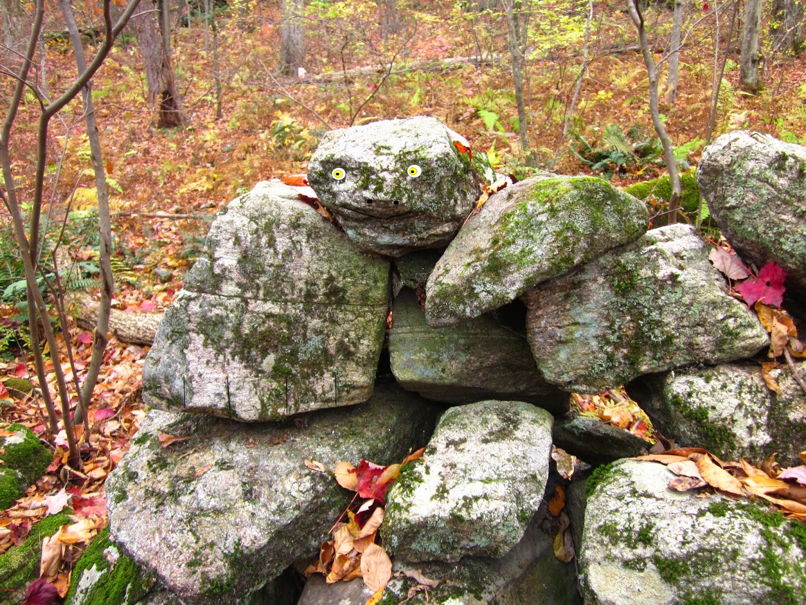
What IS That?
http://wakinguponturtleisland.blogspot.com/2013/10/what-is-it-stones.html
And some Turtles too (of course):
http://wakinguponturtleisland.blogspot.com/2013/10/quonopaug-turtles.html
And some Turtles too (of course):
http://wakinguponturtleisland.blogspot.com/2013/10/quonopaug-turtles.html
(And new trail maps I haven't even scoped out yet:
This would be on the section marked #28.)
Thursday, October 24, 2013
Bird?
The above photo prompted Mr. JimP to comment elsewhere: "Love that boulder worked into the shape of a bird head. Those are *all* over New England."
I did respond with the eventual posting of a photo:
(I used it here once: http://wakinguponturtleisland.blogspot.com/2011/06/rock-piles-in-pines.html)
This boulder, perhaps 3 or 4 feet in diameter, was found while walking along what you really could call a "terrace-like stone row." There was wet land below and I stepped up to higher ground after looking at the lower east facing side. I call this photo below evidence that it was modernly farmed:
Now there were some rock piles of sorts and other boulders here and there along this row:
There was even a little segment jutting out at a right angle from the terrace-like row, into the one time field, now succeeding back into wooded land trust property:
Modern field clearing by farmers too lazy, too tired or possibly too intoxicated, to add to the "stone wall" reminder of our agricultural past, or something older, ceremonial in nature, that's even older?
The Bing link: http://binged.it/1fXtKXT
Subscribe to:
Posts
(
Atom
)
(1).jpg)
.jpg)