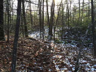
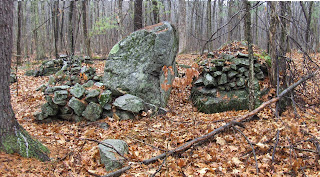
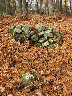
On the hill to the west of the lower blue dot (here) a couple of subtle things:
If you look closely, there are 4 rocks visible on the surface, in a slight curve. Statistically impossible, this must be the work of man. Another view from off to the side, where there was a white rock.
Near there, a low place. Is that another?
No, it is part of a larger structure:
The Wilder Brook area is full of things to look at. One notes it is a portage place between the CT and Merrimack river systems.
Tuesday, December 13, 2016
Monday, December 12, 2016
A couple of rock pile sites along Wilder Brook in Winchendon
I am not worried about vandals damaging these places. They are so far gone, who would spend sweat digging into them - with no hope of a find in sight?
The "almost nothing" from last week (click here) was located at the lower blue outline. And I mention it in the context of all these other "top of the ravine" places. This one was as beat up as the one from Townsend. I mention these particulars because they are recent not because they are unique.
The upper blue outline was a small marker pile site.
Closeup of old mound at Wolf Brook start
I had pretty much given up hope of finding anything on an otherwise pretty barren hillside and was headed back down following a wet place between the private properties and got onto higher ground as soon as possible, which immediately took me to some rocks on the surface and then, suprisingly, a mound just where it was supposed to be. At the top of a gully, as I showed here.
Another picture:
I forgot my camera and am not used to the cellphone.Nevertheless, this is a traditional site. There were a few other traces across the way:
I am hoping to make the point that these ravine 'tops' seem to be the prime real estate.
Another picture:
I forgot my camera and am not used to the cellphone.Nevertheless, this is a traditional site. There were a few other traces across the way:
I am hoping to make the point that these ravine 'tops' seem to be the prime real estate.
Sunday, December 11, 2016
Invisible Mounds - invisible but necessary
There is something poignant about the mound there, a bit to the left in back, almost invisible. Houses a few feet beyond.
I gotta say this location is very very typical. So much so, that the placement at the tops of ravines (this is above Wolf Brook, Townsend) cannot have been optional.
Maybe this is a good time to post a similar location from Carlisle: this is visible to the west from Lowell Rd, on the way to Concord. This is also at the top of a ravine, in a similar disposition but looking much fresher:
So, what I am saying is that no gully goes un used. Compare locations: in Townsend vs in Carlisle:
It suggests a required behavior.
Saturday, December 10, 2016
Wednesday, December 07, 2016
Almost nothing...in the middle of almost nowhere
A large stone mound along the side of a ridge:
Another view:
That's laid up rock. But almost gone.
I wasn't sure why bother with a photo like this, looking down from the top:
I see now that it shows a 'notch' of some sort.
Northernmost Gardner MA, west of the road and east of Wilder Bk.
Another view:
That's laid up rock. But almost gone.
I wasn't sure why bother with a photo like this, looking down from the top:
I see now that it shows a 'notch' of some sort.
Northernmost Gardner MA, west of the road and east of Wilder Bk.
Thursday, December 01, 2016
Brown Rd Harvard
You can see things from the car. We spotted a new site in an area I already explored.
So we saw:
and thought it looked a bit rectangular with a bit of a hollow or two.
From the side:
A few other piles in there:
So we saw:
and thought it looked a bit rectangular with a bit of a hollow or two.
From the side:
A few other piles in there:
Nice to get to show these to a son.
Down stream from "Above the Falls"
A place I have managed to keep secret because it is special to me and delicate. Went with my son and saw a couple new things a little downstream from the main site.
A collapsed "niche" perhaps? We saw no sign of fire on the inside.
A collapsed "niche" perhaps? We saw no sign of fire on the inside.
Lessons in Forest Forensics
“Tom Wessels... is
the author of Reading the Forested Landscape, a guide to discerning the history
of virtually any piece of wooded land, and on Saturday afternoon (in 2013), he
led a group of interested folks through the forested landscape of the Hennig
Preserve up in the Town of Providence at the western edge of Saratoga County...
Near the end of
our walk on Saturday, we came across several piles of rocks in the woods that
by Wessel's own admission didn't conform to any of the theories he had
posited. But that's okay. I like to think that some mysteries remain
that have yet to be explained.”
Wednesday, November 30, 2016
Ceremonial Stonework - new book
Jeff in RI writes:
A new book published by Mark Starr, Ceremonial Stonework I'm sure would be of interest to the readers of your blog.
Tuesday, November 29, 2016
coming up
I vegetated over Thanksgiving. Got out with my son, though:
And showed him some of my favorite things.
Perhaps a view from another direction would be helpful:
And showed him some of my favorite things.
Perhaps a view from another direction would be helpful:
Short spurs of stone wall at Half Moon Meadow - Boxboro
Off Sargent Rd in Boxboro you can see the rock piles from the road at Half Moon Meadow conservation land. We saw some piles (see here) and some short stretches of wall. Thought I would pass these along:
And:
These were on top of the last rock there, which...yeah...I guess it looks like something.
Whether that is a "head" or just a resting place for colorful rocks, I don't know.
And:
These were on top of the last rock there, which...yeah...I guess it looks like something.
Whether that is a "head" or just a resting place for colorful rocks, I don't know.
A fieldtrip in Boxboro
From the remaining vertical facing and from a general impression that these piles all were slanted in the same way, I get the sense of a calenderical function. Also, other things:
and a hint:
We also saw some piles over by the railroad, that did not photo too well. I had explored in there before but Dave found some things I missed right next to the brook.
Boxboro is a town that "never disappoints". We passed a conservation land, with rock piles you could see from the road. Off Sargent Rd at "Half Moon Meadow": Looking at it: it seems to be a pathway leading up to the outcrop, and then along it. Thanks David.
Sunday, November 27, 2016
Saturday, November 26, 2016
How the archaeological review behind the Dakota Access Pipeline went wrong
by Chip Colwell
November 20, 2016 8.21pm EST
“This summer, Tim Mentz Sr. took to YouTube to
tell the world about the destruction of his cultural heritage. A former tribal
historic preservation officer of the Standing Rock Sioux, Mentz wore a baseball
cap, rimless glasses and two thin braids of graying hair. He was upset and
spoke rapidly about the area behind him, an expanse of the Great Plains cut by
a new 150-foot-wide road.
Two days before, Mentz
had testified to the D.C. District Court to report the area that lay
in the path of the controversial Dakota Access Pipeline (DAPL) corridor holds
82 cultural features and 27 graves. By the next day, DAPL construction workers graded
the area. Behind where Mentz stood in the video was a place known as the
Strong Heart Society Staff, where a sacred rattle or staff was placed within
stone rings. Here members of the elite warrior society would come to make
pledges. Mentz explained the site is tangible evidence that Strong Heart
members followed a “spiritual path...
Zuni elders Octavius Seowtewa and John Bowannie, and
archaeologist Sarah Herr, look at a shrine archaeologists misidentified. (Chip
Colwell photo)
On another project
I conducted with the Zuni tribe, I watched as elders explained to the
archaeologists excavating a site in the path of a new Arizona highway that they
had placed a survey flag in a semicircle of rocks – which was likely a shrine
used to bless and protect the ancient village. When it comes to traditional
practices, Native Americans see what archaeologists overlook...”Monday, November 21, 2016
Sunday, November 20, 2016
Subscribe to:
Posts
(
Atom
)


