
Showing posts sorted by relevance for query Ashland. Sort by date Show all posts
Showing posts sorted by relevance for query Ashland. Sort by date Show all posts
Sunday, December 06, 2015
Wildcat Hill Ashland
From Curt Hoffman:
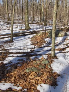
 I took a walk in the Ashland Town Forest yesterday, looking for the two
sites on Wildcat Hill which Peter reported here some time ago. I didn’t
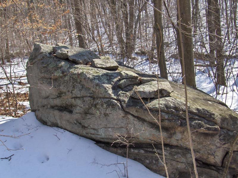
find them, but I did spot a sweet little balanced rock on the northwest
slope of the hill. Notice the rock-on-rock on top!
I took a walk in the Ashland Town Forest yesterday, looking for the two
sites on Wildcat Hill which Peter reported here some time ago. I didn’t
find them, but I did spot a sweet little balanced rock on the northwest
slope of the hill. Notice the rock-on-rock on top!


Sunday, November 19, 2017
Town of Ashland votes to protect Wildcat Hill
From Curt Hoffman:
At Town Meeting on Tuesday, November 14th, the citizens of Ashland, Massachusetts voted to purchase a 34-acre parcel adjacent to the Town Forest, for a sum of $926,000. This parcel includes the well-known Wildcat Hill sites, which have many stone structures. This fact was noted at the meeting and was explicitly one of the factors in favor of the purchase. The Town also voted to expend $40,050 for Town Forest improvements, which will include a 5-car parking lot at the Oregon Road end of the White Trail, which passes by Wildcat Hill, making it more accessible to the public.

Thursday, February 06, 2014
Wildcat Hill, Ashland
From Curt Hoffman:
Since
business has been a bit slow on the rockpiles blog the past few weeks, I
thought I’d share a few images from sites in the Ashland Town Forest –
where I know you’ve [PWAX] wandered. I discovered these sites (with the
exception of the split wedged boulder) in previous trips, but we took
advantage of the nice(r) weather today to get some photos.
The
first site is off the orange trail. It is a large (ca 10’ high)
standing boulder, which appears to me to have been deliberately shaped
so as to create a curved area on the left side. A viewer standing on
what I think may have been the foresight stone and looking uphill at it
would see summer solstice sunset, reasonably accurately (40 degrees west
of magnetic north). There is a small possible stone pile at the base
of the boulder.


The
second site is beside the red trail. I first noticed a simple
rock-on-rock pile, and then I took a closer look at the stone row behind
it. The row is not straight, but is rather sinuous, has an azimuth of
about 30 degrees east of magnetic north, and at a certain point it takes
a bend, heads magnetic north, and ends in a swamp.


The
third site is on the margin of Wildcat Hill, off the blue trail. It is
a large rock outcrop which has been split in several places. But the
most prominent split has several rocks wedged between the split
portions.
The
last site is on the yellow trail, at a point where it turns onto a cart
path. It is a small stone pile, and may be of recent origin. But
there is a short stone row on the opposite side of the path which goes
nowhere. There is also a split filled boulder nearby, but we couldn’t
relocate that today


Below is a bit of USGS map showing the locations of these sites, as well as some of the ones you’ve recorded. The boulder is 1146; the sinuous stone row is 1029; the split boulder is 1160, and the stone pile is 1013.

Wednesday, March 12, 2014
Dogwood Lane Sites
From Curt Hoffman:
In going through the information on Massachusetts sites at the NEARA Archive, I found a listing for a “Dogwood Road” site in Ashland, with no accompanying information except a site location. Since this is my home town – but GoogleMaps lists no such street there -- I decided to have a look yesterday. It turns out that the site is located at the end of Dogwood Lane, in Hopkinton State Park (but in Ashland). While the snow was deep enough that I didn’t want to get closer to the site, I did take some pictures from the road. There is a stone row, with what appear to be a couple of large piles, and on the far side there is a split boulder. The latter was half-full of snow, so I don’t know whether it has any rocks filling it. I plan to return there once the snow clears to check!


In going through the information on Massachusetts sites at the NEARA Archive, I found a listing for a “Dogwood Road” site in Ashland, with no accompanying information except a site location. Since this is my home town – but GoogleMaps lists no such street there -- I decided to have a look yesterday. It turns out that the site is located at the end of Dogwood Lane, in Hopkinton State Park (but in Ashland). While the snow was deep enough that I didn’t want to get closer to the site, I did take some pictures from the road. There is a stone row, with what appear to be a couple of large piles, and on the far side there is a split boulder. The latter was half-full of snow, so I don’t know whether it has any rocks filling it. I plan to return there once the snow clears to check!
Thursday, June 02, 2016
"To Walk" - a list a places that look worth visiting
Thought this might be slightly interesting. Current list of suggested walks:
To walk:
To walk:
- Just east and south of Flat Rock Hill, Dunstable
- SE of Ashland REservoir
- southwest of easternmost Trout Brook (and a bit to the northeast wouldn't hurt either) scanlon brook.
- East of Stagecoach Rd.
- Nobby Hill MAson
- The rest (downhill) of from Wittemore Hill
- Russell Hill Brookline NH, has a trail through it on Mapnik.
- Rock Hill on boundary of Ayer - look to the southern innards.
- STILL RIVER, harvard. Worth a quick look at a couple of water sources
- A valley SE of West Bare Hill and Scott Rd, harvard
- Bottom of Vaughn Hill, near 110
- Between Wausachuum Ponds in Stirling/Clintton - "Kendall Hill"
- Stillwater River in general has feeder brooks to explore.
- Wallace Brook Upton.
- MA/NH border north of Dracut: Burns Hill etc.[been ther. 2 small sites]
- NOrtheast of Lake Shirley. A couple of spots.
- East end of Sherburne Rd In NH south of Gumpas: Fred. Memorial...cons land.
- "Percival Lot" next to 190 have not been explored enough.
- Tully Mountain Royalston - what the heck.
- Any bits of woods where 495 crosses Stowe Rd 0 including the median.
- Southernmost Wachusett reservoir, a hill under the “BOY” of “Boylston, written vertically on topo map.
- Hill NE of South Berlin [too small]
- E of Sawyer Hill Rd, across from Gates Pond.
- South of Mt Pisgah, north of 290.
- Many big woods north and west of Wachuestt reservoir, east of 190 (gimme a break!)
- A big empty woods in Westwood - Deadham Town Forest
- Lower Westboro Reservoir
- Northeast Dunstable.
- places in pepperel.
- North of Wright Ponds
- (Also) Along Wares Rd, Fitchburg (border of WBSF)
- Fay Mountain in Westboro, behind the water tank.
- Between New West TOwnsend Rd and Pearl Hill Rd. The souther part is boring but
- the northern part was not explored.
- --------------------------
- NW of L Whitehall [DONE]
- Lovell REservoir in northern Fitchburg is accessible from Scott Rd side. [DONE THAT NOW I THINK. and it was great!]
- East of Redeption Rock Rd, both north and south of Hobbs Rd.[DONE THAT]
- Oak Hill Ashland [YOU WERE THERE LONG AGO]
- Westmister State F. near border with Hubbarston - Wright's Pond and
- Partridge Pond. [DID IT...? DULL]
- North and East of Bare Hill Sherborn (so so)
- just west of little Wachuesett (2 small sites at gullies)
- NW of Witch Brook in Townsend. Park on Gilchrist Rd. Big empty woods. (SANDY?)
- East or Richardson Rd, Fitchburg. (Park on Rt 31)
- NW of Ashby Reservoir (southwest of Blood Hill)[NAAH was dull]
- Benjamin Hill Shirley [Been there, one boxmound]
- Groton Woods (west of claypit hill) [DONE. GOOD STUFF]
- Directly north of "Sudbury" Center there is a cons land "Haynes Farm". Actually more than one swamp edge sort of place.[Been THERE. Found stuff.]
- Broadmoor cons land, east of Brush Hill Sherborn And other hills (Pine, Peter's) there to do.[ALL PRETTY SANDY. SMALL POTATOES ON PETER'S HILL]
- GOSPEL HILL in Hudson - park at the school [NOT ENOUGH WOODS THERE]
- Upper Catacoonamug in Lunenburg is a conservation land. [BORING]
- North of Barrel rd, northwest of Muddy Pond. [Boring slog in winter.]
- North of Horse Hill, just across Groton Rd. [Dull on both sides if road]
Monday, March 12, 2007
Ashland Knoll site: Odds and Ends and dating - part 2A
 Here is a striking rock pile. Simple, impossible to see as farming related. This location, on a knoll in the middle of a rocky wet swampy area, is far from any plowable fields. And look at that arrangement.
While I am continuing discussing the "Ashland Knoll" site, let me mention that there were a number of outlines on the ground made from rocks. To me, these suggest more viewing locations or "seats"
 They look to have been relatively recent - these component rocks are not covered with much lichen. And mixed in with one was this bit of green plastic table cloth:
  This reminds me of something from the fifties, or perhaps a little earlier. And it makes me think the site is not too old. Perhaps 60 years or so. Combined with a measure of the amount of pile damage, this creates the possibility of calibrating rock pile half-life [Click here] - which I go on and on about. Here is a typical pile:
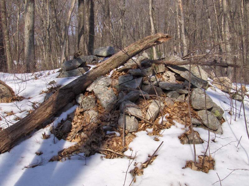 So there is something to go on. But lets not focus on that here. A point to make, relative to the green plastic table cloth, is that this site was in use relatively recently.
Some sites in Ashland, MA - part 1
I went south of the Mass Pike to explore, hoping to avoid snow. This took me to Ashland, MA. Instead the crust was just slicker than usual. I had barely stepped into the woods, when I saw a large mound of some sort and was very happy to see it was a large rock pile: Here is another view:
  This a bit reminiscent of the large "roadside attraction" in Harvard, which I illustrated a couple of weeks ago [Click here]. They certainly look similar in the snow. But this 'mound' has what appears to be damaged structure, which you can see a little in this photo:
  Perhaps there was an inner 'cist'. This is a little different from the pile in Harvard. Also unlike other large piles I have found, which often are isolated, here there seemed to be a few other structures nearby. This looked a bit like the remnants of a viewing location or "seat":
 But check out the rock it is sitting on:
 Look closely. That is quartz and not snow on the rock. Really impressive up close. And also nearby, the hint of another pile. Seen closeup, I wish this was cleaned off a bit:
 Later in my walk I found smaller, more typical, rock piles. These initial larger 'mounds" could be outlying features of the same site, or could represent work of a different culture. I don't know how to tell; just that these big piles are different.
Also nearby, a pretty little stone lined spring. As usual, the piles are near where water comes out of the ground.
 After this I explored outward from this site. In a couple of places I saw other isolated rock piles. I also explored around a prominent knoll. With this tree growing near the top of it, I am confident this was a place where people looked out over the scenery.
 There were a number of prominent outcrop/knolls visible from this first one. So I was wondering if possibly the big 'mound' would be visible from here and whether it was substituting for a natural outcrop - filling in a gap in the 360 degree view from this spot. Now, pay close attention because that is a thought that gets echo'ed over and over during the weekend, which I will try to describe in part 2.
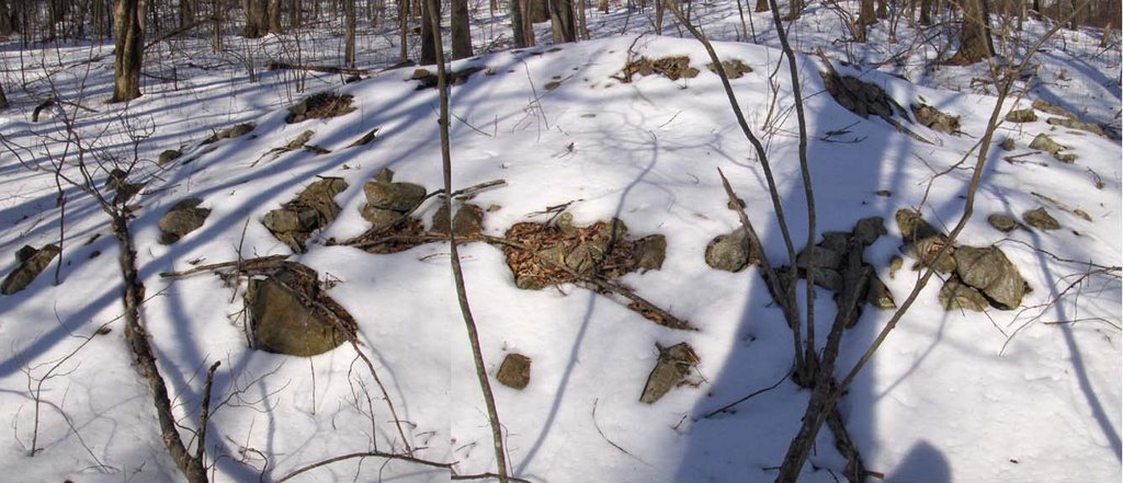 Here is another view:
 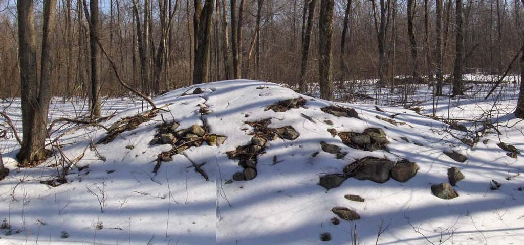 This a bit reminiscent of the large "roadside attraction" in Harvard, which I illustrated a couple of weeks ago [Click here]. They certainly look similar in the snow. But this 'mound' has what appears to be damaged structure, which you can see a little in this photo:
  Perhaps there was an inner 'cist'. This is a little different from the pile in Harvard. Also unlike other large piles I have found, which often are isolated, here there seemed to be a few other structures nearby. This looked a bit like the remnants of a viewing location or "seat":
 But check out the rock it is sitting on:
 Look closely. That is quartz and not snow on the rock. Really impressive up close. And also nearby, the hint of another pile. Seen closeup, I wish this was cleaned off a bit:
 Later in my walk I found smaller, more typical, rock piles. These initial larger 'mounds" could be outlying features of the same site, or could represent work of a different culture. I don't know how to tell; just that these big piles are different.
Also nearby, a pretty little stone lined spring. As usual, the piles are near where water comes out of the ground.
 After this I explored outward from this site. In a couple of places I saw other isolated rock piles. I also explored around a prominent knoll. With this tree growing near the top of it, I am confident this was a place where people looked out over the scenery.
 There were a number of prominent outcrop/knolls visible from this first one. So I was wondering if possibly the big 'mound' would be visible from here and whether it was substituting for a natural outcrop - filling in a gap in the 360 degree view from this spot. Now, pay close attention because that is a thought that gets echo'ed over and over during the weekend, which I will try to describe in part 2.
Wednesday, March 14, 2007
A knoll marker pile site - Ashland MA
If you have been following the narrative since last weekend, you'll recall I found a site on a knoll where I could view all the rock piles from one high point at the center of the site [click here]. This contributed to the thought that some marker pile sites might be organized with piles located on lines radiating out from a viewing position above the piles [click here]. The day after finding that site I found another site further uphill in the same part of Ashland. Here is how the hypothesis came into play:
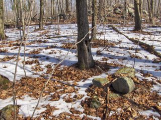 I was walking up a long slope and coming to a more level shoulder with a small knoll or outcrop when I saw a solitary rock pile (shown above). Since isolated rock piles are rare, I thought maybe this one was meant to be viewed from above on the nearby knoll and that, if I went up there I might see some other rock piles - assuming this was organized as a collection of rock piles visible from a high point. Here is a closeup of the outcrop. Note the little bit of stone wall up there.
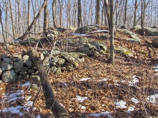 As I climbed to the top, I was already scanning the slope beyond it and thought I saw one pile and maybe a second one. When I went down to look there were actually lots of piles (~10) hiding in the dead leaves. Here are two examples:
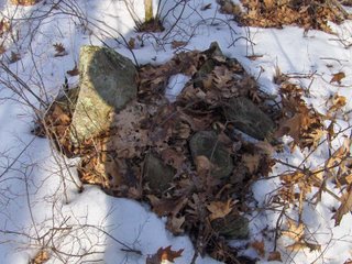
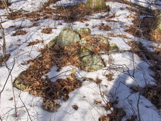 Note the larger pointed rock in the same relative position in the pile in each of these pictures. I call this type of pile "marker piles with a pointer" - the idea being that perhaps the pointed rock marks a location more precisely than the entire pile; and also that the entire pile may serve the purpose of creating a platform for the pointer. [Click here for previous discussion]
As I circled out further and further from the knoll, whenever I found another rock pile I would glance back to see if the knoll was still visible; and it was. In turn, the pile would be visible from the knoll. Then I came to a line of three piles (the picture is high res if you click on it):
 Sure enough when I looked back to the top of the outcrop, it was exactly in line with these piles. Note also the pointer in the middle one.
I continued circling outward. Here is a view back towards the knoll:
 There were walls emanating from the outcrop but not lined up - not that I could see. Rather than enclosing the area of the rock piles, one wall seemed to run down the side of the site and then stop, as if the wall end itself was a feature to be seen from the knoll. I should also mention that this wall along the side of the site was interrupted by a a store ring, possibly a fireplace:
 All and all I would not expect a normal fire circle in a place like this. I am not sure I saw any signs of charring, but I did not look too hard.
Further down hill, beyond the wall end, the features continued. But rather than being normal rock piles they were made of larger fragments and were overall larger. I kept looking back about 100 yards to see the knoll and thinking "of course the piles are getting bigger - they need to still be visible this much farther away"
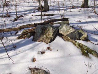 I continued outward a bit further and then circled around to the west a bit and over towards another little highpoint - a second knoll. It was getting so every rock that pocked above the snow was getting a suspicious look from me. And as I came up to this other little high point, I saw a rock-on-rock, then a pile or two and then larger piles over on the downslope a few feet beyond (see video which remains to be posted).
 These are even more substantial piles than before. They are downslope from another small knoll but I was not sure if they were still visible from the first knoll or rather part of a new organization around the second knoll. One advantage of the "radiating line" hypothesis is that it accommodates the possibility of multiple viewing locations with a second or even more groups of piles on lines radiating outward from other viewing positions. Let's have a look at a couple of these larger piles:
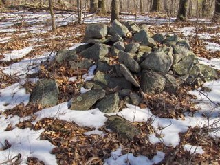
 Please note that this last picture shows a pile with a flat face towards the camera. I find it very interesting that this flat part is facing away from both the near and the far knolls. Either it is to be viewed from somewhere else or this tells us a first clue about these flat faced piles (click here for earlier discussion of flat faced piles).
So I'll leave it at that for now. We had a slight confirmation of the hypothesis of radiating lines from a viewing position above the piles. In this case I was expecting the rock piles before I saw them because I found one pile near a knoll and I supposed this might be a site with radiating lines. It is also very interesting that the majority of piles were to one side of the knoll. It is also very interesting that an example of a flat faced pile appeared to be facing away from the viewing positions. So now we have a couple of research questions to pursue:
 I was walking up a long slope and coming to a more level shoulder with a small knoll or outcrop when I saw a solitary rock pile (shown above). Since isolated rock piles are rare, I thought maybe this one was meant to be viewed from above on the nearby knoll and that, if I went up there I might see some other rock piles - assuming this was organized as a collection of rock piles visible from a high point. Here is a closeup of the outcrop. Note the little bit of stone wall up there.
 As I climbed to the top, I was already scanning the slope beyond it and thought I saw one pile and maybe a second one. When I went down to look there were actually lots of piles (~10) hiding in the dead leaves. Here are two examples: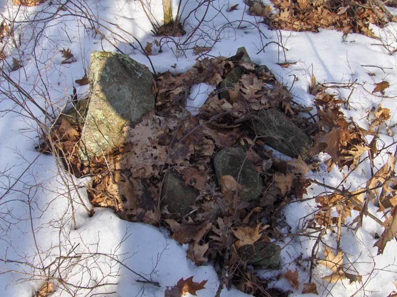
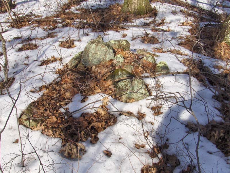 Note the larger pointed rock in the same relative position in the pile in each of these pictures. I call this type of pile "marker piles with a pointer" - the idea being that perhaps the pointed rock marks a location more precisely than the entire pile; and also that the entire pile may serve the purpose of creating a platform for the pointer. [Click here for previous discussion]
As I circled out further and further from the knoll, whenever I found another rock pile I would glance back to see if the knoll was still visible; and it was. In turn, the pile would be visible from the knoll. Then I came to a line of three piles (the picture is high res if you click on it):
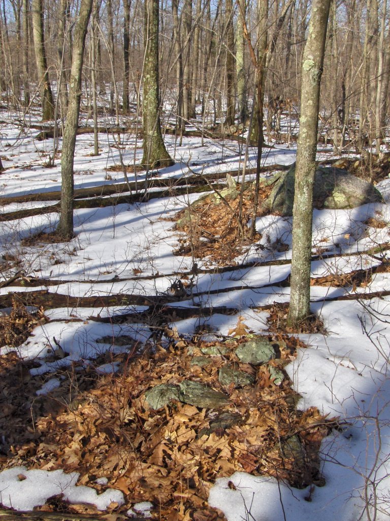 Sure enough when I looked back to the top of the outcrop, it was exactly in line with these piles. Note also the pointer in the middle one.
I continued circling outward. Here is a view back towards the knoll:
 There were walls emanating from the outcrop but not lined up - not that I could see. Rather than enclosing the area of the rock piles, one wall seemed to run down the side of the site and then stop, as if the wall end itself was a feature to be seen from the knoll. I should also mention that this wall along the side of the site was interrupted by a a store ring, possibly a fireplace:
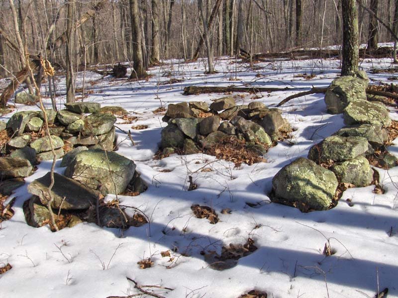 All and all I would not expect a normal fire circle in a place like this. I am not sure I saw any signs of charring, but I did not look too hard.
Further down hill, beyond the wall end, the features continued. But rather than being normal rock piles they were made of larger fragments and were overall larger. I kept looking back about 100 yards to see the knoll and thinking "of course the piles are getting bigger - they need to still be visible this much farther away"
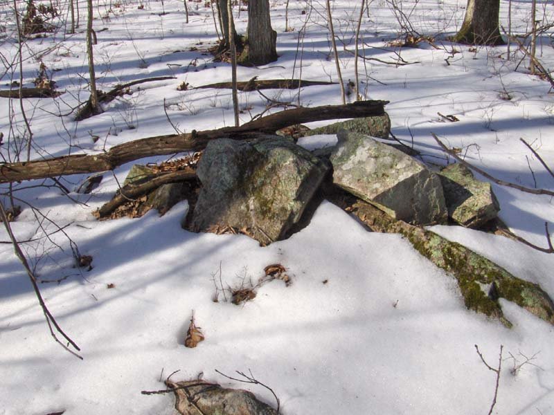 I continued outward a bit further and then circled around to the west a bit and over towards another little highpoint - a second knoll. It was getting so every rock that pocked above the snow was getting a suspicious look from me. And as I came up to this other little high point, I saw a rock-on-rock, then a pile or two and then larger piles over on the downslope a few feet beyond (see video which remains to be posted).
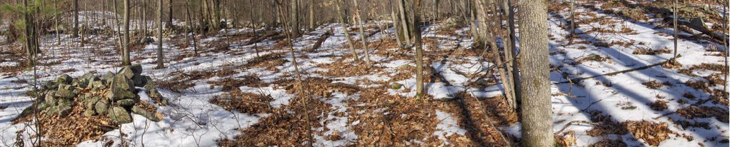 These are even more substantial piles than before. They are downslope from another small knoll but I was not sure if they were still visible from the first knoll or rather part of a new organization around the second knoll. One advantage of the "radiating line" hypothesis is that it accommodates the possibility of multiple viewing locations with a second or even more groups of piles on lines radiating outward from other viewing positions. Let's have a look at a couple of these larger piles:
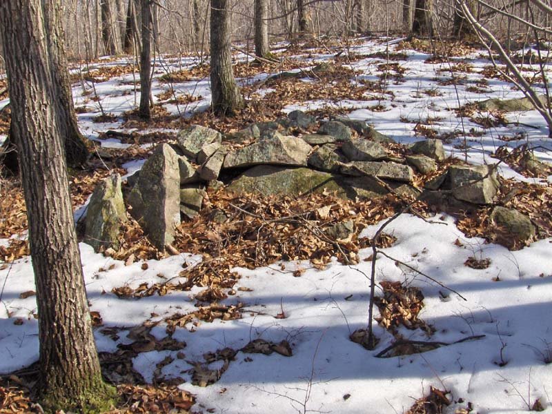 Please note that this last picture shows a pile with a flat face towards the camera. I find it very interesting that this flat part is facing away from both the near and the far knolls. Either it is to be viewed from somewhere else or this tells us a first clue about these flat faced piles (click here for earlier discussion of flat faced piles).
So I'll leave it at that for now. We had a slight confirmation of the hypothesis of radiating lines from a viewing position above the piles. In this case I was expecting the rock piles before I saw them because I found one pile near a knoll and I supposed this might be a site with radiating lines. It is also very interesting that the majority of piles were to one side of the knoll. It is also very interesting that an example of a flat faced pile appeared to be facing away from the viewing positions. So now we have a couple of research questions to pursue:
- Can a central viewing position be located at some of the other sites I call "marker pile sites"?
- In what directions are the lines radiating? Is there any commonality between different such sites as to the directions used? If so, what is the meaning of that direction?
- If we determine a high point viewing position at some of the other sites with flat faced piles, how are the flat faces oriented with respect to the viewing location?
Monday, November 19, 2012
Showing a student around Cawassock Woods
There is lots of stuff at Cowassock Woods and adjacent Wildcat Hill in Ashland, so I thought it would be a good place to walk around and talk to a student from Bridgewater State doing his senior thesis on rock pile site characteristics and their distributions.

Walked around for more than an hour and managed to miss the bulk of the sites on the hill. Did see this one nice collapsed structure built into the split of a large boulder.


Did also see faint terracing around a large collapsed chambered mound

(note: it and the previous mound in the split boulder both had big "hollows").
The conversation reminded me of some things I feel bad about. I was reminded of my relation to the community of people at large who are interested in Native American ceremonial structures. A community I am not all that close with. And I kept hearing ideas - bad ideas - I sent out into the ether myself 10 years ago. Or ideas from Mavor and Dix. A lot of it sounds wrong to me today. For example "standing stones". Are they really a separate category? Or, for example, is it good to automatically identify piles that have a single larger rock as "turtle piles"? Are the compass directions, as interpreted by today's Indians, as sacrosanct as we think? Are long range inter-site alignments real?
Years ago, when I had only seen a handful of sites, I was full of speculation. But later, after seeing hundreds of sites, many of those speculations seem silly. The whole process of speculating before observing looks worse today than it used to. And here was a student with theories who had never even seen a rock pile.
This gets to the root of my discomfort about the community of speculators, at large. There is not enough observing going on and in the rush to get towns to accept that these sites are sacred Native American artifacts, we may accept non-science. Or is bad science OK if it protects rock piles? [Sorry to be so inarticulate.]
Tuesday, January 01, 2013
2012 review
What a great year it has been for rock pile hunting. There were 73 picture folders in 2012. Here is a sampling (somewhat selective):
Falulah West (Fitchburg/Ashby):
 Tenney Rd (Westford):
 Greystone (I forget):
 Townsend State Forest:
 French Str (Dunstable):
 Rogers Land (Lincoln):
 Gibbs Environment (Framingham):
 Gates Pond SE (Berlin):
 Peter Hill (Hopkinton):
 Hobbs top (Lincoln):
 Fitchburg High school:
 Alpine Hill (Fitchburg):
 Scott Rd (Fitchburg):
 Oak Hill (Littleton):


 Scott Reservoir (Fitchburg):
 Muddy Pond extended (Westminster):

 Midway (Acton):
 Hopkinton:
 Leominster State Forest:

 Palmer Hill NW (Fitchburg/Leominster):

 Beech Tree (Billerica):
 Blood Rd (Groton):
 Blood Hill (Ashby/Ashburnham):

Falulah West (Fitchburg/Ashby):


Buck Hill (Fitchburg):

Pratt Hill (Upton):

Kendall Hill Rd (Ashby):


Flume Pond (I forget):


Cowassock (Ashland):


Subscribe to:
Posts
(
Atom
)