Showing posts sorted by relevance for query mound swamp. Sort by date Show all posts

Wednesday, March 08, 2006

Mound Swamp - by Tim MacSweeney

This is the first of several posts bringing together documents sent by Tim M.

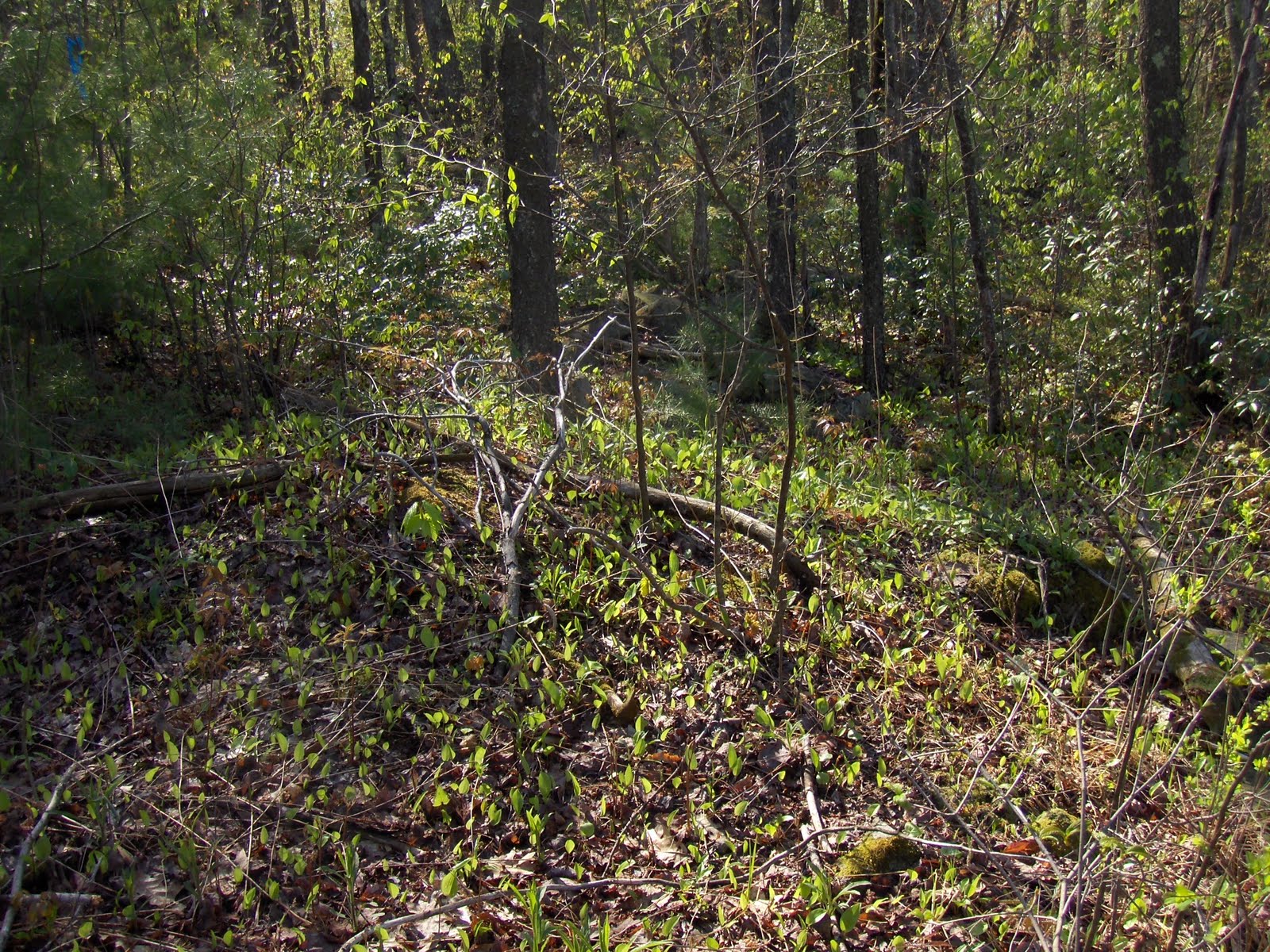
Norman, Peter and I once went up to what I call “The Mound Swamp” to have a look around.
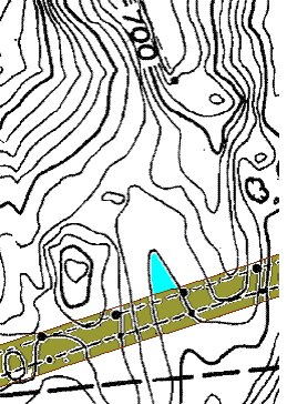
We parked the car at A, walked the power lines B, to “The Mound Swamp” C.
The detail below shows the power-line road in brown, the major disturbance to the topography of the area. It forms enough of a dam at a low point shown in blue so that there’s standing water and cattails. And Frogs.
Now here’s where a nice zoomed in satellite photo would come in handy; we’d have a photo and not just my crude drawings. And where are those drawings? I have to stop now and take a look…

Wednesday, April 14, 2010

Sites with a central "mound" - part 1

I want to describe three sites I saw over the last two weekends. One site in Wolf Swamp Boxborough had an old smeared out "mound" near the center with a very irregular shape, surrounded by a number of rock-on-rocks and low rock piles, as well as a row of stones leading off in one direction for a few yards. The other two sites are from Leominster: the one being just a single smeared out "mound" near a larger rock, with an irregular shape to the mound; and the other consisting of a low "mound" with a distinct rectangular hollow, surrounded by rock-on-rocks and a few "ski-jump" piles. In each case the mound is near the center of activity and with an irregular outline, as seen from above.

Attention to the idea of "rock piles with tails" has led to paying closer attention to such central mounds, even when they are not the most dramatic or well-preserved piles at a rock pile site. Also now, I am paying closer attention to how things are layed out around this central mound. Since I am of the opinion that these mounds with hollows represent burials and since I am of the opinion that things like ski-jumps and short stone rows are related to sky watching; so I am starting to believe these three recent sites are similar and combine something funerary with something astronomical. That's my fantasy but you can judge for yourself whether these "mounds" have anything in common. I asked a colleague one time, how many different types of rituals could be represented by the different types of rock pile sites. He said "infinite". Although I agree there is validity to the view that "no two snowflakes are alike" for rock pile sites, I think it is an anti-scientific attitude. I am looking for similarities and common patterns.

Wolf Swamp conservation land in Boxoborough has a couple of turnouts where you can park. At one, I explored across the street rather than going into the conservation land. I found a wetland and noticed a couple of rock-on-rocks:Then I noticed something larger and pretty old (based on its degree of smearing and its debris cover). I was quite taken with this and took a number of pictures:
In the 2nd and 3rd pictures you can see the irregularity of the piles shape. In particular in the 3d picture, you almost sense two lower dips in the height of the pile. These could be the "hollows" I have been noticing in some larger piles recently.

Nearby this large pile another few piles, maybe a "gap" pile (note the gap opens towards the large mound):A pile with some larger flat rocks:A bit of an "alignment" formed by a loose stone row:
And some slightly larger, "vertical-sided" piles on the other side of the large mound:
Seeing these as "vertical-sided" is a stretch but I think this is generically similar to the "ski-jump" piles we'll see at one of the Leominster sites. Also worth noticing is that these slightly larger piles are all on one side of the central mound and the minor rock-on-rocks and smaller piles are on other sides of the central mound.

Finally, here is the kind of rock pile you don't see unless you are looking for it:

Monday, May 16, 2011

Bean Porridge Hill Rd - Westminster MA

Just past Potato Hill Rd, heading north on Bean Porridge Hill Rd, there is a stretch with the stone walls on either side of the road, a swamp to west and a brief shoulder and a gradual slope down hill to the east. I thought I spotted some rock piles behind the wall on the west side, and could not decide if they were from an orchard that was in evidence nearby. In the end there were quite a few rock piles in the area, too many, and too diverse to be purely from an orchard...but the thought remained. Actually this is the common impression up here in northern Westminster, including Muddy Pond [see here, etc]: that the piles are barely distinguishable from farm related piles. But I believe it is deceptive and that some of the oldest piles may be the ones easiest to mistake for being agrarian.

Here we see a stone wall on the left, leading down to a swamp. Several piles lie along it.
Then a field-clearing like combination of a pile, another pile with bigger rocks, followed by a mound and another rock pile, all kind of in a row. This was impossible to photo because of obstructing foliage. So here is part of it, including the pile, larger rock pile, and moss covered stone mound in the background. And here is the rock pile just beyond the mound, really with its feet in the water, at the edge of the swamp:And here is another view of the first piles leading up to the mound:I try in different ways to convey this, but I think these are old rock piles. Sniffed around some more in the bushes at the edge of the swamp figuring there ought to be more and, yes, there were another couple of piles hidden in there. The colors are pretty but it is hard to get good information in that light.That all was on the west side of the road. I found more old piles on the east side of the road.

Wednesday, November 27, 2013

Whittemore Hill - New Ipswich NH

My maps show access to a conservation land up near the top of the hill. This makes is "legal" to park there - but I snuck into the private part, on the wrong side of the road, on the southwestern side of the hill.
I parked short of the last house, took a few steps downhill and hit stone mounds. My plan was to head downhill and circle the swamp but when I got down there it looked like rough going and - besides - the place to keep searching was where I first saw rock piles. So I went back up and started to circle the hilltop, heading east. After a hundred yards I came across a large mound. Then, feeling a bit played out, I turned back towards my car, hitting a couple more smaller mounds on the way. Given that I also saw some piles near the road previously [see here] and given that I have seen less that ~1/8 of the hill, it is fair to guess there are more things still to see over there. For now, I am well pleased with the mounds I found. They extend the number of examples and variations of "elongated, non-rectangular" mounds with hollows that I have seen so much lately, in these northern woods of Ashby and beyond. In particular, these mounds are much like the ones from northwestern Willard Brook State Forest, described here.
When I first stepped out of the car, I stopped to pee and saw what I would have missed otherwise because of the camouflage cover of dead leaves and ferns:
It is a good sized, long, rock pile with no obvious "hollows". (Perhaps on the near side beneath the trees growing on the pile?) It sits next to a wall with a well formed opening. Later I noticed what could be considered yet another mound built into the wall itself but it was "iffy" and I did not take pictures.
A few feet below the first mound, was a second one, long and situated like the first.
I got a most wonderful photo of this second pile:
Look at the rocks visible above the dead leaves. They show an outline of one, possibly two, "hollows" or compartments facing out and down. 

After this, I headed downhill, then back up, then east across the slope. After a hundred yards or so, I came to another mound.
I did not see how big it was at first. But soon did. As I look at the length of it, I see at least three "bays" (yet another word for "hollow") opening down and outward - toward the camera in this picture:
Here is a view down into a couple of these bays. 
I see these as clear examples of deliberate built-in structure.
Another view:
Heading back from this fine large mound, I saw a couple smaller ones right next to the open field on the hilltop. This one is well hidden in the ferns:
This one is a clear enough rectangle with white rock, but I see no "hollow"

So there were two examples of long piles with hollows, with designs like this:
For comparison, here is a sketch from the visit to Willard Brook (link is above):
Seems like a well defined alternative form of mound, common to this region in northern Ashby and adjacent southern NH. There is some similarity with the Spruce Swamp Brook site in Shirley.

Thursday, November 03, 2016

A tour of the back swamp between the Mannosnocs - Leominster

I have written very little about the Manoosnocs and Mt Elam Rd. I call this area the "capital of the inland empire" because it is the largest collection of inter related sites I know, containing mounds in the Fitchburg tradition  - which I used to call the "Wachusett Tradition" until realized that Wachusett was not the only central concept for these cultures. Anyway, this is my favorite place out there, called "NoTown" because it was where the low life's were pushed during the post colonial era.  The Notown reservoir is pretty much surrounded by sites if you are willing to push through mountain laurel to get to them. 
Anyway, I found an excuse to go back there: I had not explored the north slope of South Manoosnoc, nor the verge of the swamp at its base. I guess I made a mistake because I traversed that slope too far uphill and saw almost nothing till I got back to the lowlands.
We'll have a look at some pictures. Let me mention that I avoided the main sites (except at F) and deliberately went places that seemed less promising - because I hadn't been to them. 
I got off Mt Elam Rd and went walked parallel with it, but following closer to the power lines. Here was earthen mound at A:
An earthen mound is an unusual find. Especially here, in an area full or stone mounds. I knew it was dirt, cuz it was soft when I poked a toe into it. Then back on the Rd: here is where we cross beneath the power lines:
We glimpse some larger mounds but have other goals for the moment.

Tim MacSweeney will know why I could not resist going off in an inviting direction here:
But there were only scraps back there and I continued up and across and down over towards B. The hillside:
Make no mistake about "Notown". It was a serious, ceremonial, place. 
So I was exploring along the verge of the swamp back there. I am a bit confused by the map because I think there is another road in there that goes south towards South Manoosnoc - the way to its summit. I was on that road and cut back towards the swamps at an elbow in the road. Poking along, I see this:
I have had good luck, so I went through the opening with optimism. At B. And immediately there was the rock pile: covering the entire top of the little knoll. Hard to photo, this video captures as much as there is to see:
I was in luck along there and found a least one other bump covered with stones, so messy you would be tempted to think it was from field clearing - except there are no fields here, and the pile is part of a continuum of styles (these being much the oldest in my opinion) that are illustrated throughout this area. No field clearing, burials! Photos of same:
 
Iconic Leominster:
There was another mess atop this bump but the wall was quite eye catching (mound to the right):
What is this?
In the Manoosnocs you are never far from moose. 
Here was an isolated pile next to an old trail leading up from the swamp:
Then we start a long slow traverse of the lower north slope of South Manoosnoc. Nothing much in there. An occasional rock on rock, and occasional small pile. At the power lines, this impressive wall caught my eye:
Look closely and notice a couple of "hollows" in the wall - a couple places where there were no rocks. Traversing...(C).
Then I headed back down towards the edges of the wetland. I came across a curiously steep little bump in the woods (D), that almost seemed artificial. I climbed it dutifully, and only noticed one thing on the way down: a crater dug into the sandy side, with a stone lined entrance:
It doesn't look like much but it was a real feature. Just across a little valley was this pile, facing the crater:
It looked familiar and I soon realized it was the edge of one of the more interesting "sites" I have found here in the past. Certainly the most obscure - since it is not easy to get to D.
Then I was crossing a swamp, with difficult going through the laurel, and stumbled on a small group of piles with quartz at E. These seemed like old marker piles.


Pretty substantial. I was struck by how the landscape must be totally different not from when these piles were functional.

Then it was back to the edges of the main site, at F:
 (detail of just in front of the the log )
A bit like a quartz manitou Mavor writes about in Falmouth. A thoroughly pleasant walk, with something for everybody - from mounds to standing stones.