Tuesday, June 20, 2006

Bolton Conservation Land Odds and Ends 3

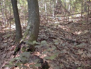
On the final approach to my car, I came around the north side of the hill. About 30 yards up from Rt 117 there was a sense of enclosure created by several rock-on-rocks and one rock pile.

This is a view westward towards the "enclosure" [Sorry for all the quotation marks].Here is a view back the other way:North facing sites are not too common. This looks to me like a place for one person to have a prayer. The role of the rock-on-rocks is still ambiguous: they could form the enclosure, they could lead to it and link it with other places, they could be designed to be looked past from within the site.

Bolton Conservation Land, Odds and Ends 2

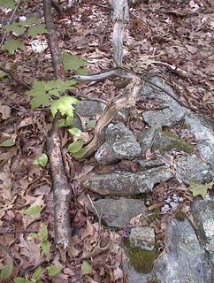
Back to the same conservation land I visited last week and the week before, I continued on the path beyond the the short stretches of stone wall, across a boardwalk through the swamp and up to the other side where the site with the wedged rock was, so I turned left and followed around the edge of the wetland there, until I got behind other houses and had to sneak along until I got to an outcrop going, maybe, northeast. I was never far from rock piles, including the "light in the forest" and the pile with wire (was it bedsprings?). Out on the outcrop there were two small platform-type piles, much broken down. Here is one:And here is the other, along with a view back towards the outcrop with the second 'platform' visible on the right of the picture.
After this, there were too many houses. So I doubled back, retraced my steps to the first hilltop site (of two weeks ago), and then went across the northwest side of the hill looking for other features.

I saw a couple of nice split-wedged rocks along the way. The first one at the head of a gully dividing two of the hills in there. The second higher near the dry top of one of the other hills.
You can see why I think this part of Bolton should be designated a rock pile "region". Every available piece of woods does have rock piles.

A light in the forest - a shadow on the rock

Monday, June 19, 2006

Spirit door at Spring Hill Acton (FFC)

Bolton Conservation Land Odds and Ends 1

I saw lots of small "cameo" scenes this weekend - interesting and nice features but no big new sites. To get started: here is a "stone wall" comprised of two pieces, neither more than 30 feet long. It was out in a flat area between hills.
A little ways down the trail roughly to the left, where the wall is pointing there was a sort of standing stone and an oval mound surrounded by a ditch. We have seen things like this before at the Acton Boyscout Land. I don't know what they could be if not burials. Here are two views, sorry it is so hard to get a decent picture of a mound in the sunlight.
Here is one in the snow from Acton [Click here]

Piles incorporating wire

A couple of examples. These seem to illustrate a point made by Mavor and Dix in Manitou that every day "junk" might have been used for offerings during Native American ceremonies.
Here is a rock pile incorporating a coil of barbed wire like a "wreath". Tim Fohl found this in Townsend.

Here, a tangle of straight wire sits on top of the pile and collects debris.I found this one in Bolton in the same conservation land as the broken plow tip pile.

The stupid sheet

It is hard correcting for the difference between true north and magnetic north. Around here (Massachusetts) they are about 15 degrees different - but who can remember which way? The idea of the stupid sheet is to show the major celestial events: solstices and equinoxes - as they would appear in their relative positions on a magnetic compass. This way you do not have to be too smart to use it. Just set the compass down on top of the paper so that the vertical "north" matches the compass north. Then you can read off the directions to various celestial events. In the winter soltice video, you can pick off the solstice sunrise direction as about "4 oclock" - which is supposed to match the direction of the "head" sticking out of the rock.

Saturday, June 17, 2006

Thiebaud Property, Switzerland County Indiana

[Click here]
Includes some rock piles of unknown purpose.

Judaculla Rock, North Carolina

Did you see this? [Click here]

Site protection via superstition

In England (not rock pile related)
[Click here]

Winter Solstice - another sacred video clip by FFC

[Click here]

Burnt Rock and Cedar

by pwax

Sacred Video Clips by FFC (Spirit doors)


[Click here]

[Click here]

Virginia Stone Altars

Excerpt from The History of Virginia by Robert Beverly ca. 1673-1722

"The Indians have posts fixed round their Quioccassan*, which have men's faces carved upon them, and are painted. They are likewise set up round some of their other celebrated places, and make a circle for them to dance about on certain solemn occasions. They very often set up pyramidal stones and pillars, which they color with puccoon, and other sorts of paint, and which they adorn with peak, roenoke, &c. To these they pay all outward signs of worship and devotion, not as to God, but as they are hieroglyphics of the permanency and immutability of the Deity; because these, both for figure and substance, are of all sublunary bodies, the least subject to decay or change; they also, for the same reason, keep baskets of stones in their cabins.

Upon this account too, they offer sacrifice to running streams, which by the perpetuity of their motion, typify the eternity of God. They erect altars wherever they have any remarkable occasion, and because their principal devotion consists in sacrifice, they have a profound respect for these altars. They have one particular altar, to which, for some mystical reason, many of their nations pay an extraordinary veneration; of this sort was [a] crystal cube**

[ . . . ]

When they travel by any of these altars, they take great care to instruct their children and young people in the particular occasion and time of their erection, and recommend the respect which they ought to have for them; so that their careful observance of these traditions proves almost as good a memorial of such antiquities as written records, especially for so long as the same people continue to inhabit in or near the same place."


*according to E. G. Squier, Quioccassan means, "temple of the idol."
**Beverly talks about this crystal cube in an earlier chapter and says it was a much-venerated altar, but he was never able to find it.

Friday, June 16, 2006

Yawgoog Trails

I know we did this before but let's do it again. [Click here]

Cobbles, Cairns, and Manitous: An Examination of the Use of Stone in Native American Landscapes

[Click here]
Title: Cobbles, Cairns, and Manitous: An Examination of the Use of Stone in
Native American Landscapes

Authors: Sean B. Dunham (Commonwealth Cultural Resources Group, Inc.), Janet
G. Brashler (Grand Valley State University), and Charles E. Cleland (Michigan
State University)

Abstract: Enigmatic cobble piles and walls have elicited a variety of
interpretations throughout the Great Lakes region, e.g., astronomical
calendars, henge monuments, and burial mounds. While most of these features
reflect early historic Euroamerican agricultural practices or natural
phenomena, certain of the sites can be attributed to prehistoric and historic
Native American land use. Both archaeological and historical sources have
indicated a variety of possible interpretations for such
features, including burial cairns, votive precincts, and the byproduct of
agricultural field clearing. This paper will present a discussion of these
stone features in the Upper Great Lakes from a variety of sources, including
ethnographic, ethnohistorical, and archaeological.

Paper presented at the 43rd Midwest Archaeological Conference, Muncie,
Indiana, 21-24 October 1998.

Silver Star Mountain WA

A well known system of pits and rock piles exist on the ridge south of Silver Star Mountain, just east of the Clark County/Skamania County line in southern Washington.....[click here]

First Nations Burial Cairns on Great Racerock Island

This is near Vancouver:
[Click here]
Thanks to Norman Muller for the link. Wonderful photos.