Wednesday, June 13, 2007

A place out west of here with "monumental" piles

One of my favorite places to walk around looks something like this, with red outlines where I have found rock pile sites:
You can see the power lines of a previous post.

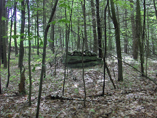
This last weekend I found the site indicated by the upper outline by penetrating the mountain laurel and going up that side of the hill. It turns out there is a trail over there from the road in along the northern edge of the swamp which takes you past the worst of the laurel. When I finally got into navigable woods there were inconspicuous rock piles and a nice pile as soon as I headed uphill:
At all of the sites shown on the map, many of the piles are large and made of large rocks. They appear to be much broken down and, in some cases seem to have some rectalinear structure inside them amidst the tumble of the rocks. Here at this northern site, there were a variety of smaller piles, niches, piles on boulders mixed in with the damaged platforms. Most of the large piles were mid-way up the hill. Some nice piles on boulders continued down into the edge of the wetland and the resumption of laurels.

Some platforms:The more I walk around here, the more I believe the sites are inter-related. The largest red outline and the one I found over the weekend both face southwest towards a prominent hill. The outline to the right has no particular such views.

Here are some other piles from the site. A niche of some sort:I'll put some other pics in a subsequent post.

In the future, after this positive experience of poking in past the laurels and finding something, I map dare to penetrate them in other places.

Tuesday, June 12, 2007

Kaaterskill, Part 2

By GeophileThe trail we hiked on led to this viewat Huckleberry Point: the ribbon in the distance is the Hudson River. Off the right side of the picture Indian Head Peak rises over 3000 feet from the valley floor. From where Eric and Jonas are sitting, you can look down on the vultures and hawks soaring over the valley.

Along the trail, we saw this stone wedged into the spilt in this boulder.

This one's a little hard to see, but it's a stone row or low wall. The spots of sun and shade camouflage it.

This wall is easier to see.

I thought this stone stuck in the ground resembled a tooth.

This interesting construction was right along the trail, just after the rock pile section. It isn't clear who built it or why or when. Could be remains of a chamber or something more mundane. There's no telling.

Near the lookout there were a number of more modern constructions, some very interesting, including a number of flat rocks set along the edge of a protruding boulder to form a shelter that looked out across the valley. This little pile caught my eye with its white stone on top. Are there people who read this blog, then go out, inspired, to build rock piles?

I've stifled my exclamations of delight here, but I have to at least mention that this was a beautiful hike, with many natural delights, even aside from the stones and the view. These lady slippers and the mountain laurel in bloom were highlights.

A manitou stone support

Norman Muller sent in this picture from Bob Miner.Saying:
"...This example, of what appears to be a small manitou stone of the head-and-shoulders variety supporting a propped slab, is unusual, and I'm not sure how one would interpret this."

Monday, June 11, 2007

Video clip of damaged pile - Leominster

So happy to be home

Here is one of my favorite stomping grounds out west of here:
Sunday I explored a new part of one of the hills in here. Turning off from the usual path, I had to penetrate the laurel. At first there was a bit of trail I took advantage of, then there was a bit of swamp. Then I pushed through the class B+ laurel and got up more onto the hill with oak. At first I just stopped to enjoy the green and the shade. But it is also so nice to come up to something interesting looking.
Traversed the hill one contour at a time and kept finding more rock piles. I'll describe them in a later post.

Kaaterskill, Green County, New York

By GeophileOn vacation last week, we hiked on Kaaterskill Peak again, in the Catskills. We didn't get to any new sites, but I got to spend more time in the one we saw last September, and we found new features. First, though, some rock piles.

Above, a long rock pile. The situation of these piles is on a flatter area well up on the peak. My son Jonas estimated there to be at least one hundred piles on both sides of the path. Far back to one side of the group was a high mountain stream. The whole area was damp.

A double pile.

Some stones in this pile looked reddish.

A nice pile. Some are just appealing.

I thought the stone in the light here had a sort of reptilian look.

A pile on a boulder.

We also saw two walls, a split-wedged boulder, and a construction that could once have been a chamber or shelter, although it could have been unrelated to the piles. I'll post them in a later post. The area also boasts some obvious recent piles and constructions, although none of those appeared in the immediate area of these piles.

Friday, June 08, 2007

Thursday, June 07, 2007

More AZ rock piles - broken down plant boxes

The most impressive collection of rock piles I saw was off Rt 60 coming south from the Apache reservation(s) entering the Tonto National Forest. I pulled off to the right and stepped into this scene:I was not clear what these might be, until I found one that was in better shape: If all of the piles originally were like this one then we are seeing another structured cultivation area. What were they cultivating? I noticed an unusual type of yucca\agave, which you can see in the background of this picture. Why use plant-boxes? I am wondering about moisture retention and the small bit of shade provided. As I mentioned these types of structures are pervasive in southern Arizona. I think I saw such things just about every time I stepped into the desert.

It is ironic that I am always putting down the "agrarian hypothesis" for rock pile around here in New England and then in Arizona, no sooner do I spot rock piles than I am quick to bring up exactly that kind of a rationale. What can I say? I was hoping to see a spring with some effigies, as I have heard rumors of. But I did not.

A rock pile sign-post - a second AZ rock pile

In Moenave on the Navajo reservation after looking at dinosaur footprints we drove over to look at a "newspaper rock" collection of petroglyphs. On the way I saw this rock pile and asked out guide about it. He said it marked the turnoff to the rodeo grounds.

A first rock pile in AZ

I saw a few rock piles in Arizona, none that seemed particularly reminiscent of the ones we have in new England. For example, the first one I saw was in the Tonto Basin. We stopped the car to take a closer look at some prickly-pear cactus fruits. We all tried some and were rewarded with out first cactus pricks of the vacation. In the midst of the cactus was this rock pile. When I saw this one I was a bit confused: those upper rocks on the pile look to have freshly exposed surfaces. How could this be a new rock pile?
Then I looked around a bit more and saw this little bit of buried wall:
The more I looked the more I noticed these vestiges of structures buried in the dirt and realized these were old house foundation - or something. So I concluded that the rock pile was what was left by the archeologists\pot-hunters after they excavated. As I looked around I noticed other little patterns of rock on the ground. An advantage of the rock pile "training" I have is that I notice non-random patterns of rock. In retrospect it seems that there were patterns in every piece of desert I stepped into during the week. Arizona is a place with a deep and complete history. So there were also these outlines:
I was trying to figure out what these were for? I may have read about it somewhere but the idea occurs that these small outlines are little "plant boxes" - I don't know what they housed and I do not know their purpose but I can guess. In fact I suppose that the edible cactus that was all over the place at this site provides an obvious clue: they may have been cultivating the prickly pear. I saw similar "plant box" formations in most of the places where I stepped out of the car.

Wednesday, June 06, 2007

In Search of the Indian Doctress - by Margaret Bruchac

Are you familiar with this, related to Old Sturbridge Village? [Click here for complete article]

"...Fortunately, Rhoades' history has not been lost. Huntington's local historians still know the house sites, the rock piles, and the gravesites of Indian Hollow, and have preserved the recollections of those who remembered its famous Native physicians...."

And what about this? It is from JSTOR: Archeological Excavations of the Uxbridge Almhouse Burial...[I cannot access the full article]
"This is a very useful monograph on a small, 19th-century New England cemetery. ... were buried in the poor farm cemetery or in nearby rock pile areas. ..."

More pics from North Smithfield - Nipsachuck

Tim M. writes in:
Here are some additional photos from Nipsachuck. As I mentioned to you in the past, the cairns Dr. Meli is surveying next week are not on the proposed development. The NS Conservation Commission hopes to find something in this abutting area that will reinforce the need of a full archeological study of the proposed site. The mounds or piles in these photos ARE within the development. I tried to show the quartz rock in each pile. There are about 20 or more of these piles in the area.
[Some of the pics:]Since the cat is more than out of the bag on this, I'll admit that these do look like what we call graves - low ground piles with a piece of quartz. There has never been any way to be sure. Perhaps we'll find out. [See this]

NEARA Field Trip to Boxborough, MA, Sunday June 24, 2007

On Sunday, June 24, 2007 NEARA member, George Krusen will lead a field trip in Boxborough, MA through an area that was part of the Nashoba Praying Village.

Meet at 3:00 P.M. in Boxborough at the intersections of Littleton Road, Depot Road, and Littlefield Road. To find this intersection take Exit 29 off I-495 and go East on Route 2 (towards Acton) to Exit 41. Go South on Central Street, toward West Acton, and turn right on the first road, which is Littlefield Road. Then go about a mile and turn right onto Littleton Road. Park your car by # 30 Littleton Road.

George Krusen will show us three sites. First, he will show the sunrise alignments on the Sudbury Valley Trustees Land. Second, he will show us a chamber. The axis line of this chamber suggests a possible connection to Hassamessitt, in Grafton, and even to Orient Point, Long Island, NY.

Then we will follow George in our cars to go to the Boxborough Esker. We will walk a mile on the esker to where we can picnic and about 7:00 P.M. observe the summer solstice sunset (or its location if it is overcast). We will leave the esker by 8:00 P.M., near the intersection of Route 495 and Route 111.

The Boxborough Esker is a two and ½ mile long ridge about 56 feet tall that runs between two swamps. There are stone rows, stone mounds, and pits, on and near the esker. Near the end of the esker two earthen ramps, which begin some feet apart, lead diagonally down to the valley below, meeting near two U-shaped “prayer seats”.

See: MANITOU, by Mavor and Dix, Chapter 11, page 275.

Please where comfortable shoes, bring food and water, a flash light, and any bug spray you would like to use. As always, dress for the weather.

RSVP to brendatoomey@verizon.net . When emailing me please put NEARA in the subject line. Please do not just hit “Reply” and send my notice back to me, start a new email, or call me at 508-885-0993 and leave a message.

Brenda Toomey

Monday, June 04, 2007

Delaware Water Gap

Norman Muller writes in:

Larry Harrop assembled my Delaware Water Gap pictures and commentary into one document... Here it is: http://www.rock-piles.com/Delaware_Water_Gap.htm.


From Norman Muller -- Photos From Russia And Web Page

by JimP
Norman Muller sent along the following photos from Vyacheslav Mizin, author of a fascinating article on perched boulders in the most recent NEARA Journal. The photos were taken by Makar Kotovsky in the Altai Mountains of eastern Russia, near Mongolia.
Vyacheslav Mizin has also created an interesting web page that compares the features of northern Europe with those of North America. [CLICK HERE] to see that page.

[CLICK HERE] to read an earlier blog post about Vyacheslav Mizin from James Gage.

For help translating the Russian pages, go to this website: http://www.online-translator.com/srvurl.asp?lang=en

Friday, June 01, 2007

Some AZ rockpiles

This is from Rt 60 going south just after you leave the SanCarlos Apache Indian Reservation and enter the Tonto National Forest. On the right at the first height of land is a camping ground access road. Go in there, park, and walk around. It is funny because I only stop the car occasionally to see what the ground looks like on foot. This was one of those rare places and ...voila! Rock piles. I'll speculate about their purpose later.

Thursday, May 31, 2007

South African Photos From Norman Muller

by JimP
Norman writes, "I'm attaching two photos that Bo Westling, a researcher from Sweden, sent me of two perched boulders in South Africa that his son-in-law took on a recent trip there. Bo has written a book (in Swedish) about perched and pedestaled boulders in his country, and is an authority on the subject. He pointed out to me that the portion of S. Africa where the photos were taken has not been glaciated."Norman also adds, "That first image of the white perched boulder in a desert environment could be what is called a tor, which is a highly weathered outcrop that looks manipulated. Such forms are found in southern England, and are sometimes located near dolmens. One researcher believes that the dolmen form was inspired by the natural tor formation."

Wednesday, May 30, 2007

The modern mixed with the more ancient

These are from Moenave, Navajo Reservation - behind the dinsosaur footprints.

Apache signal quality

At a hotel in Winslow AZ with no internet - but turned on the computer in order to look at the pics I took today. Then up pops the little info-bubble "Wireless Network Detected". Come to double click on that and, what do you know? The nearby Apache reservation appears to have a network I can borrow; and so do the Zuni's. The Apache's signal quality is better. We had a great day: found and arrowhead, saw some dino footprints and a Navajo "Newspaper Rock" of petroglyphs. We did not see the Condors. Then we got bummed by the hostile reception of the Hopi res. I don't know why they don't just put up a sign saying - "Visitors not Welcome". One of their traffic cops followed me for 10 miles hoping to catch me speeding - right on out of their territory: he thought I did not see him back there but I saw him alright - we had just finished trying out the rental car at 100 mph before slowing down to his location. Op! gotta go, Galaxy quest is on cable. Yes we saw some rock piles; but all in good time.