It was found among hundreds of smooth pebbles in a planter. Most of the other pebbles had no "divets" at all. Also, I say worn away "again" because of a sense that pebble formation is an ongoing process, only interrupted briefly by tool making.
Thursday, January 16, 2014
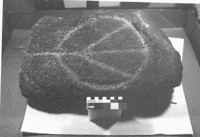
Office Park Planter Archeology
This is from Waltham. I need to find out where the landscapers are getting their pebbles:
Tuesday, January 14, 2014
Battlefield plans approved
From the Nolumbeka Project:
The application for the Battlefield Grant from the National Parks Service was approved at the Montague Selectboard meeting last night in Turners Falls. Thanks to all for your support.
The application for the Battlefield Grant from the National Parks Service was approved at the Montague Selectboard meeting last night in Turners Falls. Thanks to all for your support.
First finds in 2013
I had some time on Saturday morning to go out and search for arrowheads before the really heavy rain started. It has rained quite a bit here lately, in theory this makes for good conditions for searching for arrowheads. The reality on Saturday, though, was that the amount of rain had turned the ground into a quagmire. Standing water all over the place, just mud and ooze to wade through everywhere. Just looking at it before I even got out of my car was giving me the creeps. But I had driven for a while to get to this place, and it has been productive for me in previous winters, so I couldn't resist spending a couple of hours there despite everything. It reminded me of times in warm weather when I have waded in streams or along the edges of lakes looking for stuff, I got pretty soaked. Anyway, I didn't find anything really great but nothing much is certainly better than nothing at all. This broken quartz small stemmed arrowhead was the best of my finds, I pulled it out of a puddle. It's missing the tip and I think the base is broken as well.
 Here are all of my finds. I'm not sure what that big piece in the center is, I would like to call it a knife, perhaps it is a scraper or maybe just a preform that was discarded. It's definitely worked but pretty crude, it does look like a tool to me but I don't know. There are some broken fragments of quartz arrowheads and two pieces of English or Dutch clay tobacco pipes, from later times.
 On Sunday morning I had a chance to take a very short walk in a sandy place I like. I had less than an hour to search. It had rained really hard the night before and conditions were amazing. As soon as I got out there I was picking up nice big flakes of neat materials, different types of rhyolite and felsite. I was feeling really good, I had that feeling that with any step I might stumble on something really special. This broken edge sticking out of the ground looked really intriguing. I snapped one quick photo before I scooped it up.
 It's a Stark point!!! Broken, unfortunately. But most of it is there and I was really super excited to find it. It's made of argillite as many of these are. I love finding things like this, I don't have many of these, even broken.
 Here are the best of my weekend finds cleaned up at home. Not bad. I hope to get back to that sandy place this weekend when I have more time. I would love to find a whole Stark like that broken one...


7 Rock Piles


Looking East (above and the two below)


Looking North from that middle stone pile:

West view toward the (almost invisible) Stone Mound:

And then South:

And then there was this stone row...


Sunday, January 12, 2014
Carolinas’ rocks hold ancient messages

http://wakinguponturtleisland.blogspot.com/2014/01/carolinas-rocks-hold-ancient-messages.html
With some strange twists on this one from a book by the referred to Archaeologist Tommy Charles:
LIDAR
Several people have forwarded an article link about LIDAR from National Geographic Online. Great technology and I look forward to examining LIDAR maps.
Unfortunately the authors begin by knowing what they will find. So they are not likely to see anything else in pictures.
Unfortunately the authors begin by knowing what they will find. So they are not likely to see anything else in pictures.
Saturday, January 11, 2014

News regarding last Monday's select board meeting in Turners Falls
From the Nolumbeka Project:
Dear Friends,
Even if you're not from Turners Falls you will likely be interested in
reading about what transpired at last Monday's select board meeting in
Turners Falls. There is an article written by Chris Curtis on page C1
of today's issue of The Recorder or read it on line at
http://www.recorder.com/home/
Also, there is a short string of comments which were posted on
www.montaguema.net yesterday regarding people's impressions of what
happened at the meeting.
There is another Select board meeting scheduled for 7 p.m. next
Monday, January 13, a mere two days before the January 15 deadline for
the Battlefield Grant application. Keep updated by subscribing to
nolumbekanews.blogspot.com/ at www.nolumbekaproject.org And, if
you're a Montague resident your presence is welcome.
Friday, January 10, 2014
Klamath and Modoc Sacred Rock Cairns and Prayer Seats

(Photo - and a link to a PDF from Alyssa Alexandria)
The Influence of Sacred Rock Cairns and Prayer Seats
on Modern Klamath and Modoc Religion and World View – Patrick Haynal (2000)
“TRADITIONALLY, ethnographers have been brief in
their discussions of the ritual importance of rock cairns to the Klamath/Modoc
(e.g., Gatschet 1890; Spier 1930; Ray 1963; Stern 1966), and prayer seats
receive no direct mention at all. This article focuses on determining the
importance of these two categories of sacred sites to the practice of modern
Klamath and Modoc (hereafter Klamath/Modoc) religion and the shaping of their
contemporary world view.' To accomplish this, interviews were conducted with several
Klamath/Modoc individuals selected from a list approved by the Klamath tribes.
Rock cairns and prayer seats and their relationship to various rituals and
practices, such as the power/vision quest and funerary rites, are integral
features of the Klamath/Modoc sacred cultural landscape...For the purposes of
this article, rock cairns are defined as any stacked rock feature…Cairns come
in two general physical forms: the stacked rock column, constructed by placing
one rock directly atop another in sequence to varying heights; and the conical
cairn that has a variable number of rocks forming the base and there after
built up with additional rocks until a conical (or mound like) shape is achieved.
Occasionally linear “s” shaped or “wall-like” rock features were constructed as
well…
...Loubser and Whitley (1999) interpreted rock art from eight sites in the Lava Beds National Monument as having several religious connections, including vision questing (by both shamans and nonshamans), mythic associations, hunting magic and other ritual specializations, and mortuary associations. They reached their conclusions by careful application of the ethnographic record and recently obtained data on the manner in which the brain processes and recalls visions received during a hallucinatory state (Loubser and Whitley 1999; also see Whitley 1998). If rock art is associated with the power quest, what is the spatial association between rock art and cairns?
...(T)he land that formed Klamath territory was believed to have been brought forth solely for the Klamath by the creator and culture hero, Gmo 'kam 'c. Two Klamath tribal members (Priscilla Bettles and Karen Ray) explained that the land and the people are a part of each other and were created to care for and nurture one another (Haynal 1994:317). The Modoc had a similar spiritual bond with the land. In fact, the two tribes recognized the spiritual and sacred nature of each other's lands (Curtin 1912:vi). Obtaining power from the spirits located throughout the landscape was a key aspect of Klamath/Modoc traditional religion. Virtually every unique rock feature, mountain, cave, body of water, meadow, or any other distinct location within the land had a spirit and everything with a spirit had power. The animals of the land had power as well (and I suggest that is why animal effigies such as turtles, bears deer etc. are so often incorporated into stone concentrations here as well as there {see: http://download.springer.com/static/pdf/551/art%253A10.1007%252Fs11759-009-9108-x.pdf?auth66=1389531864_b3e469b143cfe56901f0dc8b47891e7c&ext=.pdf} - Tim) . From the Klamath perspective, all the cosmos, both animate and inanimate, was alive and everything alive had both spirit and power. Even a single rock had power. A rock from Mt. Shasta carried a portion of the great power of the mountain itself (Spier 1930; Ray 1963)...Interviewee 3, a young Klamath man in his twenties, explained that "[a] rock cairn is basically the same thing as a church, people go there to pray, men go there for puberty to put on vision quests, it's just a very spiritual place."
Interviewee 4 made a similar conunent about rock
cairns, stating: "To me those cairns are no different than a church. We know how
our people would go on a vision quest or power quest and be up all night long
building the cairn as a method of prayer.”
Interviewee 6 also described the cairns as sacred
altars: “When our people went out to seek God…seeking the truth, seeking power,
seeking direction, seeking guidance . . . whenever they went there and received
an answer or confirmation or received a power . . . they built an altar saying "this
is where the Creator spoke to me" and this is now sacred.”
In noting the power of cairns, Interviewee 6 added
that [t]he thing about cairns is, if you knock them over or if people destroy
them with malicious intent . . . somehow the spirit of the place or of this
person who put it there could come back on you…”
Thursday, January 09, 2014
Nutting Stones
Reader Stan:
Hi- just Google "nutting stones" then search images.
Plenty of examples and a valid source is relative to your interests/needs.
Wednesday, January 08, 2014
Near the top of the loop road at Hopkinton State Park
The usual advisory is to look to the right as you drive up the loop (clockwise). As you look into the woods that are uphill from a picnic area, there are some nice piles. Downhill to the left are some other impressive ones. FWIW I saw a couple new ones at the top of the hill on the north side:

 Hopkinton State Park is pretty busy with structures.
Tuesday, January 07, 2014
A knoll at the interchange between Rt 90 and Rt 495 and a good Senior Thesis


On the far side of the hill there was a larger boulder, with rock piles radiating out from it in four directions - except the lines intersected a few feet to the side of the boulder. Here are some pictures:


Saturday, January 04, 2014
In Shrewsbury before the heavy snow

.JPG)


Walked around a bit and came to an interesting enclosure on the side of a ridge near (b):
.JPG)
.JPG)
.JPG)
.JPG)
Then I was following a wall, almost back to the road across from Fortune Dr. at (c) and saw the neatest little rectangular mound with a hollow to the right of the wall:
.JPG)
Closer:
.JPG)
.JPG)
.JPG)
Not a bad collection of finds in the snow and in a small woodland.
After that, I drove back along Rt 20 towards Rt 9 and what looked like an interesting bit of hill and woods I saw earlier. This turns out to be the part of Boston Hill north of the YMCA, a smaller summit. There I saw a couple piles next to a wall:
.JPG)
.JPG)

.JPG)
Then, on the northwest facing part of this northern summit of Boston Hill there were several similar structures that looked like small seats:
.JPG)
.JPG)
.JPG)
.JPG)
Subscribe to:
Posts
(
Atom
)