
Friday, July 29, 2016
Sunday, July 24, 2016
Speaking of Walls and Rock Piles...
(and "Serpent Stacking")


{Referring to the post: http://rockpiles.blogspot.com/2011/12/speaking-of-walls-and-rock-piles.html}
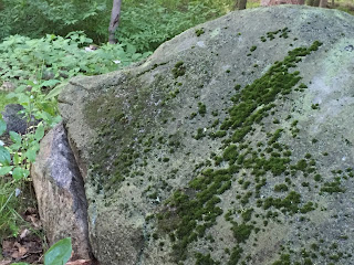
I’ve been
looking at this PWAX photo above for 5 and a half years now.
Not all the time for
5 and a half years of course, but every once in a while. The image comes up on
my screen saver, but I also open the photo up every now and then, just to view
it as a large image. I was just looking at it again:
http://wakinguponturtleisland.blogspot.com/2016/07/speaking-of-walls-and-rock-piles.html
http://wakinguponturtleisland.blogspot.com/2016/07/speaking-of-walls-and-rock-piles.html
Saturday, July 23, 2016
Thursday, July 21, 2016
Natural-Cultural Landscape Presentation by Nolumbeka Project Vice-President this week-end
From the Nolumbeka Project:
Natural-Cultural Landscape ltural Landscape of the Connecticut River Valley
Saturday, July 23rd at 10:00am-Greenfield Savings Bank
282 Avenue A, Turners Falls, Ma 01376
Natural-Cultural Landscape ltural Landscape of the Connecticut River Valley
Saturday, July 23rd at 10:00am-Greenfield Savings Bank
282 Avenue A, Turners Falls, Ma 01376
Please come and join Nolumbeka Project
vice-president Lisa McLoughlin as she explores the relationship between Nature
and Culture over time right in our back yard, the Connecticut River Valley.
Lisa’s power point presentation highlights the relationship between people and
the environment with an emphasis on how we ALL can treat and preserve our
wonderful river valley. Folks have lived and thrived here for hundreds of
years, and, with a kind heart to ourselves and Mother Earth, we can all prosper
and grow for hundreds more! Light refreshments provided in comfortable
air-conditioning! No reservations required. Invite a friend or neighbor!
Monday, July 18, 2016
Another Old Newspaper Article
There were no photos accompanying this NY Time article, so I just had to illustrate it myself (although you could use many a photo from this blog to do the same). There are some overlays etc. on this one from 1991 that I never saw before, so I'll just link you up to:

Scholar Looks at Quaint Stone Walls And Sees Pioneers' Garbage Heaps

Scholar Looks at Quaint Stone Walls And Sees Pioneers' Garbage Heaps
Saturday, July 16, 2016

Thursday, July 14, 2016
Latest update on Hopping Brook desecration
Turns out we may be looking at permitting irregularities.


- There was a EPS/NEPA permitt needed for "storm water removal"
- Native tribes were not informed.
This means the historical aspect of the permitting was improper at the Federal level. Let's hope this is enough to get some delays operating. Check out the red outlines below (which are approximate), and check out the wetland crossings. [Thanks to Matt Howes for getting this information.]


Some of these maps include stone walls but they leave out all the mounds and smaller rock piles.
Wednesday, July 13, 2016
Why get caught un-prepared?
It is striking that the threat to the Holliston site has been known for more than 10 years: to Holliston Historical Society, and to NEARA members. I know of no effort (other than Bruce McAleer's attempts to contact the developer, long ago) to scope out and prevent the damage that is happening. You could see it coming, as I mentioned the orange flags in May. Why are we always caught "off guard" when development actually begins?
Shouldn't NEARA have a registry of threatened sites, and a plan? Well someone should and it takes money. If there are any rich people reading this, think what an endowment might do to help protect sites before the damage starts.
Shouldn't NEARA have a registry of threatened sites, and a plan? Well someone should and it takes money. If there are any rich people reading this, think what an endowment might do to help protect sites before the damage starts.
Native American mounds a casualty of Hopping Brook expansion (Holliston MA)

By Bill Shaner
Daily News staff
"HOLLISTON – Along the edge of woods that crews have recently
cut to expand the Hopping Brook Business Park sat a pile of stones unlike the
uprooted boulders and tree trunks in which it surrounded.
The stones were laid in an oval-shaped mound. The mound had
rounded edges that wrapped around a depression in the center. Overgrown and
worn, with faded moss on the granite rocks, the mound had clearly been there
for years. Some would argue it's been there for centuries.
A small but resolute group of archaeologists, historians and
activists believe the mound is one of thousands of similar artifacts, sometimes
called rock piles, that predate white settlers. Left by native people, experts
believe they were created for spiritual purposes, perhaps for burial or other
ceremonies.
And soon, that one particular mound in Holliston will be
gone.

“That's pretty much the sad tale of it,” said Hulbert.
“Bulldoze it over, the march of progress, and a little vestige of Native
American evidence goes away once more.”
When the 200-acre development, essentially a delayed second
leg of the Hopping Brook Business Park, is complete, the mound will make way
for a road or a parking lot, foundation for an office space or a warehouse.
Construction started about a month ago.

Standing by the mound, Matthew Howes, a Holliston man who's
helped archaeologists discover and register native landmarks in the area,
lamented the fact it would disappear.
“People need to kind of wake up and realize that native
people were here for thousands of years … and their remains are everywhere,” he
said.
There are hundreds of similar mounds in the area, and those
who are passionate about native histories want to see more thought given to
their preservation.
Curtiss Hoffman, a Bridgewater State University professor,
has inventoried about 5,100 similar mounds all along the Eastern Seaboard, from
Georgia to Nova Scotia. The mounds, he said, often sit in clusters – 50 or so
built very close to one another. It's something he feels isn't an accident.
The only way to truly save the mounds is to have state
preservation offices acknowledge them as historic, and include them in state
registries. Until then, he said, local ordinances and land acquisitions to
preserve the mounds are the most effective method.
But before that happens, there needs to be consensus in the
archaeological community. Some feel the mounds are the product of colonial
farmers removing rocks from farmland. Hoffman feels the mounds are too
deliberate, too ornate in their arrangement, for that to be legitimate."
Bill Shaner can be reached at 508-626-3957 or at
wshaner@wickedlocal.com. Follow him on Twitter @bill_shaner.
Tuesday, July 12, 2016
Bulldozing the temple

[In more detail: this is a small flat-topped pyramid with a crater in one side. It is about 8 feet above ground level and shaped like other American burial mounds - but considerably smaller, in a traditional New England style. This style is common in the Charles and Merrimack River watersheds. If you click in to magnify, you'll see a hint of a platform or "terrace" - which is not so common]
This development at the Hopping Brook Industrial Park in Holliston, MA needs to be publicized. Is there anything you could do? How about calling a friend or someone you know from Holliston, and giving them a nudge? How about writing a letter to a newspaper, like the "Holliston Reporter"?
Monday, July 11, 2016
Hopping Brook - development starts at a massive Indian Burial Ground
Just thought you should know. I heard from Mathew Howes that they are bulldozing around and over the mounds at Hopping Brook. Now these are burial mounds and this should be a serious NAGPRA violation.
Anyone living there who can become active in fighting this development, should contact Joanne Hulbert of the Holliston Historical Society.
Anyone living there who can become active in fighting this development, should contact Joanne Hulbert of the Holliston Historical Society.
Saturday, July 02, 2016
Wednesday, June 29, 2016
A small arrangement of stones - SW Rocky Hill Groton/Ayer
Came upon a boulder with a rock pile on top.

 A bit like a gunsight. There was another boulder with a rock splinter on top:
 I do not think this was in line with the others but to the side.

Looked around a bit and the boulder seemed part of a line of boulders:


Sometimes rock piles are not ceremonial
Came across this one by itself.
 For some reason I cleaned off the leaves, which usually don't do.
 What's that in the middle?
 The iron spike suggests to me this was a surveyors fixed point, so this pile might mark a corner or some other aspect of a land survey. Any other theories?


Thursday, June 23, 2016
Short stretch of wall Sudbury State Forest
From the same location as my previous post. This seemed to be a short stretch of wall going downhill to end in a boulder but actually the wall continues after a break (behind us). Still this is of interest:
 Look at the black and white rocks right at the very beginning:


Sudbury State Forest - Deerfoot Park
I went back to the place I posted about here in 2012 (there is a map) which is a place with rock piles built into the outcrops. I saw them again with slightly sharper eyes and still did not manage to take any good pictures.
There are rock piles visible from Concord Rd but you have to get out of the car and go look at the outcrops. As I wrote before, most of the outcrops have added rocks piled on top of them, with more or less structure. They seem quite old. And the site is extremely similar to parts of Noon Hill. Let me point out three things I noticed: a rectangular pile right "below" an outcrop, a nice place to be between two fine old things, an arrangement of stone wall that was broken like a dashed line.
Here, note the smaller rectangular pile in the foreground.

 Although there are lots of things on the outcrop behind, this pile is isolated. I was excited to see it and it reminded me of something at Noon Hill - where there are also piles built on outcrops.
A few minutes into my walk, I stepped uphill between two adjacent ridges of rock and saw this one on one side:
 And this on the other:
 Not the best pictures, here is a better a picture of the first - which is the largest and least disintegrated of the whole place:
 The third thing I wanted to note was the "broken-dash" wall, that was near this pile and led towards a larger boulder.
 Now there is too much light for good photos! Anyway, I noticed a flat faced satellite pile near this wall and those outcrops with mounds. I realized later that its flat face, was aligned in the same way as the wall:
 Here we are looking towards the wall at this pile's flat face. You can make out the wall in the background:
 I nice place. Only a few steps from the road, this site is very accessible.
There are rock piles visible from Concord Rd but you have to get out of the car and go look at the outcrops. As I wrote before, most of the outcrops have added rocks piled on top of them, with more or less structure. They seem quite old. And the site is extremely similar to parts of Noon Hill. Let me point out three things I noticed: a rectangular pile right "below" an outcrop, a nice place to be between two fine old things, an arrangement of stone wall that was broken like a dashed line.
Here, note the smaller rectangular pile in the foreground.


A few minutes into my walk, I stepped uphill between two adjacent ridges of rock and saw this one on one side:


Shaped Rock from Northboro
Reader Christian C. writes:


I have been following your Blog for quite some time and
find the subject very interesting. I live in Northboro Ma in quite a old
home that is estimated from the 1800s, right next door is a original
brick one room school house and my house is right at the bottom of a
hill with a stream across the street.
There
are quite a few interesting rocks on my property as well as some unique
features, stone ring, large circular pit, as well as some mounding
shapes. The pictures I sent is of one particular rock that has a split
in it, and what looks to me like could be a "face" and behind the rock
is a long mound and the rock i attached pictures of looks to me as if it
could be the visible "head" of this long buldge/mound. Past this rock
there is another large rock almost acting as a gate, with then a third
large rock about 10 feet past this. The rock with the face also has some
white quartz on top and the sunset in almost a perfect alignment with
the rocks/mound.


The
stones you see on top of the mound behind the split rock, I had put
there since the area almost acts as a natural divider between the lawn
area and the woods. Anyways I hope you find some of this interesting and
if you find any interest in these and would like to see them in person I
would be more than willing to have you come by. Thanks and appreciate
the work you do with the blog, very interesting stuff. Thanks!
Saturday, June 18, 2016
Arrowhead finds - June
It hasn't rained much, but I have had some luck and am happy to have some photos to share.
Here are a couple of broken finds from two different sites earlier this month. It's a shame about that pink rhyolite stemmed point, it is well made, an interesting material, and it would have been really nice. The quartz Squibnocket Triangle is decent but unfortunately also damaged.


Friday, June 17, 2016
The Ograbme that Grabbed Me
I was looking at this wall this morning:

"Since I have had more than one snapping turtle give me this exact sort of look, I am reasonably sure that this is a Stone Snapping Turtle:"

More:
Subscribe to:
Posts
(
Atom
)