Fig. 1—Boulder at the
river's edge. This boulder was once a wo'ge or immortal, who tried to prevent
death from coming into the world. Having failed, he took up his abode here, but
still has an aversion to corpses. When a dead body is being taken up or down
the river it has to be landed and carried behind this rock. Women also land
from canoes and walk around on shore.
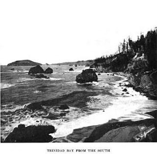
Below: A
general view of Trinidad bay. At the left in the background the rounded
promontory is Trinidad head. It is connected with the mainland by a low flat
neck. Just to the right of the neck, on a slope or declivity below the white
town of Trinidad, which is on the flat, lies the Indian town of tsu'rai. (See
map 34.) Practically every
rock in this picture has its own proper name.
(I was actually looking for info on "Trails" in this book: "Trails, for example, are '' like people,'' that is, they are sentient, and must be treated with urbanity. If you step out of a trail and in again, and fail to preserve decorum, the trail becomes resentful. Along each important trail there are "resting-places." Few of these show on my maps, because I did not travel the trails myself, but hundreds of such places are to be found. People when traveling kept on in a business-like way until they came to these resting-places. There they took off their packs and had a good breathing spell. If they did differently they were likely to have bad lucky The resting-places are invariably very pleasant spots. In this custom the Indians show the knowledge of experts. Five minutes' rest with the pack off in the shade is, of course, worth more in preventing fatigue than an hour of loitering along a trail..." [Waterman pg. 185])
Image above of the same place near Trinidad CA and "a story about a bunch of rocks" here: http://www.northcoastjournal.com/101305/cover1013.html

.jpg)

No comments :
Post a Comment