Thursday, October 30, 2014

Hill east of Lovewell Pond - border between Dunstable MA and Nashua NH

I explored this area as part of a continued exploration that started at Horse Hill in Groton, moved northward to Hauk Swamp and Hound Meadow Hill, and still further north to Blanchard and Flatrock Hills (see here) in northern Dunstable. I found sites at those places. I was looking for continuation of the pattern of low rectangular rock piles that I first saw in numbers around Horse Hill. By the time I got to Flatrock Hill, that style of pile seemed to have played out. Not so! A little further north on the edge of Nashua, I found three of them about where the blue oval is on the above map.
First glimpse, a peaceful valley:
A couple of large but beaten down rock piles are visible on the far side. It has long been a reflex to explore the flanks of shallow valleys separating hills. 
Some details of the lower one, seen from opposite "corners". Facing uphill:
 Facing downhill:
I hope you can see why I call this "rectangular".
Here is larger pile, a few feet away, uphill:
And the view back downhill:
(Several well-worn paths through there show up as paler lines in the dead leaves. This is a popular hiking-biking area.)
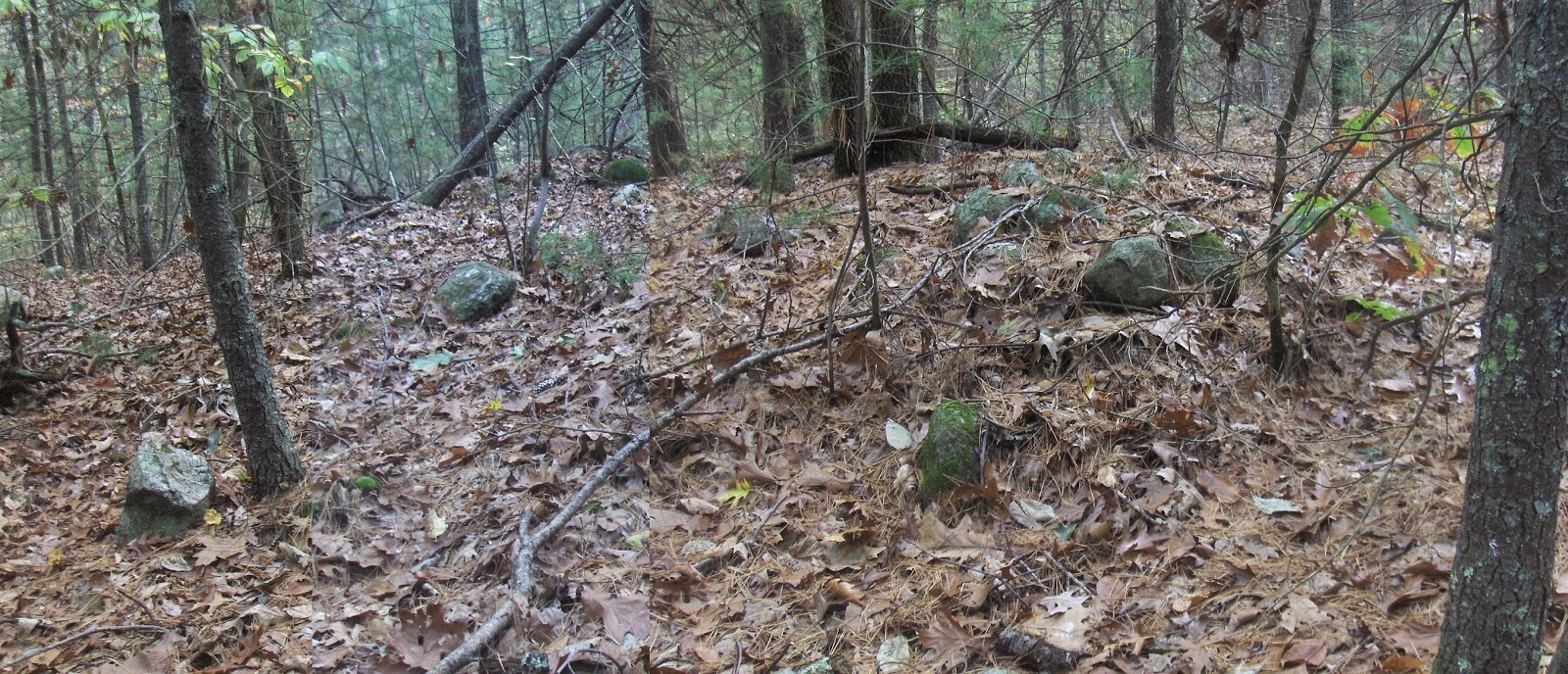
Having found two piles, it was natural to look around nearby to see if there were any others. Up on the brow of the hill I see something a bit more shapeless under the dead leaves and debris: 
 But it is definitely part of the group.
 View back towards the previous piles.
A nice little group of three mounds, in scope of the same culture present from here back to Horse Hill. I hadn't seen any like this since the Falulah, a few weeks ago.

People still making piles there today, right next to the trail:

Monday, October 27, 2014

Beaver Moon Gathering - Nov 8

From the Nolumbeka Project:
We are looking forward to our second annual Beaver Moon Gathering in 2 weeks. A flyer about the event is attached. If you can help us that day please contact Lisa McLoughlin, volunteer coordinator, at nolumbeka@hemlockhouse.net. Thanks.

Petrified Wood in a Pile of Rocks

"From the Age of Dinosaurs, Hard Clues"
By Theresa Sullivan Barger July 11, 2014
“Five years ago, when Mr. Blersch put an addition on his house, he found petrified wood in a pile of rocks that had been excavated…Since the wood was found in a section of Connecticut known on geological maps as the Pomperaug Basin, the new species was named Pomperaugoxylon connecticutense.”

Sunday, October 26, 2014

Friday, October 24, 2014

Franklin State Forest (continued 2)

Continuing from here. I got into the woods of the flat northeast summit of Forge Hill (on earlier map at E). Stepping off the road into the woods I saw a loose scatter of large rocks. They looked like something dumped in the process of making the road. A few steps and there was another scatter about the same size, then another, then another. And since they had a kind of common structure, or lack of it, I started believing they might be something deliberate - not just rock discards. Go take a look, these things are a bit unusual.
Here is one, from the front and back:

Here is another from the front, back, and side:
That is certainly not random discards.

Here is another, beyond the wall:

As I say, they are a bit unusual. I would love for other eyes take have a look.

Franklin State Forest - short stretch of wall at tip top

Continuing from here. I found a short stretch of wall while crossing the hill, just about beneath the letter "i" in the word "Forge Hill" on the previous map fragment. 
Note the faint enclosure at one end. 
The wall ends less than 10 feet beyond this horizon. The direction is ~northwest.

Back to Franklin State Forest

I never explored the northern parts of this Forest, or higher on Forge Hill. So I parked over there on the right on Grove Str (A), cut in towards (B) where there were some old low things, like stone outlines, barely visible; over and across (to C) and up the gully that divides the hill (up to D), where there was another field of low oval rock piles. Then I had vague plans to go down the brook to the north that were frustrated by new buildings in the way; so I swung back around to the northeastern summit (E); then downhill back to my car. On the northeast summit at E there was some quite large arrangements of quite large rocks - which I would have dismissed as modern except they had some non-random features. (We'll take a look below.) I was hoping to find things at B,C,D, or E and found them at all except C. Previous visits to this Forest have turned up plenty of material southwest of C as well. So this Franklin State Forest is an archeologically busy place with structures that are quite beaten down, quite variable in style and, in my opinion, quite old.
Beautiful Woods:

At B

Study this a moment and you will see little lines of rocks.

At C
Here we are on a slope west of the water tower. Looking north, the tower is to the upper right. As I poked around, I saw perhaps 20 low piles. Here are some of the nicer pictures:


There is not much to see on the surface but look at the sense of structure below the leaves. These are good sized:


In some of them there is a faint hint of a hollow. For example, three pictures ago. Also the next one. I was quite taken with this, which it seemed prudent to capture at ground level:
From above:
So then I left this slope and got tangled up with new buildings and condos. But eventually I popped back into the woods near E. I'll continue in a later post.

Thursday, October 23, 2014

Bethlehem CT Roadside and Mr. Lenik's Drawing

I always assumed that this was a stone fence, built from stones that once lined the Indian Trail from Nonnewaug or the "Fresh Water Fishing Place" to Bantam (Lake) or "He Prays." (http://books.google.com/books?id=ThSxjuCQspsC&lpg=PA93&ots=Df02GDBfJB&dq=indian%20place%20names%20bantam%20ct&pg=PA93#v=onepage&q=indian%20place%20names%20bantam%20ct&f=false)
  I always assumed that it was built as part of an estate of "a dynamic preacher, author, and educator during the 18th century and a long-time resident of Bethlehem, Connecticut." Of course that doesn't rule out the fact that it may have been built in post contact times by People of Indigenous descent. There well may be a record of that, but at this point I don't know.
Sometime between taking these two photos below, one good, one bad of some stones that stuck me as possible effigies...
...I saw this stone in the interior of the row of stones:
I knew I'd seen something similar somewhere that turned out to be in one of Ed Lenik's books:

Making Pictures in Stone: American Indian Rock Art of the Northeast (page 146)

Sunday, October 19, 2014

Saturday, October 18, 2014

Some Stone Piles in Washington CT


Flickr set of this and more:Toot Stones East


Acton Lecture on Rock Piles - this Monday evening

Reminder: I plan to talk about Acton rock piles, in context.  7:30 PM at the town Library.

Friday, October 17, 2014

An ultimate headwater of Falulah Brook - what I was "just sayin"

A few weeks ago I posted a map fragment of the woods just east of the Fitchburg Reservoir. The  article title was "Just Sayin" - my way of hinting that such woods are obviously a good place to look for larger mounds (I might as well call them "Fitchburg Mounds"). On one hand, there are lots of other sites in this area near the top of Falulah Brook but also, there were several additional spots where minor tributaries of the brook begin. [Go take a look in acme mapper at the Fitchburg Reservoir, and look at the many tributaries everywhere around  the reservoir. Here we are east of it.]
I had not been there before and I went out rain or shine. Here is the plan I made - wrinkled and smeared now from being out in the rain
I park where West Ashby Rd meets Rindge Rd. My plan was to start at A (just right and down from the "CO" of "Worcester CO") and follow the brook up to B and then over to a ridge at C, and to continue, zig-zag'ing back to swamp at D, another brook source at E, and then over to the hilltop at F. After that I was going to get out to Rindge Rd and head back to the car. This all would be about a 1.5 mile walk, except bushes.
Here is the summary:
  • At A there are piles I have seen before
  • Just before B there was a cluster of large mounds
  • I did not go to C but got out to Scott Rd. Could not get to D behind "No Trespassing" signs, and walked west out to Mayo Rd. Turned north thinking I could sneak into D from behind but the landowners make a point of letting you know there is video surveillance, so I gave up and went further north thinking about cutting towards F. Well that was too thick going and I was already wet, so I went back south along Mayo Rd towards E.
  • At E there were more rock piles - older, smaller, almost invisible.
  • Back to my car along Rindge Rd. Of course there are several kinds of sites on the west side of Rindge Rd between Mayo and West Ashby.
Here are some photos of these exploits. At A a little bit  sequence of rocks:
A more typical mound with hollow. I did not try to take decent pictures, cuz I know this one.
Then about a quarter mile up the brook, I saw piling along the side of the watercourse that was messy and consistent with field clearing.
But in one place, a sense of an empty cyst:
And within this framework, adjacent to the "cyst", was an upright triangular stone (seen on the left in this next picture).
I was not sure what to think about this pile. But continuing up the brook, more piles appeared on the left, or west side of the brook. Leading to the concentration below B, just below Scott Rd.
First was this marvelous plant covered stone mound I showed the other day:
Pushing though the thick undergrowth in northern Fitchburg and coming across something like this is as close as I am going to get to that Angkor Watt feeling. How far down do you suppose that mound goes? There was a little bit of structure at one end:
Here is a last panorama, before we move on upstream:
At the next pile, I took a selfie. I am looking more and more like Capitaine Haddock:
The pictures aren't too good in the rain:
This is an elongated pile, with a faint sense of corners and the first that might be considered as a "rectangle with hollow". 
It is on the west side of the watercourse, as are all the piles I found. I glanced over at the east side of the brook and made brief sallies over there but it was thick and I was not encouraged. 
Back on the west side, there was a smaller pile:
And then two more at the top, a few feet downhill from Scott Rd. 
A big one, almost angle of repose. With a bit of corner retaining wall, and a white quartz blaze on top:
Next to another low one made from large rocks:
Look close, it is the shape of a number "9". 
The characteristics of these piles are consistent with field clearing. I have to admit it. However they are more consistent with ceremonial locations at the headwaters of brooks. Which is what sent me to this spot looking for them. So you know which hypothesis I prefer. Some other pictures of the pile with quartz:
An awfully nice pile of rocks. Just a quick mention of another site I found down at E on the map on the way out. It was right in the wetland. I noticed a rock-on-rock then another small pile:
 
A couple little cysts:

All in all, a good fit between plan and reality. A nice walk in the rain.