Note the pathway.
Sunday, August 30, 2015
Moose Hill - Sharon
This is a likely looking place on the topo map but turned out to be a well-used woods, mostly dry. I would save energy and not go again.
There were a few interesting walls up along the outcrops. It was too thick to get in, down by the water. It is nice, though, to get to the tops of these Massachusetts hills.
There were a few interesting walls up along the outcrops. It was too thick to get in, down by the water. It is nice, though, to get to the tops of these Massachusetts hills.
Saturday, August 29, 2015
Wednesday, August 26, 2015
Mine Site (WI)
More of Todd Rongstad's SACRED GROUND DOCUMENTARY SERIES,
this one
featuring Christopher Veit, Gathering Waters Archaeology,
LLC. talking about fire and Indigenous mining. There's a few more recent related posts, showing some fine stone working of projectile points here: Todd Rongstad's YouTube Channel
Tuesday, August 25, 2015
Diver finds petroglyph submerged in Connecticut River since 1909 (VT)
By Chris Mays
08/21/2015
BRATTLEBORO VT — "Around the time Annette Spaulding started
SCUBA diving in the Connecticut River nearly 30 years ago, she came across an
old article referencing a petroglyph along the river in Brattleboro.
The article
included a description by Edward Augustus Kendall, a translator, social
campaigner and miscellaneous writer, who had observed the rock carving in 1806
and 1807.
"It could be
possibly Abenaki but no one knows exactly because there's no documentation of
how old it even is," said Spaulding, who lives in Rockingham.
"Nothing verifies what Indian tribe carved it, but it's very similar to
the ones in Bellows Falls. That's the big mystery."
Annette Spaulding, a master diver, has spent roughly the
past 25 years looking for the petroglyph located at the mouth of the West
River. (Photo(s):Kristopher Radder / Brattleboro Reformer Staff)
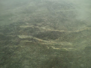
I found this
image of (possibly) some quartz veins in the stone that seemed interesting as
perhaps some naturally occurring “ambient images” that might remind a person of
Great Serpents – or Water Serpents, Horned Serpents, Underwater Panthers etc.
These veins
reminded me of some images I’d seen and mistakenly thought were from Bellows
Falls VT, but are actually in Maine and Canada that I’d seen in “A Possible
Water Serpent Effigy at Site R7-2, Rochester, Vermont” {http://rock-piles.com/R7-2/} by Norman
E. Muller (2007):
(Fig. 16 above, Fig. 17 below)
“…Snakes or serpents are common to the mythology of many
Indian tribes from South and Central America, where it is the feathered
serpent. In North America it is the
water serpent. As the Vastokases have written,
“the dwelling places of these great snakes are the insides of hills near lakes,
where underground passageways provide access to the water” and the meaning of
snakes to the Algonkians was multi-layered.
“They may represent the powers of evil and darkness in their
manifestations as fish-tailed or horned monsters, but they can also signify the
energy of life and the powers of regeneration; in myths they sometimes function
as vehicles of transition for the soul’s journey to the netherworld” (Vastokas &
Vastokas 1973:95). To Barnouw (1977:18)
“great horned serpents appear as entrance-way guardians. The bridge crossing over a river into the
land of the souls is a serpent disguised as a log.” Images of these creatures appear in the
Peterborough petroglyphs (Fig. 16) and in a petroglyph at Emden, Maine (Fig.
17), among other places. Interestingly,
the Kennebec River in Maine, in the Algonkian language, means serpent (Brinton
1868: 108) {Norman Muller on Water Serpent Effigies: http://rock-piles.com/R7-2/page3.html}.
Some of those
squiggles remind me very much of some naturally occurring (and maybe humanly
enhanced) "meandering" veins in stone below some "meandering" - and possibly Serpent-like - pictographs in this news story photo from a
little over a year ago:
And I get a
security warning when I try to get back to the online source of this photo, so please,
don’t try this at home – bad things could happen. I did talk about the photo
and the cracks and the ancient images with Jannie Loubser who appears in this
photo – and about naturally occurring veins as a sort of variant of and
placement of rock art near and more in other conversations, finding there is
often a connection between all of the above – so maybe there actually is
something significant in those quartz veins in those underwater photos of that
petroglyph so recently found by Ms. Spaulding.
And there may be
more to come about those thoughts. Proving once again that social media was
created to talk about interesting stones, I first heard about the Brattleboro
story from a post by a fellow who is interested in this ceremonial stone
business who said, “Way to go Mom!” above the link to this news story…
So, Exactly What Is A "Stonefort"?
(Tommy Hudson's comment to an earlier recent post led me to this - thanks Tommy!)
" This one-third of a mile loop trail took us on a tour of an
ancient "stonefort", one of ten wall-like structures, constructed
entirely of heavy stone, believed to have been erected in the Late Woodland
period between 600AD - 900AD in Southern Illinois. Each of these ancient
arrangements have been discovered on top of hills or promontories and were once
believed to have been used as some type of stone fortification, thus giving
them the name "Stonefort". These unique walls, consisting of heavy stones,
are now believed to have been constructed as meeting places or perhaps
ceremonial locations. The original wall that sat atop this particular trail was
actually removed, dismantled by early European settlers to the area, who used
the heavy stones as building materials. The low stone base is all that really
remains of the original site, however, in 1934 the Civilian Conservation Corps
(whom I can't thank enough) rebuilt the wall into the site that we see today.
During the reconstruction of the wall, the CCC found many Native American
artifacts including a good deal of pottery. "I personally love sites like
this that carry that hint of ancient mystery, sites such as this and Rock
Pile Mountain always pique my curiosity of early Native Americans and,
while marveling at their accomplishments and ingenuity, I also find myself
theorizing on what these sites may have been used for..."
Text and photos above are from "Giant City State Park: Stonefort Nature Trail" (Blog post for
Monday, November 3, 2014 by Shannon Buford), found at:
And that "Rock Pile Mountain" link reveals an interesting
image – and: “A word of warning, there are many different "rock
piles" on the peak of this mountain, obviously created either as a cruel
joke or as an homage to the real rock pile itself…According to what I've read
this ancient circle of granite rock is believed to have been piled near the
very peak of Rock Pile Mountain by some earlier man. The original Rock Pile,
for which this entire area and mountain was named, was over four foot tall.
However, according to some accounts I have read, due to present day travelers
and inconsiderate visitors the Rock Pile now is just over a foot or two in
areas, but you can certainly see that it is created by man, for some purpose...The exact purpose, well, we'll most likely never know…”
“Finding a spot of enlightenment and my center, in the Rock
Pile.”
Sunday, August 23, 2015
Wednesday, August 19, 2015
Tuesday, August 18, 2015
Red Brush Hill, Wrentham
I climbed up hill mostly next to the phone line, then over and down. It seems like I kept seeing a feature consisting of an outline against a boulder. This is a pattern that was familiar already from Borderland State Forest - a bit to the north. So here are examples from Red Brush Hill.
Note the small circle to the left of the larger rock:
Another, different and newer:
(from above)
And another (ain't this pretty?)
(from above, clearly with modern intervention)
It is modern but consistent with older things here.
Note the small circle to the left of the larger rock:
Another, different and newer:
(from above)
And another (ain't this pretty?)
(from above, clearly with modern intervention)
It is modern but consistent with older things here.
Sunday, August 16, 2015
Thursday, August 13, 2015
Old outlines with boulders - Borderland State Park
We saw quite a lot of these:
A few unnaturally clustered rocks, with a space between them. Here are some others:
I think these are quite old. Akin to the Lazy 9-style.
A few unnaturally clustered rocks, with a space between them. Here are some others:
I think these are quite old. Akin to the Lazy 9-style.
The Stone Age of Connecticut
New England Magazine Vol. 9 (1893-94)
(Last night I visited some friends who are visiting from Hawaii, staying at a cottage on Cedar (Swamp) Lake in Bristol CT, off of Witches Rock Road. There's some interesting "Indian stone related facts/stories" connected to the area, some I have posted about before, some details I had even missed such as this interesting observation: "At the reservoir on South Mountain, southwest of the Allen place, near the south end of the pond, and not far from the town line, the trail crossed what was then a swamp over a causeway of loose stones and earth, the nearest approach to a roadway ever made by the aborigines." But in the wee hours of this morning, I found something I hadn't seen before, this article for New England Magazine:)
“The stone age of Connecticut began its decline
with the advent of the whites in 1614, and in a very short time, probably not
more than fifty years, it had passed away forever. The Indians of Connecticut
were ignorant of the use of metal; nearly all their hardware was stone. This
age was indeed a primitive one as compared with the present, but was far from
primitive as compared with that which preceded it. These people were banded
together in many tribes, speaking different dialects, but all belonging to the
one language of the Algonquins. They fortified their villages, erected houses,
wore some clothing, slept upon bedsteads, made many implements and ornaments,
and sailed over deep waters in their canoes. They obtained food by hunting,
fishing, and trapping, prepared it when obtained by dressing and cooking, and,
not contented with natural supplies, cultivated the soil. Their crops were
harvested and stored, and meat, fish, and clams were dried for future use. When
we think of primitive man as he must have been, with no language, no shelter
but the rocks and trees, no food but such as nature furnished in an unprepared
state, and no implements of any kind, we find that these Indians were advanced
far beyond primitive man…We can learn something of the Connecticut Indians from
records of deeds, from numerous town histories, from Trumbull's and Barber’s
histories of Connecticut, and Thatcher's “Indian Biographies” ; but the only
works wholly devoted to them, so far as I know, are Trumbull’s "Indian
Names,” Orcutt’s “Indians of the Housatonic and Naugatuck Valleys," and
DeForest’s “ History of the Indians of Connecticut.” The latter is the largest
of these works, and Orcutt calls it a very creditable work for “a youth of only
one and-twenty years.” The author had, however, a hobby, and grasped at every
straw upon which he could base an argument that the former estimates of our
Indian population were too great, and he entirely disregarded or overlooked
such evidence of their numbers and location as may be found in the most
reliable of all records, —their works in stone. Trumbull has estimated the
Indian population of Connecticut at its discovery as from twelve to twenty
thousand souls, while DeForest put the figures at only six or seven thousand.
All of the State west of Farmington he describes as uninhabited, except
portions of the coast and the section near \Woodbury, where an insignificant
band was known to reside. In this DeForest is evidently mistaken. Wherever
stone relics other than a few arrow-points are found, it is certain that
Indians resided for a time at least; and many such relics have been found in
Litchfield County. Even if there was no settlement in the western part of the
State at the time of its discovery, Orcutt correctly says that “what was true two hundred years ago may not
have always been true." In 1646 there was a trading post established at
New Milford, showing that there must have been a considerable body of Indians
in that vicinity…(page 327)”
“A class of articles said to have been worn on the heads of
women is known as “bird-shaped objects” or “bird amulets,” although they have
been designated as corn huskers…”
“An interesting pipe was found at Waterbury many feet below
the surface. On the side of the bowl toward the stem is a sculptured face of an
impressive Indian character, having large ears, neatly drilled for the
attachment of drops. It is looking down upon a female figure which the artist
has carved on the top of the pipestem. Closely pressed upon the body of this
figure are her arms, with hands, which, by a daring stride of characteristic
Indian genius, are represented as of a new variety, having only three fingers
each. The stem is four inches long, and to drill it through such hard stone involved
no inconsiderable skill and labor.
(The above photo is from a different work, "Bristol CT: In the Olden Time “New Cambridge” (1907)
Another pipe (i), said by those who have
seen it to be of a make peculiar to the Northwest, was found at Waterbury
twenty-five feet below the surface…(338)”
“On the grounds of the Rev. John McCook at Niantic there
is a cupped granite bowlder of about a ton's weight. The only work on it
consists of six cup shaped depressions, which average about three inches in
diameter and five eighths of an inch deep. It is illustrated and described
in Vol. V., “Contributions to American Ethnology,” by Dr. Rau, in connection
with his paper entitled “Observations on Cup shaped and other Lapidarian Sculptures in the Old World and America.” Mr. McCook believes that it was
connected with the religious life of the Indians. Such was the use of similar
stones in the Old World; but it is not known that Connecticut Indians ever
worshipped any material object. In this paper Dr. Rau says: “Large cupped
blocks fully resembling those of the Old World have of late years been observed
in the United States. As yet a few only are known, but erelong I am confident
the existence of others will be ascertained. Whenever investigators have their
attention drawn to a new class of antiquities, they endeavor to find them, and
are usually successful in their efforts.” I doubt if the majority of collectors
ever found a single Indian relic, without having had a previous knowledge of
some similar object…(342)"
There is a ton of other artifact photos and drawings in the article.
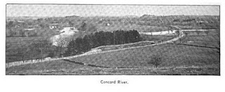
And elsewhere in the magazine are some Concord photos:
Wednesday, August 12, 2015
Monday, August 10, 2015
West side of Borderland State Park
Coming in from Massapoag, maybe 1/2 mile north of the fee-based parking lot. You cannot miss the manipulated rocks but I did not see many rock piles. Still scratching the surface here, in this park, but it is a dry woods and I am getting skeptical about spending more time exploring [I typed "boredland" before retyping the title] Here were several propped up boulders:
What was this? Some charred rocks are used to wall off a little enclosure.
But there was no charring at the bottom.
We headed east from these uplands, down towards the water. I have a few more photos.
Yes it is a dry woods, but it is a pretty place to walk around with little undergrowth:
What was this? Some charred rocks are used to wall off a little enclosure.
But there was no charring at the bottom.
We headed east from these uplands, down towards the water. I have a few more photos.
Yes it is a dry woods, but it is a pretty place to walk around with little undergrowth:
Sunday, August 09, 2015
Blueberry Mountain (Adirondacks)
"Alone in the woods" August 17, 2014
"The trail to Blueberry Mountain is very steep at the
beginning but the mountaintop offers wonderful views of the fog lifting from
the valley below. The trail is well-marked with yellow trail markers and stone
cairns placed strategically across the rock outcroppings where there are no
trees..."
"...While following the line of cairns atop Blueberry Mountain I
came upon some stones made into the shape of a heart. The moss growing on the
stones tells me they have been here for sometime..."
(Looking from?) Cascade Mountain - New York, United States
...(Toward?) Blueberry Mountain 2,897 ft / 883 m 2 mi / 3 km
away
Subscribe to:
Comments
(
Atom
)


