Wednesday, June 07, 2006

Visiting sites in Rochester, VT - from Norman Muller

Last month, a museum colleague and I went to Rochester, VT, to meet with others involved in the study of several cairn sites in the town, and to decide how best to approach their investigation. The weather was rainy and crummy for most of the weekend, but we managed to get out in the woods in spite of it and explore sites that I'm quite familiar with.

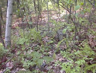
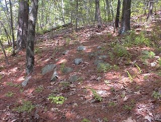
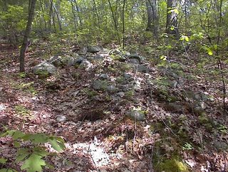
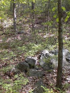
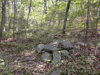
The first one we visited was a site designated R7-1, which is off West Hill Rd. This site has some 100 cairns of various shapes and sizes, many of them large and impressive. We started uphill, where we encountered a long cairn called the "Boat," but which to me looks more like a crescent when viewed on end:
In the middle of this and on top are two large slabs of quartz
that came from a large vein of the mineral about 150 feet away:
At the other end is what appears to be a Manitou stone,
an accent that I have seen at other features here and elsewhere. These stones are often associated with burials, but
they might have had other uses as well. Rains made everything wet and muddy, and rivulets of water ran over extensions to the cairns;
which I find fascinating, since they seem to have been intentionally attached to reach out to springs and other water sources. Another cairn with a smaller attachment is found lower down the slope:
We also saw a cairn with an apparently new stone placed on top (looks like quartz):
Perhaps it was left by one of the Native Americans who visit the site. At the bottom of the slope we walked past a large erratic with a stone, tongue-shaped attachment on one side
From one end the erratic looks like a turtle
with its head upraised, a characteristic that has sometimes been called simulacre.

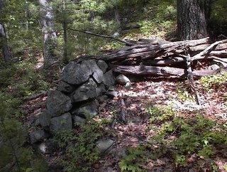
At another site (R7-2) we visited the wall-over-the-stream, which is literally a wall built on top of the stream, and follows it for hundreds of feet up the slope. In areas where the wall was breached by farmers, the wall was constructed by first constructing a stone culvert, capped with flat stones, on top of which the wall was built. In one image I am standing on top of the wall
and one can sense the undulating curve of the wall as it follows the course of the stream. As the day was very wet, one can see some water flowing against the base of the wall. The wall is a good 6' high at the end and very well constructed.
The stone lined culvert extends below the wall end.
It exits just to the left of the large dead tree in the foreground.
A closer image shows two small, moss covered piled stones supporting the capstone on the left side.

We ended our trip in Tunbridge, where I scouted some grooved boulders, one of which was on a private farm
This is called an edge grooved boulder, in that the deep banana grooves are on either side of a natural ridge on the boulder. They were once called Irish Ogam by Barry Fell, but they now appear to be associated with Indian fertility rituals; much research along this line has been done in the West. Martin and Dexter in their book on Vermont stone mysteries, America's Ancient Stone Relics, also illustrated another grooved boulder in Tunbridge, which is a much better example of edge grooving
Unfortunately, I was unable to find this example.

Tuesday, June 06, 2006

Split Boulder

by geophile

Here are two pictures of a split boulder near Oley Hills. The Oley Hills site is just a central concentration of stonework. The woods near it are full of minor separate sites of various kinds. This split boulder is part of a rock outcropping that showed signs of use. Unfortunately, when I took these pictures I didn't know to look for a wedged rock between the boulder pieces. However, in the picture above you can see a stick laid on the boulder so that it extended into the split.

One person who saw it thought the split boulder represented a deer hoof. It does bear a resemblance. However, another person said it might be a 'yoni' stone, representing female fertility. I guess it's in the eye of the beholder.

It would be worthwhile to get formal permission from as many property owners as possible along the hills near Oley Hills and make a survey of what's out there while it's still there. That's the sort of thing that might be easier to do with academic backing and student researchers, another reason to keep pushing for scientific recognition of the phenomenon of eastern indigenous stonework.

Another Wall

by geophile

Some pictures of stones along with the inimitable Frank Maykuth. He shows up in a lot of pictures because he did a lot of solo exploring and was good enough to share the sites he found. Here we see a detail of the base of one section of a very high wall or rock pile he showed us.

Frank is not a short guy but he was dwarfed by this structure. You can see moss and lichens on the rocks in the above picture, but he knew little about its history, so I can't say for sure who built it and when. It was very near, and by this I mean yards away from, other structures, some of which I've posted here before, including a 'fishtail' and a stone platform in a low area by a creek. On the other side of this structure, it rose only a few feet above the ground, so it served as a retaining wall.
I would want to do some homework on this, check with locals for stories or histories, before making any assertions about it except that it was imposing and well-made.

New Zealand rock piles and some curiosities

Norman Muller sends in this link:
http://www.celticnz.co.nz/Waitapu_Valley/Waitapu1.htm

Poking around there, led me to this [Click here] about a truly bizarre
stone structure in Oklahoma.

There seems to be a lot of curious stuff (alternate archeology) at the
parent site "Viewzone" [Click here].


One more - a ground pattern

Also from the location described in the previous post:
Note this is symmetric, following this pattern:

A unique site

I have written about this place before: a gully with little knolls and ponds and brooks and curious rock piles, near the water's edge, which are built up with one vertical side. Often the vertical side faces a smaller pile across a gap. I called this "pile-space-pile" or "pile-gap-pile". Anyway, I went back to show the place to a neighbor who was far from convinced by my talking about rock piles, that there was anything real about them. So we started the walk looking at a few minor rock-on-rock and wedged rocks - each of which he came up with some trivializing explanation for. After a while I said: you know in a few minutes you're going to stop saying that. And indeed when I showed him some of the piles pictured below he started chuckling and tried to come up with a few more explanations and finally gave up saying: well they could be ceremonial. When we got back home he said I did a good job convincing him. In fact all I did was show him the piles. So let us take a look at some of them. I am not going to say much about where this site is located and sort of like the idea of keeping it to myself - although there is at least one deer hunter who must know the place.
To give a picture of how the vertical side is important but like a "false front" with nothing behind it, here is a view from the back (note this might be an aperture pile):
I have written before about pile-gap-pile. Here are some examples, perhaps different angles on piles I have photo'ed before.
Seeing this last one, my neighbor said something to the effect that the pile was so substantial he could believe someone was buried inside it. Needless to say, I do not think these are burials. But he has a point and it certainly would be interesting to know if there is anything in there. Too bad we will not find out.

Just a couple of other nice pictures:
You can see how delicate this last one is. It must be reasonably recent. Piles that have been knocked over are easy enough to see at this site but for such delicate piles to survive long seems highly unlikely. I suspect the deer hunter's family. Speaking of deer hunters, at some point during the proceedings my neighbor was asking if these piles might not be places to hide while hunting deer? It seems the answer is simple enough: you do not need 100 places to hide when there is only one deer and one hunter. Nor do you do not need elaborate vertical piles to hide behind when a bush would do as well and when deer cannot see something if it is immobile - in fact you do not need to hide behind anything as long as you hold still and are down wind. Jokingly: also the deer would hardly be more fooled by a false front.
Of course at the site there are also numerous smaller piles, less photogenic but probably as important as the "nicer ones".

I think this is as a good a site as any to help come to grips with the purpose of the vertical facing. It would be nice to have the ability to map the site accurately and plot direction vectors for the false fronts, and see what lines up with what because, as I finally admitted to the neighbor (who had stopped asserting and started asking) I do think these have something to do with lines of sight.

One last comment: we walked through the site and out the other side along a forest path/road. Immediately after leaving the main gully and turning to look back, there is no sign at all that such a site is there downhill in the gully. You could walk by a hundred times and never suspect it.

Monday, June 05, 2006

Blogger is knackered

I can't upload pictures at the moment. I am trying.

Brown Rd Conservation Land Harvard, MA

Not much time for blogging today. Here are some pictures I took in the rain on Saturday at a conservation land north of Brown Rd in Harvard, at the lower curve of the road. There wasn't really much in the way of a "site" here, rather scattered clusters at a low density along the eastern facing slope of the hill there. I did not explore everywhere and got easily turned around in the rain until I decided to stay to the east on the side of Rt 495 so I could use the highway sounds for direction. Here are some of the highlights from that walk:

This is a vertical flake with a rock next to it.
Newcomers are not going to see anything in this and, in the past, I wouldn't have either. But as it occured in an area with numerous rock piles - a ceremonial area, and as I have seen this sort of thing before and had it pointed out enough times that I begin to credit it as a particular type of structure, I think I should pass it along. No clue about its meaning. The larger vertical rock has a notch in it like a gunsight.

Speaking of gunsights:
This split rock lines up almost accurately with a port-hole in the wall. It is not clear that it is designed with the intent of lining up with the hole in the wall. So this is just another thing to pass along. Look at these things not because they are a certainty but because they may be meaningful and we have to keep our eyes open to see what connects to what.

Here is a nice pile.
I haven't seen criss-crossed rocks like this before.

Then, I was coming down off of the hilltop, a place with boyscout seats around a campfire ring, and I was walking along an old road of sorts, and passing a stone wall, and saw this scatter of rocks beside a boulder. This certainly could be from field clearing but I am still not sure. It is a nice looking pile either way.
Then down near the eastern foot of the main hill there is a wetland with walls along its edge. Mavor & Dix calls this sort of large rock in a wall an "orthostat".

Sunday, June 04, 2006

Piles in the ferns - preview

Weekend photos from Larry Harrop

Larry writes in:

The first 27 pictures in the "colonial farm site" album
(http://larryharrop.com/main.php?g2_itemId=1630 ) were taken today.
Shows the stone walls a little better.
Don't forget to use the "Larger Photo" " link at the bottom of each image.
I also added a sub album inside the "colonial farm site" album called
"An interesting site 2 miles south of the farm"

Donation Pile in Korea

Bruce McAleer sent in this link
[Click here and scroll down]
It is worth noticing the appearance of the donation pile. A mess, unlike the organized piles we have looked at.

Rocks On Rock

by JimP
Peter's last post reminded me of this example from Parker Woodland in Coventry, RI.

Saturday, June 03, 2006

Friday, June 02, 2006

Huge piles from around the world - for comparison

[Click here and scroll down] Ireland

[Click here] Maes Howe - Orkney

[Click here] Anhui Province - China

[Click here] Not sure???

[Click here] Ostfold Norway

Yup, that is what burial mounds look like everywhere except in New England [insert snyde comment here about most Massachusetts academic archeologists.]

Russian megaliths

[Click here] for the "Dolmen Path". It may be of interest.
Thanks to reader Mike J. for the link.

Tim MacSweeney's new blog

[Click here] to see Tim's new blog "Waking up on Turtle Island". I added a link to the right. So far he has written a first post, and I'll be checking to see what else he adds. Congratulations Tim!

Thursday, June 01, 2006

Balanced Rock - Wachusetts

[Click here]
For AMC Gallery photo

Whipple Hill Lexington, MA - part 2

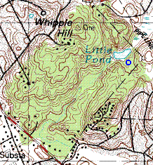
This shows the Whipple Hill Conservation Land in Lexington. The blue outline is the approximate location of a large rock pile (see part 1).

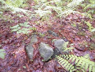
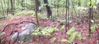
At a different place in the conservation land was a slope with low oval ground piles. I take it that these are either burials or extremely worn-down marker piles. We were walking along and were descending a slope when I saw this:
I thought it was too in-substantial to count until I noticed it was surrounded by other piles. The whole slope had nine or more piles like this:Now that I look at these more carefully, they look more like marker piles than burials.

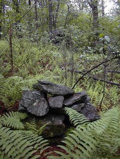
An interesting feature was what looked like a more recently built pile - a new pile built up from one of the older ones and incorporating wood to form an enclosure:
The wood might just be from a blow down but it looked as if someone put it there, and not too long ago.

Whipple Hill Lexington, MA - part 1

The Whipple Hill Conservation Land in Lexington is interesting for a number of reasons. One reason is the huge rock pile there, which I managed to miss each time I was there previously. Another is the distribution of this sort of large pile - I have only seen ones like this in Lexington and Weston, along Hobbs Brook and the upper reaches of the Charles River. Yet another reason is that Whipple Hill is really surrounded by city or at least densely populated suburbia - making the rock piles here the ones closest to downtown Boston that I have found. So let's discuss some of these topics.

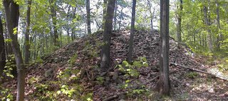
I usually enter the conservation land from the north, near the hilltop. It is a lovely place for a picnic with some bare rock and some views in all directons, except where blocked by a few trees. If you go up there, it is typical Massacusetts hilltop, with signs that everybody since whenever has been there and mucked around. Also there are a few faint traces of rock piles up there and if you head down the path you see a few more possible piles but nothing too exciting. As it turns out, there is much more conservation land downhill than I realized and there is a pond called "Little Pond". Tim Fohl was the first person to mention to me that there was a large rock pile by the pond. He also mentioned scooped out hollows in the pile as examples of deliberate prayer seats built into a pile. Here is a view of the top of the pile.
We have been disagreeing about that for quite a while. I believe it is more likely the hollows (which are very common in large rock piles) are from more recent people digging for buried treasure - it is vandalism not architecture. I don't know how to resolve this issue except, for now, to think that either is a possibility.

Anyway, this large pile is a spectacular large pile, perhaps 15 or more feet tall. It is composed of somewhat small rocks, mostly of the same general size, 6-8 inches across. Most are broken ledge rock and not glacial cobbles. The pile itself, sits next to a brook which feeds the pond about 30 yards away and it is on the eastern side of the pond - looking west over the water. The pond, if you examine it, is seen to be artificial. It is dammed at the southern end and water flows out of it to the north and also (a bit) to the south.

Now, I was walking with my father and asked: why here? He thought about it and concluded that the only plowable land nearby was adjacent to and behind this pile - so that is why it was there - the field was cleared to there. Usually I would argue that ledge rock and not glacial cobble precludes a pile from being a field clearing pile. But in this rocky area there is lots of broken up ledge rock mixed in with the dirt and my father could be right. Of course I don't think so, and my main reason is - look at the size of this thing. Thinking about the logistics of piling up more rocks on top, it would seem like a lot of unecessary work to build it so high. Luckily we do not have to make a decision about this. All piles are of interest and their particular nature is there to explore.

What had not been mentioned previously is that there are a number (I saw two) of other piles here with rocks tossed or placed on exposed outcrops.So these can be taken into further account in the discussion of why the piles are where they are and whether they are from field clearing or not.

The only other piles like this (relatively huge, made from small rocks, built up high) that I have seen, have been in the Lexington-Weston corridor, following Hobbs Brook which is a tributariey of the Charles River and which fills the "Cambridge Reservoir" system you see as you drive south on Rt 128/95, from about Rt 2. Bruce McAleer first showed me pile like this. It was overlooking one of the reservoirs in Weston:
The retaining wall you see in the second picture may be significant. I saw no retaining wall for the big pile at Whipple Hill. But nonetheless the piles are more similar than different and it is tempting to view them as a product of the same culture. By the way, this Weston pile is at the top of a ridge, not near any field. Its consituent cobbles are rounded and clearly come from Stoney Brook (another name for Hobbs Brook but further downstream), a bit of a walk down the ridge. So it strikes me as even less likely to be a field clearing pile. Anyway, I wonder about this watershed. The Charles is connected to the ocean in a way that the other watersheds I explore (the Assabet and the Nashua) are not. This opens up the possibility of a different culture, operating in a different travel corridor. To me, this is intriguing and makes me wish to explore other tributaries of the Charles and see if the pattern recurs in other place. We'll wait and see.

I had gone out out on Monday, Memorial Day, for a walk with my Dad which I expected to be a vacation from rock piles. But he wanted to go to Whipple Hill, so it was a great chance to follow up on what Tim Fohl had said and, as it turned out, there were other rock piles and even another site there.