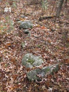
by theseventhgenerationThis is a stone wall near the Pepacton Reservoir in an area called The Pepacton Ledges. I started out by finding the end of the wall.

The wall widens just after (to the west of) the beginning in the above photo. I walked downhill and photographed some small, damaged looking rock piles, and continued walking west. I headed back up to the stone wall when I saw this in the distance.

Feeling like this is arguably some sort of mill or agrarian purpose at first glance, I still found myself attracted to the beauty of the entire structure and also surprised that this survived the flood of 2006.

The water runs right along the base of the wall on this (the western) side. The eastern side is higher and wet, but the water there is not as free flowing. It's hard to get a close look at the wall from this side without getting wet, so I hiked around through a break in the wall.
As I walked back east (now on the high side of the wall) and crossed the creek, I could hear water running underground (I have it on video, too, and it sounds wonderful). What I found next was completely unexpected.

Now standing with my back to that white rock and facing east, the wall looks like this:

After taking a waypoint and looking at it from Google Earth on the summer solstice sunrise, I changed my mind about the builder and the purpose of the wall...

...but I'll leave it up to the readers to decide.
 The lower part has been burnt.
 The upper part hasn't.
 Some nice standing stones could be natural. Except I doubt it.
 Rock-on-rock twins, each shaped from a flat plate of rock:
 My wife holds a giant puffball at the end of one walk:
 And a new rock pile! At the top of the crab apple orchard north of Hutchins Pond.
 Another view:


.JPG)
+crop.JPG)


