Saturday, June 22, 2013

A lucky week- Part 2

In the days after all my finds on June 9 I found a few hours after work to go and hit some favorite spots. I walked quite a bit in one place where I have found a lot of stuff before, hoping that the rains might have exposed something new, but there just wasn't a lot of exposure and I came up with nothing. On the way home I stopped at another place for only about 15 minutes. I got excited when I saw this:
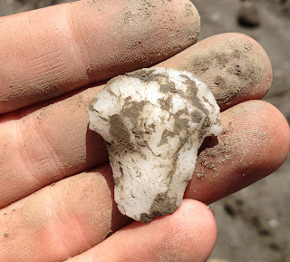
Unfortunately it is not as nice as I hoped it would be, it is a small stemmed point made of argillite, broken, and rather crudely made.
I also found another argillite artifact in that same spot, but even more crude, maybe a really rough knife or scraper, or a preform.
The next day I spent a lot of time in that same spot and found only two strange quartz artifacts that I can't readily identify. One is like a Squibnocket Triangle with a stem coming out of one corner(?). The other is maybe a broken drill.

Saturday, June 15, I returned to the spot where I had had so much luck the previous Sunday. As I wrote, I didn't have a lot of time there the first time and so I just blasted through looking for obvious stuff. I hoped that if I checked the whole place again, more carefully, I would have more luck. And I did. It had rained quite a bit since my previous visit, too, and new stuff was exposed. This small stemmed point (Wading River) is missing its tip but it looked great on the ground, with the stem sticking out.

I was specifically focusing on looking for materials other than quartz. But in this place, I kept finding broken quartz arrowheads. I read a survey of collections from eastern Massachusetts prepared by an archaeologist that indicated that while collections from north of the Mass Pike consisted of about 50 percent quartz arrowheads, collections from the southeastern part of the state were dominated by quartz.


 I finally did find something that was not quartz. This argillite piece really got my heart pumping! Unfortunately it is just a broken part of a blade, I was really disappointed.

Here is a strange one. It's whole, I'm not sure what to call it really. Maybe a specialized tool, a perforator or a drill of some kind?

I found these two small stemmed points within a few feet of each other.

Here are a few photos of some of the better finds from both trips to this small area, once I had got them home and cleaned off most of the dirt. I think this has to be the most productive area I have ever searched, based on sheer quantity.


Percolating

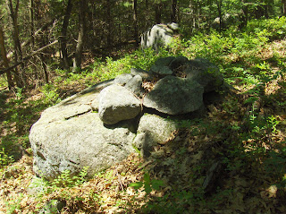
     While some sort of post about stone walls/stone rows is percolating, I started a little search for "Abandoned Stone Walls," as Prof. Thorson likes to call them - and define them. I contend that there's artistic imagery in the Native American "stone concentrations," as Prof. Thorson likes to call and define them, a way to stack the stones that recall animals important to the inhabitants of Turtle Island, some human like figures in there too. If the stones are placed to resemble/recall a bear or a deer or something, it may possibly be intended to remind you of a bear or a deer or something. 
I have stared at some stones in some mounds I've slowly been clearing debris off of, for at least 6 or 7 years now, up by my old chicken coop. It took a long time to realize there were many "single stone turtles" in among the other stones, even longer before I realized that what I thought was debitage might actually be the representation of the shell fragments surrounding a baby turtle. 
(See: http://wakinguponturtleisland.blogspot.com/2013/02/just-past-pipping.html )
     Like they say, "How long will you walk this trail of wisdom? Well, you will go to many places. You must look at them closely. You must remember all of them. Your relatives (and your friends hopefully) will talk to you about them. You must remember everything they tell you. You must think about it, and keep on thinking about it, and keep on thinking about it. You must do this because no one will help you but yourself. If you do this, your mind will become smooth. It will become steady and resilient. You will stay away from trouble. You will walk a long way and live a long time.
     Wisdom sits in places. It’s like water that never dries up. You need to drink water to stay alive, don’t you? Well, you also need to drink from places. You must remember everything about them. You must learn their names. You must remember what happened at them long ago. You must think about it and keep on thinking about it. Then your mind will become smoother and smoother. Then you will see danger before it happens. You will walk a long way and live along time. You will be wise. People will respect you (Basso 1996:127).” 
     So in a Google Image search today with "Abandoned Stone Walls" in the box, I stumbled on this one pretty quickly. My first impression: "Single Stone Turtle!"
(All I can capture is this tiny thumbnail image below; check it out on flickr, along with some other photos of some more stones:)
It is a JMurphyDesigns Photo stolen from:
We were talking about this sort of thing a while back, both in NE and the SE:

Wednesday, June 19, 2013

I didn't mean to go to Gardner

More a comedy of errors than a righteous site find. I made several tactical blunders in planning; the worst being that I misjudged the exit off Rt 2 by about 5 miles. So I passed where I thought I should exit then, confused, reversed directions and went back to the first place. Took a walk there in a woods at the end of a road that was similar enough to my plan that I only realized later it was a different place. Back in the car, I finally saw the mistake on the map (compounded by a page break at this spot in the map book) and proceeded to the originally planned exit, then drove far past the turn I wanted and gave up, going into yet another conservation land that looked a bit like the one I planned to visit. In the end I visited two places like the one I planned but never got there (Beech Hill in Westminster). 
At one point on this second walk, I saw a woodcock fly out of the woods and land on the road 20 yards ahead. It spotted me reaching for my camera and took off. On the walk, I just kept going uphill, up and over, trying to get to the back side of the hill (of course this was the wrong hill), and followed a bit of a gully - way high on the hill. There was not much there except walls. One thin trace of a wall led diagonally over to the brook so I followed it - the way you do. 
It led to the brook and across the brook was a massive bit of terracing:
This is deep in the woods and not an open field above. Instead the thick wall stopped after a few feet, then there as another wall "corner"  without much accompanying extension. It was completely covered with ferns. I walked back along the side of the slope and encountered more brief stretches of wall covered in ferns. It was hard going so I stepped down, back into the lower wetlands and hit rock piles - three or more of them.


Not much to see. But these terraces mixed with rock piles and a watershed high point are different than what I am used to. I imagine that the further from home I get, the more different things will be. It is only a bit true. I tried to sketch the features in black:
Back at my car again I realized this was still the wrong hill. I have it to do.

Tuesday, June 18, 2013

More pix from Duck Pond Ridge in Groton

I did not put these in the previous post, but it seems a shame to discard nice pictures.
 This is not the kind of thing you see too often in Groton:
 
I guess this is a "marker pile" site.
 
Lovely.
 Is this next an effigy?
 The scene:
Here the walls open to the rock pile site. Obviously designed into the original wall.
Maybe 39-40 rock piles.

Fort Devens Stone Wall Map Strikes Again!

I mentioned using the Fort Devens map (see link on the right) as a guide to two things. It shows where there are rocks in the sandy Nashua River valley. It also shows where the stone walls "go crazy" with brief stretches, strange outlines (like triangles and pentagons), walls that hug the edges of the wetlands, and persistent non-compass oriented directions re-appearing across the countryside.

It has been my working hypothesis that where the walls "go crazy" is a good place to look for rock piles. For starters, I could confirm this at a glance: the biggest concentrations of weird walls are around Patch Hill and Liberty Square in Boxborough and in Harvard at the end of Murray Ln. Indeed there are many rock pile sites in these areas with Murray Ln topping the charts.  (The site was found by Bruce McAleer and is reported with his permission). It has the densest concentration of rock piles I have seen anywhere in Middlesex County . So the hypothesis seems a good bet. Looking at the map again, I see several little pockets of weirdness and these are places I know, places with rock piles.

I used the map recently as a guide to where I should go in Shirley, and found rock piles as soon as I stepped into the woods. Last weekend I did the same thing: I noticed the walls are a bit crazy just southwest of Clay Pit Hill in Groton. Groton is a town I avoid - it is almost universally disappointing to explore there. Because of all the sand, and all the stone quarrying, and all the harsh usage. Yet I found a bit of conservation land containing the weird walls shown on the map above, drove there, stepped into the woods, and found rock piles promptly. 

This has gone beyond coincidence, beyond a simple parlor trick. What does it mean? It certainly is a useful way to locate sites but the implication for the stone walls seem a bit more important. We can now say with confidence that Indian stone walls include these properties: short stretches; large numbers of turns; hugging the wetlands; unusual shaped outlines. These "Indian" attributes may be hard to see on the ground but are easier to see from the "global perspective" of an overall map of the stone walls. In the end this tells us that some stone walls really are Indian. It is an independent verification of Mavor and Dix's theories. And it confirms a correlation between weird walls and rock piles. 
We need more of these stone wall maps. The Devens maps is a model for evaluating the quantity of ceremonial structures present. Other towns should map their stone walls! Much of the rest can be derived from that starting point.

So I called this the Duck Pond Ridge site in Groton. The site details are not particularly special. These were piles built on boulders, some with vertical facing, and no sign of larger rectangular mounds with hollows.


One detail was a small outline with a light/quartz rock placed in its center. This was at the southern extremity of the site, just above the housetops.
 
A suggestion is that the outline was used for a ceremony, and the light rock placed inside afterwards. 
It was an almost physical pleasure finding the site by hunting from the Devens map. Although the details may not be important, it is important to know there is a site there and to add a dot to the map. Here is today's version:
Also the relation to walls is important, even though it is hard to see at ground  level.

Monday, June 17, 2013

A lucky week - Part 1

     We've had a lot of heavy rain in recent weeks. There has been a lot of griping about that, but not from me. All these early summer rain storms are keeping me really busy! I've got a lot of pictures to show so please bear with me.
     I like to get out and look for arrowheads on the weekends but the weekend on June 8-9 was packed full of stuff I had to do, I didn't think I would be able to get out at all. I was out of town on Friday night but I knew it was just pouring rain and that the rain would be exposing arrowheads out there somewhere. Sunday I got up really early and had not a lot of time but I had to get out and look. I stopped at a spot where I have had some luck lately, the sun was already blinding even early in the morning and it was getting hot. Bright sun is rough when you are looking for arrowheads, it glares off the bare earth and harsh shadows can interfere with the intent focus that must be maintained when searching. But really the best time to look for arrowheads is simply when you are able to. In this place, I saw a lot of footprints, I know some of those must have been from other people looking for arrowheads, that does not bother me too much as nobody can spot everything and the ground surface is changing all the time. I found some broken fragments and this unfortunately broken large knife or scraper, this would have been really nice if not damaged.
This argillite base sticking out of the sand really got me excited. The part that you can see looks like it could be the base of something really nice. When I pulled it out I was a little disheartened to see that it was really crude, at the edge of what I would even call an arrowhead. I think these crude argillite blades were maybe hastily made for a specific use and then discarded. I find a lot of argillite chipping debris at some sites but few tools, maybe I am not even recognizing the tools as they are so crude that if broken they might be unrecognizable. The second picture shows all my finds from that spot that morning, there's another crude argillite piece, some quartz projectile point tip fragments, a tiny base. Not very much for two or three hours of searching in the sun.

As I searched, an unusual thing started happening. Every time I looked up from the ground, I would spot another person out there doing the same thing I was doing. First it was two people, then three... As the morning wore on there was at one point five other guys out there also looking for arrowheads. That makes me feel self-conscious and uneasy, it was starting to feel like a convention out there. Too much for me, and I was out of time anyway. I was not unhappy with the finds I had made and was ready to call it a day. After all, it wasn't too long ago that if I had found those fragments and pieces over the course of a month or two, I would be elated. I decided to take a different way home (I had driven kind of a long way) so I could drive by another spot where I had found a couple of arrowheads in the past. It's a small area near water, very muddy and wet. It's not a place where I would expect to find a lot of stuff because I am used to finding stuff in well-drained sandy places that would have been well-suited to setting up camps. But as I say it has produced a couple of things for me before, and where there is one there are always more so I figured it would be worth a very quick look. I got out of the car and noticed two things right away. The first was that the rain had unfortunately turned this muddy area into a morass, a quagmire of muck. The second thing, though, was more encouraging: no footprints. The ground surface was fresh, totally new since my last visit. I didn't have a lot of time but I thought maybe I could just take a very short walk along one edge of the mud. I took just a few steps and had been looking for about 20 seconds when I saw this.

That's the base of a Levanna point. Such a shame about the missing tip because this thing was a monster and it is beautifully made. The white stone against the dark mud was shining like a beacon. To find something right away like this I take as a clear sign that I could be on the verge of a very good day. I realized that I was going to have to get in there and search this place. I told myself I would force myself to walk as fast as possible and only pick up obvious stuff, like this Levanna base was. And right away I started finding more artifacts. I saw this sticking out of the mire.
I pulled on it and was disappointed when it came out of the ground with no effort. The flat triangular blade I expected was not there. Broken, I guess. I wiped away the mud and was astounded. Not broken. It's a hafted scraper.
This is an awesome find for me. It's thick and nicely made. I have some crude hafted scrapers made from small broken points at the discard stage that were reworked. But nothing like this. I love it. Another few minutes of walking, and I was spotting large bases of stemmed points just waiting to be picked up. These would have been really big arrowheads.


I thought this little piece of flaked quartz was maybe a piece of a triangular arrowhead. It turned out to be the tip of a decent point. Finally, a whole arrowhead.

Here's another whole one that was easy to spot. I really love this little stemmed point, this is a shape I like to find very much. The broken triangle was found not far away.

Another super obvious arrowhead, unfortunately missing the tip, and a triangle base. I went from being excited to elated, then to a stage where it became so surreal it did not seem like real life.

I have not shown a number of crude broken biface fragments, projectile point tips, and other badly damaged fragments. Here is my total haul for the day. And this after blasting through that productive spot as fast as possible, knowing I was missing stuff. I was back out again last week and weekend and found more artifacts. Later this week I will post my other finds from what turned out to be a really lucky week of searching. This last picture is all my finds for the day. I think I have had days where I have found more intact quality arrowheads but for sheer quantity this was my best day yet.

Foxglove

Wished I had one of these growing in my garden.
When I got home, it turned out I do have a white one.

Sunday, June 16, 2013

Saturday, June 15, 2013

CULTURAL LANDSCAPES IN CONFLICT

Photo (Dis)Credit: "My Rock Cairn" by GuthrieColin
"CULTURAL LANDSCAPES IN CONFLICT: ADDRESSING THE INTERESTS AND LANDSCAPE PERCPETIONS OF NATIVE AMERICANS, THE NATIONAL PARK SERVICE, AND THE AMERICAN PUBLIC IN NATIONAL PARKS" By Emily Anne Eide

Field Methods:
    The fieldwork for this project took place over a period of three weeks, July 11 to August 1, 2010, during which eight previously recorded prayer and fasting sites were surveyed and subject to condition assessments…Upon arriving at each site, the record site form of each individual site was compared directly to the current state of the site. When possible, the contexts of the record photos were used to further determine that the correct area for the site had been located. In some cases, it was possible to identify rocks in the record photos that were still present at the site. Once the team was confident that the correct area for the site was found and UTM coordinate information documented, any relevant structures were measured and photographed. When photographing a site, the team attempted to use the same camera placement as used in the record photos as noted earlier. Sketches of the site features and any other associated artifacts or graffiti were also drawn…
   Causes of impact include both human and natural factors ranging from bioturbation to deliberate site destruction. The most common categories of impact to the surveyed sites included natural weathering processes, recent graffiti, and the rearranging of site features into cairns or windbreaks…
   The most common forms of human impact were graffiti, the rearrangement of rock structures, noise pollution, and the placement of summit registers…(pages 30-33)”