Friday, August 24, 2018

East of the Franklin Water Tower

Going back and forth to the Cape is taking my explorations further south. I have been doing bits and pieces of Franklin for several years, Wrentham next and, eventually, Foxboro. I have been skipping Milford since Bruce MacAleer already showed me how that town is packed with rock piles. Somehow it is less fun to re-discover, so I have skipped Milford. Of course there are plenty of towns between Concord and Cape Cod and I have my work cut out for me. Anyway, here is a little piece of the map I have been looking at for a while, so I got out there last weekend. The water tower is located about at the cross-hair. After weeks away from the woods my hands were itching and curling spontaneously as I stepped out from under the power lines. Ah, the smell of hay scented ferns!
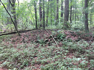
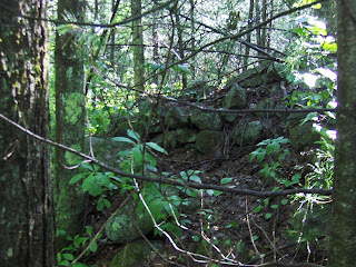
And of course there was a beautiful mound right there, which I showed previously. Here are other views. Interesting that someone would set up a camp (now abandoned) right there.
You can see the hollow better in these side views:

I do not see "corners" and the kind of rectangular shape I am used to seeing further north. This is no longer the Nashua watershed, but the sample is too small to conclude things about differences in styles of burial mounds. In fact, on this walk, there were several very different types of rock pile "mounds".

I continued south along the edge of the power lines. Having found this first mound (above) it made sense to stick to that topography, although I was headed for the headwater lake in the lower right of the map fragment. Here is a different mound, different shape, different age:

Nothing much to see. Here is another:
and another:
This one was actually quite tall, it does not show in the photo and, generally, I am sorry the pictures are not very clear. (I think an iPhone takes low contrast photos, without depth of field.)

I saw several examples like this:
This is a mixed soil/rock material in the shape of a "flattened donut" meaning the hole is not round but long and thin - more like a casket shape. There were several like this. The photos do not tell us much:

At this last place, there were several rocks-on-boulder piles, adjacent:

All in all, not too exciting. It seems that people over a wide stretch of time made there way up to this place from the water below. This is the Seven Mile River, heading south into Pawtucket.

There were a few other rock piles in there but most of the larger items were up by the power lines.

Tuesday, August 21, 2018

Got a walk in, planning another

Haven't seen one of these in a while, more later about it:

Monday, August 13, 2018

Another Stone Complex (GA)

More Rock Piles/Mounds
A large group of stone structures in the Chattahoochee National Forest
"A large, flat-topped oval mound, with large rocks stacked on top of a rock ledge base.   At one end was an upright stone that stood like an altar;   Sheldon H. stands next to it for scale.   The structure's form has been somewhat ruined due to blow-down of some large trees that had taken root in the mound..." 

Random Rock Pile

With only occasional exploring on the way back and forth to the Cape, I have seen almost nothing this summer. Stepping into the woods after a couple weeks away and it is a sheer relief to breathe in the hay-scented fern. Here was a one place where I saw an isolated pile, across Belcher Rd from Foolish Hill in Foxboro:

I will try harder today, when I head back in the other direction.

Oh yes, and this: an Ebony Spleenwort:

Wednesday, August 08, 2018

Thursday, July 26, 2018

ARCHAEOLOGISTS SAY HUMANS MAY HAVE COME TO TEXAS EARLIER THAN PREVIOUSLY THOUGHT

[From the Texas Standard, about the Gault site; a picture of  arrowheads from several layers below Clovis:]

“Right now we find no other technology that looks like this assemblage,” Williams says.

[PWAX says: really? You must not get out much. Those are the typical shapes of arrowheads from North Africa. This one is from Niger.]
[By the way, it looks like there are some Clovis precursors over there too. Or maybe they came from the US first?]

Monday, July 23, 2018

Field trip to the Upton Chamber

What:                   Field trip to the Upton Chamber and associated ceremonial stone landscape features atop nearby Pratt Hill

When:                  Saturday August 11 from 1PM to 4PM 
                              or Saturday Sept. 8 from 1-4pm 


Where:                 Meet at the American Legion parking lot at 15 Milford St, Upton, MA 01568
  • From there we will carpool to the Upton Chamber at Heritage Park, and then to the base of Pratt Hill
  • We will park at the base of Pratt Hill and walk to the NITHPT land at the top of the hill to see the stone features there
  • For elders and handicapped we will can transportation you up the hill if given advanced notice

RSVP:                    Please send email to nithpt.csl@gmail.com (we can accommodate up to 20 people)

Planning a couple walks

I am down on the Cape more than usual, so, no good walking [I have already explored around Falmouth, a lot]. I'll be heading north and hoping to get a couple walks in this week, and have something to report.
Update: struck out twice. Got wet.

Wednesday, July 11, 2018

Southern Franklin State Forest

I have reported on FSF before, here and here, when I visited the central and northern parts of the park. So on this visit, I went in from the end of Lorraine Metcalf Rd and stayed as far left as possible.
I spent most of the walk slogging - it rained hard the night before and -boy- is there a lot of Sweet Pepper Bush in there! I found some mounds around Magotty Hill but also got tuckered out when trying to return to the car I found myself at the water tower at the high point of the Forge Hill. Luckily I recognized the place and only had to do another mile of slogging to get back to the car.

So I want to say that the first mound, at A, was exactly where I expected to find something. I had taken a trail to the left from Lorraine Metcalf and, after it crossed a brook (you can see a western branch of Mine Brook there) there was another side trail leading off south. Kept south for a few yards until a stone wall crosses the trail and I followed the wall west down towards the wetland, thinking: "now this is the kind of place I expect rock piles". Sure enough, I poked my head into the bushes on the north side of the wall and saw something looming in the distance. I showed a video a couple posts ago. Here are some still photos. First a fuzzy picture from a nearby "satellite" pile towards the larger mound.
Better:


If there was a 'hollow' it was at the far end (more like what I called a "tail" in the past). 
Some other views:

How cool is that?

I continued south by bush and trail and eventually found some very messy things next to a field (at B) which I did not trust. I suspect these were real but added to by field clearing. I'll spare you all but a couple of the photos:


The piece of quartz swayed my opinion.

I continued west along and through some cleared field areas on Magotty Hill, then headed north. The underbrush was heavy and I exited the cleared area at the only spot (at C) where I would have seen this, and I take no credit for finding it - just lucky: 
(from the field view)
 (view back towards the open field)

That one is definitely real. 
After seeing these mounds in the southern part of the forest, I walked through thick wet bushes all the way north and then most of the way back to the car.

Update: I guess a chronological account like this, coming after many of the same ilk, adds little value other than the location of some rock piles - someone living nearby might want to go have a look. But in truth, what is observable at these sites is piles that are built up quite high - meaning they are young, without the type of "hollow" I expect to see in mounds further north. Should I compare these mounds to the ones over in Hassanamesit and Peppercorn Hill? My experience is still too patchy to make these comparisons confidently.

Sunday, July 01, 2018

Saturday, June 30, 2018

A mound in the "distance"

Great, when you turn aside and peak into the woods and see something through the bushes. (This is Franklin State Forest.)

Ames Long Pond (eastern side) - Stoughton Memorial Conservation Land

To be honest, it is not worth showing pictures from here - it was bright sunlight dappled shadows on top of old, broken-down, 'ground' piles.

Friday, June 29, 2018

First find in a long time

From the Concord corn fields:
This is a fine material, called hornfels, or "hornstone". I never found a complete item made from it before. Some other shots.


I believe it is a little knife. An unusual shape but undamaged.

SCOTLAND’S LONGEST NEOLITHIC CAIRN

Destroyed by Fowl Watchers
A photograph of the conceal construction erected at Carn Glas cairn. (Picture: NOSAS)

 Read more at: https://epeak.info/2018/06/27/scotlands-longest-neolithic-cairn-destroyed-by-fowl-watchers/

Wednesday, June 27, 2018

Tuesday, June 26, 2018

From Michael Hoye:
I found this portion of a stonewall to be interesting in Holland, Ma. Does anyone see anything here?

Thursday, June 21, 2018

Doug Harris leads a field trip to the Upton Chamber - July 14

(via Peter Anick)
Greetings,

Thanks to all who came to hear Doug Harris speak about indigenous ceremonial stone landscapes of New England during his recent Massachusetts tour. We at the Narragansett Indian Tribal Historic Preservation Trust (NITHPT) are excited to connect with anyone interested in learning to recognize, appreciate, and protect ceremonial stone landscapes. 

To that end, starting in June and continuing through October of this year, we will be leading monthly field trips in Upton to show people the Upton Chamber and companion features on top of Pratt Hill in Upton. The trips will be on the second Saturday of each month. The next field trip is slated for July 14th

Although there is no charge for the field trip, NITHPT is a not-for-profit 501C(3), and charitable donations are welcome to support our mission to protect and preserve ceremonial stone landscapes. 

*****************************************************************************************************
What:                   Field trip to the Upton Chamber and associated ceremonial stone landscape features atop nearby Pratt Hill

When:                  Saturday July 14th from 1PM to 4PM 

Where:                 Meet at the American Legion parking lot at 15 Milford St, Upton, MA 01568
·         From there we will carpool to the Upton Chamber at Heritage Park, and then to the base of Pratt Hill
·         We will park at the base of Pratt Hill and walk to the NITHPT land at the top of the hill to see the stone features there
·         For elders and handicapped we will can transportation you up the hill if given advanced notice

RSVP:  Please send email to nithpt.csl@gmail.com  (we can accommodate up to 20 people)

Monday, June 11, 2018

Headwaters of Canoe River - northernmost Foxborough

This the landform west of King Philips Rock, between Little Canoe River and Canoe River:
You can get there from East Str, where there is a brook croosing just below the dam of that pond in the middle of the map fragment.
At first I went more or less directly east and found a few low ground pile (upper blue outline):

Kind of a dull, dark, flat place under yearling pines.

I continued north and east, wanting to get up to whatever high points were available. Somewhere back in those hinterlands (and back down low near the water, that maybe now is "east" Canoe River) was a small site with three or four  items:
Otherwise it was dull in there. 

My main intention was to explore along the Canoe River and I am sorry I did not stick to that plan and explore along the river to the north. 

I eventually circled back to the lower end of the pond and went south along the edge of the high ground following a stone wall. This was a familiar configuration (I was reminded of Howard Rd in Shirley) of wall on bluff over brook - so I continued along southward, trying to keep an eye out for structures on either side of the wall. Not at all surprised to come to a mound. Some views:


At the end of the ridge was a collection of satellite piles that were more or less evenly spaced. A configuration of marker piles next to mound is familiar. Here we are looking back towards the mound which is to the not quite visible to the left in the background:

A little further downstream was another mound. 


This one had only one satellite.

Oley Hills - Twenty Years After

(From Norman Muller):
I retured to the Oley Hills site nearly twenty years have left it.  It is owned by a new family, and the terrain around the bottom of the hill has changed.  Attached is a photo of one of the cairns, how in an open field; before it was in a low growth of shrubs. It is built on a low, flat boulder and must be close to six feet high.

The other photo is of a donation cairn on the ridge top in view of the large platform cairn. Sorry the slide is so dark.  Attached is a photo of the platform cairn taken years ago.  I wasn't  that aware of the connection until today, approaching it from a different direction.