Friday, December 28, 2018

Hawthorne Brook - Plainville MA - part 2

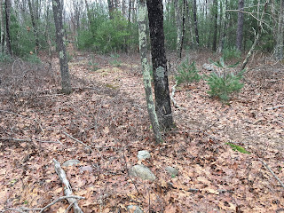
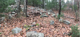
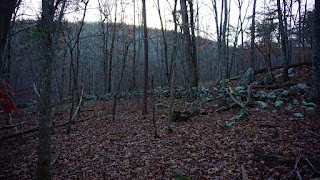
Continuing from here, we enter a space "choked with rock piles" I was getting overwhelmed:
From the looks of it, these dry ridges and dells are short walk uphill from the brook. 

Here is a smaller rectangle with a hollow:
Here are some interesting structures along the outcrop

And here is a double-chambered mound (just like in Callahan State Park)
Here is another smaller "box":
As earlier, we have small satellite piles and a trail passing through:
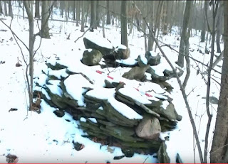
Note how someone has marked the beautiful vertical-sided pile on the left with a pink ribbon:
Here we are up on top of the ridge. I don't know what to make of this any more:
Cuz now we come to the big pavements, what bd called "terraces":
Another view:
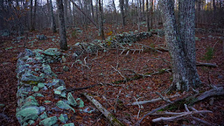
Note the bit of retaining wall.

Here is a pile with a "tail" consisting of a loose group of larger rocks connected to it on the right:
Another tumbled-down pavement:
This part of the site reminded me a lot of Pratt Hill.

Other things built against the outcrop:
Leading over to more pavement with retaining wall. Check this out:
Looking back:

And let's take a moment to look at this last pile:

What does it mean to leave a rosary by a mound?

Hawthorne Brook - Plainville MA - part 1

I was shown a superb site by reader bd, who felt it was time to let people know about this place. I found it a bit confusing because it had nicely preserved mounds with hollows - like "up north" [in Fitchburg], but you could see their affinity with more decrepit pavements - like "down south" [in Wrentham]. Plainville is the next town south of Wrentham and this complicates my attempts to distinguish north from south. Too bad about the theory, here is the data.

Between George Street and Hawthorne Brook, is essentially non-stop mounds "with hollows" including standard variations such as: free standing "pyramids", decrepit piles with tails (of more than one variety), double- and multi- chambered mounds, wall corner mounds, and large pavements. To me this suggests the site was used over a long period of time. Notably missing were the smallest form: the "lazy 9s", boxes, and other 8 foot across varieties. Also missing were the sort of well built "cairns" that one finds up north in a cluster around a spring, or in a group along a trail. I did not see any single rock-on-rock or split-wedged rocks. No propped boulders or prayer seats. So one thing that distinguishes this Hawthorne Brook site is that it is a very "pure" signal.
As you can see from the map, this is an area of little knolls and small brooks. It is very rocky and as soon as you drive in there you think: "man! this is good-for-nothing/perfect-for-rock pile territory". It is not clear how these woods might have been used in colonial times, except the land is too rocky to plow. There were no cedar trees to suggest it might have been an open field, so my guess is that it was a wood lot. It was easy walking throughout, with blueberry bushes between oaks. In any case I think this area saw light land use, because the mounds were more or less un-damaged. Some were more decrepit than others - providing an opportunity to establish chronology.

Here is the story: bd proposed a walk and we met at a conservation land parking lot. He then led me on an hour or so walk where we saw non-stop mounds made from small cobbles and occasional larger rocks. Next to almost each mounds, there were smaller piles on the ground, evenly spaced and  in a row. I call these satellites "marker" piles and often find them in association with larger mounds. The area was also full of stone walls going every which way.

I'll just show the pictures and make a few comments. First we went down into a little valley with low piles hidden in the saplings, then along a trail to this beauty, a rounded pyramid:
It looked over the valley beginning to the right of this picture. Here are the "marker" piles going on up the valley:

And another mound closer to the top of the valley. Note the style is different from the previous mound.
We go up to the corner of the walls. All the mounds seem to lie along the trail.
Then we came to a big rock overlooking a kettle hole. Clearly people know about these mounds. We'll see other evidence later.

Here is another, more like a pavement.

Along the same ridge but on the back slope, this older form, pile backed by outcrop:
In this case the "hollow" is a space between the outcrop and the cobble enclosure.

A typical wall corner:
Another:

Another archetypical rounded pyramid:
A perfect example.

After that, we walked out and across the street to another part of the area. I'll put it in a separate post.

Part 2 and Part 3.

Monday, December 24, 2018

Sunday, December 23, 2018

Wall and cairn site in Pickens County, SC

From reader dg:

I thought you might find this site interesting. It is located in the mountains of northern Pickens Co., SC. The approach is a little hazardous during the warm season (snakes, ticks, spiders, poison ivy, hidden 100-foot drop-offs, etc.), so I’ve slowly been documenting it during the winter months for a few years. I’ve also visited it with Tommy Hudson and Bill Phillips, so they may have some additional insights. I know that Bill recently showed it in one of his presentations. The most prominent features are a number of relatively short parallel walls (I’ve counted eleven) in a good state of preservation. Along with less clear features, including some cairns and berms, the whole assemblage covers a couple of acres. The walls, though in good condition, are not tall enough to be parts of livestock pens. There is no indication that the walls were joined together in the past, so the common assertion that these types of site are part of old farms seems unlikely. There are also some narrow paths or tracks on a hill adjacent to the walls — Tommy has suggested they might possibly be a result of early logging operations in the vicinity. In all, an intriguing site.


"U" or "V"-Shaped Stone Fills

From Norman Muller:

Attached is a photo my son took last October of a broad, U-shaped stone fill at the Ashfield lace wall site in MA.  This fill is partially visible on top of a large outcrop from below, and I instructed my son Pete to climb to the top of the outcrop to take the photo.  The short, lace-wall connector between the two points of the outcrop reminds me of V- and U-shaped fills I have seen and photographed at Newfane, VT, and at the Oley Hills site in PA.  The same thought process seems to be behind all three creations: to connect gaps.  Images of the two are attached, the first being the Newfane site.


Wednesday, December 19, 2018

(Almost) Solstice Sunrise (SE PA)

John's idea was to observe the sunrise from inside this stone worked circle as close to the Winter Solstice as good weather conditions allowed:


Sunrise 12/18/2018:
John pointed out to me that the "outstanding stone" you see up above in photo #3 seems to "look down toward" the circle:


Tuesday, December 18, 2018

Suggestive aerial views - Nashawena Island

The Elizabeth Islands are private islands between the Cape and the Vineyard  -  a chain of islands ending at Cuttyhunk which is public. I assume boats have been sailing though Vineyard sound, along this coastline, ever since they invented boats. I would expect to see landmarks of some kind.
Here is a bit of the east coast of one of the islands, Nashawena. One sees a couple interesting things if you zoom in (right click and open in new tab).

Monday, December 17, 2018

Finger Lakes area of NY

"This stone pile is on a west facing hill."
High quality video by David Schewe - Published on Dec 13, 2018

Thursday, December 13, 2018

Where Stuff Isn't

My lack of posts recently is not for lack of exploring. I have been driving back and forth from Concord to Woods Hole along a new route - Rt 95 which takes me past several towns I have rarely been to. I try to take a walk on each trip.

Lately that means Foxboro. Back in the day, Foxboro State Forest was well spoken of in NEARA circles  - I think because of the standing stones, perched boulders, and stone "U"s. I remember going there long ago with Alan Ruster and seeing a few rock piles but no major sites.  Now, driving past on Rt 95, I see some nice looking pieces of woods and I have been trying to get into them. I have to say that I am disappointed.

In particular, I have been along the Rumsford River; I have been over to the northern part of the State Forest, I have been northeast of Foolish Hill and, yesterday, went up and over the hill itself. There is almost nothing to show for these explorations, even though they covered a variety of topographies. At most I have seen a couple a stone "U"s here, a niche there. Each walk, separately, would have turned up multiple rock pile sites if this was Harvard or Boxborough. If it was Fitchburg, at least one of these walks would have turned up some mounds. Those towns are well north of Foxboro and in a different watershed. To the south of Foxboro, say in Wrentham, I am finding pavements as a matter of routine. But Foxboro seems noticeably devoid of rock pile sites. I am not saying there are none, just that I expected to find something by now.

I found one mound (I'll show you) and a few things suggesting astronomy but mostly...nothing. So why? Foxboro is a bit on the southern fringe of the Charles River watershed and a bit on the northern fringe of the rivers that drain into Rhode Island. Could it have been a neutral zone? Or a backwater? It could be my sampling bias. According to Curt Hoffman there are 14 sites reported for Foxboro - not necessarily rock pile sites, so perhaps he can tell us what kinds of sites they are. I find Foxboro to be somewhat of a dead zone.

It did find one mound in the low ground near the Rumsford River - a bit like a mound with a tail. I want to say that this is definitely not a pavement and nor is it a standard rectangular mound. It seems to me akin to the "lazy 9" and "pile with tail" that I have described elsewhere as a older form, found throughout the state.
Found this somewhere:

And I did find a couple things on the southwest side of Foolish Hill, on the side near Rt 95:


But as I was saying, these Foxboro finds are pretty slim pickings and there ought to be an explanation.

Monday, December 10, 2018

A Wall Site in Bartow Co., GA

Reader DG Merritt writes:
Some fall photos of a series of (likely) prehistoric walls near the headwaters of a creek in Pine Log Mtn WMA, Bartow Co., GA. Tommy Hudson led me to this site several years ago. It is well off the beaten path and mostly undisturbed. I have a lot of other pictures of this site, but since the leaves have fallen, the light put things in a different perspective. The main wall includes an interesting right-angle bend I don’t often see in the surviving walls around Georgia. The main orientation is N-S, with some separate, perpendicular segments. There are also some cairns associated with this site, on both sides of the creek; I have been trying to broaden my search around this location, since there seem to be some additional features — maybe buried by time — that are difficult to categorize.