
The two concave-base items on the right are barely arrowheads. I am not sure about the bottom one, the top one is pretty clearly a reworked flake. Kinda charming:
 A "skewed" arrowhead.


The base is carefully worked:

Just a little flake.

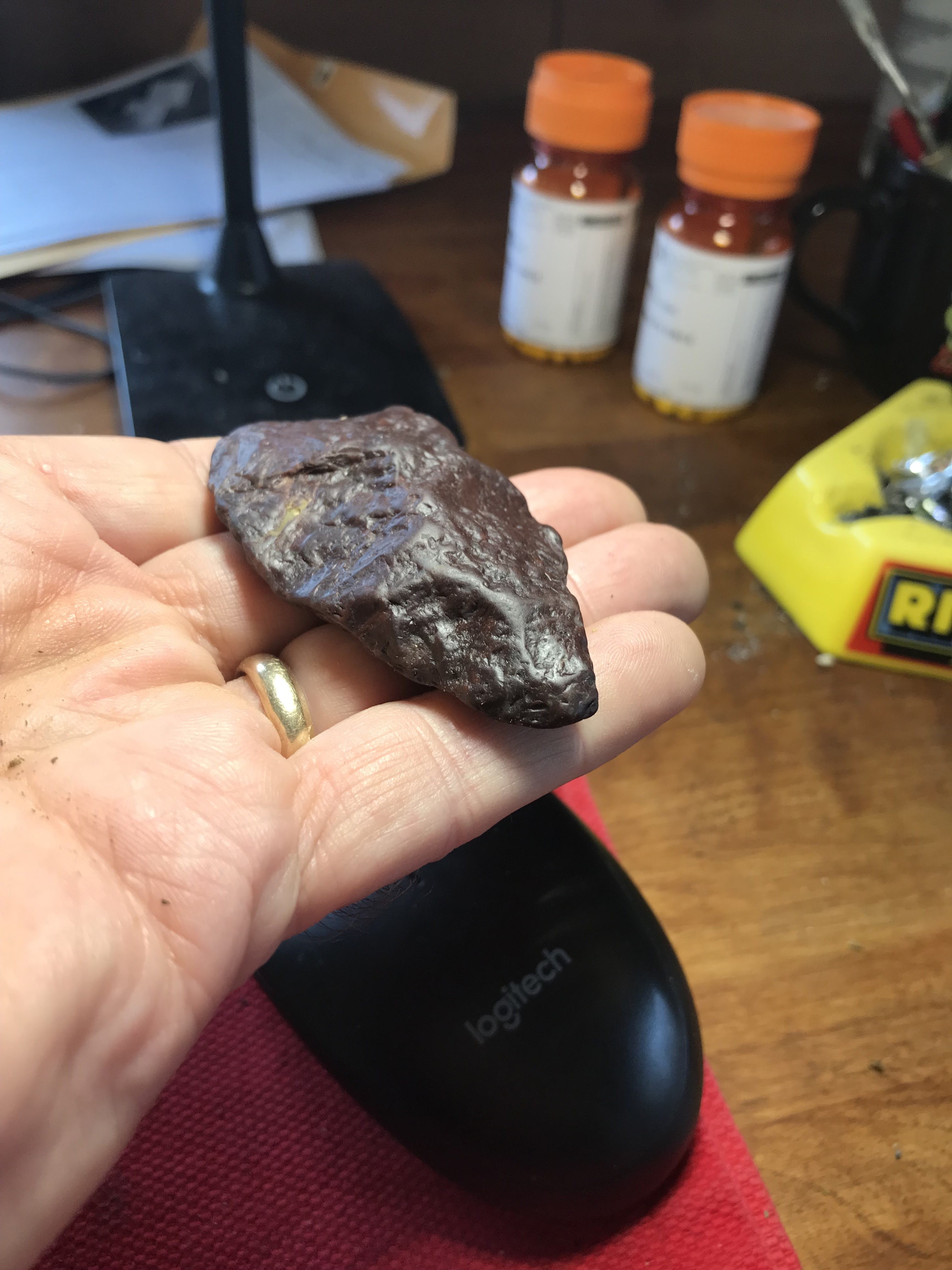
Not sure why I bent over and picked this up:

So I turned it over, hoping to see the sharp edge of a celt. Not entirely disappointed to find the curved edge of a gouge instead:


OSU archaeologists, on Idaho dig, find oldest known projectile points in the Americas - KTVZ
[Re: peopling of the Americas]
Ancient Humans May Have Sailed The Mediterranean 450,000 Years Ago : ScienceAlert
The assumption that all of our early pre-human ancestors were too dumb to walk and chew gum, seems pretty typical of a field dominated by the European male.



First in a long time, since retiring and looking for new places to hunt. I do not really count the ones from places that Chris P. showed me (see here). I found this location all on my own by looking at aerial photos and following the strategy which Chris taught me: it is about farms next to water.


I never pulled it off but have always believed it would not be hard to prove a field clearing pile had (relatively) random sized rocks - a uniform probability distribution for the different rock sizes. I stumbled over my inability to measure single rocks. When I first thought about it, I also realized that an excessive number of small flat rocks could be a signal for field clearing. Just now, I heard another one: that the collection of piles making up a field clearing pile "site" is itself a mess: piles of different shapes, piles of different sizes, piles on top of each other, piles with large, medium, or small rocks. It is not hard to see when a site is from field clearing.
[Not rock pile related]
I was driving around the "Head of the Bay" in Bourne, at the top of Buzzard's Bay. It occurred to me that where they dug the Cape Cod Canal, from the north to the south side of the cape, there was a natural series of lakes and waterways that did some of the job.
This route followed by today's canal was probably a travel corridor in pre-history. In fact, as I was driving around on Bournedale Rd there was a sign saying it was an "Ancient Way" and that I should drive carefully. [Not sure if reckless driving is a threat to the archaeological record or to the mood.]
Since they found lots of arrowheads at the southern end of this corridor, near the Aptucxet Trading Post in Bourne, I figured a good place to hunt plowed fields would be up at the Head of the Bay. Well, there were a few places visible from the aerial photos but they were either all grown over, or fenced in as part of very private farms. But as I drove back and forth checking several different places, I passed a cranberry bog several times (the one with three conspicuous windmills, that you see from Rt 495) and, eventually, thought I could spend some time looking around the edges of the bog - where they had been bulldozing not too long ago. I mean, if an ancient site is going to show up anywhere near here, it is most likely to show up in a cross section that really goes down into the glacial sands.
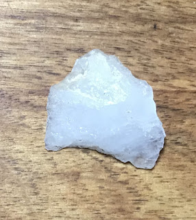
After looking around the edges of the bog, I was wandering around random piles of dirt and saw this:


But wait! Maybe the break is in the lower left of the previous picture and the lower right of this picture:

So maybe, if you are willing to spend an hour walking around newly bulldozed sand in a cranberry bog, you might find - at least - a broken quartz stone tool. It could be any age. But just because the sand is being mixed up by the bulldozer doesn't mean the find is not more or less in situ. Meaning it really is what it is: a stone tool in the glacial sand.
Did it start out on the surface or was it some depth in the sand? Well, I am not an expert but there are a couple clues. One: no weathering. Two: bits of orange (iron?) stain that have migrated into the superficial cracks on the surface of the quartz.
The long and the short of it is that this is not a completely crazy arrowhead hunting strategy. I have been eyeing some new bulldozing going on at the cranberry bogs along the Coonemessett River in Falmouth. Arrowheads are cool (and certainly what I am hoping to find) but a little bird is telling me that there could be a deeper story.
Along CA 168 near "Gilbert Pass" southwest of Fish Lake Valley at the north end of Deep Springs Valley.
What the heck is that circle?


While walking to the mailbox, I had another Serpent Surprise...

Not rock pile related but nicely done.
(2) Tom Loebel's ECIAS The Secret Lives of Paleoindians Talk - YouTube
Some very interesting ideas; for example that the largest, fanciest Clovis fluted points are found the furthest from their lithic sources. Meaning they were made for exchange rather than use.
Picked this up because it is so obviously a percussive flake:
You see a "bulb of percussion", and little radiating lines. Also the curved lines perpendicular to the radiating ones are typical conchoidal fracture. I think this is called "errailure".


Also this is a cautionary example. I am out at the opening of the harbor, looking for archaeology other than those stone rings (see here). It is underfoot, hiding within un-expected tool shapes.
Entering Tiverton from the north on Rt 24, you climb a hill from Fall River, MA up to the sign welcoming you to Rhode Islands. From there south to Fish Rd, you can see interesting boulder filled woods on either side of the highway. I went to take a look, choosing the east side to explore and wishing I could also explore the west side. I got lucky because there was a fine culvert underneath the highway - empty but with enough room for a camp of homeless - that took me to the other side.
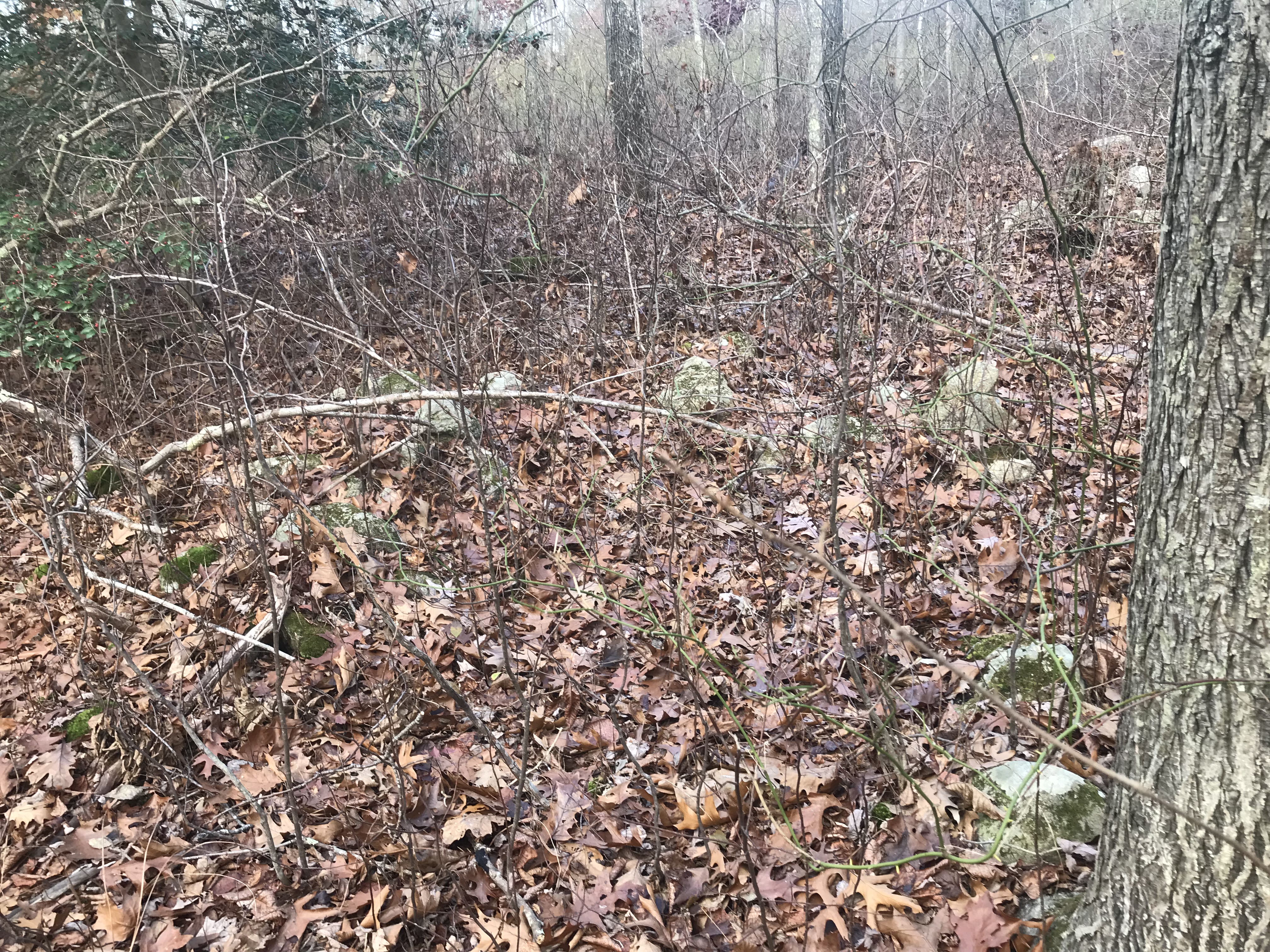
So, west side of the highway, a few inconspicuous outlines:


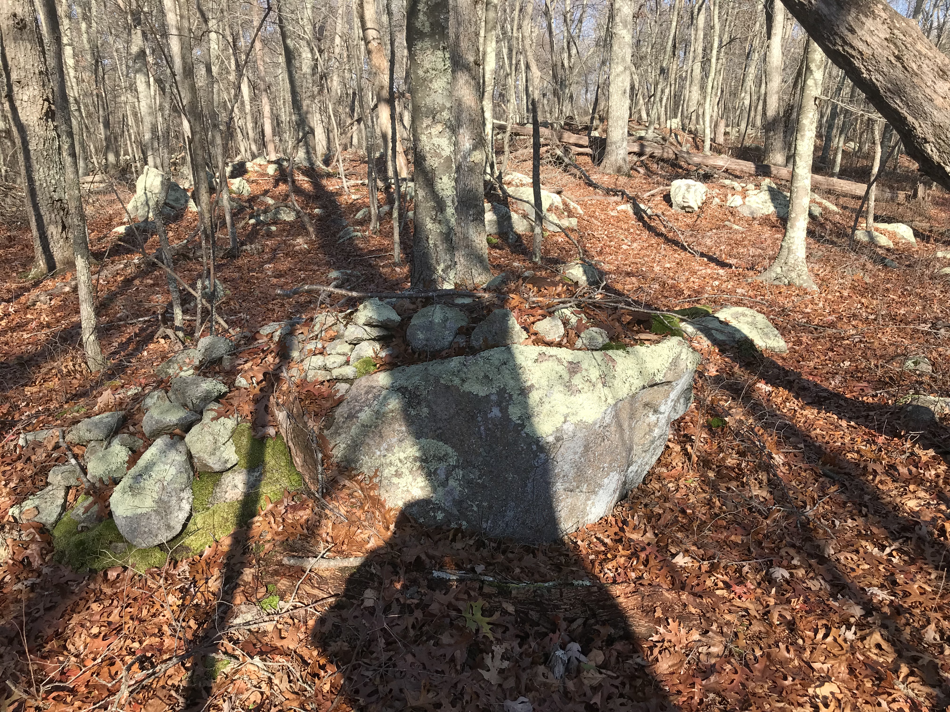
Back on the east side of the highway, I headed north towards the Massachusetts line, encountering a few signs ("evidence") here and there.




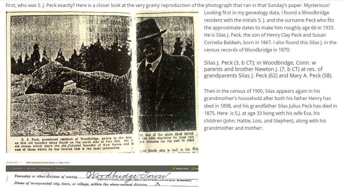
Carven Field Stones Amid Woodbridge Thickets Stand as
Silent Guardians of Line Established by First Colonial Surveyors — Penalty
Prevents Removal
New Haven Register November 26, 1933
“It seems that back
in 1933 lifelong Woodbridge resident S. J. Peck had finally uncovered a bit of
Woodbridge history he had been searching more than 20 years to find — one of
the boundary stones set out in 1672 to mark the border between what was then
the Milford Colony and the New Haven Colony. These two colonies each held
claims to the land that would one day be joined together to become the Town of
Woodbridge when it was established in 1784.
http://www.townhistory.org/ancient-boundary-markers/

I was forwarded a Facebook exchange on the subject of "aggressive" rock pile grooming. By "aggressive" I mean removing all the organic material that has accumulated on top of a stone structure - leaving only bare ("sweaty") rocks. I occasionally see pictures of piles that have been groomed like that and I refuse to publish the pictures and write the sender that they should stop doing that. This is not the only sort of vandalism that is done under the umbrella of destroying things in order to preserve them. Anyway, the following, from Mark Starr, is extremely well said:
When you strip all of that material from the boulders you
leave all those stones highly vulnerable to sliding off the next time a branch
hits it or ice and rain coat it, or even from squirrels hopping across them,
especially the ones on slopes as in your photos. All that moss and lichen not
only help define their antiquity, but act as glue, holding them in place. What
you learn by doing that is almost nothing, as the stones have undoubtedly
shifted already over time, and their position can be modeled without removing
everything holding them in place. You also ruin the possibility for modern
dating techniques such as OSL to be used. It may satisfy your personal
curiosity but ruins the science to be done in the future. Nearly everything you
show are simply stones placed by human hands randomly on the boulder. The significance
was the act of placing them. While some were undoubtedly placed in significant
patterns, nearly all of your photos simply show random placement, which is
obvious without removing moss, lichen, leaf clutter, etc.. If your photos
survive, all we will have is what they once looked like. I really wish you
would stop doing this to satisfy personal curiosity. Removing everything around
the stones no matter how carefully or respectfully still leaves them highly
vulnerable, and non-destructive documentation techniques exist that don't cause
this harm. I can always tell where you've been in the woods, and the cairns
stripped of their patina give modern hikers the impression they should get in
on the fun by adding to them or restacking them. I know you mean well and are
doing it for what you feel are the right reasons, but you are nonetheless
leaving a trail of destruction the future won't be able to study. Science isn't
served in any way by showing the stripped surfaces you leave behind.
The more important thing is still the long term preservation
of these objects. Archaeologists were taking cairns apart for years trying to
find the prize inside. They were eventually stopped from doing this because
first off, there was no prize inside, and secondly, no real science was being done.
They learned the lesson at least If you clean off 12,000 boulders to see
randomly placed stones on top and you can't figure out what's going on by then,
perhaps you should stop doing it, at least until you can figure it out. In most
cases, all you can do is speculate with the info supposedly gathered. what
little has been learned from all of this was largely known a long time ago.
Yes, a ton of speculation has been produced. So that's the second thing. Even
archeologists leave much of any site undone for the future - for more advanced
techniques and technology to come along and do a better job. How many times
have we regretted past archaeological digs that destroyed evidence they didn't
think possible to analyse? Is 12,000 examples not enough?
Thirdly, there are ways of gathering what little info that
has been gathered without resorting to what is being done. There is a
difference in removing branches, sticks, and this year's dropped leaves from a
cairn (or any other structure) and stripping off all of the materials as seen
in his photos. Everything that may have been measurable and provided clues in
the future has been erased. They never thought of studying seeds or pollen in
the past because they couldn't imagine the future. What don't we know now that's
just around the corner? DNA is now pulled from once unimaginable sources. Those
opportunities are now gone with his work. Okay, you want to try and figure out
something. How many chances do you get? If what you are learning is that people
placed stones on boulders you can do that without destructive techniques. If
its buried, and you absolutely must know there are buried stones there and how
they were placed, yes, you might have to uncover them. But what protected them
for you to get that opportunity, and more importantly can it be done in other
ways that leave them in the best state currently possible for the future? I
think we should always be looking to preserve as much as we can for the future.
With these particular cases, the ratio of knowledge gained to possible loss is
unreasonable. We can scan these structures and get far more information about
them than he is collecting without touching them.
So is this practice causing harm? Simply looking at the
photos he posts makes it more than obvious. All of the glue that has held them
together - moss, lichen, leaf clutter, etc., etc., is now gone. Just look at
the stones on the sloping edges and tell me they are less vulnerable than they
were. Yes, they were falling apart even with the glue, but now it will be far
more rapid. My original post was because I came home that day having seen this
in action. Someone had cleared out a vertical split in a boulder and after the
last big rain storm we had you could see all of the washout of materials at the
bottom. (I'm not saying YYY did this - it could be a copycat now that it's
okay to do this). The split had been filled with many small stones that were
now distributed all over the ground. Had the glue still been there so would
they. Now I can see all of the stones that were once there, but I could have
seen a whole lot of them by pulling a few leaves. What did I learn? There were
a lot of types of stones placed in the split. I pretty much knew that without
having to see them spilled out, and would have known that by pulling a few
leaves. The future will not know this. So there are photos of it. And when the
hard drive fails that stored them goes or someone tosses it out who didn't
think they were important then what? I've worked in museums and I know what
happens to ephemeral information. I worked for a museum for 20 years producing
3d models of objects in the collection. They paid a lot of money for me to do
so, and shortly after I left they threw out my computer as IT didn't know what
it was!
So what are the proper channels he's gone through? I know Doug Harris has repeatedly said in public not to touch them, as have the other tribal preservation officers I know. If he would let me with who has cleared him to do this that represents all the tribes I'd be satisfied and I can take it up with them. But in the long run, what is the goal? He states he is trying to hopefully reacquaint the tribes with their ancestors stone creations (see his full quote above). A nobel cause I'm sure, but does what he's doing do anything more than simply photographing them and sending those to them do? I know nothing I say or write is going to change what he does. Its always easy to justify what we want to do - just look at the fate of the indigenous peoples since the arrival of Europeans. Now however, with the internet, everyone and who feels they need to know what's under those leaves now has a license to do the same, and it doesn't bode well for these structures future.
The Enduring Native American Presence on the Land with Markham Starr
November 22, 2022 @ 6:30 pm – 7:30 pm

Markham Starr will present his slideshow that takes the audience on an extended walk through the woods to see the ceremonial stonework left behind by the indigenous population that occupied New England for 12,000 years. While Native American stonework is widely recognized in other sections of the United States, New England’s stonework remains obscure, having blended back into the woods. This slideshow contains photographs of objects and ceremonial sites in Connecticut and Rhode Island and information on how to find them.

Eerily parallel with the ethical issues surrounding making rock pile sites public. The main difference is that you can sell fossils but you cannot sell rock piles. [This is New Zealand:]
Bones of contention: The West Coast whale fossil and the ethics of private collecting (phys.org)
They recorded last night's talk, and I am looking forward to seeing it when it appears on YouTube. Meanwhile, it is not easy to find the video from Acton TV, with my previous talk; because that is in "Acton TV Archive". Here is the link, it is a better talk than the one I gave last night, but it is context for it and contains more details. Click Here


