Showing posts sorted by relevance for query Gap. Sort by date Show all posts

Wednesday, December 28, 2011

Some History of Rock Pile studies at Track Rock Gap and other sites in the Southeastern US

I asked Norman Muller to fill in some of the history of rock pile studies in the southeast. He writes:

In the late 1990s, probably when I contacted the University of Georgia Anthropology Department about Philip Smith’s 1962 article on prehistoric Georgia walls, someone in the department told me about Carey Waldrip’s research at Track Rock Gap. At that point, he and I maintained correspondence about his research of the terrace wall site at the Gap. This area is east of the petroglyphs at the Gap, for which the gap is named. In the 1990s, Carey, a native of Blairsville, GA, discovered the extensive stonework at the Gap. And then, in the late 1990s, he contacted Tommy Hudson, a developer, who then contracted Jannie Loubser to survey the site. Loubser at the time worked for New South Associates, an archaeological firm in Georgia. He was trained in South Africa, and is an international rock art specialist. Around 2000 Loubser surveyed the site and prepared a report, which is now available online.

In November 2002, while in Georgia attending a symposium at the University of Georgia, I drove to Blairsville to meet with Waldrip, who guided me through the wall site at the Gap, and then to another cairn and wall site a mile or so south of it. The majority of walls he showed me were low and generally parallel to the contour of the slope. The slope at the gap is rocky, the soil thin, and hardly desirable for agriculture. Plus, there were few streams or springs present to suggest that the walls served to dam or control water for an agricultural purpose. To my way of thinking, they were constructed for an entirely different function – perhaps ceremonial.

Since meeting Waldrip, I have corresponded intermittently with Loubser, and he has sent me pdf reports on the sites he has researched. Also, about four years ago I met Tommy Hudson at a meeting of the ESRARA (Eastern States Rock Art Research Association) in northwest Georgia. He funded the initial research of the Track Rock Gap site. Also, I have met and been in contact with Harry Holstein, an archaeologist in Alabama, who has researched wall sites similar to the one at Track Rock Gap.

Thornton’s recent hypothesis that the walls at Track Rock Gap are Mayan lacks credibility, judging from what I know about the site and the individuals who have studied it. If one reads what Thornton has written and compares it with reports by Loubser and Mark Williams (on Kenimer Mound), then it becomes clear that Thornton’s research is sloppy and that he modifies what others have written to support his own beliefs. Loubser’s research, however, is first class. He not only is a fine archaeologist, but he also has a deep understanding of Indian cosmology and mythology, which he incorporates in his reports. His article on Judaculla Rock in the journal Time & Mind (“From Boulder to Mountain and Back Again: Self-Similarity between Landscape and Mindscape in Cherokee Thought, Speech and Action as expressed by the Judaculla Rock Petroglyphs. Time & Mind 2 (3), 2009, 287-312) is exceptional not only for its sensitive perception and interpretation of Indian rock art, but also how knowledge of Cherokee history and beliefs amplify its interpretation.

Thursday, April 16, 2009

Gateways, Doorways, Windows - interpreting gaps, cracks, and veins in rocks

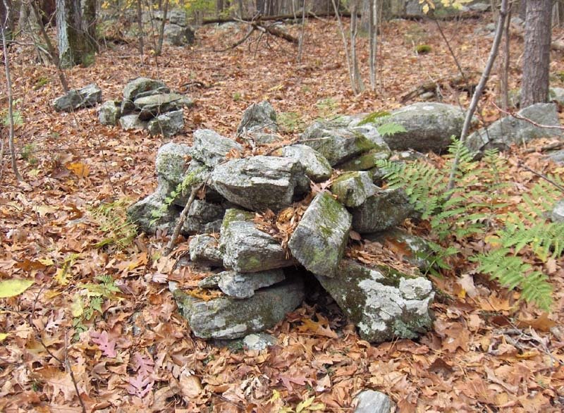
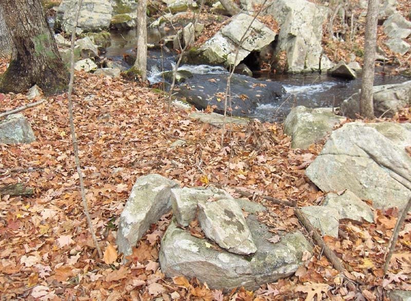
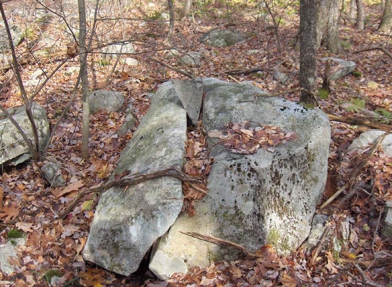
I increasingly believe that Native American ceremonialism included an understanding of spaces between rocks ("gaps"), cracks in rocks, and veins of other material within a rock. What this understanding was I don't know. One can only look at how things are being used and where they occur and what they occur in conjunction with, to try to make reasonable guesses. So here is a site at the Sargent Farm Conservation Land in Stow that occurs on a westward facing slope, at a spring - a place where water comes out of the ground with a few simple rock pile constructions all around. Here we see patterns that occur over and over at springs or at places along a brook - often where there are waterfalls or cataracts or, at least, the sound of water gurgling. Here is a first such pattern - a gap between two rocks, enhanced with some simple rock piling:Notice how the gap opens up towards a puddle of water in the background; also notice there is a smaller, subtler gap along that same line but a few feet beyond the first one. Here is a gap or a crack (narrower than a gap, not large enough for a person to walk through) that is filled with smaller rocks. I suspect this means something different than a gap. And here is another a few feet away:I could not see that these were pointed towards the water, like the gap, but I failed to observe carefully. Another very common pattern is a crack that is roofed over with a few smaller rocks. Maybe this is like the last two examples, maybe it is something different. In my little "cosmology" I imagine cracks that open downward had a particular significance - perhaps as doorways to an unpleasant spirit world, needing to be blocked. I was walking around looking at these and spotted a very noticeable black rock-on-rock: (closer)(another view)I was not until I got home and looked at the pictures that I noticed the black rock is sitting over a vein of quartz. There is some similarity to the covered crack of the previous pictures and I have very little doubt that this black rock was selected because of its deep color and iron rich composition. Did we think of quartz veins as having so much power that this was required? It is a new pattern for me and a pretty dramatic example.

I believe these gaps, cracks, and veins are a major part of what was going on at this site and my guess is that it has to do with channeling of "energy" both positive and negative, creating an interplay and perhaps balancing of forces. Some explanation is needed for why all these similar patterns occur in one place.

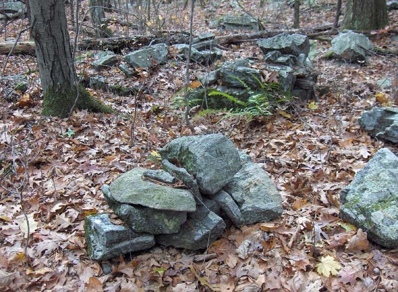
Finally let's take a closeup of some of the little rock piles:
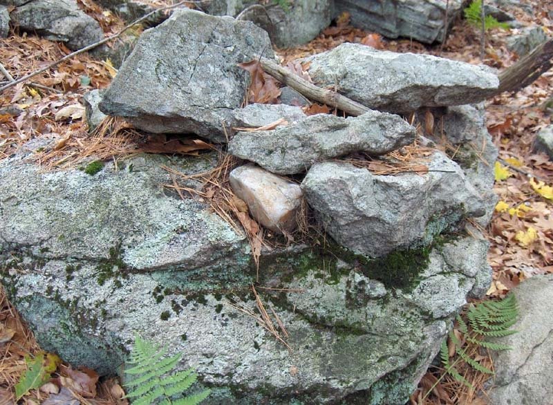
The neargound pile might actually be part of a small "gap", because of the second rock next to it. A closeup of the far pile, suggests its components are not random rocks:
I wonder about the shape of the lower rock, and about its composition:But that is another story.

Wednesday, February 12, 2014

Mayans at the Gate - from The Peoples of One Fire


Native American Brainfood No. 65
February 11, 2014
 
 Itza Mayas at the Gate
 
Information from a newly acquired map, published in 1721, reinforces architectural, genetic and linguistic evidence that Itza-Chontal Maya traders established towns in mountain gaps and river confluences along Southern Appalachian Mountain trade routes.  This is exactly how the Itza and Chontal Mayas established trade supremacy in Mesoamerica.
 
In the early 1700s the Cherokees labeled the region around Cherokee, Clay and Franklin Counties, North Carolina, plus Union, Towns, Rabun, White and Habersham Counties, Georgia as Itsayi (Place of the Itza’s.)  Most of the Cherokee towns with Itza Maya names disappeared from the European maps within a few years, while Creek and Seminole towns with Itza Maya names survived until the Trail of Tears.
 
Keywords: Itsate, Itsapa, Itsayi, Itcha-e, Itchao, Etchae, Echoee, Chiaha, Cheoah, Coweta, Coweeta, Chote, Chichi-we, Tallulah, Talasee,
 
Relates to the history of:
Itsate (Hitchiti) Creek ~ Highland Apalache ~ Valley Cherokee ~ Koweta Creek ~ Seminole ~ Overhill Cherokee ~ Apalachicola ~ Koasati ~ Kusa-te ~ Cusseta
 
One of the biggest dangers while translating Native American place names in the Southeast is that they are typically Anglicized and only approximate the original indigenous words.  For example, an internal “s” in Itstate Creek (Hitchiti) and the Maya “z” are  pronounced as “jzh” sound. In Cherokee, an English “s” more guttural “sh”.  So when an English speaker heard a Creek say It: jzhä : tē, it was written down as Hitchiti.
 
Cherokee was originally spoken with very little movement of the lips, whereas Itsate-Creek, like Maya, was often pronounced with the tip of the tongue or movement of the lips.  For example, the Itsate-Creek word for “bear”, nokoshe, became Naguche in Cherokee and Nacoochee in English.  Cherokees could not pronounce an Itzate “p” sound, so often dropped the “p” sound altogether from towns with Maya or Itsate Creek names.  Itsapo became Etchao.
 
In 2006 I was working on the design of the adaptive reuse of an early 20th century Ford dealership in downtown Clayton, GA into a locally owned mega-pharmacy.  Clayton is located in extreme northeast Georgia near the headwaters of the Little Tennessee River.  Some of the most fertile land in the Appalachians is located in the floodplain of this river between Clayton and the North Carolina line. This was also the location of an extremely important trade route that linked the South Atlantic Coast with the Tennessee Valley and Midwest.
 
The region around headwaters of the Little Tennessee and Tuckasegee River is the traditional homeland of the Koweta Creeks.  Known now by their Muskogee name, they were originally Itsate speakers, who called themselves Kowi-te (Mountain Lion People.)  The first European map to mention this ethnic group shows them living no farther north than the northeastern Georgia Mountains.  Their villages were scattered all over northern Georgia, but their capital in 1743 was in western Georgia on the Chattahoochee River. 
 
The Koweta Creeks’ presence in Franklin County, NC survives in the place names of Cowee, Coweyi and the Coweeta Mound.  The Coweeta Mound is now described in North Carolina literature as the oldest known Cherokee mound. Coweeta and Cowi are then explained as ancient Cherokee words, whose meanings have been lost.
 
After finishing the measurements of the old car dealership I drove northward to the GA-NC line to measure the little known Otto Mounds town site.  I had “discovered” the Otto Mound in 2005 by creating a triangular matrix of all Early Mississippian sites in Georgia.  The triangles were formed by the angle of the Winter Solstice Sunset, True North and True South.  All of the major towns of that period were aligned to this triangular matrix.  I suspected that there would be a mound somewhere near US 23-441 on the state line . . . and there it was.
 
Just to the south of the Otto Mound in Georgia are several other town sites with mounds along the Little Tennessee River.  They occupied what is now called Rabun Gap, but in the 1700s was called Itsate Gap.  It is a constricted, but gently sloped path through the Blue Ridge Mountains. A Native American canoe launched into the Little Tennessee River in Dillard, GA could have been paddled all the way to Cahokia and beyond.
 
This Proto-Creek province has received very little study from either Georgia or North Carolina archaeologists.  Most Georgia archaeologists have shown little interest in the mountains even though Robert Wauchope chronicled phenomenal archaeological resources in that region during 1939 and 1940.   The Otto Mound Site is 250 miles away from Chapel Hill and clearly off the radar screen of their archaeologists and educators. 
 
The only archaeological survey of the town site occurred in 1988 when a young archaeologist assigned to the Western District Office of the North Carolina State Historic Preservation Office visited it for a few hours.  She dug some post holes that immediately revealed an intense occupation of the town site going back to the Middle Woodland Period.  She found both Swift Creek and Hopewell style ceramics, plus Late Woodland and a full range of Mississippian Styles typically found around Etowah Mounds in NW Georgia. This presented a problem. Even though the same potsherds would have been labeled Napier Complicated Stamp, Woodstock, Etowah 1-3 and Lamar a hundred feet away in Georgia, she called them proto-Cherokee styles that didn’t exactly match potsherd found elsewhere in North Carolina.  She speculated that the town had been abandoned at some time in the 1600s.  There were some historical period artifacts near the surface that suggested the site might have been briefly occupied later on. 
 
The archaeologist did not know that William Bartram had visited this town in 1776. She also was not even aware that the Otto site contained several mounds and a rectangular plaza.  She apparently never looked at a topographic map, satellite photo or infrared image of the site. For reasons explained below, the Otto Site and a cluster of town sites immediately to the south in Georgia should be considered one of the more important archaeological zones in the Appalachians.  Instead these town sites are virtually ignored.
 
There is something very special about the site plan of this town on the Little Tennessee River.  The main mound is five sided like the big mound at Etowah.  The Otto Mound and its rectangular plaza are a mirror image of the five sided mound and plaza at Etowah, but approximately 1/10th the size. Both architectural monuments are aligned to the Winter Solstice sunset, which was the beginning of the Maya solar year.   It is the same shape and size as several five sided mounds along the Chattahoochee River in the vicinity of Columbus, GA. 
 
Linguistic evidence and the 1721 map
 
After measuring the main Otto Mound, I headed north to get eat some barbecue in Franklin, NC.  Along the way, a North Carolina historical marker entitled “Cherokee Victory” caught my eye.  I stopped to read about the Battle of Echoee.  It described a Cherokee victory against the British in 1760 farther south on US 23-441.  The battle was fought near the present Georgia-North Carolina line.  One word caught my eye.  It was Itsate.  That was the original name of the mountain pass at the location of the Otto Mounds, where the battle was fought.  I wondered, “Why would the most important gap in the Southern Blue Ridge Mountains have the same name as what the Itza Mayas called themselves?”   That was weird.  When I got home that evening, I looked up the words Echoee and Itsate in a Cherokee history website. Neither one had a known meaning in contemporary Cherokee.
 
In the years since then, I became aware that the original name of the large proto-Creek town around the five-side Kenimer Mound in Georgia’s Nacoochee Valley was Itsate.  This is where we re-discovered a large, terraced Chontal Maya ballcourt in October of 2013.  Robert Wauchope first documented it and gave the massive earthwork an official site number, but somehow both Georgia’s archaeologists and the Sautee Community forgot that it was literally composed the front yard of their community center.  
 
During the 1600s, French, Spanish and English maps placed a town named Apalache in the Nacoochee Valley.  This may be the European name for Itsate, since an infrared image picked up the footprint of a three sided fort immediately south of the cluster of indigenous earthworks.
 
The original name for a large town on the lower Little Tennessee River in Tennessee was also Itsate.  This town is better known by its Cherokee “nickname” of Chote.   However, Chote is also an Itza Maya word.  Cho’I was the language spoken by the Itza.  The “te” suffix means “people” in Itza and Itsate Creek.  Interestingly enough, the town named Itsate in the Nacoochee Valley eventually was also given the name Chote.  
 
Research into the Track Rock Terrace Complex in 2011 and 2012 revealed that the Itstate Creek name for the region north of the Blue Ridge Mountain in north-central Georgia, northeast Georgia and western North Carolina was Itsapa.  That is pure Itza-Chontal Maya and means “Place of the Itza.”   The Cherokee word for the region was Itsayi.  Itsayi and Itsapa had the same meaning.
 
A big surprise came with the 1721 Barnwell map of Southeastern North America. It was the first British map to mention the word “Charakee” and also included the names of many Cherokee towns.   There were three towns at Unicoi Gap, Itsate  (Echoee) Pass and Tanasee Gap that had Itza as a root word.  William Hamerton, the cartographer of this map, wrote the Cherokee “s” sound as a “tch”.  The map labeled the Cherokee province around the headwaters of the Little Tennessee River, Etchayi  (Itsayi).   That is the same label that the 1725 Hunter Map placed on the region around Brasstown Bald to the west.
 
The Barnwell map also displayed several village names along the Little Tennessee River between Rabun Gap and the Tennessee River that were obviously Itza Maya words.  Chiaha means “Salvia River” or possibly “Salvia Lord.”   Chichiwe means “Dog People.”  Several other village names had “Etchi” or “Itchi” as their anglicized roots. Near the confluence of the Tennessee and Little Tennessee River was another town named Itsate (Etchate in Hamerton’s spelling.)
 
A pattern emerges
 
The Cherokee towns with Maya names were located in North Carolina counties in which the 2102 POOF DNA study found substantial Maya DNA in members of the Eastern Band of Cherokees. This region was known as the Valley Cherokees. These Valley Cherokees had very different genetic profiles than those EBC members living on the Qualla Reservation, which were analyzed by DNA Consultants, Inc.  Also, the Valley Cherokees carried much higher percentages of Asiatic (Native American) DNA than those on the reservation.  Cherokees in Towns County, GA also carried substantial levels of South American DNA.
 
Although the POOF study was not a truly scientific random sample, no Middle Eastern DNA showed up in our test subjects, while Middle Eastern DNA was prevalent among Qualla Cherokees.  This contrast strongly suggests that the original Cherokee Alliance was composed of distinctly different ethnic groups.
 
The province of Itsapa was defined on all sides by tall mountains and interlaced by improved paths.  According to Creek tradition, a wide trail, paved with shells and white stones and known as the Great White Path, was constructed along a route that is now US 129 Highway.  It ran from the proto-Creek town of Talassee on the Little Tennessee River and Great Smoky Mountains in Graham County, NC; through present day Murphy, NC and Track Rock Gap, GA; then through Neels Gap and Dahlonega, GA to the head of canoe navigation of the Oconee River in present day Athens, GA.
 
At every one of the gaps in these high mountains there are Early Mississippian town sites with either five sided or truncated mounds.  A town named Itsate with the massive, five-sided Kenimer Mound guarded the eastern entrance to the Nacoochee Valley, while Nokoshe guarded the west. Itsapo was where Helen, GA now sits, guarding the Unicoi Gap, which was where both the Chattahoochee and Hiwassee Rivers had their sources.  Itsa-E (meaning the principal town) was the probable name of the Otto Mounds at Rabun Gap.  There was a large town at the base of Andrews Gap in Cherokee County, NC and another town with Tallula mound guarding the other side of the gap in Graham County, NC.  Tali guarded the Little Tennessee River Gorge through the Unaka Mountains. Chiaha was on an island in the Little Tennessee at the mouth of Nantahala Gorge.   A town of unknown name was situated on Cane Creek in Lumpkin County, GA where it flowed out of Neels Gap. 
 
Regional organization of town locations and maintenance of regional trade routes is strong evidence that the indigenous people of the Southern Appalachians were led by a political structure that was substantially more sophisticated than typical of what anthropologists label “chiefdoms.”  Many Southeastern tribes have a tradition that immigrants from the south introduced this political sophistication. They were called “sun lords” . . . hene ahau in Itza Maya.   The official title of the Second Chief of the Muscogee-Creek Nation is henehv.  
 
 
If anybody needs some snow, I can UPS it to you!  
 
Richard L. Thornton, Architect & City Planner
POOF Editor

Thursday, November 27, 2014

Indian Country Today article displays Maya glyph in Georgia as it disses Mayas in Georgia

From the "People of One Fire" about Track Rock Gap:

News Update
November 26, 2014

Indian Country Today article displays Maya glyph in Georgia as it disses Mayas in Georgia
You will roll over in the floor laughing when you find out who the US Forest Service experts really were! 

It was a beautiful, crisp autumn day and I was going to cut up some dead trees for firewood.  Then a Texas graduate student in anthropology, who is a POOF member,  sent me a link to an article in "Indian Country Today."  Being the proverbial Native America hunter, I smelled blood and went after the game.  The firewood had to wait.

She sent me the article because of the obvious oxymoron.  The US Forest Service had persuaded a New York City freelance writer to put out some more misinformation on Track Rock Gap and provided him the contact info for three individuals, who would say what they wanted said.  For those more idealistic among us, that is defined as propaganda.  Marxists perfected the techniques.  However, in full display of their ignorance, they sent a photo of a Maya glyph on the Track Rock petroglyphs to accompany an article which ended with a USFS "archaeologist" stating that there was no empirical or scientific evidence that any Mayas ever settled in Georgia.   You will see why we put "archaeologist" in quotes later on.

I am jest a simple mountain boy, so I guess the PhD didn't count DNA, words, architecture, agricultural methods and cultural traditions as being empirical or scientific.  He also didn't know diddlysquat about the Mayas, because the glyph he chose was for the Itza Maya word hene, which means "Royal Sun."

The theme of the article was that a small band of evil non-Native Americans in Georgia had schemed to hike on sacred Cherokee land and then claim that non-Native Americans (aka Mayas) had built the stone structures.  In partnership with three Cherokee tribes, the USFS had bravely blocked an illegal trail through the site.  Actually, the trail was a wagon road at least 200 years old that had been used by many generations of Georgians to drive cattle, go on picnics and hike. 

In the article were extensive quotations from 
Lisa LaRue-Baker, - the Historic Preservation Officer for the Keetuwah Band of Cherokee Indians in Oklahoma.  She took full credit for a half mile of trees being cut down to block Georgians from hiking at Track Rock Gap, AND demanding that neither the History Channel, PBS or National Geo be allowed to film Track Rock Gap.  Her reason stated in the article was that "Track Rock Gap was the last sacred spot that we have left."   Say what-t--t? 

FACTCHECK: The town at Track Rock was first developed around 800-1000 AD. The Cherokees didn't own that land until after 1785.  Actually, very few Cherokees ever lived nearby, and many of the indigenous Upper Creek families never left.  They still consider themselves Creeks. A nearby stream is named Coosa Creek.  The people who formed the Keetoowah Band never lived in the region near Track Rock Gap and left for Arkansas in 1817. 

Lisa LaRue Baker and USFS archaeologist, James Wettstaed,  have been quoted repeatedly in articles in newspapers and archaeological journals over the past three years as the experts on Track Rock Gap.  I decided to find out just who these experts were.  LaRue is the keyboardist for a little known rock band in Oklahoma name K2X.  You can check out her website, if you don't believe me.  In addition, she has the title of the Keetoowah Historic Preservation Officer, but the Keetoowah do not own ANY real estate, much less any historic buildings.  She performs those duties out of her home, whatever those duties actually are.  She has absolutely no educational background in historic preservation, archeology, architecture or Southeastern Native American history.

James Wettstaed, is a PhD biologist, who has worked for the past 27 years out west - mostly in Montana.   He is considered an expert on the migration patterns for bison and  elk. One can only guess why he was demoted and sent to Gainesville, GA to be their Cultural Resources officer in 2012.   

If you want to have a double belly roll full of laughs,  my Examiner article has a link to the Indian Country Today article.  The Examiner article link is:

http://www.examiner.com/article/network-displays-maya-glyph-from-georgia-article-dissing-mayas-georgia

Happy Turkey Day!

Richard Thornton

Wednesday, November 01, 2006

Above the Falls - a site at the headwaters of a brook in Bolton, MA

This weekend I found a site above a waterfall that impressed me. It was in an beautiful spot with some very nicely built piles. Also I think I learned something new which I want to try to explain. Here is a view up the waterfall:
And here is a video of the waterfall, to give you an idea of the sound.

The rock piles are up above the falls, on more level ground up there, where water is flowing underneath the tumbled boulders in a number of places.

When I first arrived in the area I saw one nice pile and then another and another.
As I proceeded I sensed something larger looming in the background - always a great feeling. Here is a video of my first impression:

I am obviously excited, although exaggerating for effect.

This large boulder is surrounded by rock piles. Here are some views of different sides and you will notice what seem like deliberate passageways between the boulder and the piles.
I was thinking, "Gosh! Walk through there and you will come out a different person". This thought had me looking at these "passageways" as if they served a purpose as a kind of doorway with the central boulder playing an important role. Then I noticed several other examples of the same sized "doorway" but without the boulder.

At around this point I realized how similar this is to what I called "pile-gap-pile" or "pile-space-pile" in describing a previously unique site in Westford. Now I know two examples of this kind of site.

Look more closely at this example:
We look out through the gap and see a wet spot (indicated by more green in ground cover) and we also see (actually FFC noticed this in the photo) a single rock and then another further off, behind the wet spot. So perhaps it is not about a person walking through a doorway but something else passing through this space. Perhaps it is a ray of light, or something - some "energy" passing out from the wet place. This last idea is re-enforced by seeing a small pile next to the waterfall with a small gap.Perhaps it is just damage not a deliberate gap but after looking at the larger pile-gap-piles I wonder. So what I learned is to think of these pile-gap-piles as related not necessarily to alignments but perhaps to doorways through which something could pass - perhaps something related to water not light.

Here is another pile:
This place in Bolton is west of the Rt 495/Beaver Brook corridor, in the same basic line of hills where all the other major rock pile sites are found (except for the Hill of 500 Cairns which is on the east side of the valley). All fall I have been looking for another largish site along here and am happy that with this site I also found something very distinct from the marker pile sites which are the norm in these hills.

Nor is this site a typical "brookside" site. Absent are the numerous rock-on-rocks and alignments. There was one seat-like arrangement of three close together piles forming three sides of what could have been an enclosure. Note the piece of quartz in the pile to the rear.
Here is a detail of it.
Also there was at least one split-wedged rock.
But this is a special kind of site.

Finally I should mention that near the boulder I found a large deer skull, with 9-point antlers, in perfect condition. The skull was lying teeth up, all the teeth were in place and one antler point was stuck into the ground. There was no sign of the rest of the deer and the skull was clean. Sort of curious. I traded it with FFC for a lunch.

Thursday, June 24, 2010

Odds and Ends - Upton State Forest

There is a place on Spring Street where a path leads into Upton State Forest to the east of the road. Starting in there, something like a "gap" pile appears immediately on your left:By a "gap" pile, I mean a pile on a rock, separated by a few feet from another rock, giving the impression of a single structure, with the gap between the rocks playing a role in the structure's function. In this case, the rock on the left has piled on smaller rocks, and across the gap, the other rock has a thick vein of quartz:Further in along the path is a boulder with a short stretch of stone wall. I think we went down and then back up and I left the path following the ridge to the right - where I came across some hints of ceremonialism and, in particular, a somewhat rare thing: a rock-on-rock made of quartz: This was at the edge of ridge looking out over a steep drop-off. I remember (but might not be able to locate a picture of it) another example of a quartz rock-on-rock from exactly the same context - looking out over a steep drop-off. Here is a detail of the quartz:I haven't mentioned it recently for newer readers but the belief is that quartz is an amplifier for "spiritual energy", lacking any particular characteristics of its own. Found occasionally in this context as a rock-on-rock at the edge of an outlook, the interpretation would be that this helps whatever "energy" is passing outward or back inward from that look out.

Returning to the entrance, the obligatory split-wedged rock:

Monday, May 29, 2023

Hunting for Archeology near Boulder CO, Day 2 - The Ron Steward Preserve on Rabbit Mountain

Another one of the types of places in CO that seemed worth exploring for arrowheads were a few spots marked "spring" on my topo map. I picked the furthest east foothill of the Rockies I could find. I figured that, in an arid environment, a spring would be a likely place to find signs of man. Sadly most of the "nature" around Boulder is fenced off to protect it from a bike-crazed culture. 

[A brief digression for social commentary: Boulder area is overrun with physical fitness enthusiasts. For them, nature is an extension of the gym - a place for vigorous exercise. Sadly they have no idea what to do outdoors. The rivers did not even have boat launches! It makes me contemplate trying some kind of outreach, to teach them about identifying flowers, birdwatching, archeology hunting, butterflies and moths.....the list goes on. One senses that a large number of New Yorkers relocated to this area, for the rock climbing and the overall hipness of the place. On the other hand, it has the least expensive and most excellent food I have had, anywhere in America.]

Driving up to the Ron Stewart Preserve, I started to notice stone walls:

The first spring we went to on Rabbit Mountain was public land, fenced off from the public. We got lucky and found some un-fenced public trails on the western side of Rabbit Mountain. 

Everywhere, there were suggestive bits of wall, propped rocks, and outlines on the ground. Was it purely ceremonial? I doubt it. This is the traditional homeland of the Arapahoe, who where a [displaced eastern?] Algonquian speaking tribe. One imagines them sharing some stone placing traditions with the New England tribes. But we were looking for arrowheads and thinking about hunters. All the walls I got to look at carefully were designed as funnels running up the sides of slopes.

We walked up the path a bit:
I kept noticing rock-on-rock, and little hints of stone wall. After thinking about it, I conclude that animals would prefer to not step on rocks, so even a sketchy wall is enough to encourage an animal to make a choice. In this last photo there is a bit of wall along the side of the path. You could suppose they tossed rocks over there while making the path. Or you could assume the wall caused the animals to walk along that side of the wall - creating a game trail which, today, is a human one.

We left the path at an outlook, heading down over slippery rocks to get a better look at a wall. It was rainy so what is apparently a very rattlesnake-y place was safe to scramble around. There was a big wall cutting across the slope:

The wall passes a pine tree, right of center. Just left of there, is a bare place on the hill with a scatter of rocks. That is a structure. Up close: 
It turns out that just below the pine tree, there is a gap in the wall and a short stretch just below that, blocking the gap - as I'll show in a moment. I wanted to believe this 'structure' was where the hunters waited. So the arrowheads and flaking debris would be under ground here. We should have stopped and looked more carefully. We should have climbed further up hill and examined the "pass". I was over-pre-occupied with the stone wall.

Here is the pine tree, the gap is below it.

Just below the gap was a short stretch of stone wall:
At the near end:
That looks like a path. I conclude, the walls are there for animal flow control. Look closely at this. There are little hints:
We did not see a single flaked rock. I was too busy looking at arranged rocks.

Wednesday, November 03, 2010

Small Site on Greenough Land, Carlisle MA

Although consisting of no more than 4 or 5 rock piles this little site had a couple of interesting features. On approach, a simple construction:Then, an outcrop:A spotted the first larger rock pile downhill from the outcrop:The important point here is the bit of stone wall that zigzags from the pile back up to the outcrop. Maybe you are thinking "turtle". But turtles do not have long necks, so what then? That was a first interesting feature. Here is a closeup of the pile:And then a "Gap Pile".
What is interesting about this, to me, is that I sometimes think a person is supposed to walk through that gap. In this example there is actually a path through the gap. Respectfully, I walked clockwise around the larger pile.

Wednesday, October 14, 2009

Gap Piles

I have written about piles that make a space, either with a rock or with another pile. The space, which I am calling a "gap" would be wide enough to walk through and often is angled to open towards water. Here is an example from Marble Hill, StowCloser:Can one compare this to a split rock? Some other examples here.

UPDATE: I should mention that often some interesting object or feature appears directly along the midline of the gap.

Tuesday, May 19, 2009

Looking over Hy-Crest Pond - Sterling, MA

The springs and headwaters in Sterling frequently have small rock pile sites, so I thought it would be worth exploring a bit more out there in "Wachusett Greenway" territory. I saw rock piles in three different places but the site looking north over Hy-Crest Pond was a bit different. This is a site with rock piles on top of boulders, all around a cellar hole. Having just seen this phenomenon last weekend around the Kibbe cellar hole in Carlisle it kind of stands out as a particular type of rock pile site. In addition to a cellar hole and rock piles on surrounding boulders, there were also examples of pile-gap-piles. For lack of a better phrase let's call this a "cellar hole rock pile site". Here is a view of the hilltop looking towards the pond:When I stepped into the woods, I saw a first pile on a boulder, with a lot of debris on it:
And then, I saw several others. They were so covered with debris I figured them to be dumped soil and dirt - not a good sign. But later I decided they were just old piles.Here was another:And another:
I could not shake the doubt that these had something to do (something practical and mundane) with the cellar hole at the top of the hill. But these next ones reassured me:A possible pile-gap-pile:Not much doubt about this one:If you go poking around in there, walk downhill to the east towards the brook. You'll come to a stone wall with a curious tumble of rocks along the wall. I did not photo it because it looked like a rock dump. But at the time, I was wondering if it was a collapsed chamber. The rocks were mostly of the same dimension and there was something a bit odd about the tumble. I should have photo'd it.

So, if I see a site around a cellar hole again, I am going to look for:
  • cellar hole
  • pile on boulders around the hole
  • pile-gap-pile (or wedged rock with very wide split)
This may be a pattern worth noticing. It seems to me, some of the places on Larry Harrop's website are somehow similar.