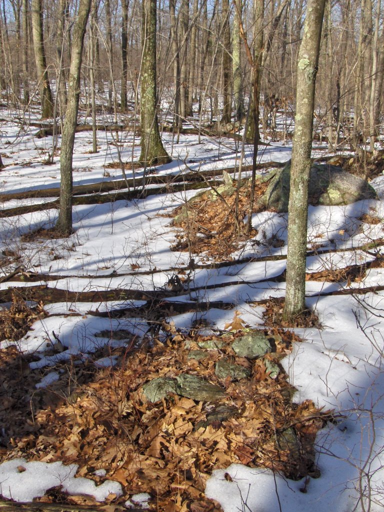
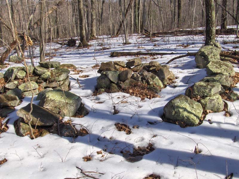
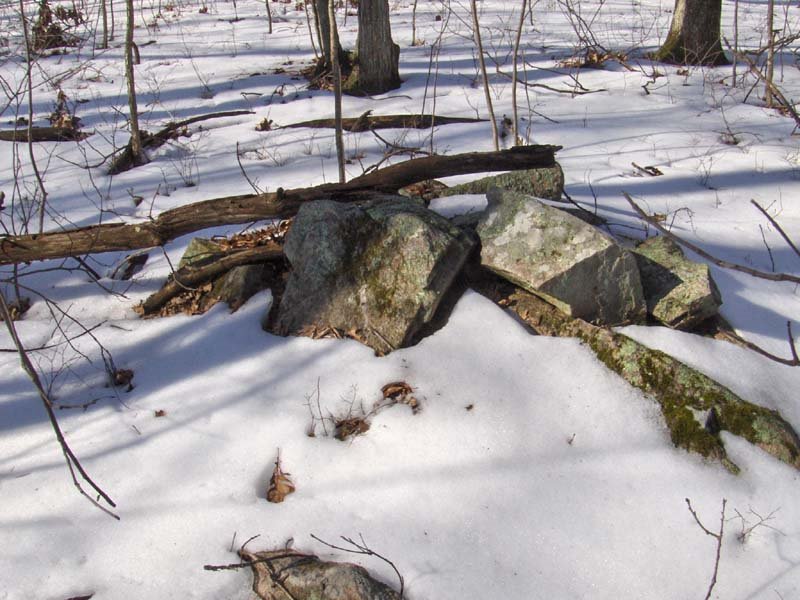
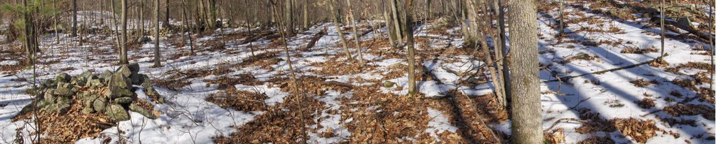
Showing posts sorted by relevance for query bigger piles. Sort by date Show all posts

Monday, July 24, 2006

Looking out over Notown Reservoir, Leominster MA

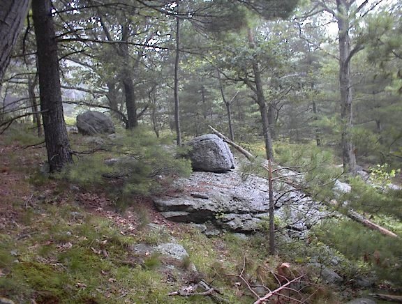
I guess it is no secret I have been exploring the eastern hills of Leominster State Forest and, although I won't say exactly where, here is another clue: I explored a different part of a hill I was on the weekend before last, on a slope facing southwest. The view to the southwest was down the valley filled by "No Town" reservoir and I suspect the view is towards Mt. Wachusett, although it was foggy and cloudy when I was out and I could not see any distance to verify it.

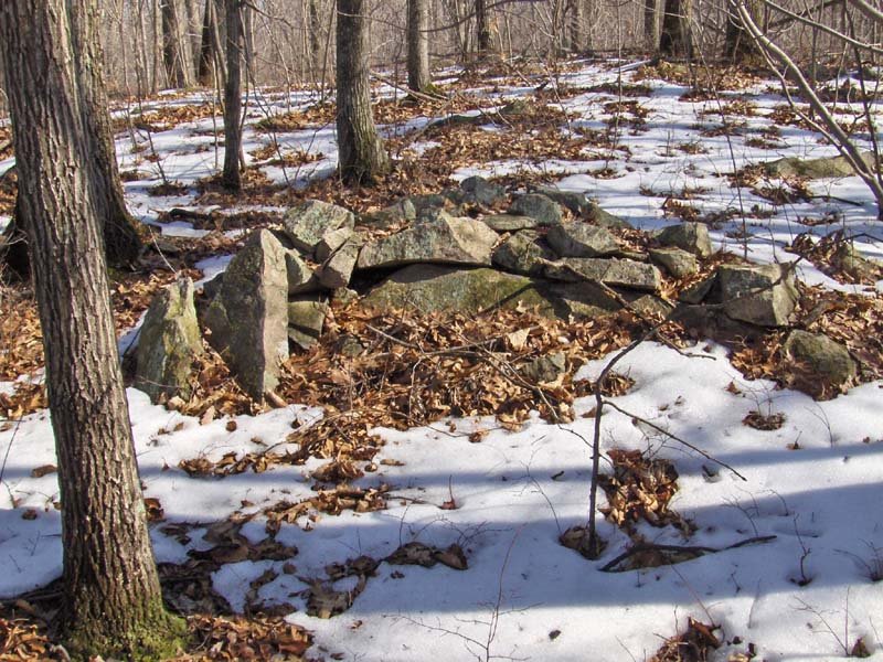
As before, I headed in from the north on the same forest road as before but where I turned left, this time I headed straight, up and over onto the southwestern slope of the hill. At first I passed the two "stone mounds" I photo'd previously, and then I continued. I started seeing faint traces of a rock pile site: some rock-on-rocks and some out of place boulders on the ledges.[Parenthetically, this is same old camera I have been using, and I held it very steady as I took pictures on this rainy day. I think the camera did well.]

As I continued along the western slope, I tried to keep an eye on the more level summit area to my left but also to check the slope to my right. I suspected I was getting close to rock piles and saw a first one: with a bit of retaining wall and a nice chunk of quartz:
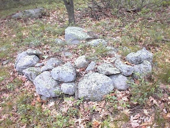
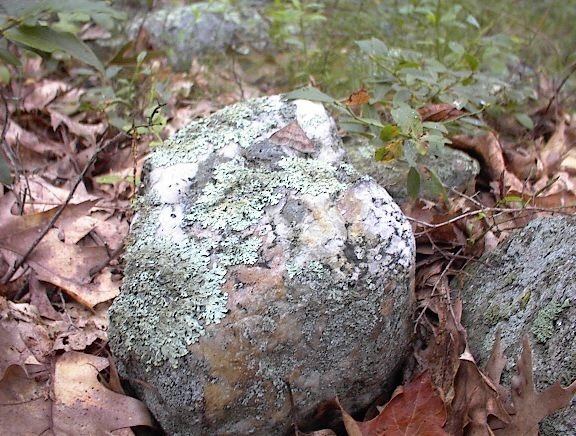
Here is a detail of the quartz:I think of this as being very "grave-like". But as I continued I started seeing other piles, built with uniformly large rocks and with "pointers" sticking out of them. The piles appeared to be lined up and evenly spaced. These, taken together, are exactly what I have been calling the characteristics of marker piles, which are not graves. In fact this site is a classic example of a marker pile site on a somewhat steep southwestern facing slope. In my first real look at the place, here is what I saw:
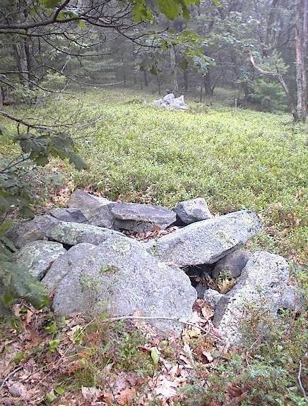
This picture shows three piles in a line. The third, furthest back, is hard to see. Here is a closeup of the second pile.
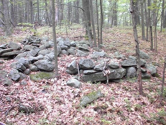
Going along the slope, the piles seemed to grow larger and more substantial, more rectangular and suggestive of more internal structure. Here are four in a row, along a low ridge.
They were so close together I was worried I was looking not at piles but at stone wall. In fact I was worried the whole time that I might be looking at field clearing piles. But here are some reasons that convinced me otherwise:
  • there were no small rocks which are always the majority of what is cleared from a field
  • all the rocks were uniformly sized
  • the piles were once well made and had clear rectangular structure, still visible in the bits of remaining retaining wall that occured around the edges of the piles
  • the piles were carefully lined up
  • there were larger and smaller piles mixed together at the site
  • the piles continued all across the southwestern slope of the hill, from just below the level summit (which could have been a field) down to the foot of the hill and then on into the swamp below. In a true field clearing the piles would all be dumped at the edge of the field not way off at the foot of the hill.
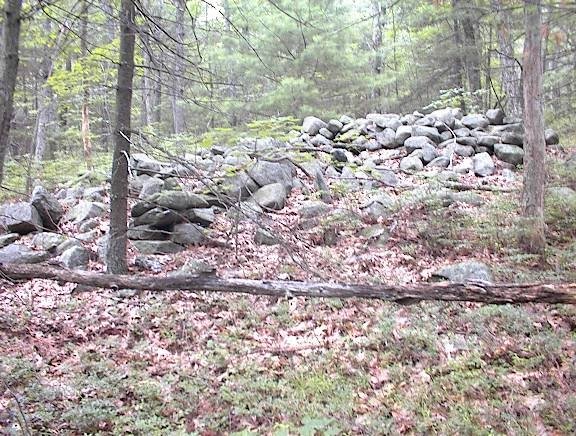
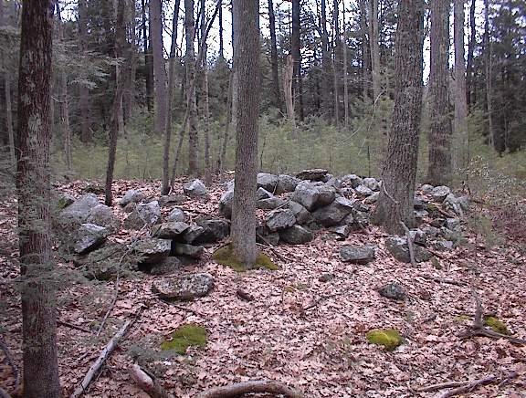
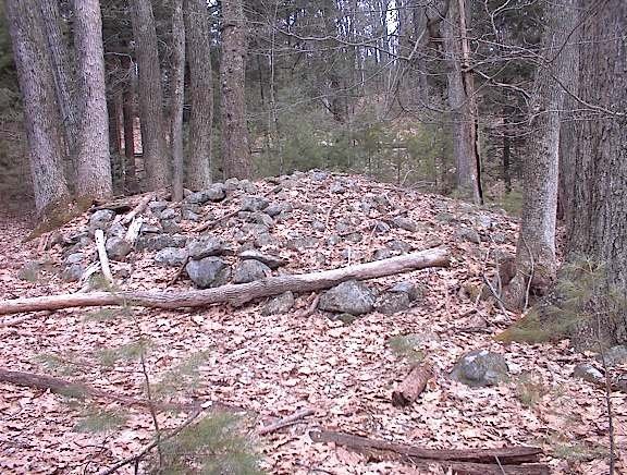
Here are some of the bigger piles which looked to have once had some internal structure:
I felt like I was walking around among the traces of a lost civilization. But it has all been damaged. I see significant and systematic vandalism here. That is why the site should be publicized - because it has already been destroyed. Every one of these larger piles, and most the smaller ones too, have been thrown down. What were they looking for? Why all the bother? There was one smaller pile that was torn up in the last two or three years. You could tell because of the dirt still stuck to the up-rooted rocks. What is it that makes destroying rock piles so appealing? Before I leave the topic of internal structure, let me mention again the "stone mounds" from the previous weekend. The suggestion was that these mounds enclosed and inner stone-lined room, digging down to which might have been the goal of the vandalism. The same pattern seems to be repeated here.

Anyway the site is still there and I think one of its most important aspects is the placement of the piles and the directions indicated by the lines of piles. The pile locations have not changed and I hope there is still a lot of information to be found here. The piles were destroyed but the site is still good.

After this I continued down to the foot of the hill where there were some other things at the edge of the wetland. And I continued my walk over to other hills in the area, until I got tired and too wet and headed out and home.

Tuesday, March 28, 2006

Moosehorn Rd, New Salem MA

As we are driving south on Rt 202 I spotted a low rectangular platform pile out the car window. "There's a rock pile" and then I saw another and before we could find a good place to stop we had passed the site and gone down to the next side street which was Moosehorn Rd. So we turned around, drove back, parked and got out to take a closer look.
We found several small piles in the woods before coming up to the one I had spotted.

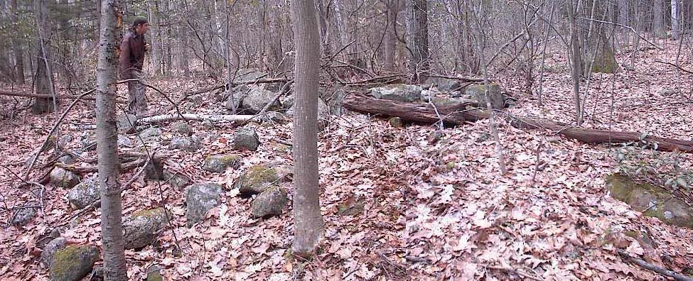
There was another larger pile in there but when I saw it was integrated into a stone wall I erased the picture of it. [Later on I am sorry that I did, because the site had several low walls running through it and obviously part of it] But then as we followed the wall it broke off into separate rock piles much too large to be single drops from a loaded cart. But I could not tell if these might be agriculture related:
But soon I was not giving the "agrarian" hypothesis any more thought.

I decided to take a look over on the other side of the road and went over because I saw what looked like a very substantial pile there right at the edge of a gully, similar to that Big Pile from Fielding Farm Rd that Jic showed me last week. But soon I saw that there were some other large platform piles in here.
The nice thing, though, was that the big piles were intersperced with smaller piles which seemed just as important to the design of the site. In this next picture the pile has a large white feldspar stone in the foreground, seeming to align this pile with another further back which Bruce is looking at. We are on a nearly level terrace above a gully which is curving around behind where Bruce is standing.
But even as we saw these smaller piles, bigger piles were looming in the background. What a wonderful experience that is when you start to suspect greater wonders still. And there they were: monster piles.
You can see these are very large piles, almost the largest I have seen and definately the only ones this size that are nicely made from smaller cobbles. Rectangular and obviously very old and broken down. To me this site had the feel of a mound-builder complex.

Between the large piles, more small ones; obviously part of the organizartion of the site.
Here is one more platform and a detail of the white quartz at the top of the pile.
This site was on a terrace overlooking a gully and facing east and southeast across and down the valley. Bruce pointed out a prominent hill blocking the view to the north east. This hill divided the eastern sky. I was very impressed by several things about this site. It seemed undisturbed and still in its original form. There were about 6 large rectangular platform piles. There were low stone walls integrated into the site (although I payed them no attention). There large platforms were intermixed with smaller piles, and the location would have had a spectacular view to the east and southeast if there were not trees in the way. To me this site was reminiscent of the monumental sites seen in Pennsylvania and Vermont - just a bit like Oley Hills. I have seen broken down rectangles almost as large as these - in Weston and Carlisle, and smaller ones all over, for example in Boxborough. But here was an entire undisturbed example of - may I say- a particular rock pile building culture. Almost pristine. Still monumental. I think Bruce and I were proud to find this site. We know someone will come back and study it someday. Also it is within the boundaries of the Quabbin Reservation, so it is reasonably protected.

Wednesday, March 14, 2007

A knoll marker pile site - Ashland MA

If you have been following the narrative since last weekend, you'll recall I found a site on a knoll where I could view all the rock piles from one high point at the center of the site [click here]. This contributed to the thought that some marker pile sites might be organized with piles located on lines radiating out from a viewing position above the piles [click here]. The day after finding that site I found another site further uphill in the same part of Ashland. Here is how the hypothesis came into play:
I was walking up a long slope and coming to a more level shoulder with a small knoll or outcrop when I saw a solitary rock pile (shown above). Since isolated rock piles are rare, I thought maybe this one was meant to be viewed from above on the nearby knoll and that, if I went up there I might see some other rock piles - assuming this was organized as a collection of rock piles visible from a high point. Here is a closeup of the outcrop. Note the little bit of stone wall up there.As I climbed to the top, I was already scanning the slope beyond it and thought I saw one pile and maybe a second one. When I went down to look there were actually lots of piles (~10) hiding in the dead leaves. Here are two examples:
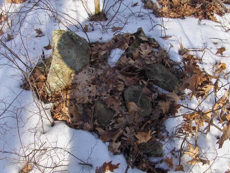
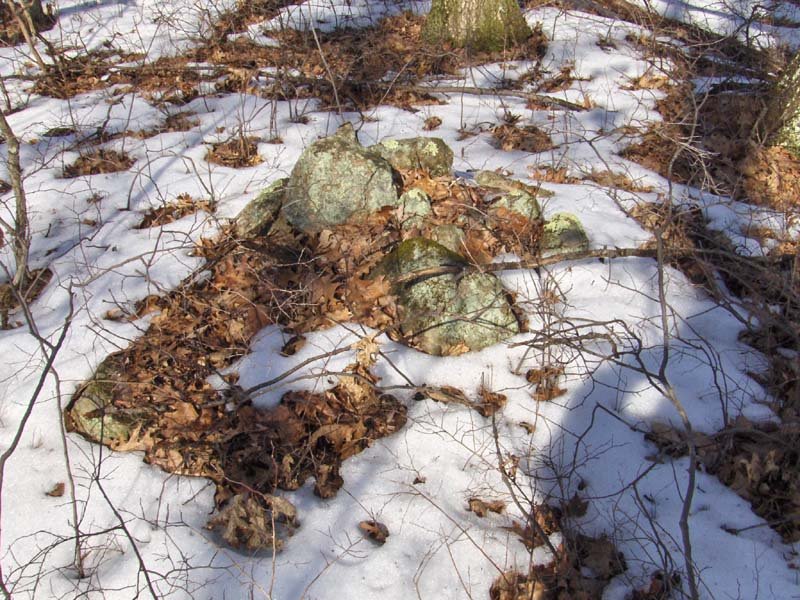
Note the larger pointed rock in the same relative position in the pile in each of these pictures. I call this type of pile "marker piles with a pointer" - the idea being that perhaps the pointed rock marks a location more precisely than the entire pile; and also that the entire pile may serve the purpose of creating a platform for the pointer. [Click here for previous discussion]

As I circled out further and further from the knoll, whenever I found another rock pile I would glance back to see if the knoll was still visible; and it was. In turn, the pile would be visible from the knoll. Then I came to a line of three piles (the picture is high res if you click on it):
Sure enough when I looked back to the top of the outcrop, it was exactly in line with these piles. Note also the pointer in the middle one.

I continued circling outward. H
ere is a view back towards the knoll:
There were walls emanating from the outcrop but not lined up - not that I could see. Rather than enclosing the area of the rock piles, one wall seemed to run down the side of the site and then stop, as if the wall end itself was a feature to be seen from the knoll. I should also mention that this wall along the side of the site was interrupted by a a store ring, possibly a fireplace:All and all I would not expect a normal fire circle in a place like this. I am not sure I saw any signs of charring, but I did not look too hard.

Further down hill, beyond the wall end, the features continued. But rather than being normal rock piles they were made of larger fragments and were overall larger. I kept looking back about 100 yards to see the knoll and thinking "of course the piles are getting bigger - they need to still be visible this much farther away"
I continued outward a bit further and then circled around to the west a bit and over towards another little highpoint - a second knoll. It was getting so every rock that pocked above the snow was getting a suspicious look from me. And as I came up to this other little high point, I saw a rock-on-rock, then a pile or two and then larger piles over on the downslope a few feet beyond (see video which remains to be posted).
These are even more substantial piles than before. They are downslope from another small knoll but I was not sure if they were still visible from the first knoll or rather part of a new organization around the second knoll. One advantage of the "radiating line" hypothesis is that it accommodates the possibility of multiple viewing locations with a second or even more groups of piles on lines radiating outward from other viewing positions. Let's have a look at a couple of these larger piles:
Please note that this last picture shows a pile with a flat face towards the camera. I find it very interesting that this flat part is facing away from both the near and the far knolls. Either it is to be viewed from somewhere else or this tells us a first clue about these flat faced piles (click here for earlier discussion of flat faced piles).

So I'll leave it at that for now. We had a slight confirmation of the hypothesis of radiating lines from a viewing position above the piles. In this case I was expecting the rock piles before I saw them because I found one pile near a knoll and I supposed this might be a site with radiating lines. It is also very interesting that the majority of piles were to one side of the knoll. It is also very interesting that an example of a flat faced pile appeared to be facing away from the viewing positions. So now we have a couple of research questions to pursue:
  • Can a central viewing position be located at some of the other sites I call "marker pile sites"?
  • In what directions are the lines radiating? Is there any commonality between different such sites as to the directions used? If so, what is the meaning of that direction?
  • If we determine a high point viewing position at some of the other sites with flat faced piles, how are the flat faces oriented with respect to the viewing location?
I don't know how this will pan out but am encouraged to be making slight progress understanding these sites.

Wednesday, October 21, 2009

A hillside covered with marker pile clusters

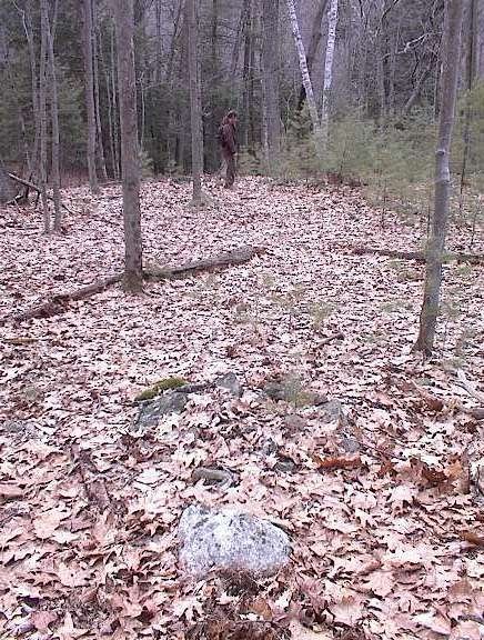
I was exploring a hill in XXXXX called Peach Hill with a substantial west-facing flank that looked undisturbed in the aerial photos. As usual you walk along without much hope of finding anything and then, when you see a low rock pile, you have a hard time believing it is part of a legitimate site. Later, when you find the really big piles nearby, the earlier doubts are dismissed. In this case I saw this pile and thought maybe it was a solitary boundary pile. But I soon found a neighbor:
and beyond that, another.I noticed these piles were sort of evenly spaced, and definitely in a row. So I continued with my pessimism, thinking this was just piles being staged for later stone wall building. It was only when I found another pile off of this line that I was confident this was a ceremonial site. After poking around carefully, I found 5 piles in a cluster, in this arrangement:
[I showed this same diagram once, in reference to a hill in Westford, but this no longer turns up in my "Search this blog" searches, so I could not locate it for comparison.] Slightly uphill from this there were a couple of other piles (off to the upper left in the above diagram). These are the features: even spacing and rows forming a grid-like pattern, that lead me to calling it a "marker pile sites". No one seems to believe this but marker pile sites are by far the most common type of rock pile site. The word "marker" - perhaps poorly chosen- indicates these piles mark a position on a horizon, as seen from someplace nearby [possibly the uphill structures?]. Here is one of the uphill structures:
Might this be the viewing location?

So I was happy to find a little west-facing cluster of piles. If there were no trees we would be looking towards Mt. Wachusett - something which is also a common feature of many marker pile sites around here: a nice view over water and towards Wachusett.

But I was dreaming of finding a bigger rock pile, and found three of them about 30 yards further downhill. Later I realized that, without underbrush, both smaller and larger piles would have been visible at the same time. Seeing larger piles further downhill is also typical of marker pile sites (for example and scroll down). This suggests that the viewing position is uphill and the increase in size of the lower piles is necessitated by their being further from a viewing position.

I believe most of my readers think I have gone off the deep end when I start talking about grids of piles, lines of piles, viewpoints and this sort of thing. It is too bad because this is what observation shows me. To me these pile placements form a sort of gird:Here are the larger piles:Another:
Note the nearly vertical side (another common feature of marker piles) and note the rock propped up against the pile. My colleagues have taught me to look closely at flat triangular- or manitou-shaped stones leaning against rock piles. Have another look:That is not a fallen rock but a deliberate placement.

Here is that third large pile:I poked around some more in the vicinity and came up with one more substantial pile (there were a few minor rock-on-rocks I am not showing). This one was elongated and perhaps damaged:What with the original little cluster of 5 piles, the occasional rock-on-rock, the minor structures uphill that could have been a viewing location, the larger piles downhill, and this elongated pile to the side - what with all these specifics, it is clear this is not just a grid but a small detailed site, well worth studying more.

After this I combed the hillside back and forth until I realized there were clusters everywhere, and I got tired of looking for them before I ran out of new things to see. I'll post some more later.

Overall this cluster looked (in a very crude approximation) something like this:

Friday, July 22, 2011

A Falmouth Kettle Hole and a Hypothesis about Marker Piles

A few years ago Mavor gave me copies of his topo maps for the Falmouth area - fragments of the larger map - and, over time, I have been able to match the features on his fragments to known landmarks on bigger maps, to see how to get to the places. Over time, I located most of his sites but there was one I could not figure out, showing four rock piles near the notation "chamber". Working harder at map matching before coming down to the Falmouth area this summer, I figured out where this spot was and realized it was a kettle hole site I knew about. But I never found four rock piles (I remembered two or three) and the notation "chamber" was intriguing since it was mentioned several times in Manitou that there were no stone chambers on the Cape. So I went to take another look at the site and, in the end, found 12 rock piles in the kettle hole as well as the "chamber" nearby.

A couple of personal comments. First, it is gratifying that both Mavor and I missed the majority of the rock piles. Another is that the four piles he found were in a line and evenly spaced in a pattern which, over and over again, appears in his writing as being part of a larger scale alignment of features and piles that can stretch a quarter of a mile or so across the landscape. In fact, following this line of piles across the highway, there is indeed another cluster of rock piles in another kettle hole. But I am pretty sure that is not it, at all.The picture shows the kettle hole: a bowl-like valley created (we are told) by uneven melting of glacial ice. At the top of the western slope were two prominent boulders, and on the eastern and northeastern slopes were twelve evenly spaced piles forming a typical example of what I call a "marker pile site", or a "grid" of piles. Four in a row (actually five) do point as Mavor indicated but there are several other lines and directions present and a different explanation is suggested.

Here is a view from the bottom of the hole up towards the boulders:
Note how flat the slope is.

And here is a view back down towards the piles from the top of the western slope:The piles would all be visible from here, if not for the foliage, and they are arranged in a way that covers the entire opposite slope.

It occurred to me that the boulders were part of the site, so I climbed up to them to look around and found a damaged rock pile and a rock-on-rock up there, somewhat confirming that this is part of the "site":Here are some of the rock piles, hidden in the blueberry bushes:
These are pretty big, somewhat rectangular, and thoroughly smeared out. Which says to me that they are pretty old. Let me put it this way: several pairs of well-trained eyes missed these completely. Here's what you get, a view of three rock piles in a line, but who would know:
A Hypothesis:
Standing at the bottom of the kettle hole, and looking up the slope towards the boulders, I could see that the slope was very even and flat (but not level) below the boulders and I could see that the setting sun would graze the slope evenly and, inevitably, would cause shadows of the boulders to project down the slope and over against the opposite sides. Inevitably those shadows would have to pass over the rock piles as the sun sets. Could it be that the rock piles are evenly spaced because a certain fixed number of days have elapsed since the shadow crossed one pile; and now the sunset shadow falls across a new pile? Could this be a simple calendar mechanism?
In this version of the sketch, looking southwest, the sun sets further to the right in summer time, and sets further to the left in winter. I invite the reader to think what happens to the channel of light between the two shadows as the winter solstice approaches.

Perhaps I can get out there more often. A little more time-lapsed observation would confirm this.