Showing posts sorted by relevance for query confluence. Sort by date Show all posts

Monday, June 26, 2006

Brook Confluence in Bolton MA

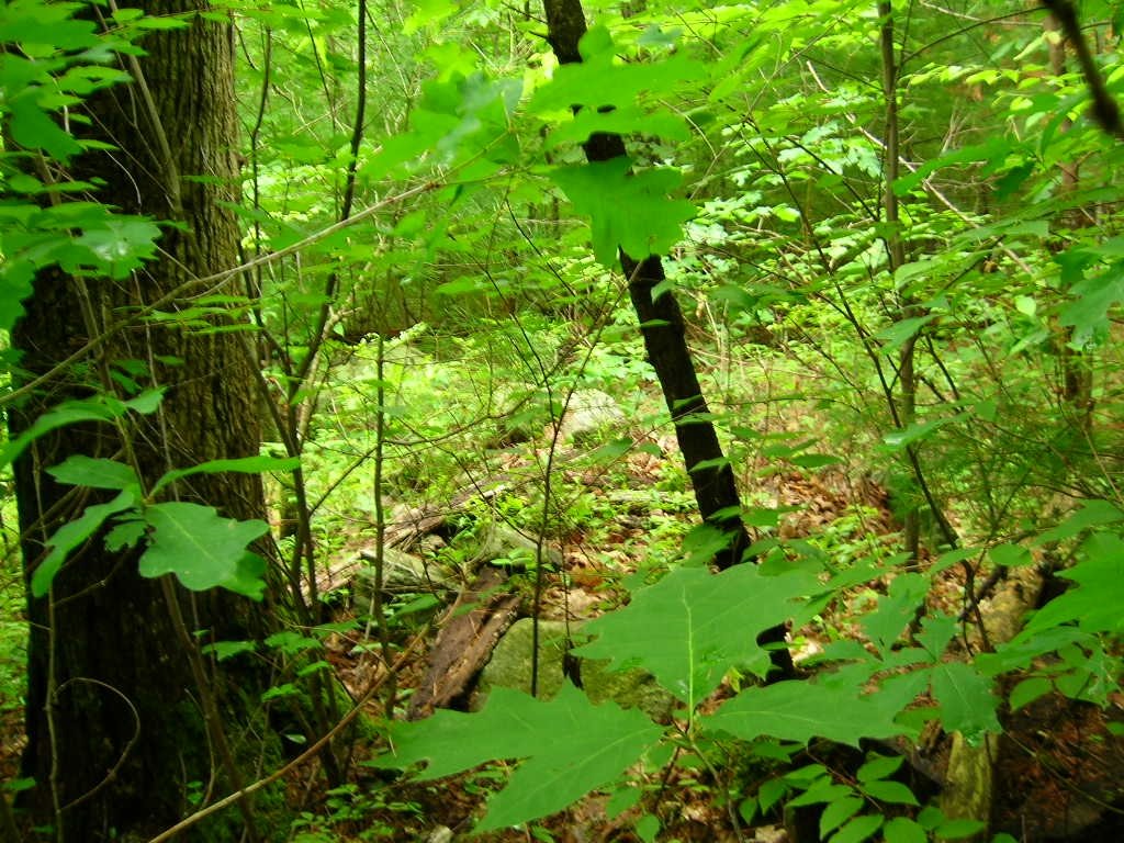
I was looking at the topo map for Bolton, having found the Bolton Conservation Land maps on-line, and noticed a likely place near another place where I found rock piles in the past. Where should I expect to find rock piles in there? Right at the confluence of the brooks. I went there Saturday in the rain. Walking up the trail and up the common brook from the south, I started seeing small rock-on-rock and other typical "brookside" features, looked around, and realized I was already at the confluence. The site continues a hundred yards or so in all directions and, in particular, continues up the hill between the two branches of the brook. I was mostly pre-occupied (and I still am) with the new camera technology, so attention to the details at the site itself was at a minimum. But I got a couple of nice pictures. Here we are looking upstream towards the confluence.
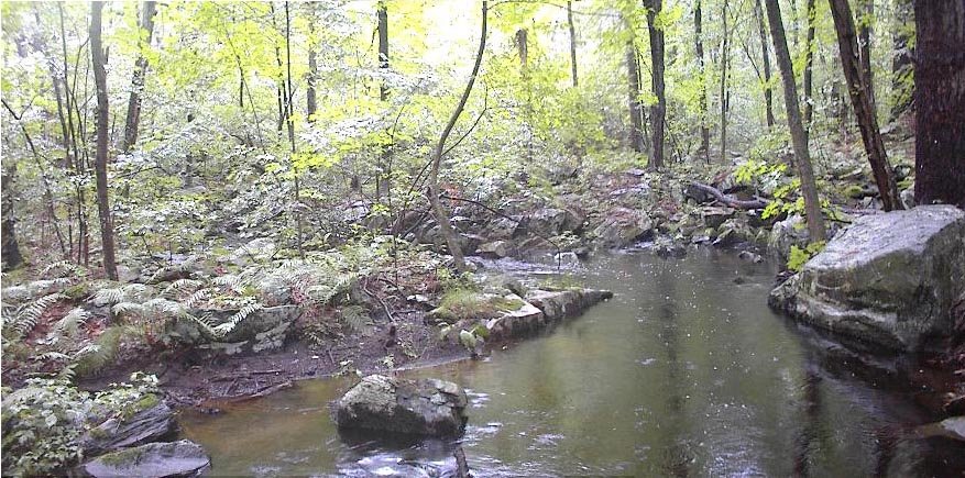
My old camera can take decent pictures occasionally.

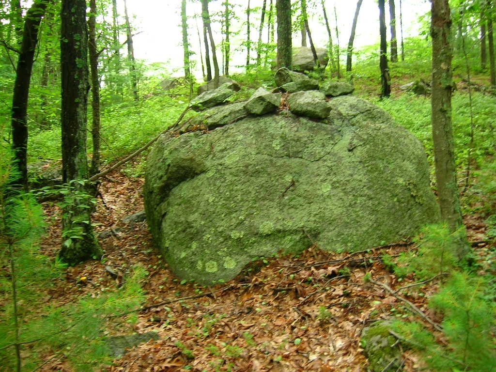
The piles were small, on supports, and mostly seemed to be grouped with rock-on-rocks. I have never seen so many rock-on-rocks. They appeared to be functioning in various ways such as being part of little groupings:
or being part of a line of rock-on-rocks connecting one part of the "site" to another.

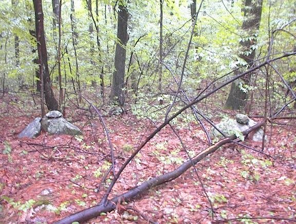
[and I already showed you this from the new camera].

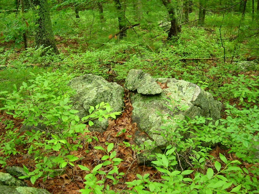
Directly up from the confluence, and between the two brooks, is a wetland full of little things which were hard to photo on a rainy day under the leaves.
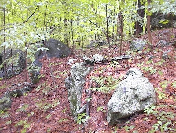
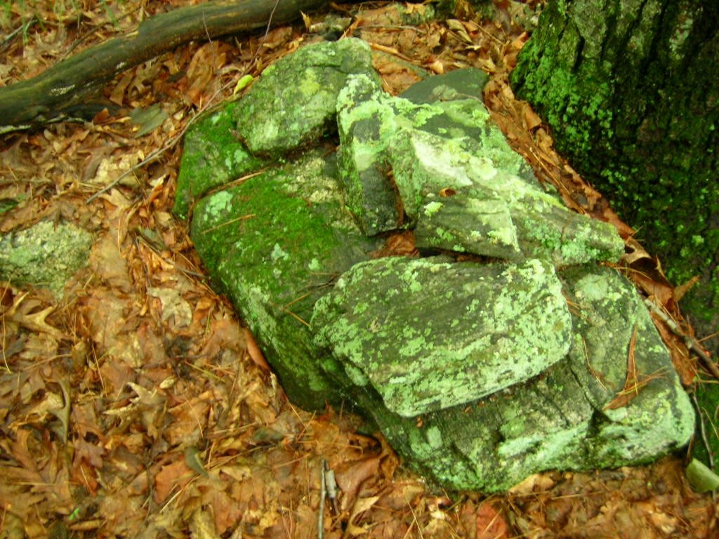
For example this last photo shows a very minor gully with a pile above it, looking down on it. As you walk through the wetland, keeping your eyes open, everything looks manipulated and re-arranged.

And there are some nice piles in there. Delicate little structures:
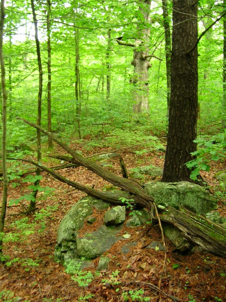
It was raining the whole time and difficult to manage an umbrella, two camera, etc. So I came back out after getting a sense of the scope of the site. The next day I went back and explored uphill.

Thursday, September 10, 2015

Knoll-top mounds, at headwaters - Mamjohn Pond, Gardner MA

I mentioned these in an earlier post [click here].
Was going to park on the road just east of the pond and head for the place where those three brooks meet, north of the pond. But I took a wrong turn and ended up opting for a different entrance to the woods, where Stone Street turns into a dirt road. This was ok as I had also planned to go to the wetland just southeast of the larger blue outline, in the map fragment above. So I parked at the end of "navigation" on Stone Street and continued north along the dirt road. 
At the height of land the road crosses just to the west of the summit (see smaller blue outline above) and there is a wall next to the road. But at the high point there was also an extra isolated piece of wall or pile:
There was a faint depression running along it. I don't know what this is but, it being near the summit, I left the road to take pictures and then continued on through the bushes to the very top of the hill.

I half expected to see another rock pile up there. And there it was:
or, without the flash:
You can see it has rectangular elements - a corner in the foreground in this picture:
From further away:
I went back to the road and continued north and, it seems to me I found another similar pile but the lighting is so bad, I am not sure, from picture or memory, whether this is a second example. 

In any case, I thought it was time to head east, towards the brook confluence, so I headed off from the road, through the ferns. And within 50 yards stepped on another mound (see video here).
Some other views:
A fine pile that makes the effort worthwhile.

Apparently there were others as well in the ferns (roughly within the larger blue outline on the map). I had forgotten this one:

And this one with its satellite pile:

Somewhere else in these woods was a house foundation, without lintel:
And also more fine examples of rectangular mounds with internal structure:
Here is one that extended down an entire outcrop, next to a wetland:
 closer:
After this, I gave up on trying to get to the brook confluence, went back to my car and drove to the originally planned spot. Entered the woods but was a bit tired and obviously I had already had a good walk, so I never did get to the brook confluence. Perhaps I got close to it, with the last pictures. 
A fine place. It seems unfair to be in and out, take some pictures, and forget much of it just a few days later. So let us at least take a lesson: that the wetlands at the headwaters of brooks in these towns in north central MA (and adjacent NH) are a good place to look for mounds on knolls or outcrops that poke above the surrounding terrain. You may see rectangular elements of structure, and you may see craters. I think this is the Otter River Watershed.

Wednesday, April 23, 2008

Sudbury State Forest - a knoll at the confluence of brooks

I got into the woods a differet way, thinking I was exploring a new place and was overjoyed to walk right up to the rock piles. Later I realized this is a site I have seen before. So I'll just post a couple of pictures to give a feel for the place:
The location near a brook confluence with a view to the south is typical. These are old beat up piles a bit like the ones from the Berlin hilltop. No sign of structure, just old medium sized ground piles. No quartz.And a sense of the pile density on this knoll. There were perhaps 10 piles in all:And a last look back up the knoll from the direction of the brook:
A nice little site and it is always good to walk directly up to the rock piles. Compare with other "knoll+brook" [Click here]

Thursday, May 21, 2009

Rock-on-rock like a bird - confluence of brooks

This lovely example was at the place where a smaller tributary of Rocky Brook meets the main flow out from Hy-Crest pond. It was placed a few feet in front of and in line with the split of a large split rock. I am sorry I did not photo the relationship. It was the only thing I noticed in this area which was mostly low wetland. I had pushed onwards to get to the confluence.

Tuesday, June 27, 2006

Southern hillside above the brook Confluence - Bolton, MA

On Sunday I tried some other places that looked good on the Bolton Conservation Land maps. For example I thought "Rocky Dundee Road" was almost a guaranteed winner - with a name like that. But it was a disappointment. So I went somewhere else on the map and it was all blocked off by new housing. I had in the back of my mind that I could go back to the brook confluence and explore outward and, in particular, uphill from there. I did that and, getting past the initial site, found myself climbing up to where the hill leveled off, where I started seeing some "maybe" rock piles. They were not well formed and I was not sure I was at a site. I noticed a huge grandmother white oak (the kind people call "Council Oak") and figured "if I see one more rock pile I am going to believe this is a site". I saw another a few moments later. Unfortunately I was using the new camera so almost all my pictures were throw-aways and very few are worth reproducing here. Here is a pile beneath the white oak. You can see the white oak trunk in the background. This is a tree about 3 feet in diameter, which I take to mean the tree (a slow growing white oak) is more than 100 years old. It seems likely it was there when the rest of the hill was clear of trees - perhaps when the rock piles were constructed. Now, as I look at these pictures with green color values close to the color of toxic waste, the color which the popsicle label calls "watermelon green" or "bubble gum", I cannot imaging why this Nikon camera gets good reviews. Luckily I did not buy it and can try some better models. Guys at work have lots of different ones to examine. Yet, surprisingly, every once in a while you get a decent picture: The resolution is fabulous and the colors are not bad. This pile seems to have a lot of symmetry along the horizontal axis which runs through the middle of the pile. Here is another: a view of a pile glimpsed through the leaves: And then, just a bit higher on the hill and still close to the white oak, was this beautiful one - I love these piles on support. This one looks like it has sustained some damage. There were a number of other piles around but the pictures failed - they were too blurry. It turns out that at "low light levels" i.e. in the rain under the forest canopy, these digital cameras are having a hard time getting enough light to function properly. The autofocus fails and the colors go askew. I consider Larry Harrop's pictures to be the golden standard for rock pile photos but I think I saw one picture where the greens started to go and I am guessing this was another low light level situation. Apparently the solution is a camera with a long exposure time, a white point balance adjustment (combined with knowledge I do not have about how to use it) , and a very stable platform like a tripod. Lacking these I was only able to get a couple of other shots:
There is a distinct sense of shape to these piles. Note again, this is uphill from a brookside site. Similar topography to what we saw on the Westford/Groton line along Rt 40.

The final straw about this Nikon "Coolpix" dog of a camera is that after two days of minimal use, it ran out of batteries, without the advertised warning. This distracted me from paying much attention to what I was looking at. I tried to shoot some video clips (this was posted earlier)

This site runs back downhill until the sound of the brook - loud from all the rain - was audible and, with a continuum of rock piles, goes on down into the low wet area next to and between the brooks there, in areas where the sensitive eye sees that every single rock is part of a manipulated scene. These are shrines of one sort of another.

Sometime I will go back when I have learned how to take better pictures.

Wednesday, November 20, 2013

Arrowhead from Egg Rock Concord

From reader Will Kemeza:
I live in Concord (Main Street in West Concord). I was out walking with my family on Sunday - and we ended up throwing rocks (my boys are 3 and 5) into the river just below Egg Rock, right at the confluence of the rivers.

In a moment of serendipity, I had just finished telling them about what little I know of the place's history as an important Indian site. I picked up a rock, was about to skip it toward Lowell Road, but I somehow looked down and realized that I had a small arrowhead. I was thrilled. I've been rambling around in the woods and fields here for years (I grew up in town), but had never found one before. It occurs to me that the place we were gathering rocks is usually underwater - obviously, the river's very low at the moment.
So: now I'm deeply curious... I've attached a picture. Any thoughts about the point which could illuminate things for a total novice?

Saturday, April 08, 2017

West of Peppercorn Hill, Headwaters of Mill River Upton

Had a fun walk down from the W. Main Str following the brook south and over to where it crosses East Str near the termination of Walnut Str. The walk was fun because, after crossing East street, I had an adventure getting through 50 yards of rose bushes in order to avoid the houses on either side. Boy! are rose bushes a pain. I exited, bloodied, via a small site and then on to the western edge of Peppercorn Hill. I got up on the hill then circled round though a new development and back west to East Str. - then back to my car, walking on roads.
At the beginning when I was north of Walnut Str, a small brook confluence was the first place I saw rock piles - and they are very much to be expected in this context: low to the ground, possibly in a line with spacing:


Right nearby, just to the south, a typical rectangular mound:

 Note the "trail" going through it on the left side. Closer:
Closer:
Other views:

Then that peculiar mound at the edge of the field:
Now I cross East Str at the intersection with Walnut. 50 yards in (wiping off some blood), some unexpected old piles in the swamp:

 This is right at a spring:

Then I went in a little further east, where there were several other small clusters of rock piles on the outcrops along the brook.


And:
 Closer:
And a path leading up past some rock piles:
With
 Closer:
And let's follow the path a little farther, to an outcrop over the brook:


Or we can look at this same outcrop, as it appears from the brook side, a trail leading up it: