
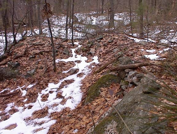
Rt 27 is the road at the bottom in the map. After parking, I went down to the pond and then left along the old road, across the brook and rightish uphill to a stone wall along a ridge at A. There were three nice rock piles over against the wall there like this.
 And one more on the backside of the wall
 And then back in, farther upstream along the little brook, there around B on private property (which by the way the owners are busy tearing up with a back hoe), there were several more rock piles. Most of the piles I saw in this woods were the type incorporated into the bedrock ledges.
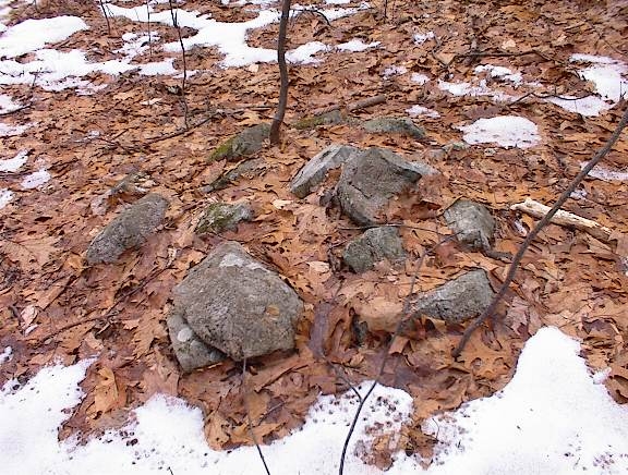
 There were many examples like these in there - elongated piles coming out of ledges, sometimes forming slight platforms, tumbled around and without any shape I could see. Sometimes these were incorporated into stone walls, other times they were parallel to or adjacent to the stone walls. There are far more walls back in there than indicated by the map.
Just a word about other similar sites. Where else are there these kinds of semi-platform mounds incorporated into ledgerock? Places which come to mind are: Rattlesnake Hill in Bolton and Mill Street in Lincoln. Also a bit like some piles at Willow Guzzle Conservation Land in Concord - north of this place in Sudbury. These sites are quite different from the ones with low ground piles and effigies in Acton and Carlisle.
Come to look at that map I really only explored about 1/2 of the place, mostly uphill northwest from the little gem of a pond. You know that is the focus of the place. Checking it out on-line I find that this piece of land has an extremely interesting history. Near this spot a final decisive battle in the King Phillips War occurred - where the Native Americans won but failed to consolidate their advantage and all subsequent battles were lost. On one day, April 21, 1676 the American Indians began their final decline. But there is more! Apparently at the bottom of the hill was a tavern called the "Tavern of the Damned" where a highwayman, Captain Lightfoot, murdered and buried 13 victims. I cannot say I was aware of these bad vibes. I was just happy to find a rock pile site, stolen here from the midst of winter. Here are a couple more from near B.

 On the way in, at the parking spot, there was a small conservation land kiosk with a text version of the land's history. It mentioned that early on (before 1676?) this land was a kind of praying Indian village. I should have read it more carefully. Anyway as I went in there I was thinking that any rock piles I found would have some pedigree. There was also a lot of bull briar on the ground and I associate this with land disturbace. I figured there might have been some houses or some kind of village in here around B. And clearly the hand of the Indian does still sit heavily on the place.
So I circled around to the left where I could get across and above the little brook and saw a few more rock piles at around C on my way back to Rt 27. Here is a view back towards the pond from there. Also another example of pile/platform incorporated into bedrock outcrop. It is awfully messy in there. The whole place needs to be burnt off.
 Back on Rt 27 headed to my car, I could see that this last pile is the one I thought I saw from the road before stopping my car. Walking downhill, here is a little context for a rock-on-rock.
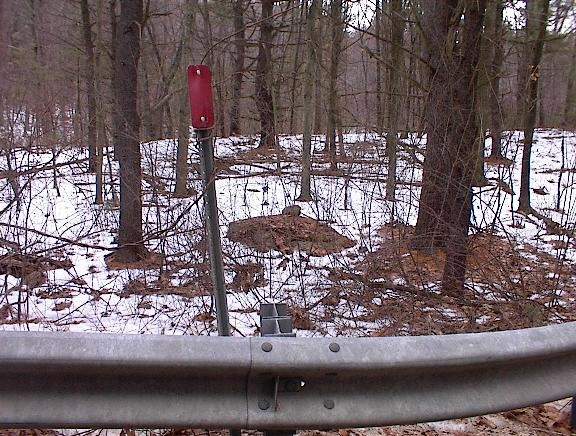 But when I got back to my car, I noticed that the little bump in the background of the rock-on-rock picture, continued a bit beyond the parking lot - perhaps a final lookout over the river valley. Naturally I had to take a peek even though it was scrappy and right next to the road. I found a first bottle pointing me along. And naturally there were some more rock piles there.
At a place like this, every outcrop is important and has been used. I hope I can go back in the summer and find some other things. I think the place needs to be cleaned up. And someone should get after the owners of the private land near B.
5 comments :
This area was home to a Massachuset village called Magaehnak, led by the sachem Cutshamakin. They were loyal to Nanepashemet and then his widow the Squaw Sachem, and they were part of the Massachuset confederacy.
Magaehnak was, for a short time, a praying village. The exact location has been debated by historians for a long time. Being in a frontier town, the praying village didn't last and was abandoned long before the Sudbury Fight during King Philip's War.
Maybe some of the rock piles are memorial and some are damaged structures.
Holy shit! I can tell you rite now them are buried Indians, if a Indian died & it was to far for other Indians to Carry their fallen warriors they so burry them right on the spot! Then when other Indians passed by, to pay their respect they would pile rocks on that grave! Wow I need to go back knowing this good find!
Holy shit! I can tell you rite now them are buried Indians, if a Indian died & it was to far for other Indians to Carry their fallen warriors they so burry them right on the spot! Then when other Indians passed by, to pay their respect they would pile rocks on that grave! Wow I need to go back knowing this good find!
I got a couple of chances to check out the area. Though I do need to return, since most ruin is more visible with lack of vegetation. I do agree, for a land trust historical area, it really does need to be cared for a lot better. Apart from that, I noticed a lot of old debris, and ruins of what I assume to be from a garage perhaps, from the 1960s or 70s, or 80s. Given the car items, or bottles. Artifacts of trash. Well, this is sadly, not the only historical area in Massachusetts to be left to decay. There are so many other spots with lack of acknowledgement as to their significant past.
Post a Comment