 I spent the weekend tramping around places on this map. Starting at Ashby West Rd and Falulah Brook, I thought I would follow the water courses up and to the west towards Jewell Hill. But it was a cloudy gray day and I got turned around somewhere like A and saw rock piles at a place looking out to the north over a marsh. Most of the pictures are blurry and the sites I found were not spectacular.
At the very beginning, I was pleased to find a small "F" shaped pile, having something like a hollow and something like a tail (here the top of the "F" is in the foreground and the tail is trailing away in the background): Here is a bit of color for a change:
 I walked until this popped up in the ferns:
 Looking around carefully there were more and more. Maybe 20-30, in the end. This was at a place where the stone walls formed a T, with and abrupt and messy ending, in the midst of the rock piles:
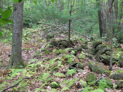 Here we are looking from the messy ending back toward the main wall. Most of the rock piles I saw were to the left in this picture, off in the direction of water. There were also piles to the right in this picture but three yellow jacket stings, in quick succession, dissuaded me from exploring more thoroughly there.
Overall, the piles had characteristics of marker piles. The better built/preserved ones had almost vertical sides: and, at least occasionally, they seemed lined up and evenly spaced:
 Do you see the three piles in a row? Note the vertical faces of these piles. Their orientation is perpendicular to the row of piles.
There were some other piles down closer to the edge of the marsh. In the background is another abrupt wall ending. Occasionally a nicer pile:
 About where I got stung:
 A more soothing image, rock piles under beech trees:
 Uh Oh!
 The M'F'ing loggers...they are coming...with big equipment!
 Here is a bit of color for a change:
 I walked until this popped up in the ferns:
 Looking around carefully there were more and more. Maybe 20-30, in the end. This was at a place where the stone walls formed a T, with and abrupt and messy ending, in the midst of the rock piles:
 Here we are looking from the messy ending back toward the main wall. Most of the rock piles I saw were to the left in this picture, off in the direction of water. There were also piles to the right in this picture but three yellow jacket stings, in quick succession, dissuaded me from exploring more thoroughly there.
Overall, the piles had characteristics of marker piles. The better built/preserved ones had almost vertical sides:
 and, at least occasionally, they seemed lined up and evenly spaced:
 Do you see the three piles in a row? Note the vertical faces of these piles. Their orientation is perpendicular to the row of piles.
There were some other piles down closer to the edge of the marsh.
 In the background is another abrupt wall ending. Occasionally a nicer pile:
 About where I got stung:
 A more soothing image, rock piles under beech trees:
 Uh Oh!
 The M'F'ing loggers...they are coming...with big equipment!
No comments :
Post a Comment