Thursday, April 06, 2006

Monroe County Site, Last Part

By Geophile

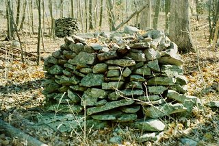
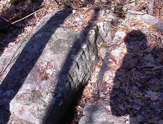
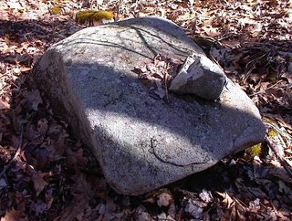
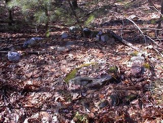
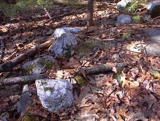
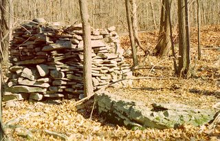
I have many more photos of these piles, but I'll just post two more. This one could illustrate the perspective of someone hiding behind one of the piles, watching for quarry if it were a hunting site.
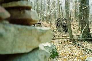
This one, well, it's just pretty.

Here's a picture of the wall I mentioned that goes up the hill at a slant, toward the rock ridge at the top. The theory is that people would have placed sticks with something waving at the tops all along this wall. Members of the party who were hiding behind the rock piles at the bottom would jump out and yell and gesticulate when necessary to chase the game into this corridor, which would be wide at the bottom.
Then hunters would drive the quarry upward, some probably coming up from the rock piles to line the wall and keep the quarry in. If there were many helping, some could also line the rock ridge above.
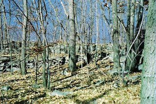
The quarry would then be driven to the bluff where they could either be shot or driven off the edge.

Just speculation, but the terrain and features suggested it. As I said in a comment, we don't know for certain who built this or any of these sites, but the Unami Lenape for example sent hunters to the camps in Poconos in the fall. These people were expected to provide skins, dried meat and other animal products that would make it easier to get through the winter, so they had reason to want to take down large numbers of game, rather than just enough for their own use.

As long as I'm speculating, I'll bring up Mesingwe, the spirit thought to be guardian of the animals. It was he who would be prayed to and possibly propitiated before a hunt. He, it was thought, understood the people's need for game as food and would cause the game to be available or unavailable according to how pleased he might be with them. He is a figure not so different from the European horned god types like Cernunnos, but in form more like a Bigfoot.

Rituals at a hunting site might be centered on him. I pass on this story with trepidation, because it's kind of far out for a down-to-earth forum like this, but with that caveat, here it is. Some say that Mesingwe or Bigfoot likes to eat chipmunks. Chipmunks like to live in walls and stone piles, and can supposedly be scared out by striking the stone piles with a stick. Thus, in a site like this, the piles might serve not only as blinds during hunting but as a form of offering to the animal guardian all year long.

I hasten to say that this was not told to me by Indians but by people talking about Indians, and there may be nothing to it. I pass it along to show that we can't know the traditions of the builders of these sites and therefore we can't know the ritual status or the uses of the sites. What's that quote about archaeology--it's like looking at the props from a play and trying to figure out the plot.

One more interesting note that should probably be mentioned in connection with stone sites from the Poconos north toward the Catskills, traditionally the territory of the Munsee or wolf clan of the Lenape, the word Munsee itself means "at the place where the stones are gathered together." As I've gone up Rte. 209 toward Kingston, NY, I've seen glimpses of interesting walls and piles. More to discover!

Someone notices Cairns in Parker Woodland

[Click here]

Wednesday, April 05, 2006

EZ Storage by Rt 3 - a roadside attraction from the Journals

I have been wanting to tell about this site because I see it twice a day. So here is my account from April 2004.

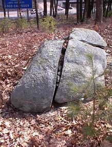
I have been commuting between home and Andover Mass. This takes me along Route 3 and along Rt 495 twice at day. I always look for interesting things in the woods, when I can spare a moment's attention from the traffic, and, of course, there are a few places along there that look interesting and worth exploring. Years ago I noticed a large rock in back of a company off of Route 3, which you can see in the southbound direction just before an overpass directly to the north of Treble Cove Rd. So I also look at this big rock on the way by every afternoon. In the past I thought it looked like a turtle and certainly this looked like one of those "spots"; even though it was in the narrow strip of woods between Rt. 3 and the EZ-Storage Company parking. From Rt. 3 you'll see something like this:
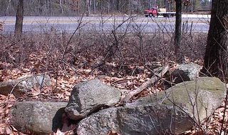
Looking more carefully at it, or rather glimpsing it more carefully as I rush by at ~70 mph, I noticed what looked like rock piles next to it, so today I figured out how to get there on surface streets and went out to take some pictures. For the record, the overpass to Rt 3 is Rangeway Rd in Billerica, just north of the Treble Cove Rd exit from Rt 3. The Rangeway Rd overpass and Rt 3 divide the land area into 4 quadrants and I explored each of them. Mainly the northwest quadrant is the interesting one, containing this large rock and 5 or so rock piles.
I kind of like the shots with Rt 3 in the background.

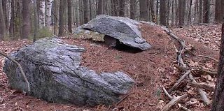
Several of the piles had a turtle like look to them, with a large rock hanging over the edge. Here is one, front and back:
And here is an interesting "seat" style pile only a few yards from Rt 3. It is interesting to me because of the rusting bucket in the interior. This cannot be too old and I very much think the bucket is from a "user" of the rock piles.
Previously, on Little Bear Hill, I thought I had found a rock pile with a rusted gear incorporated into it. I was judging from a picture and later concluded the "gear" was just a curl of bark. So this rusted bucket is the first certain example of a recent offering, included in a rock pile.

At the back of the main large rock there are some damaged structures. One consists of a short stone wall leading out (west) to end in yet another turtle like pile. The next picture shows this pile, in relation to the large rock. The other picture is a detail of some of the structure in the front of the large rock, which includes propped up fragments. You can barely make out a small dark cobble wedging up the middle two fragments.
After spending no more than 10 minutes at this site (hardly a place to hang out, next to Rt 3 and behind the EZ Storage Company's parking lot; but I feel bad that I was "site bagging" which I am, all too often, guilty of), I went back to the car and drove to each of the other "quadrants" to take a look around. It appears the Rt 3 and Rangeway Rd overpass pretty much went right through the middle of this nice site. But I am not saddened; perhaps because this, today, is the place I know, not the one that was here before. Also, it is still a nice site, in spite of it having been so thoroughly ravaged. Another possibility occurs to me: that this site was created after the roads were put in.

Anyway, across Rt 3 from the turtles, there were two nice split-wedge/filled rocks. Here is the first, right out near the highway (visible in the background), showing first the rock and then a look down into the split, with an arrangement of several wedges.
Here is a second split-wedged rocks, a little further back in the woods. That's a heavy rock on top: too heavy for a passing "boy scout".
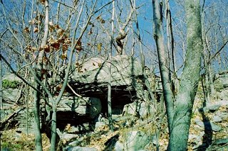
Across Rangeway Rd from this place, is not much. Across Rangeway Rd from the driveway into the EZ-Storage company is a little up-and-down above a wetland. Several nice larger rocks but I only noticed one rock-pile structure of the platform/seat variety behind one large rock (you can see Rt 3 through the trees):I noticed from the car, but did not stop to photo it, that there was what looked like a "Twin" pile down in there too, closer to Rt. 3. Probably worth taking a closer look at sometime. So there you have it. Another little site, not too much the worse for wear for having been chopped into pieces by a road and a highway. Interestingly, this location is on the same direct diagonal line, which I call "Hobomock's Spine" that includes all the other sites down through Carlisle, Acton, etc.

Detail of Hematite on Chamber - from Norman Muller

I am attaching a detail of the hematite I found on the Washington, MA, chamber. I just hope it is left alone. It is very pure; when I lifted it up, I was amazed at how heavy it was, almost like lifting a piece of pure iron. I wonder where it came from.

Scotrun Chamber / nearby sites

The picture of the Scotrun chamber in a wall that Norman mentions is here. The question being asked the day I saw it was whether it was a chamber to receive the sunlight on a certain day or days or if it was for offerings of some kind.

The Monroe County site in my last few posts is just a few miles away from Scotrun, but seems to be a completely different kind of site. Scotrun is on a hillside, while all the rock piles at the other site are in a flat, low area.

If I could I would spend time examining the whole area near these sites and documenting anything I find, but I don't drive. What we need is a grad student!
More minor details requested

To tell the truth, looking back over the recent pictures of tall truncated cone-shaped cairns, it is hard to tell Nancy's pictures apart from Norman's. The presence of a "niche" or recess seems to be reasonably established by these example. So what are the minor details around these cairns and are they also similar? What about the topography; is it similar? If so, we could start putting together a more comprehensive view of a these as one type of site.

More from the Monroe County Rock Pile Site

By Geophile
(again, all these photos are from a damaged disk, and colors may be off)

Since Norman mentioned rock piles with chambers in them, I'll start with this picture. It's possible that someone was just playing Jenga and managed to get a stone out, leaving a hollow, but it seemed possible at the time that the space had been left for offerings.
The question has come up whether the sticks leaning on piles have sometimes been placed as homage to whatever the rock pile represents. I don't know the answer to that one. Sticks can be found all over the ground in the woods. It seems reasonable that some would just fall on rock piles. On the other hand it would therefore be an ideal way to honor the site in an unnoticeable way. We can only see the sticks and wonder. I used to remove sticks before taking pictures, but there's really no reason to.

This is the same rock pile from another angle. Someone did a nice job making this one.
Here's one of the walls on the same site.

Here is a picture of the inside of a rock shelter we found at the top of the hill above the rock pile site.


And here's the rock shelter. It's probably naturally-occurring. Pretty difficult to wield that huge boulder on rocky and sloping ground. Nevertheless, it would have been noticed and possibly used by the people who built the rock piles.

That shelter was part of a ridge of boulders that ran along the top of the hill. An interesting feature at this site was a low wall that started some distance down the hill, then ran up the hill at an angle, eventually almost meeting the rock ridge at a cliff or bluff. I'll post pictures of the walls and bluff next time. Was this a hunting site?

Tuesday, April 04, 2006

Cairns and small chambers in Washington MA, from Norman Muller

Last year around this time, I spent a day exploring parts of Washington, MA, with a former NEARA member, who has spent years exploring this part of the state. Following is a selection of the features we saw that day.
In the morning, I was taken to a side street out of town, where I was shown a very small chamber built into a slope -- certainly too small for a person. On top of the lintel, in the center, was a piece of hematite, which is pure iron oxide and very heavy. Was this placement purely accidental? I don’t think so. Hematite is a source of red ochre, which is often associated with ancient burials.

Later that morning, I was shown a huge cone cairn, probably 7’ high, in the middle of a trail.
At the base, on one side, was a tiny chamber, and it was topped with a piece of quartz. I had seen a chamber built into a wall before (at Scotrun, PA), but never an obvious chamber in a cairn. [Reverse view:]

In the afternoon we visited a cairn site on a ridge outside of town. It was the high point of the trip, and rather overwhelming. There were several large platform cairns (two are shown), one of which had a long “pointer” stone row below it. This was a new element for me.
Then there were a number of very elaborate cairns on boulders, one of which had at its base a small above-ground chamber. [A closeup of the cairn is also shown] This reminded me somewhat of the chambers I saw in Hopkinton, RI, in a middle of a boulder field. Since they were in an area of underground springs, which were audible in places, I concluded that the small chambers were built over locations where the sound of the springs was strongest. But the one in Washington is in a different class altogether, and I am not sure what to make of it. I am convinced, however, that it is related to all the other stonework around.

Lastly, was a very nice boulder fill, of a type that I have seen numerous times, but not like this.

Monday, April 03, 2006

Monroe County Cairn Field

By Geophile

Apologies if some of these pictures look peculiar. Something is wrong with the CD they've been stored on.

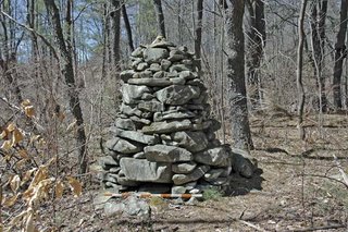
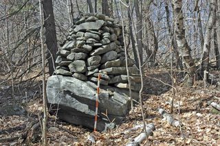
Monroe County, including the area known as the Poconos, is rich with rock piles. They often occur in large areas or fields of many close together. The pictures below are from one site. I counted 34 full rock piles on this site, not including those that were badly broken down or those that must have been destroyed when the road was built through the middle. Walls surrounded parts of the site.

The rock piles pictured below were all on one side of the road. They varied from tall and squarish

to lower and concave on top

many built on boulders

in various states of repair.

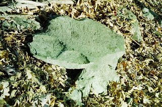
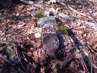
An interesting feature I found among the rock piles was a flat, possibly shaped stone

propped up on a small boulder, possibly pointing somewhere.

These rock piles were in a low area, one that might be swampy in wet weather. Is it likely that people were buried in such an area? I don't know.

In my next posts I will show a few more rock piles from this site as well as some features from the slope above them.

Quartz Outline near a vernal pond on a hill in Shirley

I did not find anything during my planned exploration in Shirley this Sunday so I decided to go re-visit a site where I remembered an interesting outline made of quartz blocks. My friend from Carlisle and I found this site when I did not have a digital camera.

We found little else of interest at the time except this one point where there was a little spring fed puddle with a few features around it. Here are the small indicators that this spot was a sacred site. A rock-on-rock:A split-wedged rock, with its feet in the water:
Note the drill holes used to split the rock and note that no rock was removed. The split appears to have been intended to create a split rock, and not for another reason. The round glacial cobble that was shoved down in the split is not part of this rock.

Here was another rock-on-rock:

I came back to this site to get some photos of this outline made from quartz:
I addition to the main outline, there is a smaller outline behind and to the right. The plan of these outlines and their orientation, is something like this:
I did not notice before that the larger outline was only partially made of quartz and I did not notice that opposite the quartz was a noticable red stone. I believe these colors are crucial to the meaning of this artifact. Here is a detail of some of the quartz:
And here is a detail of the red stone opposite them:
The stone is a deep rich red color - a type of marbled quartzite.

Here, finally is the smaller outline. I should have cleaned off more of the leaves so it would be easier to see.
This would be barely big enough for a person to sit in. Also in this smaller outline, again not shown well by the photo, there was one noticeable piece of quartz - a sort of yellow piece at 3 oclock.

It is a small site but that quartz outline is a unique feature.

Sunday, April 02, 2006

Parker Woodland - more photos from Larry Harrop

Larry wrote in saying:

I went back to Parker this morning.
Found a couple of big platform cairns ,lots of rock on rocks and small rock piles. Seems like no matter where you go, you'll find something in this area..

I followed an old stone wall that just starts from nothing and goes about 50 yards and then turns 90 degrees and continues another 50 yards and just ends. At this end , there is a space of about 6 feet then 2 boulders with stones filled in between them.. Very impressive. I added a sub-album to the parker album called new photos.
http://larryharrop.com/v/ParkerWoodland/

#1 shows the wall starting out.
#2 shows the turn
#3 shows where it stops. You can see the boulders right of center in the
picture.
#4&5 shows the boulders.

I recommend trying the link below each photo labelled "Large Photo". For example:
[Click here]

Light Posting

My weekend explorations were not successful so there will be little new material this week. I'll have to tap into the Journals or perhaps I can get someone to send in some of their stuff. There is one little thing from Shirley I'll show you tomorrow.

Platform Stones Near Other Features

By Geophile

Since we're discussing elements that sites may have in common, I'll bring up this one: the flat stone or platform near a boulder or rock pile. I haven't been sure if these happened by chance or if they're purposeful elements, and this seems like a good place to ask that kind of question.

Here's an example, from Oley Hills, Berks County, of a platform stone in front of some interesting boulders.


And here's an example, from Monroe County, of a similar flat rock in front of one of the rock piles in a 'cairn field.' Sorry about the color on this. Something happened to the CD these pictures are on.


Anyone seeing anything comparable out there?

Saturday, April 01, 2006

Birchtown

I assume you've seen this stuff about the Black Loyalist village called Birchtown. If not, take a look.[Click here]

Rock-on-rock in front of split rock

I have seen this combination enough times to suspect it might be deliberate: a rock-on-rock aligned with the split in a split rock.I went for a bit of a drive to get to un-explored territory in Bolton. Found a small "brookside" site with rock-on-rock at a rocky swampy place. Pictures are drab because of the light and this photo above was about the only thing of note. This is on Powder House Hill in Bolton if you feel like looking for it. During my walk there were multiple occasions when the random tumble of rocks looked just a wee bit too organized to be natural and I was at pains to decide what was a rock pile and what was not. For example, I am pretty sure this was part of a line of organized rock manipulation:I guess this might also be interesting:
The vertical flake next to a rock is something my friend from Carlisle comments on frequently and which Geophile mentioned the other day.