Tuesday, April 11, 2006

Cairns from Morris County NJ - from Robert Peal

A reader, Bob Peal, wrote in:
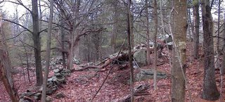
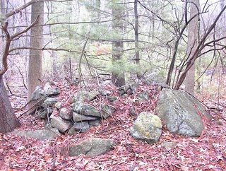
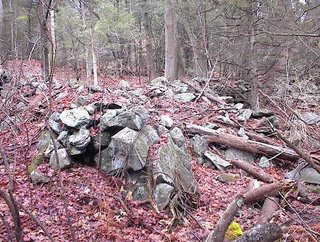
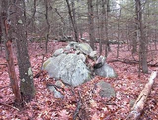
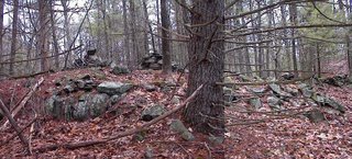
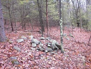
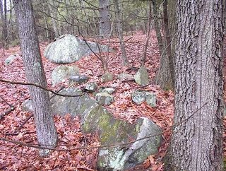
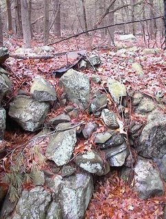
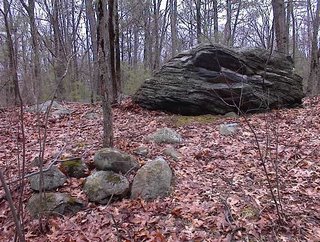
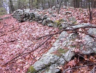
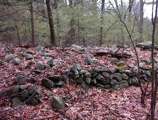
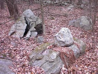
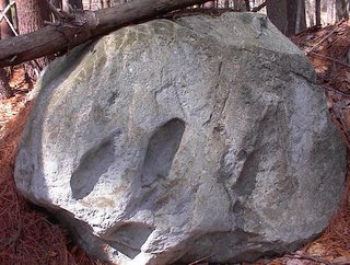
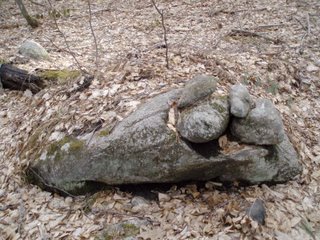
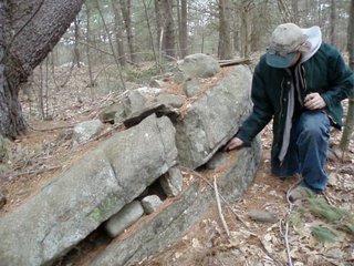
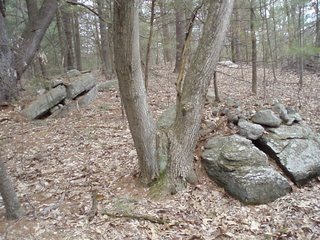
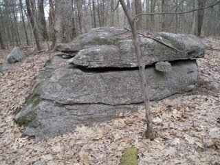
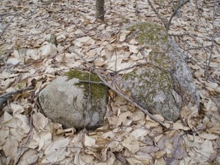
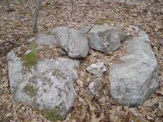
...Yesterday when I saw the pile with that big flat stone and a hole underneath I thought of your site. I could picture the rest of those stones on top but I'm not really sure. Anyway, I was just curious as to what you thought. These are in Morris County, N.J.
Bob had sent this email to a friend:
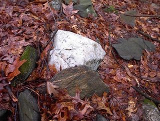
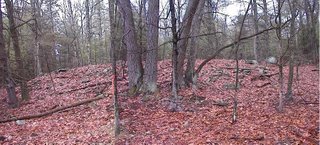
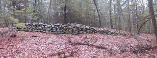
This is that site you sent. If you scroll all the way down and see the cairns they have. When I saw the bottom stone this morning that's the first thing I thought of. The first two pictures are of one right in the beginning of the hike today. I wasn't in the woods 2 minutes and I saw this. There are so many slag piles in the area I assumed this was one but something doesn't look right, they are not slag type stones that are broken up. What do you think, I'm sure a lot of the stones are missing but it looks good? The other pictures are of the ones that got this rock pile thing started. I passed it today and there is another one about 10' away so there are pictures of both. It looks like they caved in, like they were high and fell. Maybe to much imagination. I went on a real long hike today, took 107 photos and the thing is only supposed to hold 90 plus the camera holds some. It was 5.5 hrs long and real hard and hot and buggy but it was well worth the trip.
Quartz on stone wall - from Norman Muller

Norman writes:

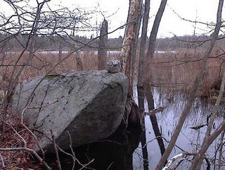
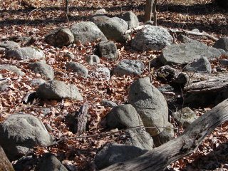
Attached is an image I took four to five years ago or more when you and I visited Tim in CT and saw the stone row in a swamp, among other features. This one shows the quartz cobbles placed intermittently on top of a row.

Monday, April 10, 2006

Near Fort Pond

It is strange that there are still little pockets of unexplored woods nearby even though my searching for new woods has taken me as far as Ayer or even Shirley to the west and Tyngsborough and Dunstable to the north. So I was looking over the topo maps for Acton and Littleton and realized there were several spots I missed in Littleton - one being near Fort Pond and the Sarah Doublet Forest I talked about in the previous post. I went driving over in that area figuring I would stop if I saw some good woods by the road. So I was bit lost when I saw what looked like some huge field clearing piles on the downhill side of the road. I got out, took some pictures, and noticed that the piles might just not be from field clearing because, although totally mussed up, they showed remnants of structure.

The road is just to the right in this picture.
Here are some of the other piles from down in there:
You can see they show signs of having underlying structure. Were these originally ceremonial piles which were then dumped on, perhaps during road building. The last one has a wild look to it; I wonder what happened to these piles?

As I was climbing back up to the car I noticed that the other side of the road looked like it might be a likely woods. I had no excuse not to leave my car parked where it was, cross the road, and explore over there. So I went over there and saw more piles that seemed like they could easily be from field clearing.
But as I continued, the piles started looking more and more "ceremonial". Things low on slope are more likely to have been dumped on than things higher up a slope. So perhaps it makes sense that as I progressed upwards I was less and less in doubt as to whether this was a real rock pile site. I was getting quite suspicious by the time I saw this combination of piles and wall anomalies.
At around this point in my walk I forgot about field clearing and knew these piles were ceremonial.
Here we are climbing a hill from the south. The piles were all over that slope. In one place were what I would normally call "platform piles" however with Norman's strictures in mind I will just say that they appear to be broken down plaform piles - with a view down the gully to the right in the pictures:
These piles are facing east or southeast into the gully on the right in the pictures.

Then I came across this totally broken down item. Again, I think this was once a platform pile.
You can see something white at the lower right edge of the pile. Here is a closeup:
Needless to say, that makes me mighty suspicious. Quartz is so dramatic. Notice also that there is nothing even remotely quartz-like visible anywhere else on the pile.

Anyway, I kept climbing and combing back and forth over the slope. I came across the first of those "serpents" described in the previous post. Found more piles, found another serpent. Avoided a few residences which I was beginning to come up to, reversed direction and started back down. More piles and growing paranoia about being observed tresspassing. And then out.
As I pass one that I saw on the way in I notice it incorporates a rusted piece of iron plate.
I cannot really describe this as one particular type of site. Evidently it was part of a farm until pretty recently. But as I went I became convinced that this is the sort of farming on top of ceremony which I rationalize as the "Indian Farmer" - someone doing farming but retaining ceremony in the piling of rocks. The hodgepodge of different styles of piles here - broken down platforms, large effigy-like piles (see previous post), small piles packed into a space between rocks, these suggest several different traditions of pile building including but not limited to an "agrarian" one.

Serpent Mounds, Turtle Mounds and John Hansen Mitchell

John Hansen Mitchell wrote a book "Tresspassing" about the history of the Sarah Doublet Forest in Littleton. Originally the land was the entire praying Indian village of Nashoba and it was whittled down bit by bit until an old lady, Sarah Doublet, was the only remaining person on the land - which she traded with some tavern keepers in exchange for room and board until her death. I think that is the outline of the story.

In one part of the book Mitchell discusses a "serpent mound" snaking back and forth through the woods. For a number of us, this discussion was one of the things that first got us out exploring the woods looking for unusual mounds and - as it turns out - rock piles. I eventually located what I thought Mitchell must have been writing about and for several years I have been under the impression the so-called "Serpent Mound" was actually a berm of cobbles that was curved but was not really "snaking through the woods". Well I have a couple things to announce. One is that I was wrong, Mitchell was right. I took a closer look at his mound this weekend and it does indeed curve back-and-forth and has at least two points of inflection along it. The second announcement is that there are at least two more long curved (although not necessarily re-curved) rock piles in the same vicinity.

Here is the best shot I could get of Mitchell's "Serpent Mound". Note the "head" at the far right.
Here is a detail of the "head":

I was exploring in the same area, around Fort Pond in Littleton, this weekend. I figured other woods near the Sarah Doublet Forest might be just as interesting. In fact I came across a major concentration of large-scale effigies which is, as yet, private property. It definately should be part of the Littleton Conservation land.

I will give you a site description in a bit. For now I want to show you these "serpents" - actually long, curved, low, rock piles, with a prominent larger "head" rock at one end. Here is one of them. This view from below is the best shot I can get showing the entirety of the pile.
And then here is another nearby.
I realize that these last two piles are not very similar. This last one is a good deal like what Geophile mentioned as a "whatsit" or a "fishtail". It almost seems like a road edge - stabilized on the slope; or like a bit of terracing. But it is not any of those things. Here is another view:
I am probably completely mis-identifying this pile. I like it a lot because I was looking for "whatsits" and here I finally found a good one. It may not be a serpent or even an effigy. However, it was near another "whatsit", and I strongly favor the idea that these are representations of different subjects.
[I am sorry for the lousy picture, barely giving a sense of the overall pile.]

At any rate, I wanted to leave you with two thoughts. One was that this new site is an important adjunct to what we see at Sarah Doublet Forest - and which Mitchell made famous. The other is that collections of large effigy-like rock piles can contain serpents as well as turtles.

Mitchell also mentions a turtle pile near his "serpent". There are actually two piles that could be turtles. I think this is the one referred to in "Tresspassing".
An entire post could be written about this pile - including its location near the "serpent"; the damage it has - suggesting someone looked for buried treasure in it; the single white cobble on its back. For now, let's just note it is built a few yards from the head of the "serpent".

Sunday, April 09, 2006

Larry Harrop writes:

The only new thing of interest that I found today was a pile on top of a boulder with 2 red stones on it ( one on top of the other)
[Click here]

[and here]

(Actually the entire album has the usual excellent photos:)
[Click here]

Quartz-on-rock

As I said, these are rare structures. But I found three on Wilderness Hill in Littleton. Here are two others. Two views of one:
Two views of another found close to this above one:
Note that this one is placed in line with the split in a "spirit door". Taking into account the idea that a quartz-on-rock would function to project energy outward, a speculation about this structure is that it functioned to amplify what came out of the split.

The heart of Nashoba

At the heart of the "Praying Indian" village of Nashoba were four lakes: Nagog Pond, Grassy Pond, Fort Pond, and Long Pond. These were the most sacred places, located today in northern Acton and southern Littleton. In all the undisturbed woods around these ponds there are still rock piles today. The landscape may still be a little as the Indians left it.

This photo shows a quartz-on-rock structure at the northern edge of Long Pond. Quartz is rarely used this way and, when it is, it is thought [by me anyway] to function as a focusing of energy outward. There was another rock-on-rock back aways along with a few other placed rocks leading up to this final structure at the edge of the water.

Saturday, April 08, 2006

Try Again - video shorts

Here is what my friend calls a spirit door.

And here is what I call a quartz rock-on-rock in front of a split rock. Quartz is rarely used this way.

Centuries of Wear

By Geophile

Here's the image. This depression is in a boulder that's part of an outcropping in a ridge in New Jersey, I believe it's part of the New Jersey Highlands. You can see the Delaware Water Gap from there. A woman took me there when she learned I was interested in Indians and stones because she remembered partying there. (It's possible that teenagers may still be among the most likely people to lead us to interesting and special spots. They find them to be good places to get high!)

Anyway, this isn't the first of these depressions I've seen on high rock outcroppings, but it's the only with such an interesting shape, sort of paw-print or leaf shaped. The person who started me looking at stone work in PA said he believed pre-European peoples ground medicinal herbs in special places like this in order to include in them some of the natural power of the rocks and place.

Link sent in by Geodowser

[Click here]
It is about standing stones and such.

Long Thin Pile - Littleton

I'll tell you later about the site where I found this today. It is the nicest pile I saw and I think it is a bit effigy-like with the larger rock at the end on the right. It is also a bit like Geophile's "fishtails".

A sharpening stone?

Took a stroll at lunch yesterday. No rock piles (except for field clearing ones) but I thought this rock looked suspiciously like some stones said to have been used for sharpening stone tools. I see pictures of such things online. There also seems to be a "7" inscribed above the right hand hollow.

Friday, April 07, 2006

Between a spring and a lime kiln (2)

I am not going to try to describe this site. Although it is within about three acres, there is too much going on in different parts of it. Also there is a complicated overlay of ceremony back on top of land that was systematically processed for limestone and later for pasture. I got some nice pictures using my friend from Carlisle's camera. Continuing the description started several posts below, we now walk a few yards over to the spring. This area is enclosed in stone walls which have no entrance. There are numerous small piles, some on the ground but most on or beside a support. Some of these piles look representational. For example in this previous one, I see an outline at the lower right part of the pile. Is this just an illusion from the way the leaves are covering it?Many of these piles have been groomed in the past which makes some more visible. This next one has been previously published.
Needless to say this strikes me as particularly feminine and I believe it is a classic female effigy. Just next to this pile the water comes out of the ground. On the other side of this out-flow, ten feet from the above pile, is this other one which unfortunately looks pretty damaged.
This next one, seems to be avoiding a similar fate:
I always thought this next one was a representation.
However attention focuses on the interesting black-and-white rock near the center. Here, take a closer look:For reference, there are several interesting rock here. The one to the left, which I think of as a "head". Between it and the black-and-white rock is another interesting shaped rock.

The spring creates a small valley which opens to the southeast. I believe this is a different kind of site than some others we have seen here. I think some of these piles are effigies. If you are not comfortable using the word "effigy" look at the example below called "Rock pile picture of the week". That is the kind of symmetry I am calling an effigy.

When we first came here

My friend relates that when we first came to this site, I was arguing that these features were not just stones from the farm.
I commented on the little piece of quartz that was in the crack of the rock: saying that someone had to have put that there deliberately. Here is the piece of quartz: Not too consipicuous.

Between a spring and a lime kiln.

Start out on the knoll with the vein of limestone and the quarry on one side. On the other are these piles. The emphasis here is on split rocks that are filled or wedged.
I thought of the following recently when Larry Harrop photo'd a similar example. This one has been published before.Someone claimed that this structure was made by the mother of the previous landowner. That is all very well and good but I doubt that the mother also lifted up that multi-ton cap stone/table rock above.

Here is a closeup of the table rock with this last split-filled boulder in the background.

Just nice colors

I went out with my friend from Carlisle and took some pictures at an old favorite site. So I'll be posting examples of some of the nice structures from there. The previous post is an example. Here is a nice photo:Click on the picture to see a magnified view.

Rock pile picture of the week

Observe the symmetry along the vertical axis slightly to the right of center in the picture. Note also the position of the white stone . To me this looks very feminine.

Foxwoods and Indian ceremonial rock piles

Foxwoods is a casino in CT and it is reputed to be a place that was built by the Pequots on top of a Pequot ceremonial place. I have heard that this was pretty upsetting to some of their more devout neighbors.

I have a friend at work who went to Foxwoods last weekend and today, knowing about my interest in rock piles, he told me that there were many rock piles along the road entering the casino. Some were big (like 40' long) others small. He asked his friends what they thought about the rock piles and they said they did not see anything interesting about rocks.

If you live near Foxwoods, could you please go out and get some pictures?

Thursday, April 06, 2006

Seats looking over Kibbe's Cellar Hole in Concord

Thoreau made a big deal about the Kibbes being dull earth grubbers. But if you locate the Kibbe cellar hole in Estabrook Woods in Concord you may notice it is within a rock pile site. This leads to the puzzle of when it became a rock pile site - during or after the Kibbes lived here? For example, these seats appear to have been built after the property was abandoned because they are made with rocks from the adjacent stone wall. I wonder if they were built after Thoreau visited the place?

In And Of Themselves

Don't know whether you've posted this before, but despite being about Western peoples, it gives an interesting perspective on what the sites may mean to those who 'use' them.

"SACRED LANDSCAPES ARE NOT SACRED BECAUSE NATIVE people believe they are. They are sacred in and of themselves. Even if we all die off, they will still be sacred," says Chris Peters, a Pohlik-lah tribal member and director of the Seventh Generation Fund, a Native advocacy foundation based in Arcata, California. "Over the course of time Native people have grown to understand there is power in these places--power that is significant to the entire ecosystem of all living things. The Earth is sacred and needs to be protected, and we as humans need to take responsibility to live in a sustainable way."

Prayer seat in plain sight

Look carefully at the lower left in the picture
[Click here]

Ozark rock pile

[Click here]

Archeology by satellite

This is not specifically rock pile related but is interesting anyway - people scouting for archeology using Google "Earth" mapping.
[Click here]