Wednesday, April 20, 2011

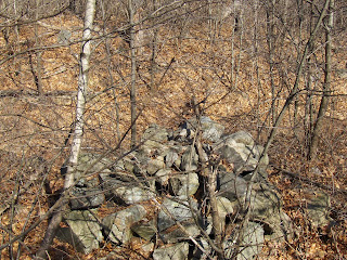
Small rock pile site near southern entrance to Estabrook Woods - Concord, MA

Something was telling me I never looked carefully at the woods at the very beginning of the Estabrook Road, so I went out to comb that part very carefully. Finding a solitary rock pile was no surprise, then I came across some funny things that - in the end - I had to recognize as a sort of rock pile site.

Here is a quick description.
Entering the woods following Estabrook Rd from the south, leads past some beautifully manicured mansions. I could not resist this one scene with the first hint of spring color and the thought "and now it begins...."I continued up the road, heading north, and took the left hand path when I got to the initial cross roads. This left hand path is the one called "Estabrook Rd" although it is a dirt path today. Actually rather than taking the path, I headed into the woods to the right of that path and swept back and forth. I found myself on a secondary path, parallel with the main Estabrook Rd. At one point, next to this secondary path, I came across a disturbed rock pile. My pictures are lousy but to get some idea, it kind of snaked around:At one end was a larger boulder, like a "head" on a snake:I did not give it much credit. There were some other pile-like collections of rocks nearby, incorporated into a stone wall. I did not give these much credit either. It all just seemed like messy wall construction. But then I spotted this a few feet away:I thought "wait a minute...that's a real rock pile". And with that the other piles came into focus as old remnants built into the walls and otherwise part of a small site. Here is a view southward of the small valley I was in. The notable pile is one of two on the left. On the right, a wall comes up (from the south) and tops the knoll with another rock pile. The "snake" is behind me while taking the photo. I should have blogged about this at the time, two weeks ago. Now I cannot remember how many piles in all or how exactly they were placed. Something like this: two piles downhill from the snake, the "notable" and adjacent piles, the one on the knoll, and two boulders with loose rocks on top. An interesting structured layout. It is not just an array of evenly (or unevenly) spaced piles of the same sort. Frankly it reminds me of some of the Wachusett Tradition sites I have looked at recently.

Here are some of the piles. Downhill from the "snake":Here is a the "notable" pile: Looks a bit familiar, eh? [Try drawing the outline]. Here is a detail: Here is a small neighboring pile:I did not get any decent photos of the boulders with scattered rocks on top. Here is a view back over to the knoll:A picture of the pile on top of the knoll, trying to make it look like a pile rather than a brief widening of the wall: Definately an easy walk: 3 minutes from the entrance, following Estabrook Road, on the right at the point where the first dip occurs to the left.

Sunday, April 17, 2011

Again with the eagles

Seen in Maynard along the Assabet.

Saturday, April 16, 2011

Wednesday, April 13, 2011

Wood Rd on the edge of the Blue Hills Reservation - Braintree MA

Wood Road is the service road that accesses the office building there along Rt 93 across from the Rt 37 cloverleaf. Along it, there are several entrances to the reservation and I parked at the first one (northeastern most along Wood Rd) and circumnavigated the wetland there, to the left of the cross-hairs. You can see the dashed lines indicating old roads.

I found nicely built "cairns" twice. Once at the headwaters of the wetland, where the brook comes out of the hill. I dismissed these since they were present only along a short stretch of the old road and seemed much too integrated with the road. But then I saw others, again along side of the road [at the cross-hair in the above map fragment], and thought they were too nicely built to ignore. But I was pretty unsure of their nature. They were kind of recent, and exactly along the road in a most suspicious way. Luckily as amateurs we do not have to make a final decision. Someone should go have a look when they are in the neighborhood. Here are some pictures:[This next one was more rectangular than the others.]Another:
Maybe ~8 piles in all.

Reasons why these piles might be ceremonial:
  • nicely built
  • of a familiar "beehive" shape
  • constructed together as part of a single 'expression'
  • one pile was on the other side of the road, and seemed to have been cut in half by the road:
Definitely a place worth examining more carefully. I poked around and the only piles I could find were right next to the road. The undergrowth is pretty dense in there. I think it might be re-growth after a fire. In any case it would take someone a lot of work to explore any part of that reservation thoroughly. It is too far a drive for me.

Last mention of northeastern Groton, Blood Rd, etc...for a while

I suppose that readers who read all the way through my site reports are tired of the interminable discussion of rock piles and mounds "with hollows", accompanied by vague photos of a few rocks poking up through the dead leaves of the forest floor. Unfortunately it is hard to write about the technical details of these sites and even harder to convey some of the pleasure of happening upon new rock piles in the woods and being overwhelmed by their beauty and the mystery of their age and purpose. I wish I could capture the facts and the experience of being there. But I won't go on much longer about the site(s) in northeastern Groton.

Some final highlights of the walk I took last weekend: left the dirt road and spotted that "butterflied" boulder connected to a pile; kept walking and eventually spotted some small rock piles around a prominent boulder [a type of "marker pile" site]; then there was a linear feature about 30 feet long with rock piles at either end; then some low ground piles with quartz. The piles were unevenly spaced and lying next to a stone wall; then the beginning of rock piles with hollows, followed non-stop by pile after pile, then some modern agriculture, then some more piles. I had been heading north, turned back, and was then heading south while the piles seemed to get bigger and bigger and more and more numerous until I reached a nexus, just before getting back to the dirt road. I took 98 photos, but am only posting a few. They are probably a bit repetitive.

Here we are near the end of my hike:See the larger one in the background? It is not surprising that these are essentially undisturbed. The rocky wetland would never support anything too usefully agrarian. So there they sit.

On the hilltop above was an unusual rock pile I have blogged before (but cannot find) that looked like a short stretch of stone wall:
Note the small linear spur coming off the main pile diagonally:This is unfamiliar.

So that is about it, a rewarding walk through a very extensive site east of Horse Hill. Go there, check it out, I will write about something else now.

Tuesday, April 12, 2011

Blood Rd - Groton, MA

From what started as a run down little site I spotted from the car (here), to some "crescents" in the snow (here), to a village of small mounds with hollows (here), this site has proven to be larger than expected until, now, it is found to fill a valley more than a mile and a half long.

Small rectangular rock piles with hollows, some occasional "sentinel" rock piles sticking up high above the surrounding smeared out mounds, and (what we'll see today) rock piles built against boulders but with vestiges of hollows - all these features make the site a somewhat unique manifestation of the "Wachusett Tradition". This site is a northern variant, with piles down by the water,like the rock piles "with tails", and different from the larger mounds one finds 20 miles further south, which are larger and located high on hill slopes.

I went back to explore further north in this valley between Blood Rd and Horse Hill. I was following a dirt road "Dan Parker Road" and cut off to the east at the high point, and immediately came to a split boulder that was butterflied into two vertical faces, connected to a very smeared out mound with a hollow:It takes some deliberate imagining to see this as a variant of a mound with a hollow. But what else could it be? Here is a closeup of the split boulder: Here is the "hollow":
Adding: By "butterflied" I mean the boulder was split and (apparently) opened up so the flat surface of both pieces face outward in the same direction.

To be clearer, here are some other examples of rock piles built up against boulders. You can decide whether they might have been burials once upon a time.
Meanwhile, here are some more conventional rectangular piles with hollows. In these examples there is often a hint of a 2nd hollow - which I think is one form of the "tail" we see on some rock piles.
Especially on this one:I'll show some other features I spotted in another post.

Meanwhile, outside of the blue outline on the map fragment, there is a bit more of this valley still to explore and probably more to see.

A pretty good weekend

I took an extra day off, Monday, and had 3 days of napping, hiking, and over eating. Saw some interesting wildlife (eagles and deer) and explored three sites: new mounds with hollows in Groton, questionable cairns in Braintree and -a special treat- a new rock pile site in Estabrook Woods in my hometown Concord. Lots of photos to process.

Got my first tick bite in more than a year. Seems like the heavy snow cover is what they needed.

Monday, April 11, 2011

Also coming up: Blood Rd Groton

Cairns at Blue Hills - preview

Not sure these piles are legit. They were along the first forest road into the Blue Hills Reservation, off Wood Rd in Braintree. Their coordination with the forest road was suspicious. Nevertheless they are shaped like the kinds of "cairns" I would usually care about. More later.

Sunday, April 10, 2011

Saturday, April 09, 2011

Bald Eagle - Fort Devens MA

Seen at the Oxbow:Here is the full picture:

Friday, April 08, 2011

Propped Boulder and Quartz Outcrop at Madison Springs, NH

Since Norman mentioned it, here is a photo from my first visit to the pass between Mt Adams and Mt Madison in the NH White Mountains.Note the quartz outcrop in the background.

Update: ALSO, this nearby:

Thursday, April 07, 2011

Valsequillo

Link from Norman here. (It is a pdf)

Madison Springs Ceremonial Site

Norman Muller writes:

I am attaching a scan of a photo I took of that split-wedged boulder on Mount Madison you took me to many years ago. It looks as though there is a quartz piece wedged in the crack, and perhaps some quartz pieces lying on top. Is this what you remember?

PWAX: I do not remember quartz in that split. I was struck by the quartz outcrop there at Madison Springs, as well as by the number of large propper boulders.

A better photo of that little black knife

Tuesday, April 05, 2011

Field finds from southeasern MA

Chris Pittman has some more good hunting:

Broken knife tip:"In situ" find:closeup:

Chris writes that he believes this is a Squibnockett Triangle.

Broken Wood

The colors were prettier in the original but this is the only picture I took all weekend - not for lack if trying.

Saturday, April 02, 2011

No, I am talking about structure you can see

I have to disagree with Tim MacSweeney's comparison (in comments here, 1st and 2nd photos, after the map) between rock piles with hollows and the rock pile in his chicken yard. Here is the structure I am seeing:This is not just another smeared out pile. There are very few rocks out of place and the original outline of the pile is reasonably clear. If there is a visible outline in Tim's example (see here) I do not see it. I mention this not to be disagree-able but to enforce the point that it is worth examining these old structures carefully.