There are a lot of rock piles in Leominster State Forest and it is a good study area as it has been little disturbed in recent times. I am told that it was an area with pestilence houses, an area that was never really farmed but was used as woodlots, as a place for charcoal manufacture, a place for pastures. There is a thin layer of soil over bedrock and glacial till - soil a plow would never be able to get through. Anyway, looking at the topo maps, I picked a place in there with a wetland between some summits and a dirt road nearby - so we would have a chance of being able to get there on foot. It turns out that these eastern hills of Leominster State Forest are not quite so dense in Laurel and a bit easier to navigate than the ones I explored in the past. So actually my son and I had a pleasant walk, but a short walk because I forgot to bring water.
So up we went on a hot day, driving as close as possible, parking, and walking in on a dirt road through the forest. Hot and muggy in the woods but with a fresh breeze on the hilltops. My plan was to explore a few hilltops and around the wet places in between. Before we even got to the first hilltop there were a couple of large "mounds" which I did not think were ceremonial:
 They were not too well made, with different sized rocks, and they were near a power line where I think there must have been plenty of earth moving equipment. Also the piles were isolated and so I wrote them off as something other than ceremonial. A few feet away, under the power lines, was a quarry and another large loose pile which looked like debris from the quarry - another reason for discounting these as Indian piles.
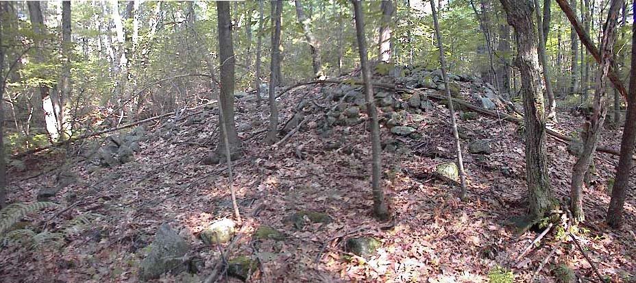
 A bright, sunny, humid, breezy day. The view here is facing north and northwest. Later we found a site with large mound piles and, in retrospect, I think these first piles are part of the same general site. In the end I concluded these were probably ceremonial.
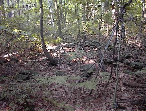
From here we continued up and over one of the hilltops and then went back down towards the valley between summits. There were a few minor things in a water break-out zone, a rock-on-rock here, a split-wedged rock there; and then we are continuing along the dirt road and there was a place where a small side road came in from the right following a stone wall. The wall had a bulge in it which looked suspiciously like an old rock pile, so I asked Joe if we could take a little detour down the side road, and when we did we immediately came to a low flat wet area with some other big mound piles. This was very close to the place I had hoped to get to when studying the topo maps. Here was the first glimpse:
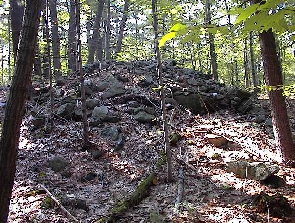
 And here is a closeup of the first pile.
 Note the suggestion of internal structure in this picture. A bit of vertical walling to the right, and a bit of a hollowed out nest to the left.
 While taking the photo I became aware of other large piles looming in the background:
 In the end there were about six of these large piles around a small wet area which fed into a larger wet area which, in turn, developed into a brook which was the headwater of one of the major brooks in the State Forest, flowing down into the lowlands where there were mills and such. In fact this first minor wet area was just adjacent to a watershed divide such that, a short distance away, the brooks flow in the opposite direction. So this is at the start of two different brook systems, nestled in a level spot between hilltops.
At this point my son was thirsty and after continuing a short ways we turned and started back along the dirt road. A few paces along and there was a small hill we had passed on the way in, and I asked Joe if I could "pop over there" just to check the hilltop. It was a good thing I did because there was one more large "mound" at the top, directly above the low place with the other mounds:
 Here is the view back towards this mound from a short distance away:
 In the end we explored a very small portion of the woods, mostly just along the forest road we had been following. This makes me wonder what lies a bit further along? Are there mounds like this everywhere in there, just hiding behind the Mountain Laurel?
 There is a lot more woods to explore but I suspect the wet place and brook, and watershed divide, and view out over the wetland to the northwest and, in the other direction, to the northeast all play a role and make it most likely that the site would be here instead of somewhere else. I am guessing further explorations will not be so fruitful and needs to concentrate on similar topography. As a rule of thumb when you go to explore a new place, you cannot assume the sites will be where you would expect them. But once you have found a site, other sites nearby are most likely to be in similar topographical settings - similar elevation, viewing direction, relation to water, etc.
Note that I am calling these large piles "mounds". They do not have retaining walls and have little external structure. They do not seem to be platforms. These are big piles (20-30 feet across). Where have we seen something similar? The closest I can think of is the large piles along the Hobbs Brook in Lexington and Weston. Maybe there is no comparison but I was thinking of Whippile Hill.
In a couple of the pictures, one sees the suggestion of structure within the piles. Looking at all of the pictures I see that every one of the piles is badly damaged and was cratered on one side near the top. It is within this "crater" that I am thinking I see a bit of internal structure. For example, that last pile really looks like it might have had a small inner chamber that was breached by the damage. We'll take another look at this in a moment.
No comments :
Post a Comment